Like Urban Research on Facebook

Showing posts with label Portland. Show all posts

Saturday, August 31, 2019

Measuring Gentrification in the Interstate Corridor Urban Renewal Area

By Indrani Boyle

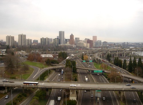
This study seeks to evaluate and reflect upon attempts to measure gentrification in the Interstate Corridor Urban Renewal Area (ICURA) of Portland, Oregon. Established in 2000 by the Portland City Council, and managed by the Portland Development Commission (PDC), the urban renewal area relies on the use of Tax Increment Financing (TIF) to fund capital improvements in a defined area of North/Northeast Portland. Although twenty urban renewal areas have been instituted within the City of Portland since the late 1950’s, few in recent history have included substantial residential areas (B. Durston, personal communication, October 1, 2008). For example, the River District Urban Renewal Area targeted a largely abandoned industrial area beginning in 1998, resulting in the creation of “The Pearl,” a vibrant multi-use district with a significant amount of housing. Although the growth of The Pearl has inspired concerns about gentrification and housing affordability, the prospect of urban renewal in the heavily residential areas of North/Northeast Portland prompted stronger reactions. In a largely homogenous city, the ICURA contains sections of 10 neighborhoods, including historically African American neighborhoods. History makes the racial composition of neighborhoods relevant. Previous actions of PDC led to the relocation of hundreds of African American households to make way for large-scale redevelopment projects. In addition, persistent patterns of legal and illegal discrimination contributed to income and housing instability. Homeownership rates for African Americans in Portland remain well below population averages. However, the neighborhoods within the ICURA were characterized by a deteriorating housing stock, declining employment opportunities, and criminal activity. To many, urban renewal represented both a threat and an opportunity. By necessity, the implementation of urban renewal causes change. In both fact and perception, these changes are likely to be simultaneously positive and negative.


Portland

More articles about urban renewal and revitalization:
Planning and Urban Design for a Liveable High-Density City

Friday, June 24, 2016

Bicycling as a Way of Life: A Comparative Case Study of Bicycle Culture in Portland, OR and Amsterdam

By Peter Pelzer,

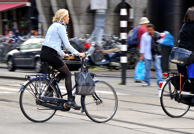
Over the last decade, bicycling has found itself a place on both the policy and academic agenda. The bike is becoming an important part of urban transportation and life. Most academic research focuses either on determinants of bicycle use or emphasises bicycling as a cultural phenomenon. This paper attempts to bridge these two strands by arguing that ‘bicycle culture’ consists of both a material and a socially constructed dimension. This notion is explored empirically in a comparative case study of Amsterdam and Portland, OR. It concludes with some of the underlying mechanisms in which material and discursive factors interact and states that both policy makers and academics should be sensitive to their respective geohistorical context.


Nederland beweegt
More about bicycle planning:

Walking, Cycling, and Obesity Rates in Europe, North America, and Australia

Bike-sharing arrives in New York City via Citi Bike

TOWARDS A SUSTAINABLE URBAN TRANSPORT SYSTEM: PLANNING FOR NON-MOTORIZED VEHICLES IN CITIES

China’s Hangzhou Public Bicycle: Understanding Early Adoption and Behavioral Response to Bikesharing

Chinese bike-sharing dwarfs US and European programs

Monday, June 25, 2012

Improving the Pedestrian Environment Through Innovative Transportation Design

Institute of Transportation Engineers

The U.S. Surgeon General recommends that we participate in 30 minutes of activity most days of the week. Walking might seem like a suitable approach to attaining this goal, but it can also be dangerous when practiced in the presence of automobiles. Motor vehicle collisions with pedestrians accounted for 4,808 deaths in 2002. The number of reported injuries involving pedestrians that year was much higher, at 71,000.
Pedestrian fatalities represent just over 11 percent of all traffic fatalities, yet walking trips account for only about 6 percent of all trips in the United States. Despite these statistics, walking remains a healthful, inherently safe activity for tens of millions of people every year. Recent numbers from the Bureau of Transportation Statistics reveal that three-quarters of U.S. adults (152 million) walked, ran, or jogged for more than 10 minutes within the past 30 days.
Clearly there is a need for transportation facilities that can safely accommodate the needs of pedestrians and bicyclists of all ages and abilities. Communities have been responding to this need with driver and pedestrian education campaigns,safety programs for schoolchildren, traffic calming measures, safer crosswalks for all user groups including the handicapped, improved surfaces and lighting and advertising campaigns to raise awareness of pedestrian issues.
The following case studies highlight various education and safety programs and facility improvements that some communities have implemented:
-In Boulder, CO, city officials analyzed and tested ways to improve vehicular traffic control compliance at crosswalks. The results indicate that drivers are now paying more attention.
-In Phoenix, AZ, hundreds of schools are now safer places for schoolchildren to walk because of its crosswalk safety program.
-In Oregon, the city of Portland took safety one step further with its accessible pedestrian signal (APS) program.
-In Seattle, Councilmember Richard Conlin initiated a citywide pedestrian awareness program.
-“Slow down! Chill out! Drive well!” The San Francisco Department of Public Health campaigned for increased pedestrian awareness and reports improved driver behavior.


shared bicycle / pedestrian sidewalk in use

shared bicycle / pedestrian sidewalk in use, Portland, by Mark Stosberg

more about pedestrianization:

Walking and cycling for sustainable mobility in Singapore

Perceptions of Accessibility to Neighborhood Retail and Other Public Services

Bridges to Utopia? A Sustainable Urban District in Freiburg, Germany

TRANSFORMING AUTO-CENTRIC COMMUNITIES INTO WALKABLE NEIGHBORHOODS: WALKABILITY AUDITS OF TWO NEIGHBORHOODS IN SAN JOSÉ

Evaluating integration between public transportation and pedestrian-oriented urban spaces in two main metro stations of Tehran

Mixing Cars, Cyclists & Pedestrians on Exhibition Road – London’s Take on Shared Space

Monday, January 23, 2012

BEST PRACTICE IN FACILITATING AND PROMOTING ACTIVE TRAVEL

via Department for Regional Development

“Policies and strategies at all levels advocate walking and cycling but motor transport still takes priority in the big decisions and in the allocation of investment. As a consequence the UK lags badly behind many European countries in levels of active travel. To return walking and cycling to levels that can contribute to a healthy society, changes are needed in policy and practice.”1
A number of papers exist summarising the success of The Netherlands, Denmark and Germany in promoting active travel, especially cycling. Pucher et al Making Cycling Irresistible: Lessons from The Netherlands, Denmark and Germany, 2008;2 Buehler et al Sustainable Transport that Works: Lessons from Germany, 2009;3 Atkins, European Best Practice Report, 2006;4 Jacobs Consultancy, European Best Practice Report, Final Report December 2006.5 Some of these successes are discussed in more detail in the next section.

German bikers, by Qlis

more about travel behavior in urban areas:

OVERVIEW OF LAND-USE TRANSPORT MODELS

Building More Roads Does Not Ease Congestion

How Urban Design Affect Personal Activity and Travel Choice - An Analysis of Travel Data from Sample Communities in Adelaide

Effects of Site Design on Pedestrian Travel in Mixed-Use, Medium-Density Environments

Comparative Study of Pedestrian Travel Culture in Different Cities in Japan

Friday, November 18, 2011

Analyzing Land Use Change In Urban Environments

by USGS

Metropolitan areas in the United States are growing at unprecedented rates, creating extensive urban landscapes. Many of the farmlands, wetlands, forests, and deserts that formed the America of 1900 have been transformed during the past 100 years into human settlements. Almost everyone has seen these changes to their local environment but without a clear understanding of their impacts. It is not until we study these landscapes from a spatial perspective and the time scale of decades that we can begin to measure the changes that have occurred and predict the impact of changes to come.
The U.S. Geological Survey's (USGS) Urban Dynamics Research (UDR) program studies the landscape transformations that result from the growth of metropolitan regions over time. Using sources such as historic maps, aerial photographs, and Landsat satellite data, USGS scientists first assemble retrospective urban land use databases that reflect several decades of change. These databases are then used to analyze the effects of urbanization on the landscape, and to model urban growth and land use change under alternative growth scenarios.


Land use change in lower Queen Anne, Seattle, 1920-1953, by Seattle Municipal Archives


more about urban land use:

SMART GROWTH, SMART CHOICES SERIES: MIXED-USE DEVELOPMENT

Innovation and the American Metropolis

Spatial Planning, Urban Form and Sustainable Transport: An Introduction

Research Methods in Urban and Regional Planning

Monday, October 3, 2011

Master of Urban and Regional Planning (MURP)-Portland State University

The Master of Urban and Regional Planning is a two-year, 72 credit professional degree program designed for those interested in working as professional planners. The curriculum includes a 43-credit core that focuses on the history and theory of planning as a field, plan implementation, analytical methods (including Geographic Information Systems [GIS]), and the dynamics of metropolitan development. 
The program offers five specializations: 
Remaining credits are taken as electives or as a second specialization.
For the last two quarters of the program, students work in groups on community-based, client-focused workshop projects. This two-term (winter and spring) sequence provides students with the opportunity to form teams to work on projects for community clients, and to produce a professional product by the end of the spring term. Check out examples of past workshop projects.
Experiential learning is an integral component of the program. The program requires 400 hours of internship experience. Internships in the Portland region are plentiful and varied, and include opportunities such as working with Metro's state-of-the-art transportation planning model, with a non-profit community development corporation to revitalize neighborhoods, or with a bi-state agency to implement the Columbia Gorge National Scenic Area Act.

read more

similar master degrees:

MSc in Spatial Planning- University of Dundee


Master in Urban Planning (MUP) in Harvard University

The 10 Best Graduate Programs In Urban And Regional Planning

Urban Planning Master's Program in Rutgers University

Thursday, April 7, 2011

Monday, March 28, 2011

Urban Planning Today

Urban Planning Today
Urban Planning Today reports on projects in Atlanta, Boston, Chicago, New York, and Portland, bringing perspectives of urban design, city planning, criticism, and law to bear on the mixed bag of results observed in these cities.


more about Atlanta:

New Urbanism and Planning History: Back to the Future

Skyline photos of Atlanta 1

Tomorrow is Another Day for Atlanta’s Sustainable Transport

Tuesday, March 8, 2011

Transitography 101: The Portland Metro – A Case Study on Regional Government


As Miami politicians struggle with decisions like whether to fund the area’s second commuter rail line or how to provide adequate bicycle infrastructure, it may be worthwhile to look at how other American cities approach the challenges related to regional transportation planning and decision-making.
The Portland Area Metro has emerged as a model for sustainable regional governance as it pursues aggressive reductions in vehicle miles traveled, by drastically expanding its bikeway network, making investments in mass transit and encouraging transit oriented development. These decisions are made by a regional governing body: Metro, “an elected regional government, serving more than 1.5 million residents in Clackamas, Multnomah and Washington counties and the 25 cities in the Portland region.”
Metro is the agency responsible for planning the region’s five light rail lines (52.4 miles), a commuter rail line (14.7 miles), a 651 bus fleet, an aerial tram, and, since 2009, the only American streetcar system with cars made in the USA. The entire system logs an estimated 350,000 weekday rides.
Comparatively, Miami-Dade County has a population of 2.5 million residents, has a heavy rail line (22.4 miles), a downtown people mover (4.4 miles), a strained fleet of 893 buses, and one ailing commuter rail line (70.9 miles) -  representing just over 400,000 daily rides, and run by competing agencies.
Metro’s transit expansion is only part of its successful mode shift. The region has seen the number trips made by bike double since 1997 . Approximately six percent of Portland commuters now take their bikes to work, the highest percentage in America and about 10 times the national average.


Trolley in Portland, photo by Slideshow Bruce


 more posts about public transit in the US:

Light Rail, Primary Arterial Transport

Rapid Transit Closer to Realization as Honolulu’s Rail Project Breaks Ground

High speed rail in Texas: options

Sunday, March 6, 2011

Light Rail, Primary Arterial Transport


Skytrain is by far one of the best example of light rail done right in North America.  It carries over 300k people each day and runs an actual profit on operations.  No other system in North America can boast such an efficient, clean, and effective system.
The Sound Transit Central Link will likely become a very strong player in Seattle’s future transit.  The ridership this fourth quarter was up 5%, almost entirely because of Sound Transit Central Link.  Bus ridership stayed pretty much at the same level.  This is the same thing that has occurred in every single system (except Buffalo, NY) that built a light rail line to act as an arterial – or even minor arterial – transport.  The light rail, as people become familiar with it, regularly choose it over regular or BRT bus service, and a huge percentage of riders are choosing it over a car (i.e. they traditionally did not ride the bus or transit at all for that matter).  Light rail is a very effective way to increase transit usage, and in the long run it also decreases operational costs for a transit authority.
Light Rail in Seattle is set to be exceptionally costly in capital costs, primarily because of the city’s decision to build most (over 90% of it) in huge tunnels, raised above road & ground level, or placed underground (dig and cover style).  This has made the capital costs massive.  However, in 20 years, especially with inflation kicking in, the light rail will most likely prove to have been one of the most intelligent transit decisions in Seattle in well over 30 years or so.


Skytrain Vancouver, photo by Cee-Bee
Skytrain Vancouver, by abcde.
more posts about public transport in North America:

Tussle over SB 375 target for Southern California resolved, but funding challenges remain

Transportation: Austin - Rail studies costing city millions, before public vote

The Belt Line and Rail Traffic in Atlanta’s Urban Core