Like Urban Research on Facebook

Showing posts with label Boston. Show all posts

Friday, July 11, 2014

Vehicle Miles Traveled and the Built Environment: Evidence from Vehicle Safety Inspection Data

By Mi Diao and Joseph Ferreira, Jr.

This study examines the linkage between household vehicle usage and their residential locations within a metropolitan area using a newly available administrative dataset of annual private passenger vehicle safety inspection records (with odometer readings) and spatially detailed data on the built environment. Vehicle miles travelled (VMT) and a set of comprehensive built-environment measures are computed for a statewide 250m*250m grid cell layer using advanced Geographic Information Systems and database management tools. We apply factor analysis to construct five factors that differentiate the built-environment characteristics of the grid cells and then integrate the built-environment factors into spatial regression models of household vehicle usage that account for built environment, demographics, and spatial interactions. The empirical results suggest that built-environment factors not only play an important role in explaining the intra-urban variation of household vehicle usage, but may also be underestimated by previous studies that use more aggregate built-environment measures. One standard deviation variations in the built-environment factors are associated with as much as 5,000 mile differences in annual VMT per-household. This study also demonstrates the potential value of new georeferenced administrative datasets in developing indicators that can assist urban planning and urban management.


more about urban travel behavior:
Residential Self-Selection and Its Effects on Urban Commute Travels in Iranian Cities Compared to US, UK, and Germany

MODELING THE TRAVEL BEHAVIOR IMPACTS OF MICRO-SCALE LAND USE AND SOCIO-ECONOMIC FACTORS

Determinants of Automobile Use: A Comparison of Germany and the U.S.

The influence of neighbourhood design on travel behaviour: Empirical evidence from North East England

Mobility biographies. A new perspective for understanding travel behaviour

Residential self-selection and travel: The relationship between travel-related attitudes, built environment characteristics and travel behaviour

Dynamic GPS-position correction for mobile pedestrian navigation and orientation

Monday, January 21, 2013

Master of City Planning (MCP) in Boston University

The Master of City Planning (MCP) at Boston University’s Metropolitan College helps address these questions and, more importantly, prepares students for a wide variety of professional roles in planning for urban and regional development. City planners specialize in an array of complex sub-topics that include: land-use regulation; community and local economic development; infrastructure planning and budgeting; transportation planning; sustainable development; and urban design. The planning field is intensely political, dealing with core issues of resource distribution and the co-habitation of diverse communities. In this context, city planners are also called upon to be savvy mediators or advocates for an array of social, economic, and cultural issues. In addition, an acute sense of the public policy process is a hallmark trait of most city planners. The professional city planner frequently functions as a member of a multidisciplinary team and may be involved in such tasks as the analysis of policy alternatives, formulation of public investment programs, forecasting and monitoring urban and regional systems performance, development of joint programs among various public and private sector institutions, and plan design and implementation. 


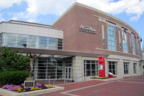
Boston University: Agganis Arena
Boston University - Mugar Library
more master programs:

Urban Environmental Management in (M.Sc.) Wageningen University, The Netherlands

Research M.Sc. in Urban Studies, University of Amsterdam, The Netherlands

Master's programme in Sustainable Urban Planning and Design in KTH Royal Institute of Technology, Sweden

Master of Architecture, Urban Design, University of Delhi, India

Master of Landscape Architecture, University of Texas, Arlington

Master of architecture, University of Sydney, Australia

Master of Urban Design Studies- University of Toronto

Friday, November 30, 2012

ANALYZING NEIGHBORHOOD RETAIL AND SERVICE CHANGE IN SIX CITIES

by C. Theodore Koebel

Little is known about neighborhood retail and service establishments, although they are often identified as positive attributes of successful neighborhoods and have been promoted through various community development programs. To date, research from urban and public policy fields has concentrated on the political economy of large-scale commercial development projects, particularly those promoted through public-private partnerships. Nonetheless, distressed neighborhood commercial districts present serious obstacles to the vitality of neighborhoods and the success of residential redevelopment. Consequently, neighborhood commercial spaces are often the focus of redevelopment programming. Our lack of knowledge about neighborhood retail and service establishments is itself an obstacle to community development.
The fundamental thesis of this research is that change in neighborhood retail and service establishments (number of establishments, employment size of establishment, number of employees, and payroll) is a function of market and non-market factors. The primary market factors relate to levels of demand from the residents of the businesses’ market areas and proximity to negative externalities in or near the neighborhood. The primary non-market factors are discrimination due to race and ethnicity, and the impact of household characteristics unrelated to demand.
The study uses a special data set for six cities (Baltimore, Boston, Chicago, Cleveland, Pittsburgh, and Oakland) and immediately surrounding counties. The data set includes 1980 and 1990 decennial census variables, and 1982-83 and 1992-93 mortgage volumes, as well as change measures for "stock" variables and rate of change measures for "flow" variables. Additional items (e.g. public housing units, distance to the CBD, and location of major retail centers outside the CBD) have been added to the data set. The dependent variable is the change in the number of establishments for neighborhood retail and service businesses. The current study overcomes previous impediments to analyzing neighborhood retail and service establishments by utilizing a special five-digit zip code data set from the CBP program and by aggregating census tracts to correspond to zip code areas.
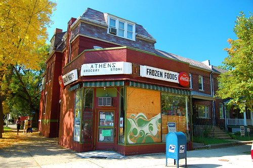
Athens Grocery Store

more about centrality:

Can Betweenness Centrality Explain Traffic Flow?

Correlating Densities of Centrality and Activities in Cities: the Cases of Bologna (IT) and Barcelona (ES)

Geographically Weighted Regression: A Method for Exploring Spatial Nonstationarity

Correlating street centrality with commerce and service location in cities

Street Centrality and Densities of Retails and Services in Bologna, Italy

Street Centrality and Densities of Retails and Services in Bologna, Italy

Spatial Network Analysis of Public Transport Systems: Developing a Strategic Planning Tool to Assess the Congruence of Movement and Urban Structure in Australian Cities

Centrality in networks of urban streets

Monday, March 12, 2012

Measuring neighborhood distress: a tool for place-based urban revitalization strategies

by James Jennings

The United States federal administration’s recent Promise Neighborhood and Choice Neighborhood initiatives are part of increasing calls for place-based strategies in the delivery of education and human services in inner cities. Within this new policy context, measures of community-level inequality emerge as a key tool for identifying places which manifest relatively high levels of social and economic distress and where this condition places acute pressures on local servicedelivery nonprofits. Measuring and spatially showing levels of neighborhood social and economic distress can enhance our understandings of the needs associated with low-income communities and facilitate civic engagement in the development of neighborhood-based responses. A ‘‘neighborhood distress score’’ can be generated and used to target services into urban areas but can also encourage greater resident civic participation. This score is based on the variables identified in the literature and input from community and civic leaders in Boston, MA.


more about urban revitalization:

The Tragedy of Urban Renewal – The Destruction and Survival of a New York City neighborhood

How Brownfield Redevelopment Reduces Pollution

Gentrification before Gentrification? The Plight of Pilsen in Chicago

It's a Big Week for the Ft. McPherson Redevelopment Project

Shrinking Cities: The Forgetting Machine

Culture and Urban Revitalization: A Harvest Document

Sunday, January 22, 2012

Bicycle Use and Safety In Paris, Boston, and Amsterdam

by J. Scott Osberg and Sarah C. Stiles

This article examines bicycle use and safety behavior in Paris, Boston, and Amsterdam. Population-adjusted bicycle and passenger car death rates in France, the United States, and The Netherlands provide context for understanding bicycle use and safety behavior. Observation data on helmet use and use of lights at night are also presented. Boston has the fewest bicycles per hour at 55, Paris is next at 74, compared to 242 cyclists per hour in Amsterdam. Thirty-two percent of Boston cyclists wore helmets versus only 2.4% of Paris cyclists and only 0.1% of Amsterdam cyclists. In contrast, Paris cyclists were far more likely to use lights at night (45.2%), than Boston cyclists (15.6%) or Amsterdam cyclists (7.6%). With bicycle and car deaths as the numerators, and the French, U.S., and Dutch populations as the denominators, the Netherlands appears to have a dramatically lower death rate for people in passenger cars and for the combined group of cyclists and passenger car occupants. Transportation safety policies in the Netherlands appear to be working better than policies in the U.S. or France. Politicians, transportation planners, and safety experts can learn a lot from the Dutch about how to promote cycling and build a safe bicyclefriendly environment.


Amsterdam cyclists:


more about bicycle planning:

The Münster Application for the European Green Capital Award

Bicycle policies of the European principals: continuous and integral

Sights and details from the 2011 NJ Bike and Walk Summit

On Amsterdam, bikes and the Copenhagen Wheel thingy

Metroradruhr: Germany's Ruhr Valley Inter-City Bike Sharing

Monday, November 21, 2011

City of Boston Announces Its BIXI Bike Share Program Is a Go

by Laura K. Cowan

Boston’s Bike Czar Nicole Freedman has achieved her goal to make Boston a biking city. Boston Mayor Thomas Menino has announced that his fair city, previously known as the worst cycling city in the country, will be getting one of the nation’s first public bike sharing systems, dubbed “Hubway,” from BIXI Bikes and the Public Bike Sharing Company. To be launched in early July, Boston’s bike sharing system will offer the public a green alternative to car share systems already in place and will work in a similar way. Customers can pick up a bike from any bike sharing station, then return it to any other station in the system.

Bike sahring in Boston, Hubway Station, photo by Chasqui (Luis Tamayo)


similar posts:

Sunday, April 3, 2011

Master of City Planning in Boston University

The Master of City Planning (MCP) prepares students for a wide variety of professional roles in planning for urban and regional development. The professional regional city planner frequently functions as a member of a multidisciplinary team and may be involved in such tasks as the analysis of policy alternatives, formulation of public investment programs, forecasting and monitoring urban and regional systems performance, development of joint programs among various public and private sector institutions, and plan design and implementation.
Candidates for admission to the degree program are selected on the basis of academic transcripts, academic and personal references, and interviews or statements of intent. Applicants with an undergraduate grade point average (GPA) lower than 3.0 are encouraged to submit additional information to demonstrate their capacity to succeed in graduate school. There are no fixed application deadlines. The program allows students to submit applications on a rolling basis. Admission decisions are announced promptly pending receipt of all application materials. Students can also register for and take up to two Metropolitan College Urban Affairs or City Planning courses prior to applying to the degree program.


Boston University, by wallyg
more master's degrees in urban planning:

Urban and Regional Planning Programs, Courses, Schools and Degrees in Ontario Universities

Master in Urban Planning (MUP) in Harvard University

The 10 Best Graduate Programs In Urban And Regional Planning

Monday, March 28, 2011

Urban Planning Today

Urban Planning Today
Urban Planning Today reports on projects in Atlanta, Boston, Chicago, New York, and Portland, bringing perspectives of urban design, city planning, criticism, and law to bear on the mixed bag of results observed in these cities.


more about Atlanta:

New Urbanism and Planning History: Back to the Future

Skyline photos of Atlanta 1

Tomorrow is Another Day for Atlanta’s Sustainable Transport

Saturday, January 29, 2011

The real story on Charlestown's bike lane removal

by Pete Stidman

The recent removal of the bike lane in Charlestown has been largely misunderstood and poorly reported in the biking blogosphere. A more accurate account has been published at Charlestown Patch, and I give some details on the situation on the ground below. But most importantly, I would like to ask my fellow cyclists to remain positive and to refrain from harassing Charlestown neighborhood activists or city employees. This is not helpful.
Charlestown is not anti-bike, and the city may have taken the right approach given the situation.
Let me introduce you to Tom Cunha, the dedicated chair of the Charlestown Neighborhood Council. I first met Tom at a meeting for the Rutherford Avenue/Sullivan Square reconstruction project where he expressed support for bike routes and a traffic-calming of the street to become a “boulevard” rather than a “highway.” He struck me as even keeled fellow who takes into account the needs of all the residents and businesspeople he represents—including cyclists.
“People think we’re anti-bike, we’re not anti-bike,” said Mr. Cunha in a phone conversation I had with him about the bike lanes today. “We just don’t want to create a tremendous parking situation for people on Main Street.”
What happened on Main Street was, after all, more about a miscommunication between the city and the neighborhood than any sentiment against cycling in Charlestown.
“Some of our businesses on Main Street have been closing because people couldn’t park,” said Cunha. And the neighborhood council had been discussing ideas for angled parking along the street to increase those parking opportunities.

Charlestown bicycle, photo by SignalPAD

more articles about Boston:

THE QUEST FOR ENVIRONMENTAL JUSTICE IN BOSTON TRANSPORTATION CONTROVERSIES 1969-73

On Walkability, Density, and Transit Villages

Friday, January 7, 2011

THE QUEST FOR ENVIRONMENTAL JUSTICE IN BOSTON TRANSPORTATION CONTROVERSIES 1969-73

By John G. Wofford
Conference on “The State of Environmental Justice in America 2007”
Howard University School of Law, March 2007
The transportation plan for the Boston area, which had been evolving since its formulation in 1948, called for major expansions of highways and rapid transit lines, and the curtailment of an existing commuter rail network. Its philosophy was that travel by auto and transit would compete for downtown Boston as a destination, and highways needed to be built to meet growing demand.

• Highways: The plan proposed three additional six- to eight-lane highways radiating into and out from a circular hub at the center, and a new highway tunnel to Logan Airport. Two of the new radial spokes were to be extensions of Interstate I-95, the so-called “Maine-to-Florida” highway. At one end, the Southwest Expressway would have extended I-95 from Route 128 (Boston’s circumferential highway about 10-12 miles from downtown) into the center of Boston; its site called for a highway through parklands called the Fowl Meadow and the Blue Hills at the outer end, and through dense working class and minority areas as it progressed toward the center. At the other end, I-95 North would have gone through mostly working class cities of Revere, Saugus, and Lynn, as well as one of the largest municipal parks in the country, the Lynn Woods, with its municipal reservoir. The Inner Belt would have connected those spokes and closed the circle of an inner ring road through the dense central part of the Boston area by linking to both ends of the already-built Central Artery; it would have gone through dense inner-city, mostly working class neighborhoods in the cities of Boston, Cambridge and Somerville as well as parklands along the Charles River and next to the Museum of Fine Arts, and an extension would have gone through the mixed-income South End.
 
• Rapid Transit: The existing Red Line of the subway system was to be extended at each end, and another rapid transit line, the elevated Orange Line along Washington Street, was to be torn down and the line relocated to an existing rail corridor serving Amtrak and commuter lines – improving service for some mixed income, inner-city residents, but removing it from an area substantially populated by low income and black residents. Commuter rail serving the outer suburbs was to be substantially reduced.


Green Line, Boston, image by wallyg
Aquarium Subway Stop, image by Nantaskart!
Brylaine, Boston, image by hesterjenna

more articles about urban transportation:

Rethinking Traffic Congestion

Making Transportation Sustainable: Insights from Germany

The Belt Line and Rail Traffic in Atlanta’s Urban Core

Thursday, September 23, 2010

On Walkability, Density, and Transit Villages

by Transbay Blog
17 July 2008

It’s official: according to the WalkScore.com rankings, San Francisco has been determined to be America’s most walkable city, as reported by the Chronicle. Our fair city’s score of 86 out of 100 just edged out New York’s 83, Boston’s 79, Chicago’s 76, and Philadelphia’s 74. The WalkScore algorithm does have some shortcomings (which the site frankly admits) — pedestrian conditions on Stockton Street in SF’s Chinatown could be much better than they are now, but that did not stop Chinatown from receiving a top score of 99 out of 100, a score largely based on the high density of a large variety of shops and services in a very compact area. But for anyone who has strolled through San Francisco’s downtown or neighborhood commercial districts, this news does not really come as too much of a surprise. Check out the complete listing of neighborhood scores here.
But the most revealing part of the article was not the part glorifying San Francisco, but rather, the part indicating that the Bay Area, taken as a whole, could be much more walkable than it is now. The Bay Area region fell in third place, “well below the greater Washington, D.C., and Boston regions,” according to the Chron.
Read more