Like Urban Research on Facebook

Showing posts with label Urban Gentrification. Show all posts

Monday, August 17, 2026

Skopje 2014: A New Vision for a Timeless City

A city reborn in just a few years—what does it look like when architecture becomes a symbol of identity? Welcome to Skopje, North Macedonia’s capital, where one of Europe’s most ambitious urban projects—Skopje 2014—aimed to transform the capital’s appearance and spirit. With more than €600 million invested, this effort reshaped the cityscape with symbolism, heritage, and vision. 

Recently I visited Skopje, where I had the chance to visit the city and its transport systems. The recent projects of the city with the aim of recreating and reclaiming history is being criticized by some, especially the neighboring countries. This video deals with such projects. 


Skopje 2014: A National Vision in Stone

Skopje 2014 was initiated with the goal of presenting the city in a more "classical" European light, contributing to a renewed sense of national identity. The project was closely linked to the country’s aspirations for self-definition after independence and its complex international naming discussions. The transformation introduced a wave of neo-classical facades, new monuments, bridges, government buildings, and the monumental Porta Macedonia, a grand archway reminiscent of historic European capitals.

Reimagining the Heart of Skopje

At the center of this transformation is Macedonia Square, crowned by the imposing Warrior on a Horse statue, widely associated with Alexander the Great. Standing at 22 meters, the statue and its accompanying fountain and bronze lions have become icons of the city. Completed in 2011, this sculpture anchors the new vision of the capital’s center.

More than 130 statues were installed across Skopje as part of the project. These include representations of historical figures, as well as symbolic pieces like "The Artist," "The Prometheus," and "The Beggar." Together, they create a narrative thread through public spaces, blending symbolism with national storytelling.

A Landmark on the Vardar River

The elegant Archaeological Museum of Macedonia, located on the Vardar River, is a centerpiece of the project. Designed in a neoclassical style with prominent columns and gleaming marble, it stands near the equally striking Ministry of Foreign Affairs. These institutions reflect the broader visual strategy of the project: unity through consistent architectural themes.

Investing in the Urban Image

Originally budgeted at €80 million, the total cost eventually rose to over €600 million. This level of investment demonstrated a strong commitment to urban renewal and cultural representation. While some questioned the scale and budget during times of economic challenge—unemployment was around 30% in 2013—many saw the project as a long-term investment in national pride and tourism.

Design and Environment

The materials and methods used for Skopje 2014 also drew attention. Marble, often imported, was a key component in achieving the desired aesthetic. Changes along the Vardar Riverfront reshaped public spaces, and some critiques focused on how new structures interacted with existing infrastructure. While the buildings favored symbolic presence over modern energy efficiency, they significantly changed how locals and visitors experience the city.

Cultural Layers and Urban Dialogue

Skopje is a city with a deep and varied history. From the ancient Roman town of Scupi, through the Ottoman period, to its modern development under Yugoslavia, the city has long been a mosaic of influences. This layered identity is visible in places like the Old Bazaar, the Stone Bridge, and modernist structures from the 20th century.

A City Rebuilt After Disaster

After a 6.1-magnitude earthquake in 1963 destroyed more than 75% of the city, Skopje underwent a dramatic transformation. International aid poured in, and Japanese architect Kenzo Tange helped guide a reconstruction plan based on modernist principles. The result was a cityscape defined by bold geometry, functional zoning, and a vision of progress through modernism.

Skopje 2014, launched between 2010 and 2017, introduced a classical architectural style that layered onto these earlier influences. Some modernist buildings were redesigned with new facades, offering a visual blend that reflects Skopje’s diverse identity.

A New Attraction for Locals and Visitors

Tourism has grown significantly, as visitors from around the world come to witness Skopje’s eclectic architectural landscape. The visual juxtaposition of Ottoman mosques, Brutalist towers, and neoclassical monuments offers a unique urban experience. For many, this variety illustrates how cities can tell their stories through buildings and public spaces.

Public Reactions and Civic Pride

Reactions to Skopje 2014 have been mixed, as is often the case with transformative projects. Some residents admire the grandeur and symbolism, seeing it as a source of pride and a way to put Skopje on the map. Others have called for more community engagement in urban planning processes. Nevertheless, the changes have undeniably created a cityscape that is both distinctive and memorable.

Urban Planning and Future Prospects

As the city moves forward, there is an opportunity to balance tradition with innovation. The legacy of Skopje 2014 is still being shaped, not only by maintenance and tourism but also by ongoing public dialogue. Some elements may be reimagined over time, while others will become historic symbols in their own right.

Architecture and Identity

The core idea behind Skopje 2014—that urban design can express national character—is not unique to North Macedonia. Cities around the world use architecture to project values, build memory, and frame collective identity. Skopje’s project represents one such effort: a vision cast in stone and bronze to mark a new chapter in the nation’s history.

Looking Ahead

Skopje 2014 stands today not only as a development plan but as a powerful example of how cities adapt and grow. Its classical columns and grand plazas invite reflection on heritage, ambition, and the role of public space. Whether admired as visionary or debated for its scale, it has succeeded in putting Skopje into the global spotlight.

Through architecture, Skopje 2014 aimed to tell a story of resilience, culture, and unity. And in doing so, it opened a new conversation about how cities shape identity, not only for those who live in them, but for everyone who visits and looks upon their skyline.

More about urban planning policy:

How London’s Radical Green Plan Could Save Every Major City


Saturday, July 25, 2026

How London’s Radical Green Plan Could Save Every Major City

How do you fit nine million people into one of the world’s most dynamic cities—without losing its trees, parks, and wild edges? That’s the central challenge London faces. This isn’t just about concrete and steel versus grass and gardens—it’s about how a global city evolves while keeping its soul rooted in green.


The Pressure of Growth

London is growing—fast. As of 2023, the city’s population surpassed 9 million, and projections suggest it could reach 10.5 million by 2050. With such rapid urban expansion, demand for housing, office space, and transport infrastructure has never been greater. At the same time, London is committed to being one of the greenest major cities in the world.

Balancing these priorities is at the heart of the London Plan—a strategic planning document guiding development in the city. First introduced in 2004, and most recently updated in 2021, the Plan emphasizes “Good Growth”, a principle that aims to integrate density, affordability, inclusivity, and environmental sustainability.

But how does this actually play out on the ground?

King’s Cross: Model for Urban Regeneration

One of the clearest examples is the King’s Cross redevelopment. Once an underused industrial zone, King’s Cross has undergone a transformation that embodies what the London Plan hopes to achieve. Over £3 billion has been invested into the area since the early 2000s.

This 67-acre site now includes over 2,000 new homes, 3.4 million square feet of office space—including the European headquarters of Google, and 26 acres of open space, including Granary Square and Gasholder Park.

King’s Cross demonstrates that high-density urban living and green public spaces can coexist—but not without careful design and planning. Developers here worked closely with Camden Council and community stakeholders to ensure that the area remained accessible, walkable, and inviting to the public, not just corporate tenants.

The Green Belt: London's Environmental Safety Net

Zooming out from the city center, we encounter one of the most hotly debated features of London’s planning ecosystem: the Green Belt.

Established in 1955, the Metropolitan Green Belt covers more than 5,000 square kilometers, or about 22% of all land in the Greater London area. The goal was simple: prevent urban sprawl and maintain a clear boundary between city and countryside.

It has largely succeeded—London is surrounded by protected woodland, farmland, and parkland, and unlike many global megacities, you can reach the countryside by train in under an hour.

But critics argue the Green Belt now acts as a constraint, artificially driving up housing prices by limiting available land. The average London home now costs £523,000, nearly 14 times the average salary.

Advocates of “Green Belt reform” suggest opening some parts for selective development, especially areas near existing transport infrastructure, while protecting ecologically valuable zones. But for many, the Green Belt remains sacred—a buffer against overdevelopment.

Inner-City Nature: The Role of Community Gardens

While policy debates rage at the macro level, a quiet revolution is happening at the local scale: community gardens and urban greening initiatives are reintroducing nature into London’s most densely built environments.

Across the capital, there are now over 2,500 registered community green spaces, including rooftop gardens, allotments, and micro-parks. In boroughs like Hackney and Southwark, local groups have reclaimed disused plots to create thriving green oases.

Take Dalston Eastern Curve Garden, built on an old railway line. It’s now a lively public space that hosts workshops, composting programs, and even movie nights—all while supporting biodiversity in one of London’s most urban neighborhoods.

These initiatives are more than just pretty—they help reduce urban heat, absorb rainwater runoff, and improve mental health. They represent how grassroots action can complement top-down policy.

Green Infrastructure and Climate Resilience

The role of green spaces has taken on new urgency as London grapples with climate change. The city experienced record-breaking heat in July 2022, with temperatures soaring past 40°C for the first time in recorded history.

To tackle this, the Greater London Authority is investing in green infrastructure, which includes not only parks and trees but also green roofs, walls, and rain gardens. These features reduce urban heat islands, lower energy use, and manage flooding—a growing concern due to heavier rainfall and aging drainage systems.

As of 2023, more than 700 green roofs had been installed in London, and the city’s Urban Greening Factor policy now requires developers to incorporate natural elements into new buildings.

The Importance of Access

Having green space is one thing—access is another. A key principle in London’s planning is that everyone should be within 400 meters (a 5-minute walk) of a green area.

But in reality, access is uneven. Neighborhoods like Tower Hamlets and Lambeth fall below this threshold, while wealthier boroughs like Richmond and Kensington & Chelsea exceed it. This inequality in green access mirrors broader socioeconomic divides.

To address this, local authorities are mapping “green poverty” zones and prioritizing investment in underserved areas. In Lewisham, for instance, the Greening Fund has supported 70+ projects aimed at increasing tree cover and revitalizing public parks in lower-income neighborhoods.

New Developments and Controversies

Not all land use stories in London end harmoniously. The Silvertown Tunnel project in East London, set to cost £2.2 billion, has sparked controversy. While supporters argue it will reduce congestion and support economic growth, critics say it will bring more cars into already polluted areas like Greenwich and Newham.

Similarly, plans for housing developments in Barnet and Hounslow have faced pushback due to fears of losing green space. These debates underscore the trade-offs involved in balancing housing, transport, and environmental goals.

Technology and Mapping the Future

Digital tools are now helping to map and manage London’s land use more effectively. The London DataStore, operated by the Greater London Authority, offers open access to detailed maps of land usage, green space distribution, and planning permissions.

Developers are also using GIS and machine learning to identify underused land, optimize green infrastructure layouts, and forecast future environmental impacts.

In a 2022 pilot, Lambeth Council used drone mapping to analyze tree canopy cover and identify where to plant new trees to cool down hotspots. This type of data-driven planning is reshaping how urban design happens in real time.

London’s Green Future

So, where is London heading?

The Mayor’s Environment Strategy lays out a bold vision: by 2050, London aims to become the world’s first National Park City, with more than 50% of its surface covered by green or blue infrastructure (including rivers, lakes, and ponds).

To get there, the city needs to deliver more homes—especially affordable ones—without sacrificing its green character. This means building up rather than out, promoting car-free developments, and using brownfield sites instead of greenfield ones.

Conclusion: The Living City

London’s story is not one of choosing between growth and green—it’s about finding new ways to do both. From Victorian parks to 21st-century eco-roofs, the city has always reinvented how space is used.

As new towers rise and neighborhoods evolve, the real challenge is ensuring that London remains a place where people can live, work, and breathe—together. Because in the end, a great city isn’t just made of buildings. It’s also made of gardens, trees, and the people who care for them.

More about London:

Why are some modern cities removing sidewalks? Are shared spaces good for mobility?


What is Urban Blight, and what causes it?

Urban blight, also known as urban decay, refers to the deterioration and decline of city areas, usually due to neglect, economic downturn, or poor urban planning. This phenomenon often leads to vacant buildings, rundown infrastructure, and declining property values. The result is a negative impact on the quality of life, reduced economic activity, and increased social challenges such as crime and unemployment. Let's explore what causes urban blight, its effects, and examples of cities that have faced this issue.


Causes of Urban Blight

1. Economic Decline: When industries or businesses shut down, cities can lose a significant portion of their economic base. This was seen in places like Detroit, where the decline of the auto industry left vast areas of the city abandoned.

2. Suburbanization: As people move to the suburbs for better housing, schools, and safety, inner-city areas can experience depopulation and neglect. This “flight” to the suburbs can drain cities of their middle-class residents and tax revenue.

3. Neglect of Infrastructure: Lack of investment in public infrastructure like roads, public transport, and utilities can lead to the decay of entire neighborhoods. Over time, the area becomes less attractive for residents and businesses.

4. Poor Urban Planning: Bad zoning laws and lack of long-term planning can create environments where buildings and public spaces deteriorate faster. For example, areas with mixed-use zoning (residential, commercial, and industrial) without proper planning can suffer from blight due to incompatible land use.

5. Political and Social Factors: Corruption, mismanagement, and lack of governance can accelerate the decline of urban areas. Social factors like crime and poverty can also contribute to the decline, creating a cycle that’s difficult to break.

Effects of Urban Blight

• Vacant and Abandoned Properties: Empty homes and commercial buildings become common, leading to a decline in property values. In the U.S., it is estimated that there are over 17 million vacant properties nationwide, with many in blighted urban areas.

• Increased Crime: Blighted areas often see a rise in crime due to a lack of social cohesion and economic opportunities. Studies show that abandoned properties are linked to higher rates of vandalism, drug use, and other illegal activities.

• Economic Decline: The decline in property values and loss of businesses can result in a reduced tax base, making it difficult for cities to fund public services like education, police, and fire departments.

• Health and Environmental Issues: Urban blight can lead to public health problems, including higher rates of asthma and lead poisoning due to poor housing conditions. Abandoned buildings and lots can also become dumping grounds for hazardous waste.

Strategies to Combat Urban Blight

1. Urban Renewal Projects: Some cities have launched large-scale urban renewal initiatives to revitalize blighted areas. For example, New York City successfully transformed Times Square from a crime-ridden neighborhood in the 1980s to a major tourist attraction today.

2. Community Involvement: Grassroots efforts, such as community gardens, neighborhood clean-ups, and local arts projects, have proven effective in revitalizing neighborhoods. Philadelphia’s “Mural Arts Program” turned abandoned walls into vibrant public art, which helped to reduce blight and foster community pride.

3. Adaptive Reuse of Buildings: Converting old, vacant buildings into new uses can breathe new life into blighted areas. In Pittsburgh, old warehouses have been transformed into trendy lofts, offices, and art spaces, attracting new residents and businesses.

4. Economic Incentives: Offering tax breaks and incentives for businesses and developers to invest in blighted areas can encourage redevelopment. New Orleans, after Hurricane Katrina, used tax incentives to attract investors to rebuild the city.

5. Land Banks: Many cities use land banks to acquire, manage, and repurpose vacant properties. This strategy helps to stabilize property values and reduce the negative effects of blight. As of 2021, over 250 land banks operate in the United States, targeting cities like Flint, Michigan, and Buffalo, New York.

Conclusion

Urban blight is a complex problem with deep economic, social, and political roots. However, with targeted strategies like urban renewal, community engagement, and adaptive reuse, cities can transform decaying areas into thriving neighborhoods. The key to reversing urban blight lies in strategic planning, investment, and a commitment to building sustainable, vibrant communities.

As cities continue to grow and evolve, addressing urban blight will remain crucial for ensuring that urban spaces are livable and prosperous for future generations.

More about urban planning:

Complexity Theory and Urban Planning

The 3 Most Successful Examples of Urban Planning in Modern India


Wednesday, December 10, 2025

Daniel Burnham: The Man Who Planned the Future of Cities

Meet Daniel Burnham, the visionary behind the 1909 Plan of Chicago, one of the most influential urban plans in history. His designs weren’t just about beauty—they were about efficiency, mobility, and making cities places people wanted to live in. He believed in bold visions, grand architecture, and transforming chaotic urban sprawl into well-organized, monumental spaces.

But how did Burnham come up with his ideas? And how did the 1909 Chicago Plan change the city forever? Stay with me as we explore the story of a man who believed in "Make no little plans" and forever changed urban life.


Early Life and Career: The Architect of the Future


Born in 1846, Daniel Burnham started his career in architecture but soon realized that buildings alone weren’t enough—entire cities needed better planning. By the late 19th century, Chicago was booming. The population had exploded from 30,000 in 1850 to over 1.7 million by 1900. But with that growth came problems: overcrowding, poor sanitation, traffic congestion, and lack of green space.

Burnham had already made a name for himself as the director of the 1893 World’s Columbian Exposition, where he transformed 600 acres of swampy land into a stunning neoclassical "White City" that attracted over 27 million visitors. The success of this fair proved that urban design could be both beautiful and functional, inspiring Burnham’s future city planning ideas.


The 1909 Plan of Chicago: A Bold Vision


At the turn of the century, Chicago was growing faster than any city in the world. But with rapid growth came chaos—narrow streets, pollution, and slums. Burnham, alongside his partner Edward Bennett, took on the ambitious task of redesigning the entire city with the Plan of Chicago, published in 1909.

This plan was revolutionary. It proposed:

  • A citywide road system with grand boulevards and diagonal streets for better traffic flow.
  • A massive lakefront park system, ensuring that the entire Chicago lakefront remained public land.
  • A network of parks and green spaces, to improve quality of life.
  • A new, efficient rail and freight system to reduce congestion.
  • Civic and cultural centers, including a majestic central plaza inspired by European cities.

One of the most audacious ideas? A completely restructured lakefront, turning what was once industrial land into over 25 miles of uninterrupted public parks and beaches—a feature that defines Chicago to this day.


Transforming Chicago: What Was Actually Built?


The Plan of Chicago wasn’t just an idea—it shaped real, lasting changes. Over the next decades, the following have been fulfilled. 

  • Grant Park was expanded, becoming Chicago’s "front yard," home to landmarks like Millennium Park and the Art Institute of Chicago.
  • The city developed a network of parks and forest preserves, adding thousands of acres of green space.
  • Wacker Drive was constructed, following Burnham’s vision for multilayered roads that separated commercial and pedestrian traffic.
  • The rail system was restructured, leading to modern commuter transit improvements.

But not everything in the plan came to life. Burnham envisioned monumental civic centers and grand European-style boulevards that never fully materialized. Still, his ideas inspired countless city planners across the U.S., leading to better city layouts in Washington D.C., San Francisco, and even overseas in Manila.


Beyond Chicago: Burnham’s Global Influence


Burnham’s genius wasn’t limited to Chicago. His planning ideas influenced:

  • Washington D.C. – He redesigned the National Mall, shaping it into the monumental space we know today.
  • San Francisco – After the 1906 earthquake, he proposed a radical redesign of the city, though it was never fully realized.
  • Manila and Baguio (Philippines) – Burnham’s master plan for Manila featured wide boulevards, waterfront parks, and grand civic buildings, some of which still exist today.

His influence laid the foundation for modern urban planning, inspiring the City Beautiful Movement, which emphasized grand, organized, and aesthetically pleasing city designs.


The Legacy of Daniel Burnham


More than a century later, Daniel Burnham’s vision still shapes Chicago and countless other cities. His ideas about green space, transportation, and urban beauty remain cornerstones of city planning today. His "Make no little plans" philosophy reminds us that cities should be designed for both function and inspiration.

So, next time you walk through Chicago’s downtown, Washington D.C.’s National Mall, or even parts of Manila, remember that one man’s big dreams and bold ideas helped create the cities we know today.


More about the history of urban planning:

The history of Indian railways: Colonial beginnings, overcrowding, and socioeconomic impacts


Tuesday, December 17, 2024

Gentrification: Why Cities Keep Changing

Gentrification. It’s a term that stirs up mixed emotions. Some see it as urban revitalization, while others view it as a force of displacement. But why do cities keep changing, and who benefits from this transformation? Let’s dive into two iconic case studies: Brooklyn, New York, and 19th-century Paris.


Brooklyn, New York: The Hipster Takeover

In the last two decades, Brooklyn has become a prime example of gentrification in action. Neighborhoods like Williamsburg and Bushwick have transformed from industrial areas to trendy hotspots. Once a gritty, working-class borough, Brooklyn saw an influx of young professionals, artists, and tech-savvy entrepreneurs in the early 2000s. But this shift came at a price.

Rising Property Prices:
From 2000 to 2020, property values in Williamsburg skyrocketed by nearly 200%, pushing out long-time residents who could no longer afford the rising rents. The median rent for a one-bedroom apartment jumped from $1,100 in 2010 to over $3,000 in 2023. This trend isn’t limited to Williamsburg; the entire borough saw property values increase by 65% between 2010 and 2020.

Demographic Shifts:
Brooklyn’s transformation also changed its demographic makeup. According to the U.S. Census Bureau, the white population in Williamsburg increased by 44% between 2000 and 2010, while the Latino population decreased by 27% in the same period. The cultural diversity that once defined these neighborhoods is slowly fading, replaced by upscale cafes, art galleries, and high-end boutiques.

Economic Impact:
However, it’s not all bad news. The influx of wealthier residents has revitalized local businesses, leading to new job opportunities. The New York City Economic Development Corporation reported that Brooklyn added over 90,000 jobs between 2010 and 2019, mainly in tech, healthcare, and hospitality. But critics argue that these jobs don’t always benefit the original residents, many of whom are priced out before they can reap the rewards.


Paris and Haussmannization: The Original Gentrification?

While gentrification might seem like a modern phenomenon, it actually dates back to the 19th century with one of the most ambitious urban renewal projects in history—Haussmannization in Paris. In the 1850s, under the direction of Baron Georges-Eugène Haussmann, the French government undertook a massive project to modernize Paris. The narrow medieval streets were replaced with wide boulevards, parks, and grand buildings.

Transforming Paris:
Haussmann’s renovation wasn’t just about aesthetics. It was a deliberate move to make Paris more navigable and healthier, reducing the spread of diseases like cholera. Over 12,000 buildings were demolished, and 80 miles of new roads were constructed. This gave birth to the iconic Paris we know today, with its grand avenues and uniform architectural style.

Social Displacement:
But this transformation came at a significant social cost. Haussmann’s project displaced nearly 350,000 residents, primarily the working-class poor. Many were forced to move to the outskirts of the city, giving rise to the suburbs or “banlieues.” This form of displacement created a clear divide between the affluent city center and the poorer periphery, a pattern that still exists today.

Legacy and Criticism:
While Haussmannization is often celebrated for turning Paris into the “City of Light,” it also sparked criticism. The project faced backlash for prioritizing aesthetics and infrastructure over the needs of the existing residents. Many historians argue that Haussmannization was an early form of gentrification, where modernization served the wealthy at the expense of the poor.


The Double-Edged Sword of Gentrification

Gentrification isn’t inherently good or bad—it’s a double-edged sword. On one hand, it can breathe new life into decaying neighborhoods, increase property values, and attract investment. On the other hand, it often results in the displacement of long-time residents, erases cultural heritage, and creates social divides.

For example, in cities like San Francisco, the tech boom led to a surge in gentrification, particularly in areas like the Mission District. From 2011 to 2021, median home prices in San Francisco rose by over 80%, forcing many low-income residents to leave. Meanwhile, in Berlin, where rent controls are stricter, gentrification has been slower but not entirely avoidable. The city introduced a rent cap in 2020, which temporarily froze rent prices for five years, although it was later overturned.


Conclusion: The Future of Urban Change

So, why do cities keep changing? The answer lies in the constant push and pull between growth and preservation. Gentrification is a byproduct of cities evolving to meet the demands of a new generation. But as we’ve seen, this transformation comes with a cost. The challenge for urban planners is to find a balance that revitalizes neighborhoods without displacing the people who call them home.

Cities like Copenhagen and Portland are experimenting with inclusive urban policies to mitigate the negative effects of gentrification. Whether these efforts will succeed remains to be seen, but one thing is clear: as long as cities evolve, the debate over gentrification will continue.


More about gentrification:

Measuring Gentrification in the Interstate Corridor Urban Renewal Area

Saturday, August 31, 2019

Measuring Gentrification in the Interstate Corridor Urban Renewal Area

By Indrani Boyle

This study seeks to evaluate and reflect upon attempts to measure gentrification in the Interstate Corridor Urban Renewal Area (ICURA) of Portland, Oregon. Established in 2000 by the Portland City Council, and managed by the Portland Development Commission (PDC), the urban renewal area relies on the use of Tax Increment Financing (TIF) to fund capital improvements in a defined area of North/Northeast Portland. Although twenty urban renewal areas have been instituted within the City of Portland since the late 1950’s, few in recent history have included substantial residential areas (B. Durston, personal communication, October 1, 2008). For example, the River District Urban Renewal Area targeted a largely abandoned industrial area beginning in 1998, resulting in the creation of “The Pearl,” a vibrant multi-use district with a significant amount of housing. Although the growth of The Pearl has inspired concerns about gentrification and housing affordability, the prospect of urban renewal in the heavily residential areas of North/Northeast Portland prompted stronger reactions. In a largely homogenous city, the ICURA contains sections of 10 neighborhoods, including historically African American neighborhoods. History makes the racial composition of neighborhoods relevant. Previous actions of PDC led to the relocation of hundreds of African American households to make way for large-scale redevelopment projects. In addition, persistent patterns of legal and illegal discrimination contributed to income and housing instability. Homeownership rates for African Americans in Portland remain well below population averages. However, the neighborhoods within the ICURA were characterized by a deteriorating housing stock, declining employment opportunities, and criminal activity. To many, urban renewal represented both a threat and an opportunity. By necessity, the implementation of urban renewal causes change. In both fact and perception, these changes are likely to be simultaneously positive and negative.


Portland

More articles about urban renewal and revitalization:

Planning and Urban Design for a Liveable High-Density City

Tuesday, August 8, 2017

Urban Design and the Changing Context of Urban Regeneration in the Netherlands

By Paul STOUTEN,

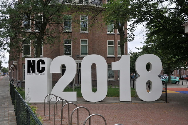
Urban design schemes accompanied by avant-garde design of space have been an outcome of economic growth of cities and countries in many periods of time. At the beginning of the 21st century, Nieuw Crooswijk in Rotterdam was the largest area involved in nationally launched policies. Many times the conflicts surrounding the plan were in the news, particularly concerning the aim to attract higher incomes. Gentrification, with displacement of present and original residents forms a central issue and the discussions in Nieuw Crooswijk fit within the more general urban landscape and language of urban regeneration in Europe.


'Nieuw Crooswijk 2018' Rotterdam

More about the Netherlands:

Photos of bike lanes in Amsterdam, Netherlands (1)

Residential self-selection and travel: The relationship between travel-related attitudes, built environment characteristics and travel behaviour

The World's 7 Most Bike-friendly Cities

Graffiti photos of Rotterdam, Netherlands

BEST PRACTICE IN FACILITATING AND PROMOTING ACTIVE TRAVEL