Like Urban Research on Facebook

Saturday, October 26, 2013

Residential Self-Selection and Its Effects on Urban Commute Travels in Iranian Cities Compared to US, UK, and Germany

by Houshmand E. Masoumi

Residential self-selection has gained increasing attention in the Western travel behavior research during the past decade. Many studies in the US, UK, and Germany conclude that the role of individuals’ residential location choice on commute travel behavior is more important than that of the built environment or at least it has considerable effects. However the effectiveness of location choice in many countries and cultures like Iran is unclear. This study examines the self-selections in two neighborhoods in Tehran. As a part of a research about the influences of land use on travel behavior information about people’s location preferences was collected by direct questioning. The findings show that the main reasons for selecting the location of residential units are related to socio-economic factors such as rise of house price and affordability of house prices. Transportation has little impacts on location decisions. Moreover, residential self-selection accounts for only 3 to 7.5 percent of the pedestrian, PT, and car trips.


Hemmat Highway

more about  planning in Iran:

MODELING THE TRAVEL BEHAVIOR IMPACTS OF MICRO-SCALE LAND USE AND SOCIO-ECONOMIC FACTORS

The Study of Land Use Changes in the Tehran Metropolitan Area by Using MOLAND Model


Distribution and Determining of Urban Sprawl in Kerman with Emphasis on Kariz Water System


URBAN PATTERNS FOR A GREEN ECONOMY: LEVERAGING DENSITY


Facilitating Urban Management Through Local SDI Case Study: The Municipality of Tehran 

URBAN SPRAWL IN IRANIAN CITIES AND ITS DIFFERENCES WITH THE WESTERN SPRAWL


A new approach to the Iranian urban planning, using neo-traditional development

Tuesday, August 27, 2013

MODELING THE TRAVEL BEHAVIOR IMPACTS OF MICRO-SCALE LAND USE AND SOCIO-ECONOMIC FACTORS

by Houshmand E. Masoumi

The effects of neighbourhood-level land use characteristics on urban travel behaviour of Iranian cities are under-researched. The present paper examines such influences in a microscopic scale. In this study the role of socio-economic factors is also studies and compared to that of urban form. Two case-study neighbourhoods in west of Tehran are selected and considered, first of which is a centralized and compact neighbourhood and the other is a sprawled and centreless one. A Multinomial Logit Regression model is developed to consider the effects of socio-economic and land use factors on urban travel pattern. In addition, to consider the effective factors, cross-sectional comparison between the influences of local accessibility and attractiveness of the neighbourhoodcentres of the two case-study areas are undertaken. Also the causality relationships are considered according to the findings of the survey. The findings indicate significant effects of age and household income as socio-economic factors on transportation mode choice in neighbourhoods with central structure. One the other hand, no meaningful association between socio-economic or land use variables are resulted by the model for the sprawled case. The most effective land use concept in micro-scale is considered to be satisfaction of entertainment facilities of the neighbourhood. Also the descriptive findings show that the centralized neighbourhood that gives more local accessibility to shops and retail generates less shopping trips. In considering the causal relations, the study shows that providing neighbourhood infrastructures that increase or ease the accessibility to neighbourhood amenities can lead to higher shares of sustainable transportation modes like walking, biking, or public transportation use.


A view of Tehran

more about urban planning in Iran:

Sustainable Urban Growth Management Using What-If?

Monitoring and modeling the urban growth of mid-size cities in Iran by Markov model: the case study of Zanjan City

An investigation of urban systems using entropy and elasticity measures: case study of North Region of Iran


Socio-spatial Obstacles of Urban Sustainability in Historic Center of Cities in Iran


Impact Assessment of Sustainable Public Transportation System on Quality of Life in Tehran


URBAN SPRAWL IN IRANIAN CITIES AND ITS DIFFERENCES WITH THE WESTERN SPRAWL


A new approach to the Iranian urban planning, using neo-traditional development

The Study of Land Use Changes in the Tehran Metropolitan Area by Using MOLAND Model


Distribution and Determining of Urban Sprawl in Kerman with Emphasis on Kariz Water System


URBAN PATTERNS FOR A GREEN ECONOMY: LEVERAGING DENSITY


Facilitating Urban Management Through Local SDI Case Study: The Municipality of Tehran

Monday, August 26, 2013

Sustainable Urban Growth Management Using What-If?

by Asgary, A., Klosterman, R. and Razani, A.

This paper examines the application of a GIS based planning support system, What If? TM, to evaluate alternative growth policies for sustainable urban growth in a rapidly growing city of Iran. The paper describes the study area, Dorood city, and the What If? Model. It then explains the procedures that were used to obtain the required data and to run the model to Dorood city. The paper concludes by considering the results and implications, which the study has for urban growth management of the city to preserve farmland and accommodate growth in the city.

read more


more about urban sprawl in Iran:

Monitoring and modeling the urban growth of mid-size cities in Iran by Markov model: the case study of Zanjan City

Distribution and Determining of Urban Sprawl in Kerman with Emphasis on Kariz Water System

The Impact of Urban Sprawl up on Air Pollution 

URBAN SPRAWL IN IRANIAN CITIES AND ITS DIFFERENCES WITH THE WESTERN SPRAWL

An investigation of urban systems using entropy and elasticity measures: case study of North Region of Iran

Strategy for Sustainable Urban Development: A Case Study of Urmia City, Iran

Studying the effects of urban sprawl of metropolis on tourism - climate index oscillation: A case study of Tehran city

Changes in population settlement pattern in urban system of Tehran province (1966 to 2006)

URBAN SPRAWL AND CLIMATIC CHANGES IN TEHRAN

Monitoring and modeling the urban growth of mid-size cities in Iran by Markov model: the case study of Zanjan City

by Akbar Asghari Zamani and Saeed Maleki

Rapid land use change has taken place in many mid-sized cities of Iran such as Zanjan over the past three decades. This research analyzed the land use/cover change Zanjan from 1965 to 2005; identified the patterns of urban growth and the fragmentation of the urban space by applying GIS and remote sensing tools. The main driving forces of the urban changes were analyzed and the model to predict the land use/cover changes was applied. Our results show the importance of monitoring and modeling of rapid urban growth for attaining sustainable mid-sized cities in developing countries that are strongly dependent on export of natural resources. The results indicated that there had been a notable and uneven urban growth and a major loss of cropland loss between 1965 and 2005. Most of the urban growth and loss of agriculture land occurred in inner and outer suburbs. This research analyzed the land use/cover change Zanjan from 1965 to 2005, identified the patterns of urban growth and the fragmentation of the urban space, applying GIS and remote sensing tools. We believe that in urban growth modeling process there has been multi socialeconomical and physical elements in which have key rules in it, and we attempted to use some of them.


more about urban planning in Iran:

The Impact of Urban Sprawl up on Air Pollution 

Strategy for Sustainable Urban Development: A Case Study of Urmia City, Iran

Good Governance, (as promoting in decision-making process) and its influence on urban strategic plans

Abadan: planning and architecture under the Anglo- Iranian Oil Company

Changes in population settlement pattern in urban system of Tehran province (1966 to 2006)

An investigation of urban systems using entropy and elasticity measures: case study of North Region of Iran

Socio-spatial Obstacles of Urban Sustainability in Historic Center of Cities in Iran

Impact Assessment of Sustainable Public Transportation System on Quality of Life in Tehran

URBAN SPRAWL IN IRANIAN CITIES AND ITS DIFFERENCES WITH THE WESTERN SPRAWL

A new approach to the Iranian urban planning, using neo-traditional development

The Impact of Urban Sprawl up on Air Pollution

by Pourahmad, A., Baghvand, A., Zangenehe Shahraki, S., and Givehchi, S.

About half a century ago, following the introduction of urban sprawl up concept, various studies have been conducted to describe the mechanism and the formation of this phenomenon. Some of these studies aimed at finding the negative and positive impacts of such phenomenon on urban area with emphasis on how such concept may be looked open from environmental, economical and social perspectives.The main research objective, in this article, focuses on adverse impacts of urban sprawl on air pollution in a mega city such as Tehran. Therefore, attempts have been made to show a relationship between urban sprawl up and the increase in air pollutants concentration. Three methods have been investigated to validate such a concept methodologically. Tehran has been chosen as a case study to further demonstrate validity of such a correlation between urban sprawl up and rise in air pollution scientifically. The results confirmed a function relating air pollution increase to urban sprawl up. 
IMG_2642

more about Iran:

A GEOGRAPHICAL STUDY OF KARAJ : A SATELLITE CITY IN THE URBAN REGION OF TEHRAN

Studying the effect of neighborhood size in urban growth modeling using cellular automata

The Study of Land Use Changes in the Tehran Metropolitan Area by Using MOLAND Model

Distribution and Determining of Urban Sprawl in Kerman with Emphasis on Kariz Water System

URBAN PATTERNS FOR A GREEN ECONOMY: LEVERAGING DENSITY

Facilitating Urban Management Through Local SDI Case Study: The Municipality of Tehran

Monday, August 19, 2013

Liveable Neighbourhoods: Street Layout, Design and Traffic Management Guidelines

Based on a report by ERM Mitchell McCotter Pty Ltd.

This chapter reviews the objectives of the Liveable Neighbourhoods Community Design Code (Liveable Neighbourhoods) and examines the relationship between urban design and the guidelines for street layout, design and traffic management which are the principal subject of this publication. For simplicity these guidelines will be referred to as ‘Traffic Management Guidelines’ throughout the remainder of the document.

Liveable Neighbourhoods promotes a more traditional spatial structure for new developments and provides an alternative approach to the design of neighbourhoods and towns to achieve compact, well-defined and more sustainable communities. It provides an approach to movement networks, street design and intersection control to support communities of neighbourhoods.
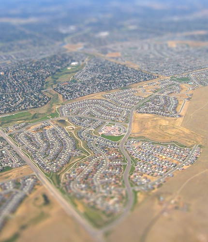
Communities are based on a system of ‘walkable neighbourhoods’. The neighbourhoods comprise land within a five-minute walk, or 400-metre radius. They are shown as circles with an area of around 50 hectares. Where a site is of sufficient size, neighbourhoods are clustered together around a central town.
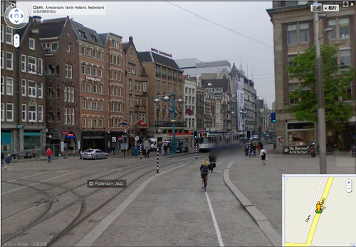
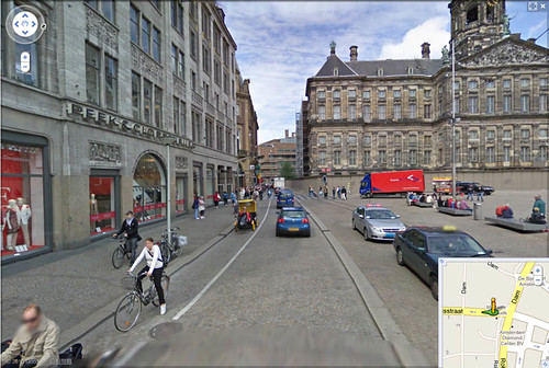
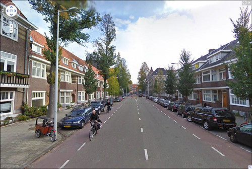
Neighbourhood centres are no longer located in the centre of ‘cells’. Arterial streets and important local streets called Neighbourhood Connectors form the spine of the neighbourhoods and town, rather than the edges. Neighbourhood and town centres are located at the junction of these streets, reflecting their economic value in the modern movement economy. In this way the passing vehicle traffic supplements the local neighbourhood pedestrian and cyclist traffic in supporting the local shops (refer to Figure 1).
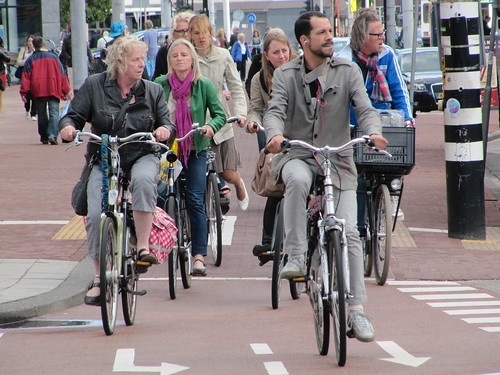
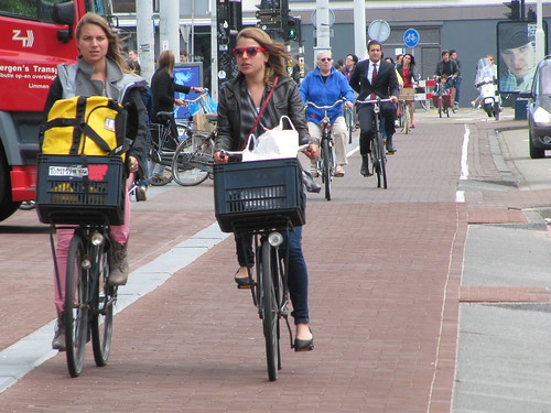
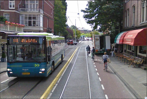
Liveable Neighbourhoods provides for a highly interconnected network of streets. The interconnected network allows compatible land uses that are required for daily needs to be located with walkable access and proximity. This provides a viable alternative to the need to drive from one land use to another, thus reducing traffic congestion on Arterial streets.
Culs-de-sac become less frequent, and are normally located near the far edge of a neighbourhood or town. They should be placed in a through reservation for pedestrian and cycle access and located so that they do not impede overall connectivity.
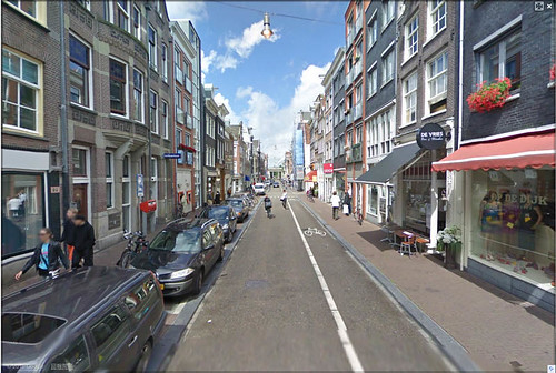
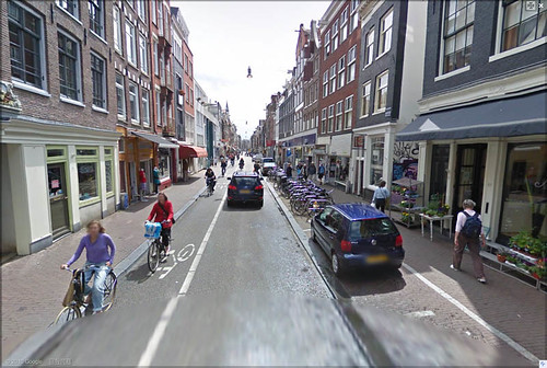
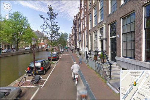
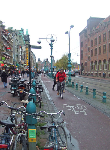
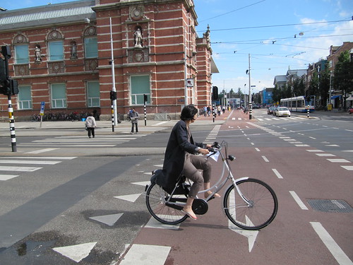
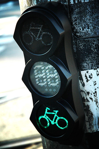
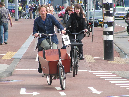
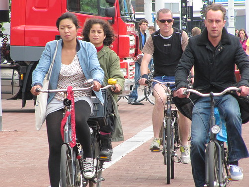
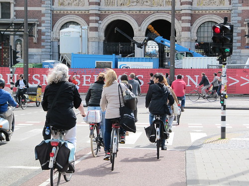
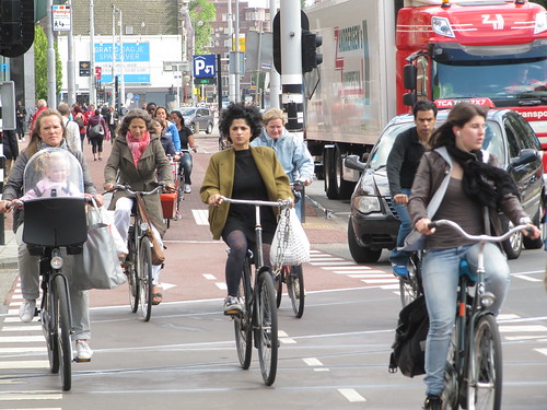
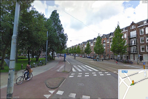
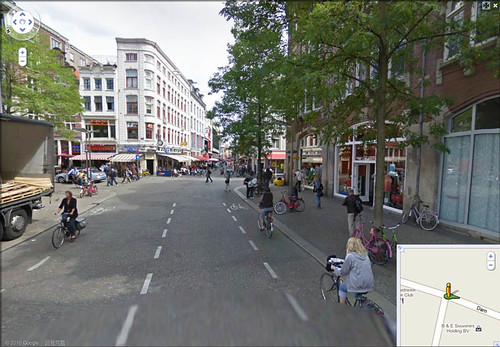
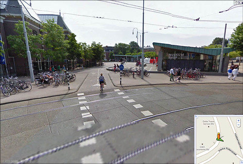
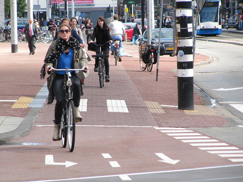
All streets, including Arterial streets and Neighbourhood Connectors, have an important role in the urban structure. They contribute to community liveability by integrating all modes of travel including motoring, walking, cycling and using public transport; and by supporting active land uses on both sides. The emphasis is upon connectivity, amenity and integration to achieve safe, efficient and attractive street networks.
The interconnected street system provides for ‘perimeter block’ development. Development fronts streets and open spaces, which is important for passive surveillance of these public spaces to provide for personal safety. On busier streets, service roads, laneways or lot layout techniques are used to enable development to front arterial routes, rather than back fencing. Personal safety of pedestrians is also achieved through avoiding segregated trails and narrow pedestrian underpasses in favour of on-street footpaths and safe pedestrian crossings at intersections through appropriate controls, including traffic lights.
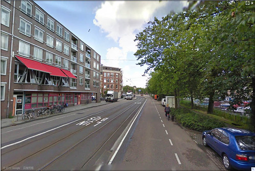
Streets are designed to comfortably accommodate non-vehicular users and to support adjacent land uses. Footpaths and generous street trees are reintroduced to make walking attractive in Western Australia’s predominantly hot climate.
Streets are provided with on-street parking capacity to increase the amount of shared public parking and allow better utilisation of parking spaces. Onstreet parking also supports changes to development (intensification) over time.
Liveable Neighbourhoods provides for enhanced local identity, a wider choice of housing type, increased residential density over time, a more significant component of other land uses to support daily needs, including local employment, and higher levels of public transport provision.
Hastings Neighbourhood Renewal

more about walkability:

The influence of neighbourhood design on travel behaviour: Empirical evidence from North East England

Photos of pedestrian urban spaces in Barcelona (2)

Residents’ perceptions of walkability attributes in objectively different neighbourhoods: a pilot study

Reliable and valid NEWS for Chinese seniors: measuring perceived neighborhood attributes related to walking

A planned carfree neighborhood: Rieselfeld in Freiburg, Germany

TRANSFORMING AUTO-CENTRIC COMMUNITIES INTO WALKABLE NEIGHBORHOODS: WALKABILITY AUDITS OF TWO NEIGHBORHOODS IN SAN JOSÉ

Steps Forward: Review and Recommendations for Research on Walkability, Physical Activity and Cardiovascular Health

New German community models car-free living

BEST PRACTICE IN FACILITATING AND PROMOTING ACTIVE TRAVEL

Wednesday, August 14, 2013

A GEOGRAPHICAL STUDY OF KARAJ : A SATELLITE CITY IN THE URBAN REGION OF TEHRAN

by H. BAHRAMBEYGUI,

A PhD dissertation from University of Durham, 1978. 

The main object of this study is to analyse the socio-economic situation of Karaj city -a medium-sized Iranian city which has grown rapidly as a result of being located in the neighbourhood of the Capital city of Tehran. Its particular geographical location has been mainly responsible for the city experiencing the most rapid rate of population growth of any Iranian city during the 1966-76 intercensal period. The population of Karaj, having increased annually 12.1% between 1966-76, has grown more than 3-fold over this period to a total of 138,774 persons. The acute housing shortages, difficulties with domestic water supply, and the congested traffic conditions, which are currently the main problems of the city, are mainly the result of this population explosion.
The proximity of Karaj to Tehran and the pressures this creates has recently caused the earlier functions of Karaj as an agricultural and tourist centre, to be gradually subordinated to those of a major step-migration city for many people migrating to Tehran. Lower prices of land and accommodation as compared with Tehran are becoming the important factors also in turning Karaj into a growing residential, satellite of the capital. The consequences of these two new functions are among the major issues to be pursued in this thesis.

read more 
 
2102. Karaj

more about Iran:

Studying the effect of neighborhood size in urban growth modeling using cellular automata

Strategy for Sustainable Urban Development: A Case Study of Urmia City, Iran

Studying the effects of urban sprawl of metropolis on tourism - climate index oscillation: A case study of Tehran city

An Analysis to Challenges of Urban Management in Historic Center of Cities in Iran

COMPARATIVE SUSTAINABILITY OF BAZAAR IN IRANIAN TRADITIONAL CITIES: CASE STUDIES IN ISFAHAN AND TABRIZ

The influence of urban physical form on trip generation, evidence from metropolitan Shiraz, Iran

Changes in population settlement pattern in urban system of Tehran province (1966 to 2006)

AIR QUALITY MANAGEMENT IN TEHRAN

Studying the effect of neighborhood size in urban growth modeling using cellular automata

by ,

Urban growth faces a great increase during recent decades. Many studies have been done to study and model this phenomenon. One of the suitable approaches to do so is cellular automata. In cellular automata, each cell state is dependent on its neighbor cells. This is what happens in urbanization. Many researchers have studied use of CA for urban growth modeling. In this paper, authors tried to study the effect of neighbor size in prediction process of urban growth. The results show the smaller neighbor size, the more precise prediction.  


more about urban planning in Iran:

The Study of Land Use Changes in the Tehran Metropolitan Area by Using MOLAND Model

Distribution and Determining of Urban Sprawl in Kerman with Emphasis on Kariz Water System

URBAN PATTERNS FOR A GREEN ECONOMY: LEVERAGING DENSITY

Facilitating Urban Management Through Local SDI Case Study: The Municipality of Tehran 

A new approach to the Iranian urban planning, using neo-traditional development

URBAN SPRAWL IN IRANIAN CITIES AND ITS DIFFERENCES WITH THE WESTERN SPRAWL

An Analysis to Challenges of Urban Management in Historic Center of Cities in Iran

Studying the effects of urban sprawl of metropolis on tourism - climate index oscillation: A case study of Tehran city

Sunday, August 4, 2013

The Study of Land Use Changes in the Tehran Metropolitan Area by Using MOLAND Model

by Morteza Yaghoubkhani

Increasingly, in urban areas land is too scarce a commodity to allow it to be taken up in unplanned growth. However, any action – or lack of it – to influence land use has significant consequences both for people, businesses, and organizations in the area, and, more generally, for the urban morphology itself. According to the FAO’s definition of land use planning, estimating the socio-economic conditions of human society and the land potential for development, is necessary to select the best land-use options. So “Planning involves anticipation of the need for change as well as reactions to it” (FAO, 1993). Forecasting the effectiveness as well as the indirect consequences of policies are two main focal points of planning studies. Modeling urban land use changes is helpful to understanding urban dynamics and can be used as an important tool for planners, capable of producing insights about the possible consequences of decisions made by them. Land use modeling can provide a dynamic information base that can inform the policy process at the local, national, and transnational levels. Urban planning and urban models have to be discussed jointly. Couclelis has argued that connecting these two spheres could “amplify the positive synergies between the two domains and enhance the ability of spatial planning to prepare for the future” (Couclelis 2005: 1353).
Land use transformation models can therefore generate data of meaningful representations of the region’s characteristics and allow the processing of different data sets. The models contribute to understand the landscape changes and drivers of the dynamics in the development conditions of each study area. It is also helpful to answer where and at which intensity land-take for urbanization occurs and how spatial growth patterns alter over time; how urbanization (e.g. sprawl) affects large areas overruling local and regional decision.


more about urban planning of Iran:

Distribution and Determining of Urban Sprawl in Kerman with Emphasis on Kariz Water System

Facilitating Urban Management Through Local SDI Case Study: The Municipality of Tehran 

Development Guidelines for Disaster Risk Management in Tehran 

The impact of modernization on traditional Iranian cities the case of Kerman

THE IDENTITY OF OPEN SPACE: ADAPTING FROM THE MODEL OF TRADITIONAL NEIGHBORHOOD CENTER

TRADITIONAL SHOPPING: A Syntactic Comparison of Commercial Spaces in Iran and Turkey

A new approach to the Iranian urban planning, using neo-traditional development

URBAN SPRAWL IN IRANIAN CITIES AND ITS DIFFERENCES WITH THE WESTERN SPRAWL

Friday, August 2, 2013

A scale-adjusted measure of ‘‘Urban sprawl’’ using nighttime satellite imagery

by Paul C. Sutton

‘‘Urban Sprawl’’ is a growing concern of citizens, environmental organizations, and governments. Negative impacts often attributed to urban sprawl are traffic congestion, loss of open space, and increased pollutant runoff into natural waterways. Definitions of ‘‘Urban Sprawl’’ range from local patterns of land use and development to aggregate measures of per capita land consumption for given contiguous urban areas (UA). This research creates a measure of per capita land use consumption as an aggregate index for the spatially contiguous urban areas of the conterminous United States with population of 50,000 or greater. Nighttime satellite imagery obtained by the Defense Meteorological Satellite Program’s Operational Linescan System (DMSP OLS) is used as a proxy measure of urban extent. The corresponding population of these urban areas is derived from a grid of the block group level data from the 1990 U.S. Census. These numbers are used to develop a regression equation between Ln(Urban Area) and Ln(Urban Population). The ‘scale-adjustment’ mentioned in the title characterizes the ‘‘Urban Sprawl’’ of each of the urban areas by how far above or below they are on the ‘‘Sprawl Line’’ determined by this regression. This ‘‘Sprawl Line’’ allows for a more fair comparison of ‘‘Urban Sprawl’’ between larger and smaller metropolitan areas because a simple measure of per capita land consumption or population density does not account for the natural increase in aggregate population density that occurs as cities grow in population. Cities that have more ‘‘Urban Sprawl’’ by this measure tended to be inland and Midwestern cities such as Minneapolis–St. Paul, Atlanta, Dallas–Ft. Worth, St. Louis, and Kansas City. Surprisingly, west coast cities including Los Angeles had some of the lowest levels of ‘‘Urban Sprawl’’ by this measure. There were many low light levels seen in the nighttime imagery around these major urban areas that were not included in either of the two definitions of urban extent used in this study. These areas may represent a growing commuter-shed of urban workers who do not live in the urban core but nonetheless contribute to many of the impacts typically attributed to ‘‘Urban Sprawl’’. ‘‘Urban Sprawl’’ is difficult to define precisely partly because public perception of sprawl is likely derived from local land use planning decisions, spatio-demographic change in growing urban areas, and changing values and social mores resulting from differential rates of international migration to the urban areas of the United States. Nonetheless, the aggregate measures derived here are somewhat different than similar previously used measures in that they are ‘scale-adjusted’; also, the spatial patterns of ‘‘Urban Sprawl’’ shown here shed some insight and raise interesting questions about how the dynamics of ‘‘Urban Sprawl’’ are changing.
denver from the air tilt shift
Urban and suburban sprawl in Denver, by S Reilly

more about urban sprawl:

Measurement and Monitoring of Urban Sprawl in a Rapidly Growing Region Using Entropy

Distribution and Determining of Urban Sprawl in Kerman with Emphasis on Kariz Water System

URBAN PATTERNS FOR A GREEN ECONOMY: LEVERAGING DENSITY

Assessment of development and regeneration urban projects: cultural and operational implications in metropolization context 

A new approach to the Iranian urban planning, using neo-traditional development

URBAN SPRAWL IN IRANIAN CITIES AND ITS DIFFERENCES WITH THE WESTERN SPRAWL

Land use change modelling in an urban region with simultaneous population growth and shrinkage including planning and governance feedbacks

Municipal Finance and the Pattern of Urban Growth

Tuesday, July 30, 2013

Measurement and Monitoring of Urban Sprawl in a Rapidly Growing Region Using Entropy

by Anthony Gar-On Yeh and Xia Li

Rapid urban development and dramatic change of landscape have been recently witnessed in some developing countries as a result of rapid economic development. The measurement and monitoring of land-use changes in these areas are crucial to government officials and planners who urgently need updated information for planning and management purposes. This paper examines the use of entropy in the measurement and monitoring of urban sprawl by the integration of remote sensing and GIS.h e advantages of the entropy method are its simplicity and easy integration with GIS. The measurement of entropy is devised based on two locational factors-distances from town centers and roads-to capture and reveal spatial patterns of urban sprawl. The entropy space can be conveniently used to differentiate various kinds of urban growth patterns. The application of the method in the Pearl River Delta, one of the fastest growing regions in China, has demonstmted that it is very useful and effective for the monitoring of urban sprawl. It provides a useful tool for the quantitative measurement that is much needed for rapidly growing regions in identifying the spatial variations and temporal changes of urban sprawl patterns.


Photos of Dongguan in China, by Chris


The Hyatt Regency Hotel Dongguan China Changan views from Lotus Hill Dongguan China views from Lotus Hill Dongguan China

Monday, July 29, 2013

Distribution and Determining of Urban Sprawl in Kerman with Emphasis on Kariz Water System

by Ali Hosseini, Mohammad Shabanifard, Mostafa Rashidi, and Mamohammad Reza Saiydzade

Problem statement: Urban sprawl is one of the contemporary issues of cities all over the world. The Kariz system consists of underground channels that convey water from aquifers in highlands to the surface at lower levels by gravity. The problem of water shortage in arid and semi-arid regions is one of low rainfall and uneven distribution throughout the season, which makes rain fed agriculture a risky enterprise. The system supplies 75% of all the water used in that country, providing water not only for irrigation but also for house-hold consumption. Approach: This study explained and determined role Karizs in urban sprawl in Kerman. Results: Absence of planning for maintaining the Kariz s within the urban planning and their extinction have led to inclination toward other methods such as digging few deep wells during forth recent decades. Conclusion: A Kariz system has a profound influence on the lives of the water users. It allows those living in a desert environment adjacent to a mountain watershed to create a large oasis in an otherwise stark environment.

read more

Kerman Skyline
Kerman, Iran, by Alan


more about urban sprawl in Iranian cities:

URBAN SPRAWL IN IRANIAN CITIES AND ITS DIFFERENCES WITH THE WESTERN SPRAWL

Strategy for Sustainable Urban Development: A Case Study of Urmia City, Iran

Studying the effects of urban sprawl of metropolis on tourism - climate index oscillation: A case study of Tehran city

Changes in population settlement pattern in urban system of Tehran province (1966 to 2006)

URBAN SPRAWL AND CLIMATIC CHANGES IN TEHRAN

Friday, July 26, 2013

Evaluating Urban Sustainability Using Land-Use Transport Interaction Models

by Klaus Spiekermann and Michael Wegener

The objective of the EU research project PROPOLIS (Planning and Research of Policies for Land Use and Transport for Increasing Urban Sustainability) was to assess urban strategies and to demonstrate their long-term effects in European cities. To reach this goal, a comprehensive framework of methodologies including integrated land-use, transport and environmental models as well as indicator, evaluation and presentation systems was developed.
Sustainable development is viewed as comprising the environmental, socio-cultural and economic dimension. Thirty-five indicators were defined to measure the three dimensions of sustainability, such as air pollution, consumption of natural resources, quality of open space, population exposure to air pollution and noise, equity and opportunities and economic benefits from transport and land use.
Indicator values are derived from state-of-the-art urban land-use and transport models. A number of additional modules, including a justice evaluation module, an economic evaluation module and a GIS-based raster module, were developed and integrated to provide further indicator values. Both multicriteria and cost-benefit analysis methods are used to consistently evaluate the impacts of the policies. The environmental and social dimensions of sustainability are measured using multicriteria analysis for the evaluation of the indicators, whereas cost-benefit analysis is used for the economic dimension. The modelling and evaluation system was implemented in seven European urban regions: Bilbao (Spain), Brussels (Belgium), Dortmund (Germany), Helsinki (Finland), Inverness (Scotland), Naples (Italy) and Vicenza (Italy).
A large number of policies were tested with the modelling and evaluation system in the seven urban regions. Policies investigated are land use policies, transport infrastructure policies, transport regulation and pricing policies and combinations of these. Besides a common set of policies examined in all seven urban regions, also city-specific local policies were assessed in each urban region.


more about land use planning:

The influence of neighbourhood design on travel behaviour: Empirical evidence from North East England

How the Built Environment Influences Non-Work Travel: Theoretical and Empirical Essays 

SIMULATING URBAN AND REGIONAL EVOLUTIONS: SCENARIOS OF DEVELOPMENT IN THREE STUDY CASES: ALGARVE PROVINCE (PORTUGAL), DRESDEN-PRAGUE TRANSPORT CORRIDOR (GERMANY-CZECH REPUBLIC) AND FRIULI-VENEZIA GIULIA REGION (ITALY)

Exploring the Historical Determinants of Urban Growth Patterns through Cellular Automata

Simulating land-use change in Portugal using an activitybased model

URBAN PLANNING AND DEVELOPMENT OF THE AUSTRALIAN CAPITAL TERRITORY, CANBERRA: A CRITICAL REVIEW

A new approach to the Iranian urban planning, using neo-traditional development

Correlating Densities of Centrality and Activities in Cities: the Cases of Bologna (IT) and Barcelona (ES)