Like Urban Research on Facebook

Showing posts with label San Fransisco. Show all posts

Wednesday, December 10, 2025

Daniel Burnham: The Man Who Planned the Future of Cities

Meet Daniel Burnham, the visionary behind the 1909 Plan of Chicago, one of the most influential urban plans in history. His designs weren’t just about beauty—they were about efficiency, mobility, and making cities places people wanted to live in. He believed in bold visions, grand architecture, and transforming chaotic urban sprawl into well-organized, monumental spaces.

But how did Burnham come up with his ideas? And how did the 1909 Chicago Plan change the city forever? Stay with me as we explore the story of a man who believed in "Make no little plans" and forever changed urban life.


Early Life and Career: The Architect of the Future


Born in 1846, Daniel Burnham started his career in architecture but soon realized that buildings alone weren’t enough—entire cities needed better planning. By the late 19th century, Chicago was booming. The population had exploded from 30,000 in 1850 to over 1.7 million by 1900. But with that growth came problems: overcrowding, poor sanitation, traffic congestion, and lack of green space.

Burnham had already made a name for himself as the director of the 1893 World’s Columbian Exposition, where he transformed 600 acres of swampy land into a stunning neoclassical "White City" that attracted over 27 million visitors. The success of this fair proved that urban design could be both beautiful and functional, inspiring Burnham’s future city planning ideas.


The 1909 Plan of Chicago: A Bold Vision


At the turn of the century, Chicago was growing faster than any city in the world. But with rapid growth came chaos—narrow streets, pollution, and slums. Burnham, alongside his partner Edward Bennett, took on the ambitious task of redesigning the entire city with the Plan of Chicago, published in 1909.

This plan was revolutionary. It proposed:

  • A citywide road system with grand boulevards and diagonal streets for better traffic flow.
  • A massive lakefront park system, ensuring that the entire Chicago lakefront remained public land.
  • A network of parks and green spaces, to improve quality of life.
  • A new, efficient rail and freight system to reduce congestion.
  • Civic and cultural centers, including a majestic central plaza inspired by European cities.

One of the most audacious ideas? A completely restructured lakefront, turning what was once industrial land into over 25 miles of uninterrupted public parks and beaches—a feature that defines Chicago to this day.


Transforming Chicago: What Was Actually Built?


The Plan of Chicago wasn’t just an idea—it shaped real, lasting changes. Over the next decades, the following have been fulfilled. 

  • Grant Park was expanded, becoming Chicago’s "front yard," home to landmarks like Millennium Park and the Art Institute of Chicago.
  • The city developed a network of parks and forest preserves, adding thousands of acres of green space.
  • Wacker Drive was constructed, following Burnham’s vision for multilayered roads that separated commercial and pedestrian traffic.
  • The rail system was restructured, leading to modern commuter transit improvements.

But not everything in the plan came to life. Burnham envisioned monumental civic centers and grand European-style boulevards that never fully materialized. Still, his ideas inspired countless city planners across the U.S., leading to better city layouts in Washington D.C., San Francisco, and even overseas in Manila.


Beyond Chicago: Burnham’s Global Influence


Burnham’s genius wasn’t limited to Chicago. His planning ideas influenced:

  • Washington D.C. – He redesigned the National Mall, shaping it into the monumental space we know today.
  • San Francisco – After the 1906 earthquake, he proposed a radical redesign of the city, though it was never fully realized.
  • Manila and Baguio (Philippines) – Burnham’s master plan for Manila featured wide boulevards, waterfront parks, and grand civic buildings, some of which still exist today.

His influence laid the foundation for modern urban planning, inspiring the City Beautiful Movement, which emphasized grand, organized, and aesthetically pleasing city designs.


The Legacy of Daniel Burnham


More than a century later, Daniel Burnham’s vision still shapes Chicago and countless other cities. His ideas about green space, transportation, and urban beauty remain cornerstones of city planning today. His "Make no little plans" philosophy reminds us that cities should be designed for both function and inspiration.

So, next time you walk through Chicago’s downtown, Washington D.C.’s National Mall, or even parts of Manila, remember that one man’s big dreams and bold ideas helped create the cities we know today.


More about the history of urban planning:
The history of Indian railways: Colonial beginnings, overcrowding, and socioeconomic impacts


Sunday, January 26, 2025

Spanning History: How Bridges Transformed Cities


Bridges are more than feats of engineering; they’re symbols of connection and progress that have fundamentally shaped the urban world. They link people, fuel economies, and transform landscapes. Two iconic examples, the Brooklyn Bridge in New York City and the Golden Gate Bridge in San Francisco, illustrate how these structures redefine cities and their futures.


The Brooklyn Bridge: A Gateway to New York’s Future

Completed in 1883, the Brooklyn Bridge was an unprecedented achievement in engineering. It was the first steel-wire suspension bridge and, at the time of its opening, the longest suspension bridge in the world, stretching 1,595 feet across the East River. Before the bridge, Brooklyn and Manhattan relied on ferries to connect their residents, a method that was often unreliable and slow. The bridge revolutionized this connection, paving the way for Brooklyn to become part of New York City in 1898.

The construction of the bridge wasn’t without challenges. It took 14 years to complete, costing $15 million—equivalent to nearly $400 million today—and the lives of at least 27 workers, including its original designer, John A. Roebling. However, the payoff was immense. By the early 20th century, Brooklyn emerged as a major industrial hub, and the bridge facilitated the daily commute of thousands. Today, the bridge carries approximately 120,000 vehicles, cyclists, and pedestrians daily, serving as both a vital transport link and a global icon.

The Golden Gate Bridge: Opening the Bay Area

The Golden Gate Bridge, completed in 1937, had a similarly transformative effect on San Francisco and its surrounding areas. Spanning 4,200 feet, it was the longest suspension bridge in the world at the time and remains an engineering marvel. Its construction cost $35 million (around $700 million in today’s dollars), and its vibrant International Orange color was chosen to enhance visibility in the Bay Area’s infamous fog.

Before the bridge, the only way to travel between San Francisco and Marin County was via ferry—a time-consuming and limited option. The bridge slashed travel times, opening up Marin County and the northern Bay Area for development. Suburban areas flourished, and economic activity surged as businesses and residents gained easier access to the city. Today, the bridge carries over 100,000 vehicles daily, making it a lifeline for the region.

Beyond the Icons: The Broader Impact of Bridges

Bridges have left a mark on cities around the world. The Tower Bridge in London, completed in 1894, not only became an iconic landmark but also addressed the challenges of increasing traffic during the Industrial Revolution by allowing both vehicles and ships to pass. In modern times, the Danyang-Kunshan Grand Bridge in China, which stretches an astonishing 102 miles, connects key cities along the Beijing-Shanghai High-Speed Railway, promoting regional development.

However, bridges come with challenges. The environmental impact during construction, such as habitat disruption, and long-term maintenance costs pose ongoing issues. For example, the Brooklyn Bridge has undergone several renovations over the years, with recent projects costing upwards of $800 million. Similarly, the Golden Gate Bridge requires constant upkeep to combat the corrosive effects of saltwater and fog, costing millions annually.

Bridges as Cultural Icons

In addition to their functional roles, bridges often become cultural symbols. The Brooklyn Bridge has been featured in countless films, books, and artworks, symbolizing innovation and resilience. The Golden Gate Bridge, with its unique color and sweeping vistas, is one of the most photographed structures in the world.

Conclusion: Building Futures

From uniting boroughs in New York to connecting regions in San Francisco, bridges are not just structures; they’re agents of transformation. They link people, spur economic growth, and redefine landscapes. As cities continue to grow, bridges will remain vital in shaping urban futures, proving that the path to progress is often a bridge away.

More about San Francisco:

How Public Markets Shaped Cities

Monday, November 18, 2024

How Public Markets Shaped Cities

Public markets have been an integral part of urban life for thousands of years, acting as the beating heart of cities around the world. From the bustling agora of ancient Greece to the vibrant Pike Place Market in Seattle, public markets have shaped how cities function and interact. Let’s dive into the story of public markets, how they evolved, and the impact they still have on our lives today.


The Origins of Public Markets: The Agora of Ancient Greece

The concept of a public market dates back to ancient civilizations, and few places exemplify this better than the Agora of Athens. Established around the 6th century BCE, the Agora was much more than a marketplace; it was the epicenter of social, economic, and political life in Athens. This large, open space was filled with stalls offering food, goods, and crafts, attracting people from all walks of life. Covering approximately 30,000 square meters, the Agora was strategically located at the city center, making it easily accessible.

In ancient Greece, the agora wasn’t merely a place to buy and sell; it was also a space for political discussion, civic engagement, and public debate. Citizens gathered here to hear speeches, engage in philosophy, and participate in democratic processes. In many ways, the agora was the birthplace of Western democracy, hosting discussions that would shape Greek society. The agora embodied the idea that a public market could be more than an economic hub—it could be the social and political heart of a community.

Medieval Markets: The Rise of Weekly Trade

As cities in Europe grew during the medieval period, public markets became central to urban development. Medieval markets generally operated on a weekly basis and were strategically located along trade routes, allowing cities to flourish as trading centers. For example, Bruges in Belgium was famous for its central market square, the Grote Markt, which became a major trading hub for merchants from across Europe. The success of markets like these helped medieval cities thrive, stimulating both population growth and economic expansion.

The Transformation of Public Markets During the Industrial Revolution

The Industrial Revolution brought rapid urbanization, changing the nature of public markets. By the 19th century, many cities had permanent indoor markets, adapting to the growing urban population. Les Halles in Paris, constructed in 1850, was one of the largest and most famous examples of this. Known as the “Belly of Paris,” Les Halles covered 20,000 square meters and supplied the city with fresh produce, meats, and fish. The market became a microcosm of Parisian life, serving everyone from street vendors to upper-class Parisians, providing not only goods but a vibrant social scene.

The Decline and Revival of Public Markets: Pike Place Market, Seattle

In the 20th century, public markets faced challenges as supermarkets, chain stores, and shopping malls took over urban retail. However, in the 1970s, cities across the world recognized the importance of preserving public markets, leading to a revival. One of the most famous examples of this is Seattle’s Pike Place Market. Opened in 1907, Pike Place Market was initially a space for farmers to sell directly to consumers, bypassing middlemen.

By the 1960s, however, Pike Place was threatened by development pressures. But thanks to public advocacy, it was preserved and revitalized. Today, Pike Place Market is one of Seattle’s top tourist attractions, drawing more than 10 million visitors annually. It’s home to hundreds of vendors, artisans, and food stalls, contributing over $250 million to Seattle’s economy each year. This revival highlights how public markets can serve as both commercial hubs and tourist destinations, revitalizing neighborhoods and enhancing community identity.

Modern Public Markets: A Global Phenomenon

Today, cities worldwide are embracing public markets for their economic and social value. La Boqueria in Barcelona, established in the 13th century, is one of Europe’s most vibrant public markets. With over 200 vendors, it attracts both locals and tourists, offering fresh produce, seafood, and tapas. La Boqueria not only supports local agriculture but also fosters a unique atmosphere that reinforces Barcelona’s identity as a cultural capital.

In Mexico City, the Mercado de la Merced is one of the largest markets in the Americas, covering over 72,000 square meters and offering thousands of different products. It serves as a crucial source of affordable food for the city’s 9 million residents and sustains thousands of jobs, showing how public markets continue to play an essential role in food security.

In Bangkok, Thailand, the Chatuchak Market spans over 35 acres and hosts more than 15,000 stalls every weekend. Attracting an estimated 200,000 visitors per day, it has become an international attraction, drawing shoppers looking for everything from local crafts to exotic foods. Chatuchak’s economic impact is immense, supporting local vendors and reinforcing Bangkok’s status as a global shopping destination.

The Role of Public Markets in Modern Urban Planning

In recent years, urban planners have recognized the importance of public markets for sustainable urban development. Public markets encourage walkability, reduce reliance on cars, and support local economies by providing spaces for small businesses. They also offer fresh food, which can improve public health, particularly in urban “food deserts,” areas lacking access to affordable, nutritious food. Cities such as Toronto and San Francisco have integrated public markets into their urban planning as a means of fostering sustainable food systems.

For example, The Ferry Building Marketplace in San Francisco, originally constructed in 1898, was transformed in 2003 into a public market emphasizing local, sustainable produce. Today, it supports over 80 local farmers and artisans, drawing millions of visitors annually. The marketplace has not only become a vital part of San Francisco’s food culture but also a model for using public markets to strengthen local food systems and reduce the city’s carbon footprint.

Conclusion: The Enduring Power of Public Markets

Public markets have endured for thousands of years because they provide more than just goods; they are social and cultural gathering spaces, economic engines, and symbols of civic pride. From the ancient agora of Athens to the bustling stalls of Pike Place Market, public markets continue to adapt to the needs of modern cities while preserving a timeless tradition of community and commerce. Today, as cities prioritize sustainability, walkability, and local economies, public markets are more important than ever.

By reconnecting us with local products, people, and cultures, public markets remind us that cities aren’t just places to live and work—they’re communities built around shared experiences and connections.

More about walkability:

Why Some Cities Feel Like a Maze

Monday, August 14, 2017

A comparative study of the morphological characteristics of residential areas in San Francisco

By Mehmet TOPCU and Michael SOUTHWORTH

This study compares residential neighborhoods with different gridiron patterns in terms of some morphological properties. Nine different gridiron street patterns of San Francisco neighborhoods were chosen to assess the livability of residential areas in terms of several morphological evaluation criteria including accessibility (local and global spatial integration), intelligibility, density, livability index and time period. When measuring these criteria, the focus was on the street-block and building-lot relationships using several different methods. Accessibility and intelligibility values were measured by the ‘space syntax’ method which evaluates the street system of urban form. Density measures were calculated by the ratio of total built area within sample areas to the total sample area and by the ratio of private open spaces of sample areas to the total built area. In addition, a livability index was calculated by the ratio of pedestrian area to total built area. The contribution of time in the process of city building is also an important part of the morphology of cities. Therefore, in this study time period was used to analyze the historical background of the city. All the findings were evaluated according to these criteria by using GIS. In conclusion, based on the findings, this study stresses that the criteria of accessibility, intelligibility levels and density are inversely proportional with the degree of livability in the study areas. Therefore, we hypothesize that accessibility, density and livability index are the important inputs for making better designs for urban residential space and city design as a whole.


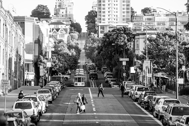
Russian Hill

More about urban form:

Longitudinal correlations of car ownership with socio-economics, urban form, and transport infrastructure in Latin America: Example from Ensenada, Mexico

Children’s Travel to School and their Body Weight; Results of a Survey in Seven European Countries: Technical Report

The Role of the Built Environment in Human Life. Selected Issues

REDUCING CRIME BY SHAPING THE BUILT ENVIRONMENT WITH ZONING: AN EMPIRICAL STUDY OF LOS ANGELES

Evaluation of Urban Sprawl Speed and Intensity Based on International Urbanization. Example from a Mexican City

A THEORETICAL APPROACH TO CAPABILITIES OF THE TRADITIONAL URBAN FORM IN PROMOTING SUSTAINABLE TRANSPORTATION

Sustainable Urban Growth Management Using What-If?

Wednesday, July 16, 2014

What if you live in the wrong neighborhood? The impact of residential neighborhood type dissonance on distance traveled

by Tim Schwanen and Patricia L. Mokhtarian

While urban form in general and density in particular are believed by many to significantly influence travel behavior, various recent studies have argued that the true determinants of travel patterns are attitudes rather than land use characteristics. This research builds on this notion and investigates to what extent a lackof congruence between physical neighborhood structure and preferences regarding land use near one s home location (termed residential neighborhood type dissonance or mismatch) affect distance traveled overall and by mode. A conceptual model is described in which the relationship between neighborhood type dissonance and distance traveled is embedded in a wider set of individual and household choices, and tobit models of the influence of neighborhood type mismatch are presented. The results suggest that neighborhood type mismatch should be taken into account in future research as well as in policies attempting to modify travel behavior through land use regulations.

more about travel behavior:

Vehicle Miles Traveled and the Built Environment: Evidence from Vehicle Safety Inspection Data

Residential Self-Selection and Its Effects on Urban Commute Travels in Iranian Cities Compared to US, UK, and Germany

MODELING THE TRAVEL BEHAVIOR IMPACTS OF MICRO-SCALE LAND USE AND SOCIO-ECONOMIC FACTORS

Determinants of Automobile Use: A Comparison of Germany and the U.S.

UNDERSTANDING PERCEPTIONS OF ACCESSIBILITY AND MOBILITY THROUGH STRUCTURATION THEORY

A Copula-Based Approach to Accommodate Residential Self-Selection Effects in Travel Behavior Modeling

Examining the Impacts of Residential Self-Selection on Travel Behaviour: A Focus on Empirical Findings

MODELLING AND PROSPECTS OF THE AUDIENCE MEASUREMENT FOR OUTDOOR ADVERTISING BASED ON DATA COLLECTION USING GPS DEVICES (ELECTRONIC PASSIVE MEASUREMENT SYSTEM)

Saturday, May 18, 2013

How the Built Environment Influences Non-Work Travel: Theoretical and Empirical Essays

by Daniel Gregory Chatman

Characteristics of the built environment include the arrangement of land uses, transportation infrastructure, and neighborhood design. Built environment policies are hypothesized to influence congestion- and pollution-causing auto use by affecting the convenience of travel by different modes. But after decades of empirical research measuring the strength of built environment influences on travel, theories remain poorly articulated and empirical research contradictory.
In the first essay, I argue that the built environment can be expected to influence the quality, quantity and price of traveling to out-of-home activities. Travel choices depend crucially on how the built environment simultaneously affects characteristics of travel by all modes. The proposed theoretical framework provides a means of organizing common hypotheses about the built environment and travel, leading to an increased understanding of interrelationships, better interpretations of existing studies, and improved empirical strategies for future research.
The second essay is an empirical study on how development density influences out-of-home non-work activity participation and auto use, using data from a survey that I carried out in San Diego and the San Francisco Bay Area from November 2003 to April 2004. Density’s most significant influences are not on the ease of reaching activities on foot or via transit, but on the difficulty of using the auto and, to a lesser extent, on the quality of walking. Previous contradictory empirical findings likely suffer from omitted variable bias.
The third essay investigates the hypothesis that densely-developed neighborhoods with walking access to retail shops, good transit service, and finely-meshed street grids attract households who prefer to walk and take transit. If so, observed relationships between the built environment and travel may reflect a residential sorting process rather than an exogenous effect of the built environment on travel. I theorize that residential self-selection is imperfect with respect to non-work accessibility, and show that accounting for pre-existing travel-related preferences increases the explanatory power of statistical models but reveals relatively little bias in conventional analysis.


more about travel behavior research:

Wednesday, November 23, 2011

AN EQUILIBRIUM MODEL OF SORTING IN AN URBAN HOUSING MARKET: A Study of the Causes and Consequences of Residential Segregation

by Patrick Bayer, Robert McMillan, and Kim Rueben

This paper presents a new equilibrium framework for analyzing economic and policy questions related to the sorting of households within a large metropolitan area. At its heart is a model describing the residential location choices of households that makes explicit the way that individual decisions aggregate to form a housing market equilibrium. The model incorporates choice-specific unobservables, and in the presence of these, a general strategy is provided for identifying household preferences over choice characteristics, including those that depend on household sorting such as neighborhood racial composition. We estimate the model using restricted-access Census data that characterize the precise residential and employment locations of a quarter of a million households in the San Francisco Bay Area, yielding accurate measures of preferences for a wide variety of housing and neighborhood attributes across different types of household. The main economic analysis of the paper uses these estimates in combination with the equilibrium model to explore the causes and consequences of racial segregation in the housing market. Our results indicate that, given the preference structure of households in the Bay Area, the elimination of racial differences in income and wealth would significantly increase the residential segregation of each major racial group. Given the relatively small fractions of Asian, Black, and Hispanic households in the Bay Area (each around 10%), the elimination of racial differences in income/wealth (or, education or employment geography) spreads households in these racial groups much more evenly across the income distribution, allowing more racial sorting to occur at all points in the distribution – e.g., leading to the formation of wealthy, segregated Black and Hispanic neighborhoods. The partial equilibrium predictions of the model, which do not account for the fact that neighborhood sociodemographic compositions and prices adjust as part of moving to a new equilibrium, lead to the opposite conclusion, emphasizing the value of the general equilibrium approach developed in the paper. Our analysis also provides evidence that sorting on the basis of race itself (whether driven by preferences directly or discrimination) leads to large reductions in the consumption of public safety and school quality by all Black and Hispanic households, and large reductions in the housing consumption of upper-income Black and Hispanic households.


similar studies:

Residential Location Decisions: Heterogeneity and the Trade-off between Location and Housing Quality

Tradeoffs in residential location decisions: Transportation versus other factors

Monday, April 18, 2011

Walking, Bicycling, and Urban Landscapes: Evidence from the San Francisco Bay Area

by Robert Cervero and Michael Duncan

Car-dependent cities, some claim, contribute to obesity by discouraging walking and bicycling. This paper uses household activity data from the San Francisco region to study the links between urban environments and non-motorized travel. Factor analysis is used to represent the urban design and land-use diversity dimensions of built environments. Combining factor scores with control variables, like steep terrain, which gauge impediments to walking and cycling, discrete-choice models are estimated. Built environment factors exerted far weaker, though not inconsequential, influences on walking and cycling than control variables. Stronger evidence on the importance of urban landscapes in shaping foot and bicycle travel is needed if the urban planning and public health professions are to forge an effective alliance against car-dependent sprawl.


Biking in San Francisco, by Adrienne Johnson SF


more biking posts:

Urban Transport in Bangalore - The Worsening Crisis

Sydney Cycle Strategy: Building a Bicycle Friendly City

More Biking Lessons from Portland

Saturday, March 5, 2011

Tussle over SB 375 target for Southern California resolved, but funding challenges remain


...
There were strings attached to the Southern California targets.  Voting 29-21, the SCAG Regional Council had rejected these proposed targets on September 2, prior to their being adopted by ARB.  The Regional Council instead supported milder targets of -6 percent in 2020 and -8 percent in 2035, maintaining that targets any more ambitious than these would be appropriate only if several conditions were met.  But ARB, which had a September 30 deadline to meet, affirmed its commitment to the more ambitious targets of -8 and -13 percent proposed by agency staff.
That commitment was, however, accompanied by a compromise facilitated by Riverside Mayor Ron Loveridge, who sits on ARB.  SCAG capitulated on the -8 percent target for 2020, but final acceptance of the -13 percent target for 2035 was conditioned on the outcome of further discussion between ARB and SCAG.  The issue remained unresolved until recently.  What is interesting is not so much the fact that a resolution was reached, but the manner in which it was reached and how it reflects the challenges moving forward.


California to Reduce Carbon Emissions by...
Banning Black Cars?!, by Chuck “Caveman” Coker
more about urban sustainability:

Urban Design After Oil

TOWARDS A SUSTAINABLE URBAN TRANSPORT SYSTEM: PLANNING FOR NON-MOTORIZED VEHICLES IN CITIES

Neighbourhood planning and sustainability: mutually exclusive?

Saturday, January 22, 2011

A new direction for the BART Board of Directors: The choice is ours


If there is a silver lining to be found in the protracted Oakland Airport Connector debate and other BART drama that has ensued over the past couple of years, it’s that BART’s Board of Directors and the agency generally have been subject to an extra measure of public scrutiny.  There’s a related silver lining: candidates emerging to challenge lackluster incumbent directors.  And not just any challengers, but serious, compelling challengers that deserve our attention.  This election, we’re talking about District 8 (the north and west side of  San Francisco) and District 4 (Oakland, east of Broadway, and Alameda).
Vigorous but misguided advocacy of the senseless Oakland Airport Connector, coupled with an insensitive brushing aside of well-reasoned opposition expressed by members of the public, is reason enough to unseat current District 4 director Carole Ward Allen.  Do we even need a clearer example showing her faulty grasp of riders’ true priorities? Insert a too little, too late approach to police reform, and one cannot help but draw the conclusion that Oakland and Alameda deserve better.
 Meanwhile, current District 8 director James Fang is a lonely Republican in San Francisco who has presided for far too long over a district that is gerrymandered if there ever was one (see above map).  He has pursued an approach that values flash over substance (cell phone fare payment), not to mention flash over basic common sense  (the infamous fare rollback, overwhelmingly disdained by rider surveys).  Okay, so he did recently express his support for a BART line to serve the Richmond District — that’s at least something we can agree would be a good thing.  But then again, given that he apparently sees BART as primarily a supplier of construction jobs (rather than, you know, a transit operator), Fang is happy to build BART anywhere and everywhere, indiscriminately.

read more


BART in Oackland, photo by /\/\ichael Patric|{
more articles about urban transportation in the United States:

Rail stops that make sense

Have Streetcars Adequately Demonstrated Their Development-Generation Potential?

How a Road Can Change a City, Even If It Never Gets Built

Thursday, January 20, 2011

Top 5 Urban Design Greenifications


Nothing says “give us back our space” like some unexpected greenification amidst the pavement-and-concrete dullness of the city. So we’ve picked the top 5 ideas that bring a tasty bite-sized bit of green to our urban stew of gray.

1- The PARK(ing) Project started in 2005 when REBAR, a San Francisco collective of artists, designers and activists, decided the city was in desperate need of an intervention: the dire lack of outdoor human habitat in downtown public space deprived people of their very basic need for a space to sit, relax and do nothing.
At the same time, 70% of the city’s downtown outdoor areas were dedicated to vehicles. So REBAR decided the way to go was to temporarily reclaim some of those parking spaces, feeding meters as a way of “renting” some precious outdoor space for up to 2 hours and transforming that space into a mini-park where people could just sit and enjoy themselves.
Think of it as a bonsai version of The Great Outdoors.
Since then, urban PARK(ing) has been popping up all over the world — Santa Monica, Glasgow, Sicily — producing the expected chain of befuddlement followed by amusement and eventually a delighted grin. And we say anything that brings more smiles to our sidewalks bustling with steel-faced pedestrians is a brilliant idea.

2- The Parkwheel: ... 
read more

Thursday, December 30, 2010

San Francisco’s Big Plan: The Eastern Neighborhoods

by John Petro


San Francisco is in the midst of rezoning a huge swath of the eastern portion of the city, a whopping 2,200 acres of land. That’s the size of two Central Parks plus one Prospect Park. That’s seven percent of the City’s 47 square miles of land. That’s a pretty big deal – enormous, some might say.
The San Francisco Planning Department recently passed the Eastern Neighborhoods Plan which will guide land use and new development in four neighborhoods – The Mission, Showplace Square/Portero Hill, East SoMa, and the Central Waterfront – for the next 20 years. The Plan will now head to the City’s Board of Supervisors for approval in what is anticipated to be an all-out battle over conflicting interests and priorities for the area and its future.
In order for the Plan to be successful it must achieve a delicate balance between competing priorities. First, the Plan must balance the city’s dire need for housing with the need to preserve jobs.
A majority of the City’s industrial land is located in the Eastern Neighborhoods. These areas are zoned for light-industrial uses, or what is known as Production, Distribution, and Repair (PDR) services. PDR land covers a wide range of uses, from auto-repair, printing, storage, shipping, and transportation to other “hybrid” uses such as furniture manufacturing, food production and catering, floral design, performance spaces for the arts, audio/visual production, and digital media.


San Fransisco, image by faz the persian


more posts about the cities of California:

The Pedestrianization Fever Moves South

Are pedestrian malls the future or the relic of antiquated thinking?

Different Sprawl Patterns in the U.S. Cities