Like Urban Research on Facebook

Showing posts with label Urban Sprawl. Show all posts

Monday, April 6, 2026

Santiago's Urban Development Evolution: From Colonial Roots to Modern Metropolis

Introduction

Welcome to our comprehensive exploration of Santiago, Chile's capital. In this video, I'll delve into the city's transformation from its colonial origins to its current status as a sprawling metropolis. We'll examine the historical milestones, urban development phases, and the socio-economic factors that have shaped Santiago's urban landscape.​


Colonial Foundations and Early Growth

Santiago was founded on February 12, 1541, by Spanish conquistador Pedro de Valdivia. Strategically located in the central valley, the city was established following the Spanish grid plan, featuring a central plaza surrounded by key institutions. This layout facilitated administrative control and defense. Throughout the colonial period, Santiago remained a modest settlement, serving primarily as an administrative center for the Spanish Crown. The city's growth was gradual, with development concentrated around the central plaza.​

19th-Century Expansion and Industrialization

The 19th century marked a period of significant transformation for Santiago. The establishment of institutions like the University of Chile in 1842 and infrastructural projects such as the canalization of the Mapocho River between 1888 and 1891 spurred urban development. The introduction of railways in the 1850s connected Santiago with other regions, facilitating commerce and migration, which led to the city's expansion beyond its original boundaries. During this period, the population grew substantially, and new neighborhoods emerged to accommodate the influx of residents. Public spaces like the Quinta Normal Park, established in 1841, provided recreational areas for the burgeoning population. Additionally, the late 19th century saw the introduction of horse-drawn trams, improving urban mobility.​

Early 20th Century – Urban Modernization

The early 20th century ushered in a wave of modernization projects in Santiago. The 1910 Chile Centennial celebrations marked the beginning of several urban development initiatives, including the expansion of the railway network and the construction of the Mapocho Station. Public spaces like Parque Forestal were inaugurated in 1905, enhancing the city's green areas. Cultural institutions such as the Chilean National History Museum, founded in 1911, and the Chilean National Zoo, opened in 1925, enriched the city's cultural landscape. These developments reflected Santiago's aspiration to position itself as a modern and cosmopolitan city.​

Mid-20th Century – Population Boom and Urban Challenges

Between 1891 and 1941, Santiago experienced rapid urbanization, industrialization, and administrative expansion, accompanied by massive internal migration. This influx led to significant social and economic consequences, including the proliferation of informal settlements on the city's outskirts. The population surge strained existing infrastructure, leading to challenges in housing, sanitation, and transportation. In response, the government implemented various urban planning initiatives aimed at improving living conditions and managing the city's growth.​

Late 20th Century – Neoliberal Policies and Urban Sprawl

In 1975, Santiago became a focal point for neoliberal economic policies, resulting in significant urban transformations. The implementation of these policies led to deregulation in housing and land markets, contributing to urban sprawl and socio-spatial segregation. The privatization of public services and infrastructure further exacerbated inequalities, as access to quality housing, education, and healthcare became increasingly dependent on individual financial capacity. During this period, the city's expansion continued unabated, with new developments often lacking adequate planning and infrastructure.​

Contemporary Santiago – Urban Redevelopment and Challenges

In recent years, Santiago has undertaken various urban redevelopment projects aimed at revitalizing the city and addressing historical inequalities. The Santiago Development Corporation (SDC), established in 1985, has been instrumental in implementing renovation plans, particularly in the historic center. These efforts have focused on preserving architectural heritage while promoting economic and social revitalization. Despite these initiatives, challenges persist, including issues related to housing affordability, environmental sustainability, and social inclusion. The city's authorities continue to grapple with balancing development with the preservation of Santiago's unique cultural and historical identity.​

Conclusion

Santiago's evolution from a colonial settlement to a modern metropolis reflects a complex interplay of historical events, socio-economic factors, and urban planning decisions. The city's journey underscores the challenges of managing rapid urbanization while striving for sustainable and equitable development. As Santiago continues to grow and evolve, it faces the ongoing task of addressing these challenges to create a livable and inclusive environment for all its residents.​

Call to Action

If you found this exploration of Santiago's urban evolution insightful, please like, share, and subscribe for more content on urban development and city planning. Share your thoughts in the comments below—how do you think cities can effectively manage urban growth and promote sustainable development?


More about Latin America:
Bikes vs. Cars: The Urban Battle

Monday, March 16, 2026

Urban sprawl in Latin American cities: A historical perspective to urbanization and car ridership

 Latin American cities have experienced significant urban sprawl over the past century, characterized by the uncontrolled expansion of urban areas into peripheral zones. This phenomenon has been closely linked to socio-economic factors, car ownership, and the availability of public transportation. To understand the current landscape, it's essential to delve into the historical trajectory of urbanization in the region.​ In this video, I try to historically explain the relationship between urban sprawl in Latin American cities and socioeconomics as well as car use in 20th and 21st centuries. I will also provide some short inputs about five metropolises in Lartin America: Mexico City, Sao Paolo, Bogota, Buenos Aires, and Lima. 


Current Status of Urban Sprawl

Today, Latin American cities are among the most urbanized globally. As of 2013, approximately 80% of the region's population resided in urban areas, a significant increase from 50% in 1970. This rapid urbanization has often led to sprawling metropolitan areas with inadequate infrastructure and services.​ 

Historical Urbanization Trends in the 20th Century

Early 20th Century

In the early 1900s, Latin America was predominantly rural, with a majority engaged in agriculture. Cities like Buenos Aires, Mexico City, and São Paulo were emerging as economic centers, attracting rural migrants seeking better opportunities. However, urban growth was relatively modest during this period.​

Post-World War II Boom

The aftermath of World War II marked a turning point. Industrialization accelerated, leading to a surge in urban migration. Between 1950 and 1980, the urban population in Latin America grew from 50 million to over 200 million. Cities expanded rapidly, often without proper planning, resulting in informal settlements and inadequate infrastructure.​

Socio-Economic Factors and Urban Sprawl

Economic growth in the mid-20th century led to the expansion of the middle class, increasing demand for housing. However, limited affordable housing in central areas pushed populations toward the peripheries, contributing to sprawl. Additionally, socio-economic disparities meant that while wealthier individuals could afford centralized housing, lower-income groups settled in less accessible outskirts.​

Car Ownership and Its Impact

Rising incomes in the post-1950s made car ownership more attainable. For instance, between 1990 and 2010, per capita car ownership in Mexico more than doubled from about 75 to 175 cars per 1,000 people, and nearly tripled in Brazil from 45 to 125 cars per 1,000 people. This surge facilitated suburban living but also led to increased traffic congestion and pollution.​ 

Public Transportation Challenges

Despite urban expansion, investments in public transportation lagged. Many cities relied on informal transport systems, leading to inefficiencies. For example, in Mexico City, the metro system, inaugurated in 1969, couldn't keep pace with the city's growth, resulting in overcrowded trains and buses. By 2017, longer trips were more likely to be made by private car rather than public transit, exacerbating congestion. ​ 

Case Studies

Mexico City, Mexico

As one of the world's largest metropolises, Mexico City exemplifies urban sprawl. The city's area expanded from 1,500 km² in 1950 to over 7,800 km² by 2000. Car ownership surged, with the vehicle fleet growing by 30% between 2010 and 2018. Despite an extensive metro system, the city's public transportation has struggled to keep up with demand, leading to increased reliance on private vehicles.​ 

São Paulo, Brazil

São Paulo experienced rapid urbanization post-World War II, with its population swelling from 2.2 million in 1950 to over 12 million today. The city's car fleet grew by 22% between 2010 and 2018. Efforts to implement bus rapid transit (BRT) systems have been made, but challenges remain in reducing traffic congestion and promoting public transit use.​ 

Bogotá, Colombia

Bogotá has faced significant urban sprawl, with its population increasing from 700,000 in 1951 to over 7 million by the early 21st century. The city introduced the TransMilenio BRT system in 2000, aiming to improve public transportation. While initially successful, the system has faced challenges due to increased demand and insufficient capacity. ​ 

Buenos Aires, Argentina

Buenos Aires saw its car fleet grow from 2.4 million in 2010 to 4.2 million in 2018, a 75% increase. The city's public transportation includes buses, trains, and the Subte (subway), but the rise in car ownership has led to increased congestion and longer commute times. 

Lima, Peru

Lima's car fleet doubled from 0.9 million in 2010 to 1.8 million in 2018. The city has implemented the Metropolitano BRT system to address transportation needs, but urban sprawl continues to pose challenges for infrastructure development. 

Conclusion

The historical trajectory of urban sprawl in Latin American cities is deeply intertwined with socio-economic factors, car ownership, and public transportation development. Addressing the challenges of sprawl requires integrated urban planning, investment in efficient public transit, and policies that promote sustainable urban growth.


More about Latin America:

Bikes vs. Cars: The Urban Battle

Wednesday, December 11, 2024

Avoid the urban sprawl disaster that is coming

 Urban sprawl—two words that define the way many modern cities have grown, often at the expense of community, environment, and efficiency. Let’s dive into the origins of sprawl, its impact on our cities, and how some places are fighting back.


The Origins of Urban Sprawl

The story of urban sprawl starts in the mid-20th century, particularly in the United States. After World War II, a combination of economic prosperity, affordable cars, and the dream of owning a suburban home led to rapid expansion beyond city limits. This phenomenon is characterized by low-density, car-dependent development, with single-family homes and strip malls sprawling over vast distances.

But how did we get here? The Federal-Aid Highway Act of 1956 was a game-changer. It created 41,000 miles of interstate highways, making it easier than ever to commute long distances. In addition, the GI Bill provided low-interest home loans to millions of veterans, further fueling suburban growth.

However, this shift wasn’t just about convenience. There were also social factors at play, like “white flight,” where middle-class families moved to the suburbs, leaving behind urban centers that became increasingly segregated and underfunded.


Los Angeles: The King of Sprawl

When you think of urban sprawl, Los Angeles probably comes to mind. Spanning over 500 square miles, L.A. is the poster child for car culture. By the 1950s, the city had torn out its extensive streetcar network in favor of highways and freeways. As a result, today, Los Angeles has one of the highest car ownership rates in the world, with around 2.3 cars per household.

The impact? A study by the Urban Land Institute found that residents of sprawling cities like L.A. spend up to 30% more on transportation than those in more compact cities. The average Angeleno spends around 100 hours per year stuck in traffic, contributing to high stress levels and air pollution.

Furthermore, L.A.’s expansion has led to significant environmental consequences. The city consumes enormous amounts of water from sources like the Colorado River, depleting natural resources and impacting surrounding ecosystems. The sprawling development also contributes to the urban heat island effect, making the city 3-5°F warmer than its rural surroundings.


The Hidden Costs of Sprawl

Urban sprawl comes with hidden costs. For starters, infrastructure like roads, sewage, and electricity grids becomes more expensive to maintain over large, spread-out areas. According to the Congress for the New Urbanism, sprawl costs U.S. taxpayers $1 trillion annually due to inefficiencies in services.

Socially, sprawling cities can exacerbate inequality. With limited public transportation options, car ownership becomes a necessity, putting a strain on low-income families. In fact, 40% of low-income households in sprawling areas like Atlanta spend over 30% of their income on transportation alone.


Curitiba, Brazil: A Case Study in Smart Growth

But not all cities have fallen victim to sprawl. Curitiba, Brazil, offers a counter-narrative. Starting in the 1970s, visionary mayor Jaime Lerner implemented urban planning strategies that prioritized public transit and green spaces over car-centric development.

Curitiba’s Bus Rapid Transit (BRT) system became a model for sustainable urban planning. Today, over 70% of the city’s population uses the BRT, reducing traffic congestion and air pollution. By focusing on compact, mixed-use development, Curitiba has avoided the pitfalls of urban sprawl. As a result, the city boasts 16 parks and 14 forests, making it one of the greenest cities in Latin America.

Curitiba’s approach to urban planning has paid off. The city has a 25% lower car ownership rate compared to other Brazilian cities of similar size. Additionally, Curitiba’s residents enjoy a high quality of life, with 99% saying they are satisfied with their city’s public services.


The Future: Can We Reverse Sprawl?

With the challenges of climate change and resource depletion, many cities are reconsidering their development models. Portland, Oregon, for example, has implemented urban growth boundaries to limit sprawl, preserving over 25,000 acres of farmland and forest.

Similarly, Copenhagen aims to be carbon-neutral by 2025 by encouraging cycling and pedestrian-friendly spaces. Already, over 62% of Copenhagen’s residents commute by bike daily, drastically reducing the city’s carbon footprint.

Moreover, New York City’s recent initiatives to reclaim streets for pedestrians—like turning parts of Times Square into pedestrian-only zones—are a testament to the growing trend of prioritizing people over cars. These efforts are part of a larger movement towards “smart growth,” which focuses on sustainable, compact, and people-oriented development.


Conclusion

Urban sprawl has shaped our cities in profound ways, often with negative consequences for both people and the planet. However, cities like Curitiba and Copenhagen offer hope that a more sustainable, compact future is possible.

 More about urban sprawl:

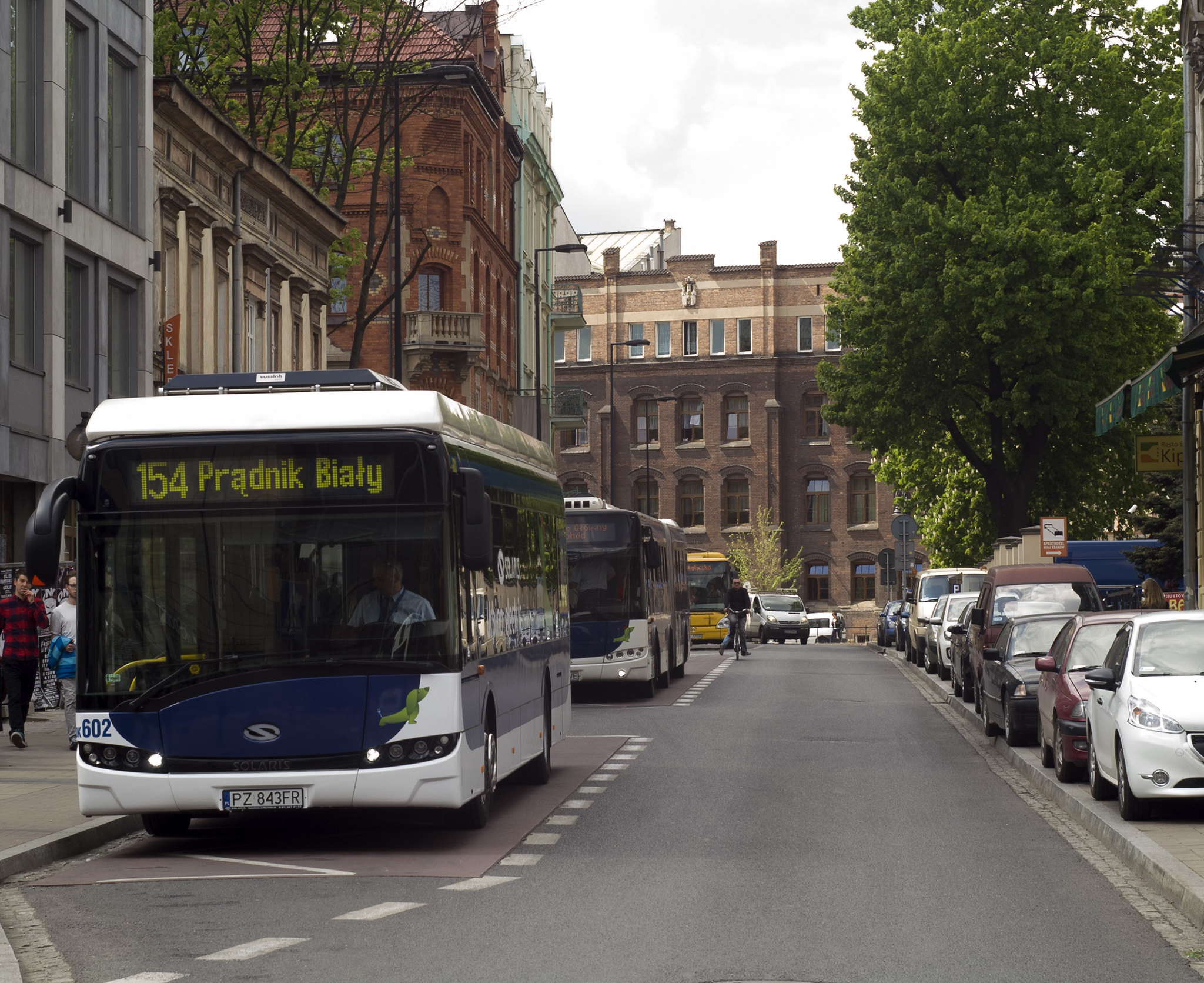
Correlations of Urban Sprawl with Transport Patterns and Socioeconomics of University Students in Cracow, Poland

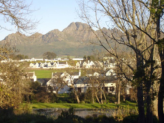
Monitoring Urban Sprawl and Sustainable Urban Development Using the Moran Index: A Case Study of Stellenbosch, South Africa

Thursday, July 30, 2020

Correlations of Urban Sprawl with Transport Patterns and Socioeconomics of University Students in Cracow, Poland

  • By Melika Mehriar, 
  • Houshmand Masoumi, and 
  • Katarzyna Nosal Hoy


  • Urban sprawl is considered as a western urban development pattern, which is common in different cities around the world. Although a large number of studies have focused on urban sprawl, modeling urban sprawl has been less emphasized, especially in various geographical contexts. The present study aimed to investigate urban sprawl and its determinants in a post-socialist country and model urban sprawl based on disaggregated data. In addition, the correlations of urban sprawl with travel patterns were examined, along with the socioeconomic characteristics of university students in Krakow, Poland by applying the Weighted Least Square (WLS) regression model. The WLS regression model was fitted based on the data from 1288 online questionnaires targeting university students. Also, urban sprawl around the home and the university for each student who indicated the nearest intersection to their home and university were separately estimated by employing Shannon entropy. Based on the findings, urban sprawl around homes was correlated with 14 transport patterns and socioeconomic features such as gender, age, driving license, financial dependency status, gross monthly income, number of commute trips, mode of transportation for commuting, number of trips for shopping or entertainment, daily shopping area, mode choice for shopping and entertainment trips inside and outside the neighborhoods, frequency of public transport use, attractiveness of shops inside the neighborhoods, and the length of time living in current home. Furthermore, urban sprawl around the university was significantly correlated with age, car ownership, number of commute trips, and sense of belonging to neighborhoods, entertainment place, and residential location choice. Finally, a positive correlation was reported between urban sprawl with higher income, elderly student, financial dependent students, and car dependency trips, while urban sprawl was negatively related to the use of public transit.


    Solaris Urbino 12 electric Krakow

    Read more about urban sprawl:

    Tuesday, September 3, 2019

    Monitoring Urban Sprawl and Sustainable Urban Development Using the Moran Index: A Case Study of Stellenbosch, South Africa

    By Walter Musakwa and Adriaan van Niekerk

    The management of urban sprawl is fundamental to achieving sustainable urban development. Monitoring urban sprawl is, however, challenging. This study proposes the use of two spatial statistics, namely global Moran and local Moran to identify statistically significant urban sprawl hot and cold spots. The findings reveal that the Moran indexes are sensitive to the distance band spatial weight matrices employed and that multiple bands should be used when these indexes are used. The authors demonstrate how the indexes can be used in combination with various visualisation methods to support planning decisions.


    Wednesday, June 13, 2018

    Drivers of urban sprawl in two large Middle-eastern countries: literature on Iran and Egypt

    By Houshmand E. Masoumi, Maryamsadat Hosseini, and Amr Ah. Gouda

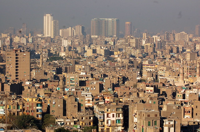
    This paper reviews the relevant literature of Iran and Egypt as two large countries of the region and concludes that four phenomena are common between the two countries and are accountable for sprawling, namely (1) wholesale land selling to the lower economic class, (2) defciencies of planning systems in controlling development plans, (3) fast and uncontrolled increase in urban population, and (4) rural-urban migration. These drivers are categorized in two classes of demographic and planning-related trends. Besides, there is a number of peculiar trends that have nationwide causes but are uncommon in Iran and Egypt. The authors of this paper consider that the demographic drivers or sprawl addressed by the Middle Eastern scholars are not actual causes but only consequences, or there is a correlation between the demographic factors and sprawl. More in-depth historical and socioeconomic studies are needed to fnd the associations between sprawl and unstudied phenomena like change in technologies, culture, and lifestyle.

    View of Cairo (القاهرة) from the Saladin Citadel (قلعة صلاح الدين)

    More about urban sprawl in developing countries:

    URBANIZATION TRENDS AND URBAN PLANNING STRATEGIES IN THREE MAJOR MIDDLE EASTERN COUNTRIES: IRAN, EGYPT, AND TURKEY

    Urban Sprawl: A view from developing and developed Countries

    The Status of Urban and Suburban Sprawl in Egypt and Iran

    Evaluation of Urban Sprawl Speed and Intensity Based on International Urbanization. Example from a Mexican City

    URBAN SPRAWL AND CLIMATIC CHANGES IN TEHRAN

    Monitoring and modeling the urban growth of mid-size cities in Iran by Markov model: the case study of Zanjan City

    Friday, December 23, 2016

    URBANIZATION TRENDS AND URBAN PLANNING STRATEGIES IN THREE MAJOR MIDDLE EASTERN COUNTRIES: IRAN, EGYPT, AND TURKEY

    By MARYAMSADAT HOSSEINI, AMR AH. GOUDA, HOUSHMAND E. MASOUMI


    Rapid urbanization has turned into a problematic phenomenon laying negative effects on the Middle Eastern cities and their peripheries. Although fast increase in urban population of the countries of the region has been well-researched, the connections to urban development strategies and patterns are being neglected. This paper examines the time coincidence of some of the dominant planning trends of the past decades that are considered to be associated with the intensive urban population changes. The paper attempts to discuss over the points in which the three countries witnessed significant increase and decrease in fertility rates. For that, the data of the World Bank have been applied. The graphs seen in this paper have been produced by the Google public data from the World Bank website, which provides the possibility of separating urban and rural populations. The descriptive analysis of this study shows that these vigorous changes of population growth rates have been more powerful in Iran and Turkey and steadier in Egypt. Examples of weak planning in the three target countries of this study, Iran, Egypt, and Turkey, such as failure in new city planning in Egypt, extensive sprawl in Turkish cities, rural-urban migration in Iran and Turkey, and the policy of wholesale land selling in Iran depict uncontrolled and vis-à-vis urban planning taking the wrong route. It is concluded that controlling urbanization trends in emerging countries, like the Middle Eastern states, requires a strong and strict urban planning system that avoids trial and error.


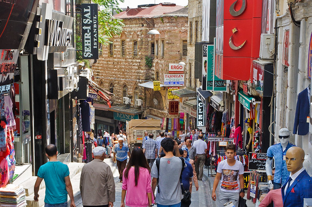
    Peripheral Shoppers  

    More about cities and urban planning in the Middle East:

    Urban Transformations of the Mediterranean Cities in Light of Developments in the Modern Era

    TENSIONS AND TRANSFORMATIONS IN THE MASTER PLANNING PROCESS OF ISTANBUL

    Upgrading informal settlements in Egypt towards a sustainable urban development

    The Status of Urban and Suburban Sprawl in Egypt and Iran

    A REGIONAL ANALYSIS OF URBAN POPULATION AND TRANSPORT ENERGY CONSUMPTION

    Urban Sprawl Pattern Recognition Using Remote Sensing and GIS – Case Study Shiraz City, Iran

    A THEORETICAL APPROACH TO CAPABILITIES OF THE TRADITIONAL URBAN FORM IN PROMOTING SUSTAINABLE TRANSPORTATION

    The Study of Land Use Changes in the Tehran Metropolitan Area by Using MOLAND Model

    Thursday, October 20, 2016

    Urban Sprawl: A view from developing and developed Countries

    By Ebenezer Adaku,

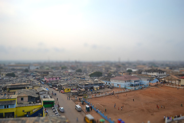
    Though urban sprawl is often discussed without a specific definition, the term generally, connotes development patterns that are undesirable. In developed countries, this phenomenon of urban sprawl has a significant attention with regard to how it is described as well as its impacts. However, the nature of this phenomenon in developing countries still requires attention and traction in literature. Therefore, this study sought to highlight some of the characteristics of urban sprawl from the perspective of a developing country by juxtaposing the Ghanaian and the U.S. versions of urban sprawl as way of also stimulating further discussions in this direction. The study found out that though there are similarities in the causes and impacts of urban sprawl in both Ghana and the U.S., the socio-economic conditions as well as cultural systems in both countries play significant roles in the evolution and perception of the phenomenon in both countries.

    Accra, Ghana Tiltshift

    More about urban and suburban sprawl:

    The Status of Urban and Suburban Sprawl in Egypt and Iran

    Evaluation of Urban Sprawl Speed and Intensity Based on International Urbanization. Example from a Mexican City

    Applying a CA-based model to explore land-use policy scenarios to contain sprawl in Thessaloniki, Greece

    Monitoring and modeling the urban growth of mid-size cities in Iran by Markov model: the case study of Zanjan City

    A scale-adjusted measure of ‘‘Urban sprawl’’ using nighttime satellite imagery

    URBAN PATTERNS FOR A GREEN ECONOMY: LEVERAGING DENSITY

    Thursday, June 30, 2016

    The Status of Urban and Suburban Sprawl in Egypt and Iran

    By Amr Ah. Gouda, Maryamsadat Hosseini, and Houshmand E. Masoumi

    The circumstances of urban sprawl in the Middle Eastern cities have been basically examined; now we are aware of the existence of a crawling sprawl in the growth pattern of the region’s cities. Nevertheless, the extent and the causes of this phenomenon have not yet been clearly explained. Thus, two questions are still unanswered: (1) to what extent are the Middle Eastern cities sprawled?, (2) what are the main drivers of sprawl in the Middle East? This paper brings together several evidences from international and the national languages to provide explanation to the above. The findings show that urban and suburban sprawl is an inclusive pattern seen in a wide variety of city sizes, planning concepts, times, etc. Sprawl is not limited to large metropolitan areas; mid-sized and small cities of the region are also sprawling. Furthermore, administrative and planning reasons are the strongest causes of urban sprawl in the region.


    More about urban planning in the Middle East:

    A REGIONAL ANALYSIS OF URBAN POPULATION AND TRANSPORT ENERGY CONSUMPTION

    Urban Sprawl Pattern Recognition Using Remote Sensing and GIS – Case Study Shiraz City, Iran

    TRADITIONAL SHOPPING: A Syntactic Comparison of Commercial Spaces in Iran and Turkey

    URBAN SPRAWL IN MID-SIZED CITIES OF MENA, EVIDENCE FROM YAZD AND KASHAN IN CENTRAL IRAN

    A THEORETICAL APPROACH TO CAPABILITIES OF THE TRADITIONAL URBAN FORM IN PROMOTING SUSTAINABLE TRANSPORTATION

    Residential Self-Selection and Its Effects on Urban Commute Travels in Iranian Cities Compared to US, UK, and Germany

    MODELING THE TRAVEL BEHAVIOR IMPACTS OF MICRO-SCALE LAND USE AND SOCIO-ECONOMIC FACTORS