Like Urban Research on Facebook

Saturday, August 31, 2019

Revisiting Urban Planning in Developed Countries

By Pietro Garau

The purpose of this paper is to describe urban planning trends in the so-called “developed countries”. And indeed, the countries under examination will be precisely those still falling under this category. Throughout this paper, however, the vast region to which they belong will be referred to as “The North”. One reason for this is that, to this author as well as to many others, it is increasingly difficult to define to what kind of end state the terms “developed” and its complementary one, “Developing”, should represent, or aspire to. When the term was coined, it was universally believed that development referred largely to the improvement of economic performance. Then, in 1989, came UNDP’s historic definition of “human development”, which expanded the concept of development to include such factors as educational attainment, health, and gender parity. After that, we began to see that “development” was a moveable object whose contours depended on the bundle of indicators chosen to define and measure it. 


France, Strasbourg

More about urban planning and policy making:

Measuring Gentrification in the Interstate Corridor Urban Renewal Area

By Indrani Boyle

This study seeks to evaluate and reflect upon attempts to measure gentrification in the Interstate Corridor Urban Renewal Area (ICURA) of Portland, Oregon. Established in 2000 by the Portland City Council, and managed by the Portland Development Commission (PDC), the urban renewal area relies on the use of Tax Increment Financing (TIF) to fund capital improvements in a defined area of North/Northeast Portland. Although twenty urban renewal areas have been instituted within the City of Portland since the late 1950’s, few in recent history have included substantial residential areas (B. Durston, personal communication, October 1, 2008). For example, the River District Urban Renewal Area targeted a largely abandoned industrial area beginning in 1998, resulting in the creation of “The Pearl,” a vibrant multi-use district with a significant amount of housing. Although the growth of The Pearl has inspired concerns about gentrification and housing affordability, the prospect of urban renewal in the heavily residential areas of North/Northeast Portland prompted stronger reactions. In a largely homogenous city, the ICURA contains sections of 10 neighborhoods, including historically African American neighborhoods. History makes the racial composition of neighborhoods relevant. Previous actions of PDC led to the relocation of hundreds of African American households to make way for large-scale redevelopment projects. In addition, persistent patterns of legal and illegal discrimination contributed to income and housing instability. Homeownership rates for African Americans in Portland remain well below population averages. However, the neighborhoods within the ICURA were characterized by a deteriorating housing stock, declining employment opportunities, and criminal activity. To many, urban renewal represented both a threat and an opportunity. By necessity, the implementation of urban renewal causes change. In both fact and perception, these changes are likely to be simultaneously positive and negative.


Portland

More articles about urban renewal and revitalization:

Planning and Urban Design for a Liveable High-Density City

Thursday, August 29, 2019

Accessibility in Cities: Transport and Urban Form

By Philipp Rode, Graham Floater, Nikolas Thomopoulos, James Docherty, Peter Schwinger, Anjali Mahendra, Wanli Fang, Bruno Friedel, Alexandra Gomes, Catarina Heeckt, and Roxana Slavcheva

This paper focusses on one central aspect of urban development: transport and urban form and how the two shape the provision of access to people, goods and services, and information in cities. The more efficient this access, the greater the economic benefits through economies of scale, agglomeration effects and networking advantages. This paper discusses how different urban accessibility pathways impact directly on other measures of human development and environmental sustainability. It also presents the enabling conditions for increasing accessibility and low-carbon mobility in cities. This paper is one of three papers by LSE Cities that form part of the cities research programme of the New Climate Economy (NCE) project for the Global Commission on the Economy and Climate. The two other contributing papers cover ‘Cities and the New Climate Economy: the Transformative Role of Global Urban Growth’ (NCE Paper 01) and ‘Steering Urban Growth: Governance, Policy and Finance’ (NCE Paper 02).


Finally 

More articles about accessibility and urban form:

A comparative study of the morphological characteristics of residential areas in San Francisco

Policies for Sustainable Accessibility and Mobility in Urban Areas of Africa

UNDERSTANDING PERCEPTIONS OF ACCESSIBILITY AND MOBILITY THROUGH STRUCTURATION THEORY

Modelling Perceived Accessibility to Urban Amenities Using Fuzzy Logic, Transportation GIS and Origin-Destination Surveys

The Effects of Teleshopping on Travel Behavior and Urban Form

Accessibility Measures: Overview and Practical Applications

MEASURING ACCESSIBILITY AND PROVIDING TRANSPORT CHOICE

Tuesday, August 27, 2019

DESIGNING THE HEALTHY NEIGHBORHOOD: DERIVING PRINCIPLES FROM THE EVIDENCE BASE

By Ellen M. Bassett, Timothy Beatley, Reuben M. Rainey, Robert Lamb Hart, David P. Howerton, J. Timothy McCarthy II, Paul Milana, and Stuart Siegel

The built environment is a critical factor in human health outcomes. In the late 19th and early 20th centuries, for instance, poor urban environments were a great threat to city residents from all walks of life. Rapidly growing cities experienced severe epidemics of infectious diseases, including tuberculosis, cholera, typhoid, and yellow fever. These epidemics were effectively mitigated through investment in public infrastructure and better urban planning. Sewers were built to manage human waste, public parks were created give access to fresh air, building standards were changed to ensure safe shelter, and development regulations served to reduce traffic congestion and relieve urban overcrowding. Importantly, visionary architects and planners of the time recognized the role of urban design as a tool for improving health. Some of the earliest American suburbs—like Riverside, Illinois, planned by Vaux and Olmstead—were created as havens from the industrial city and designed in a way that incorporated nature and health-giving open space throughout the model community. In reaction to heavily polluted London, Ebenezer Howard envisioned the “garden-city” which strove to integrate the best of the city with the benefits of rural life. His iconic vision informed the thinking of other leading 20th century designers and urbanists who created places like the New Deal-era Greenbelt towns—practical but utopian communities designed to provide decent housing, strong community life, and nearby employment and amenities to its residents. Our triumph over the acute diseases of the city provides important lessons for today since communities across the United States now face a different type of health threat—namely the spread of chronic diseases, such as asthma, Type-2 diabetes, cancer, and heart disease.1 Of particular concern relative to the rise of chronic diseases is the global rise in levels of obesity. The prevalence of obesity or extreme obesity for adults aged 20 to 74—conventionally measured as a Body Mass Index exceeding 30 for obesity and 40 for extreme obesity—has risen from 14.3% in 1960-62 to 41.9% in 2010-2011 (Fryar, et al.(a), 2014). Child and adolescent (aged 2 to 19) obesity now measures at 16.9%, up from 5.2% in 1971-1974 (Fryar, et al.,(b), 2014). At the same time that obesity has risen, average rates of physical activity have fallen for both adults and children. In the US, only 48% of adults meet the Surgeon General’s Guidelines for physical activity, namely 150 minutes of moderate intensity aerobic activity like brisk walking every week (http://www.cdc.gov/physicalactivity/data/ facts.html). Physical inactivity amongst children is also a concern. For instance, in 2009, 13 percent of children five to 14 years old usually walked or biked to school compared with 48 percent of students in 1969. The concern with obesity and physical inactivity is so pronounced in our public health conversations because of the known link between these factors and chronic diseases such as diabetes, heart disease and various forms of cancer.


Measuring Neighborhood Quality of Life: Placed-Based Sustainability Indicators in Freiburg, Germany

By Craig A. Talmage, Bjoern Hagen, David Pijawka, and Cara Nassar

There has been a recent upswing of academic interest in the social dimensions of sustainable cities, especially the dynamics of Quality of Life (QoL), Environmental Equity, Ecosystem Services, Eco-Friendliness, Public Engagement, and Well-Being and Happiness Indicators. These factors are only now being evaluated as critical aspects of sustainable place-making and community development. This paper explores the social dimensions of neighborhood development in what some believe to be one of the most sustainable cities—Freiberg, Germany. We look at two neighborhoods that were specifically designed and built with sustainability principles and practices at their core. The authors surveyed residents of these neighborhoods to measure their levels of well-being, satisfaction with place, and other important QoL factors. Quantitative data was ascertained from residents using a survey questionnaire. The results show a high correlation between QoL factors as a function of place-making and sustainability practice. 


More papers about quality of life:

Impact Assessment of Sustainable Public Transportation System on Quality of Life in Tehran

Walking and Transit Use Behavior in Walkable Urban Neighborhoods

By Devon McAslan,

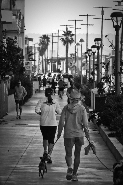
Urban transportation is one of the most important target sectors for creating more sustainable and livable cities. Many US cities are making huge investments in public transit infrastructure in efforts to lower automobile use, encourage compact development, and curb greenhouse gas emissions. This paper explores how differences in the urban environment impact walking and transit use and how urban residents utilize walking and transit as modes of transportation. I use data from neighborhood mapping, observations, surveys, and interviews to explore these two questions. I find that walking is indeed the main mode of transportation within the urban core of Seattle. In contrast to what mainstream urban planning literature would suggest, residents living in the dense urban core of Seattle do not appear to be transit dependent and continue to drive at higher than expected rates. To help explain this, I explore how the ‘theory of urban fabrics’ applies to walkability and transit planning. This new emerging theory encourages planners to rediscover how to prioritize different modes of transportation within different parts of the city instead of current trends, which advocate for multimodal and shared streets throughout the city. Evidence indicates that the most walkable neighborhoods are those that have the least number of conflicts between pedestrians, transit, and automobiles, and that the transit system in Seattle suffers because it is not prioritized over cars in any significant way. This reduces the likelihood that individuals will make the switch to transit over driving, which has important implications for transportation planning policies.


Kalamazoo is a Walkable Community Photo by Michigan Municipal League

More articles about walkability:

Urban Travel Behavior in Large Cities of MENA Region: Survey Results of Cairo, Istanbul, and Tehran