Like Urban Research on Facebook

Showing posts with label Indonesia. Show all posts

Friday, January 16, 2026

6 capital cities completely designed and built by colonial empires

Some of the world’s largest cities were never meant to serve their native populations. Instead, they were designed by foreign rulers to control land, extract wealth, and reinforce imperial dominance. Over 100 major cities worldwide were planned and constructed by colonial powers, many of which remain economic and political hubs today. But how did these cities emerge? How were they planned? And how much of their colonial legacy still lingers? Today, we uncover the most significant cities built by colonial powers—and the lasting impact they have had on the modern world.


Methodology: Defining Colonial Cities and Their Criteria

Before diving into specific cities, let's define what we mean by a colonial city. Colonialism involved powerful nations exerting control over foreign lands, often through military conquest, economic exploitation, and political dominance. These colonial powers needed administrative and trade centers, so they designed new cities rather than relying on existing indigenous settlements.

For this video, we classify a colonial city using three criteria:

  • It was planned and built primarily by colonial authorities.
  • It served as an administrative, military, or trade hub for the empire.
  • It incorporated European-style urban planning, including grid layouts, segregated districts, and monumental government structures.

Now, let’s explore some of the most historically significant cities that fit this definition.


1. New Delhi, India (British Empire)

πŸ“Œ Population (2023): ~32 million
πŸ“ Land Area: ~1,484 km²
πŸ’° Cost of Construction (1911): £4 million (Equivalent to ~£500 million today)

In 1911, the British colonial government decided to move India’s capital from Calcutta to New Delhi, aiming to create a symbol of British power. Designed by Sir Edwin Lutyens and Herbert Baker, New Delhi was built with wide boulevards, European-style government buildings, and geometric road patterns. It was intended to be a monument to British authority, segregating colonial rulers from the native Indian population.

Post-independence, New Delhi remained India’s capital, and today it is one of the world’s largest metropolitan areas, with a booming economy and a blend of colonial and modernist architecture.


2. Jakarta, Indonesia (Dutch East Indies)

πŸ“Œ Population (2023): ~11 million
πŸ“ Land Area: ~661 km²
πŸš† Dutch-built canals: Over 110 km (many still in use today)

Originally named Batavia, Jakarta was founded in 1619 by the Dutch East India Company (VOC). The Dutch meticulously planned the city with Amsterdam-style canals, aiming to facilitate trade and military defense. However, these canals became disease-ridden, leading to devastating malaria outbreaks in the 18th and 19th centuries.

Post-independence, Jakarta grew into Indonesia’s economic powerhouse, but colonial infrastructure contributed to its severe flooding problems, as many canals were poorly maintained or repurposed for informal housing.


3. Hanoi, Vietnam (French Indochina)

πŸ“Œ Population (2023): ~8 million
πŸ“ Land Area: ~3,358 km²
πŸ› French-built districts: 4 major colonial zones

Under French rule (1887–1954), Hanoi was transformed into the administrative capital of French Indochina. The French introduced:

  • Boulevards mimicking Paris, such as the iconic TrΓ ng Tiền Street.
  • European-style villas and government buildings.
  • Zoning policies that segregated French officials and Vietnamese locals.

Today, Hanoi still showcases its French colonial heritage, particularly in the Old Quarter, blending Vietnamese traditions with French-influenced urban design.


4. Nairobi, Kenya (British Empire)

πŸ“Œ Population (2023): ~5.5 million
πŸ“ Land Area: ~696 km²
πŸš‚ Founded as a railway depot (1899) for the Uganda Railway

The British founded Nairobi in 1899 as a railway hub for the Uganda Railway, but it quickly evolved into British East Africa’s colonial capital. The city was designed with rigid racial segregation, ensuring that Europeans occupied the best areas, while Africans and South Asians were pushed into underdeveloped districts.

Even today, inequalities in Nairobi’s urban landscape trace back to its colonial foundations. The city remains a major financial and diplomatic hub, but issues like poor infrastructure, wealth disparity, and informal settlements are remnants of British planning policies.


5. Manila, Philippines (Spanish & American Colonialism)

πŸ“Œ Population (2023): ~14 million
πŸ“ Land Area: ~636 km²
πŸ’° American redevelopment cost (1905–1915): $8 million (Equivalent to ~$250 million today)

Manila was initially shaped by the Spanish (1571–1898), with its Intramuros district built as a walled city to protect against invasions. After the U.S. took control in 1898, American planners, including Daniel Burnham, redesigned Manila with:

  • A grand waterfront boulevard (Roxas Boulevard).
  • Modernized road networks inspired by Washington D.C.
  • Public parks and new zoning laws.

Today, Manila is a complex mix of Spanish, American, and modern influences, reflecting its long colonial history.


6. BrasΓ­lia, Brazil (Portuguese Colonial Influence & Modernist Planning)

πŸ“Œ Population (2023): ~3 million
πŸ“ Land Area: ~5,802 km²
πŸ— Built in 41 months (1956–1960), costing $10 billion today)

While not a direct colonial city, BrasΓ­lia reflects Portuguese colonial urban planning concepts—centralized power, controlled expansion, and grand symbolic architecture. Designed by LΓΊcio Costa and Oscar Niemeyer, BrasΓ­lia was built entirely from scratch in just four years, replacing Rio de Janeiro as Brazil’s capital.

However, its strict zoning policies led to inequality, with elite government officials living in prime areas while the majority commuted from distant satellite towns.


Conclusion: The Lasting Impact of Colonial Urban Planning

Colonial cities were not just places of governance—they were built as instruments of control, designed for economic extraction, racial segregation, and political dominance. Many of these cities have since evolved, but their colonial-era foundations still shape modern urban challenges:

  • New Delhi’s grand avenues still serve as India’s political core.
  • Jakarta’s canals remain a flood-prone legacy of Dutch planning.
  • Nairobi’s zoning policies continue to affect housing inequality.
  • Manila’s American-built roads define its urban layout even today.

The legacy of colonial planning is still deeply embedded in these cities, often contributing to modern issues like traffic congestion, social inequality, and outdated infrastructure. While many have modernized, the shadows of colonialism still linger.


Read more about urban history: 
The transformation of Chinese cities (2000-2025): The rise of China’s megacities

Thursday, May 8, 2025

The WORST urban planning catastrophes of Southeast Asia


Urban planning is the art and science of designing cities to be livable, efficient, and sustainable. It involves everything from transportation systems to zoning laws, green spaces, and housing developments. When done well, it creates harmony between people and their environment. But when it fails? It can plunge cities into chaos, creating problems that linger for decades.

Southeast Asia, home to some of the most vibrant and rapidly growing cities in the world, has seen its fair share of urban planning disasters. Today, we’re peeling back the layers on the most infamous examples: traffic-clogged streets, crumbling infrastructure, and policies that failed to keep pace with urban growth. Get ready for a jaw-dropping journey through the region’s urban planning nightmares.


Growing Cities, Growing Problems
Southeast Asia’s cities are booming, with urban populations growing by more than 70 million people over the last two decades. But rapid growth brings unique challenges. Many cities in this region face unplanned urban sprawl, fueled by high rural-to-urban migration and a lack of coherent planning strategies. This has led to haphazard infrastructure development, chaotic land use, and insufficient public services.

One of the biggest challenges is traffic congestion. Cities like Manila and Jakarta are infamous for their gridlock, where peak-hour traffic feels like a constant state of paralysis. Over-reliance on private vehicles and underinvestment in public transit are common culprits.

Another key issue is environmental vulnerability. Many of these cities are coastal and face rising sea levels, monsoonal floods, and poor waste management. Jakarta’s situation, for example, has become so dire that the government is relocating the capital.

Inequality is another challenge. Poorer neighborhoods often lack access to adequate transportation, clean water, and sanitation. This leaves millions trapped in poverty while wealthier areas thrive, creating stark contrasts within the same city.


Disaster Spotlights: Where It All Went Wrong

Let’s explore some of Southeast Asia’s worst urban planning disasters in detail:

Manila, Philippines
Manila’s traffic congestion is often ranked among the worst in the world. Commuters here lose an average of 257 hours a year stuck in traffic, according to the Asian Development Bank. The root cause lies in a history of car-centric urban planning, where investment in roads vastly outpaced investment in public transit.

The city’s public transportation system is also notoriously unreliable. The Metro Rail Transit (MRT), a key commuter rail line, is plagued by overcrowding, frequent breakdowns, and insufficient capacity. Meanwhile, the jeepneys—once a cultural symbol—are aging and inefficient. Manila’s failure to integrate these systems has only worsened the chaos.

Jakarta, Indonesia
Jakarta’s sinking streets are both a symptom and a symbol of poor urban planning. 40% of the city is below sea level, and it sinks by about 25 cm per year in some areas. The primary culprit? Excessive groundwater extraction, as much of the city lacks piped water infrastructure. This has left Jakarta vulnerable to floods that regularly displace thousands and damage infrastructure.

Despite the introduction of the TransJakarta bus rapid transit system, traffic remains a major issue. With 13 million people commuting daily, the lack of an integrated, multi-modal transport network leaves most residents relying on private vehicles.

Bangkok, Thailand
Bangkok presents a mixed bag of planning successes and failures. The BTS Skytrain and MRT subway are efficient, but they only serve certain parts of the sprawling city. Most Bangkokians still rely on cars, motorcycles, and informal transport modes like tuk-tuks, contributing to gridlock. Pedestrian infrastructure is equally problematic, with narrow sidewalks that are often blocked by vendors or parked motorcycles.

Ho Chi Minh City, Vietnam
Rapid urbanization has transformed Ho Chi Minh City, but poor zoning has resulted in chaotic development. Flooding is a constant issue due to poorly designed drainage systems and widespread paving of natural floodplains. Despite the city’s attempts to modernize, its nascent metro system has faced significant delays and cost overruns.

Kuala Lumpur, Malaysia
Kuala Lumpur’s urban sprawl has created vast, car-dependent suburbs, while the city center struggles with underused public spaces. The Mass Rapid Transit (MRT) system is a step forward, but first- and last-mile connectivity remains a challenge. Meanwhile, poorly maintained drainage systems contribute to frequent flash floods.

The Worst Case: Jakarta’s Sinking Crisis

If there’s one disaster that truly captures the consequences of poor urban planning, it’s Jakarta’s sinking neighborhoods. Imagine waking up to find your street submerged in knee-deep water—not once a year, but multiple times every rainy season. Residents of Pluit, one of Jakarta’s hardest-hit districts, have been forced to build makeshift walls around their homes to hold back floodwaters.

This disaster isn’t just a local issue—it’s a national crisis. The environmental toll includes the destruction of mangrove forests, which once protected Jakarta’s coastline. The economic cost is staggering, with annual flood damages running into billions of dollars. And the social cost? Entire communities are being uprooted, with no clear solution in sight.

Jakarta’s story serves as a cautionary tale for other cities in the region. Without sustainable urban planning, the combination of rapid growth, environmental challenges, and aging infrastructure can create disasters that are almost impossible to reverse.

Lessons from Failure
Urban planning disasters are more than just stories of failure—they’re lessons in what happens when we prioritize short-term gains over long-term sustainability. From Manila’s traffic nightmares to Jakarta’s sinking streets, Southeast Asia’s cities have shown us the cost of ignoring integrated, forward-thinking planning.

But all is not lost. Cities like Singapore and Hanoi are proving that with the right investments and policies, it’s possible to turn things around. Sustainable transport, better zoning laws, and climate-resilient infrastructure can help create urban spaces that work for everyone.


More about Southeast Asia:

The Production of Urban Space in Vietnam’s Metropolis in the course of Transition: Internationalization, Polarization and Newly Emerging Lifestyles in Vietnamese Society

Friday, November 22, 2024

Top 10 Metro and Light Rail Systems in Southeast Asia Ranked

 Southeast Asia is home to some of the world’s fastest-growing cities, each grappling with the challenges of urbanization, congestion, and sustainability. Metro systems have emerged as transformative solutions, reducing traffic, cutting emissions, and making cities more livable. But not all systems are created equal. Today, we’ll rank the top 10 metro systems in Southeast Asia, considering factors like efficiency, technology, coverage, sustainability, and user experience. Each system is scored out of 100, with 100 representing world-class excellence.


1. Singapore MRT (Score: 100)

Singapore’s Mass Rapid Transit (MRT) leads the pack with its unparalleled efficiency, seamless integration, and forward-thinking design. Since its launch in 1987, the MRT has grown to over 200 kilometers of track and more than 130 stations, covering the entire island.

With an average daily ridership of 3.5 million, the MRT is known for punctuality, boasting a reliability rate of 99.8%—one of the highest globally. Its EZ-Link card system simplifies payments across trains, buses, and taxis, reflecting Singapore's emphasis on connectivity.

The MRT’s eco-friendly initiatives, like regenerative braking systems and naturally ventilated stations, save millions of kilowatt-hours annually. The recently added Thomson-East Coast Line reduced commuter times by as much as 50%, underscoring its impact on daily life. Images of ultra-modern stations and green corridors surrounding the tracks showcase the MRT as a model for urban mobility.


2. Bangkok BTS and MRT (Score: 94)

Bangkok’s Skytrain (BTS) and underground MRT form a dynamic duo that revolutionized commuting in Thailand’s capital. The BTS started in 1999 with two lines, now spanning over 70 kilometers, while the MRT began in 2004 and covers an additional 54 kilometers.

Together, they carry 1.3 million passengers daily, significantly alleviating Bangkok’s notorious traffic. The elevated BTS tracks offer breathtaking views of the cityscape, while MRT stations feature contemporary Thai art.

The efficiency of these systems is reflected in their 97% on-time performance and seamless connections to river ferries and airports. Future expansions, like the MRT Orange Line, promise to bring coverage to underserved areas. Bangkok's network balances innovation with cultural identity, making it both functional and iconic.


3. Kuala Lumpur LRT & MRT (Score: 89)

Kuala Lumpur boasts a sophisticated rail system that integrates Light Rail Transit (LRT), Monorail, and MRT lines. Collectively spanning over 170 kilometers, these systems handle 2 million passengers daily across the Klang Valley.

The Kelana Jaya Line stands out as Southeast Asia’s first driverless metro, while the MRT Sungai Buloh-Kajang Line set a benchmark for sustainable construction. Stations like Bukit Bintang showcase a mix of modernity and local culture, creating an inviting environment for commuters.

The system’s cashless ticketing, real-time arrival data, and future-proof expansions, including the MRT Putrajaya Line, elevate Kuala Lumpur’s transit ecosystem. The network’s emphasis on energy efficiency and integration has positioned it as a leader in urban connectivity.


4. Jakarta MRT (Score: 84)

Indonesia’s bustling capital took a major leap forward with the Jakarta MRT, launched in 2019. Initially covering 16 kilometers and serving 200,000 passengers daily, the MRT plans to expand to over 230 kilometers by 2030.

The MRT has reduced travel times between key areas by up to 50%, providing a reliable alternative to Jakarta’s infamous traffic. Energy-efficient trains and green urban spaces around stations reflect its commitment to sustainability.

While still in its early stages, the Jakarta MRT has demonstrated the transformative potential of urban rail. The government’s ambitious vision, combined with positive user feedback, suggests a bright future for the system.


5. Manila Metro (Score: 78)

The Manila MRT, one of Southeast Asia’s oldest, has served the Philippines’ capital since 1984. Despite carrying over 1.3 million passengers daily, the system has faced challenges like aging infrastructure and overcrowding.

Planned upgrades include air-conditioned trains, improved ticketing systems, and extensions to suburban areas. The MRT3 line, running along the bustling EDSA highway, remains a vital artery for Manila’s commuters.

While the system’s reliability has room for improvement, ongoing modernization efforts aim to restore the network’s former glory. Manila’s metro is a testament to resilience and the importance of investing in public transit.


6. Hanoi Metro (Score: 72)

Hanoi’s first metro line, the Cat Linh-Ha Dong Line, opened in 2021, marking a new chapter for Vietnam’s capital. Covering 13 kilometers and serving 12,000 passengers daily, it represents a modest start with ambitious plans for growth.

By 2030, Hanoi aims to build a network of 318 kilometers, reducing congestion and emissions. The line’s sleek trains and vibrant station interiors symbolize the city’s modernization.

While currently limited in scope, Hanoi Metro showcases the potential of public transit to reshape urban mobility in emerging economies.


7. Ho Chi Minh City Metro (Score: 70)

Expected to launch in 2024, Ho Chi Minh City’s first metro line promises to revolutionize commuting in Vietnam’s largest city. The 19.7-kilometer Line 1 will connect downtown with suburban districts, aiming to serve 220,000 passengers daily in its initial phase.

Future expansions include six lines covering 200 kilometers, addressing the city’s growing transportation needs. Early visuals of stations and trains hint at a blend of modernity and functionality.

As the system comes online, it has the potential to become a cornerstone of urban development in Ho Chi Minh City.


8. Singapore LRT (Score: 68)

Singapore’s Light Rail Transit (LRT) system complements the MRT by providing first-mile, last-mile connectivity in suburban areas. Automated and efficient, the LRT handles over 600,000 daily passengers across three lines.

While smaller in scale than the MRT, the LRT plays a critical role in linking residential areas to the main transit network. Its compact design and real-time monitoring ensure reliability and ease of use.

The LRT is a testament to Singapore’s holistic approach to urban mobility, ensuring no commuter is left behind.


9. Bangkok Airport Rail Link (Score: 65)

Connecting Suvarnabhumi Airport to central Bangkok, the Airport Rail Link serves 70,000 passengers daily, offering speeds of up to 160 km/h. While not a full metro system, it enhances the city’s transit landscape.

The link’s efficiency and affordability make it a popular choice for travelers. As expansions tie it more closely to the BTS and MRT networks, its importance will only grow.


10. Phnom Penh Metro Vision (Score: 60)

While Phnom Penh is still in the planning stages of building its first metro, the proposed $1.8 billion project has generated significant excitement. Expected to serve 50,000 passengers daily, the system aims to reduce congestion and pollution in Cambodia’s capital.

Though yet to break ground, the project represents the aspirations of a city on the cusp of transformation. Early renderings suggest a sleek, efficient design that could set a new standard for transit in emerging markets.


Conclusion: Southeast Asia’s Transit Future

Southeast Asia’s metro systems are as diverse as the region itself. From Singapore’s world-class MRT to the emerging networks in Vietnam and Cambodia, these systems showcase the power of transit to shape cities. As urban populations grow, investing in efficient, sustainable metro networks will be essential for the region’s future. Each system on this list has contributed to this vision, proving that public transit is not just about moving people—it’s about connecting lives and building better cities.

More about public transportation:

Relations of Public Transport Use and Car Ownership with Neighbourhood and City-Level Travel Purposes in Kerman, Iran

Thursday, June 27, 2019

Understanding Urban Travel Behaviour by Gender for Efficient and Equitable Transport Policies

By Wei-Shiuen Ng and Ashley Acker

Gender is one of the key socio-demographic variables that can influence travel behaviour, but it is often the least understood. Understanding travel behaviour by gender will help better design transport policies that are efficient and equitable. Due to the gendered division of work in households, women often have multiple tasks and activities. As a result, women are more likely to have shorter commute distances, to chain trips, to have more non-work related trips, to travel at off-peak hours, and to choose more flexible modes. This study examines travel behaviour by gender in eight different cities, across three different continents, focusing on transport mode, trip purpose, travel distance and departure time for Auckland, Dublin, Hanoi, Helsinki, Jakarta, Kuala Lumpur, Lisbon and Manila. The most common trends found in the cities are that women tend to travel shorter distances and prefer public transport and taxi services to cars more than men.


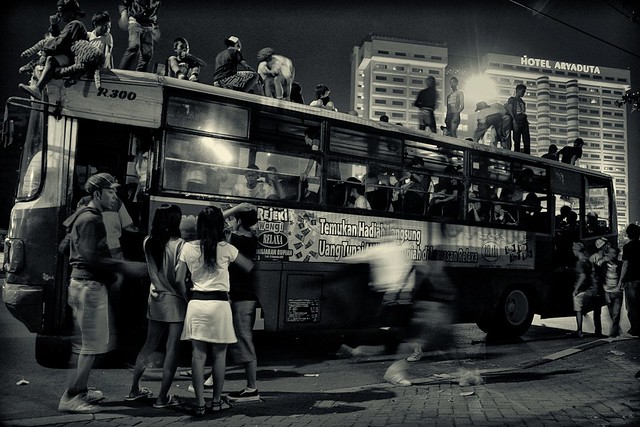
Di atas bus

Read more about urban travel transportation planning:

Economic Impacts of Adopting a Sustainable Transport System in Beirut

A critical review of new mobility services for urban transport

Urban Travel Behavior in Large Cities of MENA Region: Survey Results of Cairo, Istanbul, and Tehran

Longitudinal correlations of car ownership with socio-economics, urban form, and transport infrastructure in Latin America: Example from Ensenada, Mexico

Active Transport to School and Children's Body Weight: A Systematic Reivew

An Analysis of Car Ownership in Latin American Cities: a Perspective for Future Research

A dynamic formulation for car ownership modeling

Potential Impacts of Climate Change on U.S. Transportation

Wednesday, April 24, 2013

The 2nd INTERNATIONAL CONFERENCE ON REGIONAL DEVELOPMENT (ICRD) 2013 "Sustainable Development: Conceptual Progress and Practical Challenges"

Scholars, researchers, development practitioners, and students are invited to submit papers to be presented in The Second International Conference on Regional Development, “Sustainable Development: Conceptual Progress and Practical Challenges” which will be conducted in Semarang – Indonesia on 20 and 21 November 2013.

Selected papers may then be developed into chapters in edited book/s or articles in Tataloka Journal (nationally accredited by Dikti; ISSN: 0852-7458) or in the special edition of The Indonesian Journal of Planning and Development (ISSN: 2087-9733) after double blind-peer reviewing process. The book/s and the journal will be published in the post-conference stage.

Potential topics include, but are not limited to the followings:

A.    Climate change and natural disaster issues
B.    Inequality and poverty alleviation
C.    Environmental and spatial justice
D.    Trans-border and global issues
E.    Infrastructure and economic development 

Important Dates:
  • 6 July 2013                 : Due Date of Abstract Submission 
  • 20 July 2013               : Final Day of Notification of Accepted Abstracts 
  • 6 September 2013        : Due Date of Full Paper Submission 
  • 20 September 2013      : Final Day of Notification of Accepted Full Papers

read more

more calls for papers:

International research conference: planning / conflict - cities and citizenship in times of crisis Lisbon, October 9-11, 2013

Call for papers: T2M's 11th conference: 2013 Kouvola/St. Petersburg – Transport and borders

Call for papers: Global climate change, biodiversity and sustainability: challenged and opportunity, April 15-18, 2013, Egypt