Like Urban Research on Facebook

Showing posts with label Travel Behavior. Show all posts

Monday, May 26, 2025

Exploring Poznań's fast tram system: Revolutionizing urban transportation

Imagine a city where trams speed faster than traffic, connecting distant neighborhoods in minutes and making urban life more sustainable. Poznań, Poland, has achieved this vision with its Fast Tram—a game-changing solution to urban mobility. But how did this project reshape the city’s transportation landscape and urban growth?


Introduction

Public transportation isn’t just about getting from point A to point B; it’s about shaping the very fabric of a city. Efficient transit systems connect people, reduce congestion, cut emissions, and unlock economic potential. In the heart of Poland, the city of Poznań faced mounting challenges with rapid urban growth, sprawl, and rising car ownership during the late 20th century. By the 1990s, traffic congestion and overloaded traditional tram systems were stifling mobility.
Poznań needed a revolutionary approach, and that’s when the Poznań Fast Tram, or PST, entered the scene. Officially opened in 1997, the PST was designed to merge the speed of metro systems with the flexibility of trams. It wasn’t just a transit project; it was a bold step in reimagining urban life. Today, it serves as both a lifeline for the city and a symbol of the power of forward-thinking urban planning.
But how did Poznań evolve into a city that required such an innovative system? Let’s explore the historical and geographical context that made the PST indispensable.

Poznań’s Urban Form: The Foundation of Transit Demand
Poznań’s urban form has been shaped over centuries, reflecting its role as one of Poland’s oldest cities. Founded over 1,000 years ago, it grew from a medieval trade hub into a bustling metropolis with 540,000 residents today. The city's layout is characterized by a historic core surrounded by expanding districts that blend residential, commercial, and industrial areas.
The Old Town, with its iconic Renaissance-style Town Hall, remains the cultural and administrative heart of Poznań. However, as the population grew during the 20th century, the city expanded outward, particularly to the north. Districts like Piątkowo, Winogrady, and Rataje became home to large-scale housing developments, accommodating the influx of people moving to the city for work and education.
This expansion led to significant transportation challenges. Traditional tram lines and buses struggled to connect these peripheral districts to the city center, resulting in long commutes and frequent delays. By the 1980s, traffic congestion had become a critical issue, with car ownership rising steadily. By 1995, Poznań had nearly 300 cars per 1,000 residents, a sharp increase compared to the 1970s.
Urban sprawl further exacerbated these challenges. New housing developments were often built without sufficient consideration for public transportation, increasing reliance on cars. This unsustainable pattern strained Poznań’s road network and heightened demand for a faster, more efficient transit solution.
The Birth of the Poznań Fast Tram
Recognizing the growing transportation crisis, city planners in the late 1970s began exploring options for a high-capacity transit system. Inspired by metro networks in cities like Warsaw and Berlin, Poznań sought to develop a cost-effective alternative: a high-speed tram line operating on a dedicated corridor.
Construction of the Poznań Fast Tram began in 1986 but faced numerous delays due to Poland’s political and economic turmoil during the late communist era. Despite these challenges, the city persevered, and the PST was officially inaugurated on August 1, 1997.
The initial 8.1-kilometer route connected the city center to northern districts, featuring nine stations and grade-separated crossings to ensure uninterrupted service. The line’s trams were capable of reaching speeds of 70 km/h, more than twice the speed of traditional trams.

Technical Innovations and Operation

The PST stands out for its innovative design, which combines the efficiency of metro systems with the accessibility of trams. Key features include:
• Dedicated Tracks: The PST operates on a separate corridor, free from road traffic, ensuring reliable and punctual service.
These innovations have made the PST a model for urban transit systems worldwide. Today, the line serves an estimated 60000 passengers daily, significantly reducing travel times and improving mobility for residents in northern Poznań.
• Modern Rolling Stock: Low-floor trams like the Solaris Tramino provide easy access for all passengers, including those with disabilities.
• Integrated Network: The PST is seamlessly connected to Poznań’s broader tram and bus network, allowing for smooth transfers and greater coverage.

More about public transportation:

Saturday, January 2, 2021

Logistic models explaining the determinants of biking for commute and non-commute trips in Lahore, Pakistan

  • By Houshmand Masoumi, 
  • Muhammad Asim, 
  • Izza Anwer, and 
  • Sheikh Atif Bilal Aslam

  • The determinants of biking behavior are less studied in a wide range of developing countries including South Asia. This study takes Lahore, Pakistan as a case-study city to explore the factors defining commute and non-commute bike trips as well as commuting by bike. These issues were analyzed by collecting data from 379 subjects accommodating in three socio-economic statuses (lower, medium, and higher) in Lahore in spring 2018. The data were analyzed by applying multinomial logistic regression for investigating biking frequency and binomial logistic regression for examining commuting by bike. The results show that gender, age, education, income, purpose of the majority of trips, preferred distance to travel using cycle, preferred time to travel using cycle, and preferred bike trip purpose are significantly correlated with biking frequency. The significant determinants of bicycle commuting included categories of education, the purpose of the majority of trips, using bike in combination with other modes, preferred distance to bike, preferred biking time, and preferred bike trip purpose are associated with bicycle commuting. Commuting by bike is a more popular in socio-economically weaker neighborhoods. The discussion of this study shows that the determinants of biking in the sample in Lahore are different from those that have already been addressed by studies undertaken in high-income countries.


    displaced doors

    More about bicycle planning:

    Monday, November 23, 2020

    Urban Sprawl, Socioeconomic Features, and Travel Patterns in Middle East Countries: A Case Study in Iran

     By Melika Mehriar, Houshmand Masoumi, and Inmaculada Mohino


    The present study aimed to investigate different socioeconomic factors as well as the perceptions and travel behaviors associated with urban sprawl in two cities of different sizes in Iran, as a developing country in the Middle East. Four Weighted Least Squares (WLS) regression models were developed for Hamedan and Nowshahr, as examples of large and small cities in Iran, respectively. The findings showed different correlations related to urban sprawl between Iranian cities and high-income countries in terms of socioeconomic and travel behavior determinants. Urban sprawl around home in Hamedan was positively correlated with the number of cars and driving licenses in households, the use of a private car for trips, and less use of public transport. Urban sprawl around homes in Nowshahr was related to an increased number of cars, the use of private cars for non-commuting trips, less sense of belonging to the neighborhood, and lower income. Additionally, urban sprawl around workplaces was correlated with main daily activity, number of non-commuting trips, mode of choice for non-commuting, and residential location choice in Hamedan a swell as monthly income, daily shopping area, frequency of public transport use, quality of recreational facilities, length of time for living in the current home, and commuting distance in Nowshahr.

    Read more 


    Noshahr - IRAN

    More about urban planning and transportation in the Middle East:

    The Relationship between Regular Use of Ridesourcing and Frequency of Public Transport Use in the MENA Region (Tehran and Cairo)

    Monday, September 9, 2019

    Urban travel characteristics in relation with jobs-housing balance and accessibility: results of a survey in Lahore, Pakistan

    By Sheikh Atif Bilal Aslam, Houshmand E. Masoumi, and Syed Arif Hussain

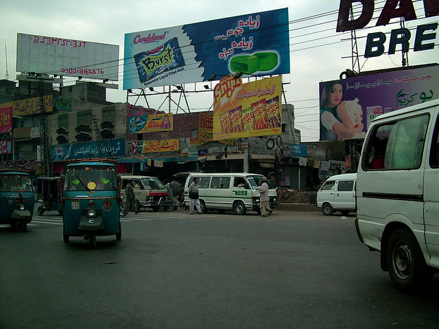
    The circumstances of the relations of jobs-housing balance and urban travel behavior are not clear in emerging and developing countries. There are limited reliable data suitable for testing the hypotheses regarding the associations of the neighborhood-level number of employment opportunities in these countries. This manuscript summarizes the results of an explorative survey undertaken in Lahore, Pakistan to support empirical analyses testing these hypotheses. The survey was undertaken in spring 2018 in six neighborhoods of Lahore and collected the data of 417 respondents. The short questionnaire applied in the survey facilitated generation of 15 individual and household, socioeconomic, and mobility-related variables of different types. Moreover, 9 land use variables as well as jobs-housing ratios were estimated for each respondent within his/her 600-meter street-network pedestrian shed. The produced dataset reveals preliminary descriptive statistics about the relations of employment and travel behavior, particularly commuting, in a less-studied context of Pakistan. It is found that a decent job-housing balance at neighborhood scale alone cannot affect the travel pattern much in the Pakistani context. It needs to be supplemented with other planning interventions, mainly the accessibility to an integrated and efficient mass public transportation system, discouraging private car based policies and promotion of sustainable non-motorized travel modes. In the future, production of disaggregate mobility and land use data will add value to urban transportation research in the Global South.
    Street of Lahore
    More papers about urban transportation in Asian cities:

    Thursday, August 3, 2017

    Children’s Travel to School and their Body Weight; Results of a Survey in Seven European Countries: Technical Report

    By Masoumi, Houshmand, E.; Zanoli, Gabriele; Papageorgiou, Athanasios; Smaga, Soultana; Miloš, Ana; Van Rooijen, Martin; Łuczak, Monika; Komorek, Joanna; Çağan, Birol; Calabrese, Carla; E. Jamerson, Gordon; Patsakas, Georgios; Parisopoulos, Georgios; Meimaridis, Ioannis; Anagnostaras, Konstantinos; Perrostis, Andreas; Dessi, Eleni; Družeta, Toni; Udović, Tatjana; Daams, Ingmar; Drużek, Paweł, and Dalcı, Ahmet 


    Problem: A number or researchers have recently focused on the interdisciplinary topic of active transportation of children and adolescents, their physical activity, and their body weight as an important aspect of their health. Such studies have been dominantly undertaken in a specific geographical context. Lack of contextual studies necessitates data collection with samples covering different countries and/or regions applying a uniform methodology. Such a lack of data is observed in both Europe and overseas.
    Objective: This survey attempts to collect dissaggregate data about the travel behaveior of children of 9-12 years of age and their parents, children’s body specifications, and their households characteristics as well as aggregate data about the built environment of their school.
    Method: direct questioning based on a standard questionnaire consisted of 26 questions was conducted in spring and summer of 2016 in nine cities in seven European countries (Foggia, Italy; Berlin, Germany; Thessaloniki, Greece; Rijeka, Croatia; Utrecht, The Netherlands; Łódź, Poland, Konstantynow, Poland; Malatya, Turkey, and Doğanşehir, Turkey).
    Results: Out of 2735 children handed out the questionnaires, the parents of 1424 schoolchildren filled out the questionnaires, 1304 of which were validated and kept for analysis. This makes an overall response rate of 52.07 percent. In this report, the researchers of M.A.P.S. project have provided detailed descriptive findings separately for each case-study citiy as well as for the whole cities together as one sample.

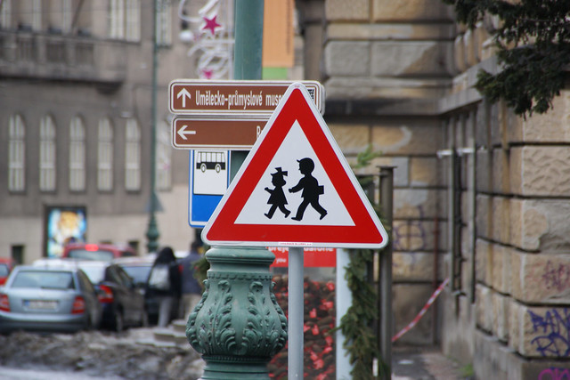
    Warning Sign "Children" in Prague, Czech Republic

    More about urban planning and children's health:

    Active Transport to School and Children's Body Weight: A Systematic Reivew

    Active transport to school and the risk of obesity


    Systematic Review of Active Commuting to School and Children’s Physical Activity and Weight

    Walking, Cycling, and Obesity Rates in Europe, North America, and Australia

    Societal trends, mobility behaviour and sustainable transport in Europe and North America

    Tuesday, May 2, 2017

    Active Transport to School and Children's Body Weight: A Systematic Review

    By ,

    Because of decreasing physical activity of children, they are becoming more obese. Moreover, commuting to school has become more passive during the past decades. The objective was to update the previous systematic reviews by narrowing down the topic to body mass index of children (3-12 years) as a representative of body composition. Applying search terms such as active transport to school, body mass index, childhood obesity, and so on in four online databases: PubMed, ScienceDirect, WorldCat, and Google Scholar. Peer reviewed English journal papers published between 2005 and 2015 presenting empirical quantitative studies were eligible studies to be reviewed. 310 journal papers were screened, 27 of which were reviewed by studying the full text. The final 13 papers were limited to those that focused only on active commuting to school and body mass index of children and adolescents. Out of 13 final studies, 3 found conclusive associations, three indicate partial associations in subgroups or societal or geographical limitations, and seven show no correlations. The existing literature are still inconsistent, so this study suggests conducting surveys with larger samples on less-studied contexts and applying more complex statistical methods for adjusting some of the variables. It is also argued that this topic can be culturally and contextually specific.


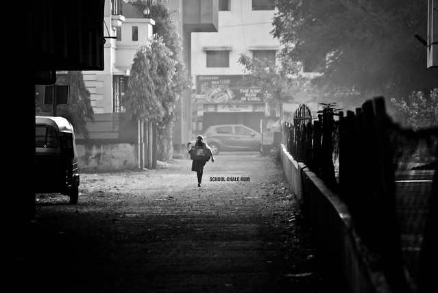
    177/365. School Chale Hum - We Go Towards The School

    more about children's mobility and active transportation:

    Active transport to school and the risk of obesity


    Systematic Review of Active Commuting to School and Children’s Physical Activity and Weight

    Walking, Cycling, and Obesity Rates in Europe, North America, and Australia

    Societal trends, mobility behaviour and sustainable transport in Europe and North America

    Friday, July 8, 2016

    Toward an understanding of children’s perceptions of their transport geographies: (non)active school travel and visual representations of the built environment

    By Caroline Fusco, Fiona Moola, Guy Faulkner, Ron Buliung, Vanessa Richichi

    Environmental measures that are designed to facilitate changes in opportunities for active school transport (AST) do not often account for individuals’ interpretations of the built environment (BE) in different urban contexts. The Built Environment and Active School Transport (BEAT) project was undertaken to explore the ways in which the transport-BE interface gives rise to the use of active or non-active travel modes as the primary travel mode for school trips. We wanted to know how children experienced and understood the transport-built environment relationship. We selected four Toronto elementary school sites in areas that differed with respect to socio-economic status and built environment. We conducted photovoice interviews with 41 children, 21 who walked to/from school, and 20 who were driven. Adopting a thematic analytic approach, this paper examines the similarities and differences in the visual narratives of children’s transport geographies and discusses some of the benefits of using photovoice with children in a study of the transport-built environment relationship.

    2014 Walk to School Day


    more about sustainable urban transportation:

    Monday, March 7, 2016

    Systematic Review of Active Commuting to School and Children’s Physical Activity and Weight

    By Murray C. Lee, Marla R. Orenstein, and Maxwell J. Richardson

    Background: The recent decline in children’s active commuting (walking or biking) to school has become an important public health issue. Recent programs have promoted the positive effects of active commuting on physical activity (PA) and overweight. However, the evidence supporting such interventions among schoolchildren has not been previously evaluated. Methods: This article presents the results of a systematic review of the association between active commuting to school and outcomes of PA, weight, and obesity in children. Results: We found 32 studies that assessed the association between active commuting to school and PA or weight in children. Most studies assessing PA outcomes found a positive association between active commuting and overall PA levels. However, almost all studies were cross-sectional in design and did not indicate whether active commuting leads to increased PA or whether active children are simply more likely to walk. Only 3 of 18 studies examining weight found consistent results, suggesting that there might be no association between active commuting and reduced weight or body mass index. Conclusion: Although there are consistent findings from cross-sectional studies associating active commuting with increased total PA, interventional studies are needed to help determine causation.


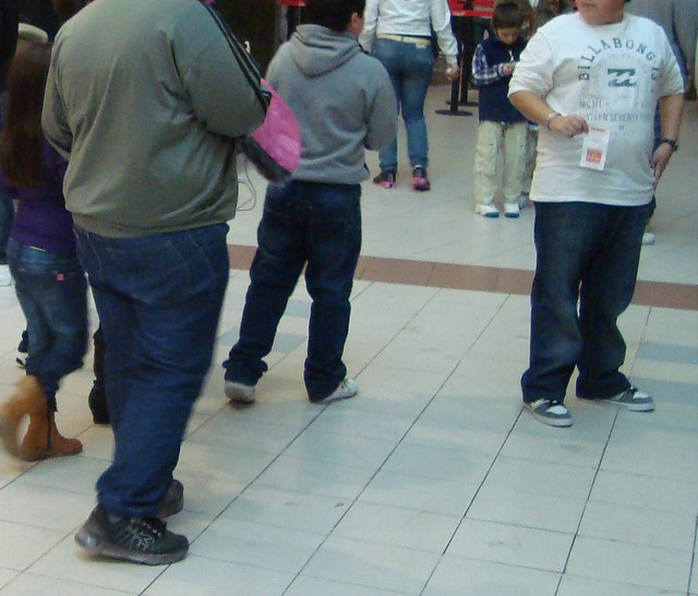
    Teen and childhood obesity

    More studies on travel behavior:

    Active transport to school and the risk of obesity

    MODE CHOICE ANALYSIS: THE DATA, THE MODELS AND FUTURE AHEAD

    USING STRUCTURAL EQUATIONS MODELLING TO UNRAVEL THE INFLUENCE OF LAND USE PATTERNS ON TRAVEL BEHAVIOR OF URBAN ADULT WORKERS OF PUGET SOUND REGION

    Feasibility of Voluntary Reduction of Private Car Use

    What if you live in the wrong neighborhood? The impact of residential neighborhood type dissonance on distance traveled

    Vehicle Miles Traveled and the Built Environment: Evidence from Vehicle Safety Inspection Data

    Residential Self-Selection and Its Effects on Urban Commute Travels in Iranian Cities Compared to US, UK, and Germany

    MODELING THE TRAVEL BEHAVIOR IMPACTS OF MICRO-SCALE LAND USE AND SOCIO-ECONOMIC FACTORS

    Determinants of Automobile Use: A Comparison of Germany and the U.S.

    Friday, February 12, 2016

    Active transport to school and the risk of obesity

    By Noreen C. McDonald

    Childhood obesity has doubled in the last thirty years. At the same time, youth travel patterns have changed greatly. In 1969, 42% of students walked or biked to school; now 13% do. These two trends have caught the attention of policymakers who have identified walking to school as a way to reintroduce physical activity into children’s lives. However, these policies have been made without much knowledge of children’s travel – an area which has been understudied by transportation researchers. This dissertation seeks to fill this knowledge gap and provide information to design better policies by asking three questions: 1) What are the current patterns of children’s travel? 2) What factors have the greatest influence on children’s mode choice for school trips, particularly for walk trips? and 3) How can land use planning affect walking to school?
    All analyses identify the spatial distribution of students and schools as the primary reason for the low rates of walking to school. For example, in 1969, 45% of elementary school students lived less than a mile from their school; today fewer than 24% live within this distance. The simple fact is that most children do not live within a walkable distance of their schools. When children do live close to school, substantial numbers walk. However, current policies aimed at increasing walking to school focus on improving trip safety rather than changing distance to school.
    To encourage large numbers of children to walk to school, planners will need to coordinate land use and school planning. Including children’s distance from school as a planning criterion could be an effective way to change community design and encourage walking. This coordination is most necessary in moderate and high density areas where neighborhood schools are a possibility. However, even in low-density areas, planners can optimize school and housing placement so that a large portion of students live within a walkable distance of their school.
    Childhood Obesity

    More about sustainable mobility:

    Friday, December 18, 2015

    MODE CHOICE ANALYSIS: THE DATA, THE MODELS AND FUTURE AHEAD

    By Minal, Ch. and Ravi Sekhar

    Mode choice is one of the most vital stages in transportation planning process and it has direct impact on the policy making decisions. Mode choice models deals very closely with the human choice making behaviour and thus continues to attract researchers for further exploration of commuter’s choice making process. The objective of this study is to carryout detailed review on various modeling methods of mode choice analysis and bottlenecks associated with the same. The factors that affect the psyche of the travelers have been discussed; further various types of data required and their method of collection has been briefed up. This paper particularly emphasizes on statistical mode choice models such as multinomial logit and probit models as well as recent advanced soft computing techniques such as Artificial Neural Network models (ANN) and Fuzzy approach model that are employed for modal split analysis. Comparative analysis were made among various modeling techniques for modeling the complex mode choice of behaviour of models carried out by various researchers in the literature and a discussion on the need of future hybrid soft computing models has been attempted.


    more about urban travel behavior:

    USING STRUCTURAL EQUATIONS MODELLING TO UNRAVEL THE INFLUENCE OF LAND USE PATTERNS ON TRAVEL BEHAVIOR OF URBAN ADULT WORKERS OF PUGET SOUND REGION

    Feasibility of Voluntary Reduction of Private Car Use

    What if you live in the wrong neighborhood? The impact of residential neighborhood type dissonance on distance traveled

    Vehicle Miles Traveled and the Built Environment: Evidence from Vehicle Safety Inspection Data

    Residential Self-Selection and Its Effects on Urban Commute Travels in Iranian Cities Compared to US, UK, and Germany

    MODELING THE TRAVEL BEHAVIOR IMPACTS OF MICRO-SCALE LAND USE AND SOCIO-ECONOMIC FACTORS

    Determinants of Automobile Use: A Comparison of Germany and the U.S

    Monday, June 1, 2015

    USING STRUCTURAL EQUATIONS MODELLING TO UNRAVEL THE INFLUENCE OF LAND USE PATTERNS ON TRAVEL BEHAVIOR OF URBAN ADULT WORKERS OF PUGET SOUND REGION

    By João de Abreu e Silva and Konstadinos G. Goulias

    This paper addresses the relationship between travel behavior and land use patterns using a Structural Equations Modeling framework.
    The proposed model structure in this paper is by design heavily influenced by a model developed for Lisbon (1) to allow comparisons. In that paper the existence of significant effects of land use patterns in travel behavior was found. The travel behavior variables included in the model are multidimensional and comprehend both short term, number of trips by mode and trip scheduling, and long term, home location, car and pass ownership, mobility decisions. The modeled land use variables measure the levels of urban intensity and density, diversity, both in terms of types of uses and the mix between jobs and inhabitants and the public transport supply levels,. The land use patterns are described both at the residence and employment zones.. 
    In order to explicitly account for self selection bias the land use variables are explicitly modeled as functions of socioeconomic attributes of individuals and their households.
    The Seattle findings are presented and then compared them to the Lisbon findings. Many commonalities between the two environments were found but also many important differences.


    More about transportation modeling:

    MATHEMATICAL MODELS OF TRANSPORTATION AND NETWORKS

    MODELING THE TRAVEL BEHAVIOR IMPACTS OF MICRO-SCALE LAND USE AND SOCIO-ECONOMIC FACTORS

    Mobility biographies. A new perspective for understanding travel behaviour

    What if you live in the wrong neighborhood? The impact of residential neighborhood type dissonance on distance traveled

    Vehicle Miles Traveled and the Built Environment: Evidence from Vehicle Safety Inspection Data

    Determinants of Automobile Use: A Comparison of Germany and the U.S.

    The influence of neighbourhood design on travel behaviour: Empirical evidence from North East England

    Thursday, July 24, 2014

    Feasibility of Voluntary Reduction of Private Car Use

    By Margareta Friman, Tore Pedersen and Tommy Gärling

    In this research report we propose a classification of the various TDM-measures, encompassing the specific characteristics of each, how the various measures may be distinguished from each other and to what extent they may interact, as well as how effective they are in modifying or reducing private car use. One distinction between the various TDM measures is that between coerciveness and non-coerciveness, that is whether a change is forced upon the private car users (e.g., road closures) or whether they are motivated to make a voluntary change (e.g., informational campaigns). Another partly overlapping distinction is that between top-down and bottom-up processes, where the former refers to changes that are not freely chosen, whereas the latter empowers car users to voluntarily change. A third distinction is that of time scale, that is at what times of day the measures are implemented, for instance, congestion pricing only during peak hours. The fourth distinction is spatial scale, that is where the measure is applied, for instance in the city centers. Marked-based (e.g., pricing mechanisms) versus regulatory-based (e.g., legislation) measures makes up a fifth distinction. A final distinction is that between influencing latent versus manifest travel demand. Measures that aims to impact the former typically consist of, for instance, building of new roads to reduce congestion, whereas measures that aim to impact the latter is characterized by an impact on manifest travel behaviour, for instance, limiting car access to specific areas at specific times of day.


    more about travel behavior research:

    What if you live in the wrong neighborhood? The impact of residential neighborhood type dissonance on distance traveled

    Vehicle Miles Traveled and the Built Environment: Evidence from Vehicle Safety Inspection Data

    Residential Self-Selection and Its Effects on Urban Commute Travels in Iranian Cities Compared to US, UK, and Germany

    MODELING THE TRAVEL BEHAVIOR IMPACTS OF MICRO-SCALE LAND USE AND SOCIO-ECONOMIC FACTORS

    A Copula-Based Approach to Accommodate Residential Self-Selection Effects in Travel Behavior Modeling

    QUALITATIVE METHODS IN TRAVEL BEHAVIOUR RESEARCH

    GPS in pedestrian and spatial behaviour surveys

    Lecture on sampling methods by Prof. Murtaza Haider

    Wednesday, July 16, 2014

    What if you live in the wrong neighborhood? The impact of residential neighborhood type dissonance on distance traveled

    by Tim Schwanen and Patricia L. Mokhtarian

    While urban form in general and density in particular are believed by many to significantly influence travel behavior, various recent studies have argued that the true determinants of travel patterns are attitudes rather than land use characteristics. This research builds on this notion and investigates to what extent a lackof congruence between physical neighborhood structure and preferences regarding land use near one s home location (termed residential neighborhood type dissonance or mismatch) affect distance traveled overall and by mode. A conceptual model is described in which the relationship between neighborhood type dissonance and distance traveled is embedded in a wider set of individual and household choices, and tobit models of the influence of neighborhood type mismatch are presented. The results suggest that neighborhood type mismatch should be taken into account in future research as well as in policies attempting to modify travel behavior through land use regulations.

    more about travel behavior:

    Vehicle Miles Traveled and the Built Environment: Evidence from Vehicle Safety Inspection Data

    Residential Self-Selection and Its Effects on Urban Commute Travels in Iranian Cities Compared to US, UK, and Germany

    MODELING THE TRAVEL BEHAVIOR IMPACTS OF MICRO-SCALE LAND USE AND SOCIO-ECONOMIC FACTORS

    Determinants of Automobile Use: A Comparison of Germany and the U.S.

    UNDERSTANDING PERCEPTIONS OF ACCESSIBILITY AND MOBILITY THROUGH STRUCTURATION THEORY

    A Copula-Based Approach to Accommodate Residential Self-Selection Effects in Travel Behavior Modeling

    Examining the Impacts of Residential Self-Selection on Travel Behaviour: A Focus on Empirical Findings

    MODELLING AND PROSPECTS OF THE AUDIENCE MEASUREMENT FOR OUTDOOR ADVERTISING BASED ON DATA COLLECTION USING GPS DEVICES (ELECTRONIC PASSIVE MEASUREMENT SYSTEM)

    Friday, July 11, 2014

    Vehicle Miles Traveled and the Built Environment: Evidence from Vehicle Safety Inspection Data

    By Mi Diao and Joseph Ferreira, Jr.

    This study examines the linkage between household vehicle usage and their residential locations within a metropolitan area using a newly available administrative dataset of annual private passenger vehicle safety inspection records (with odometer readings) and spatially detailed data on the built environment. Vehicle miles travelled (VMT) and a set of comprehensive built-environment measures are computed for a statewide 250m*250m grid cell layer using advanced Geographic Information Systems and database management tools. We apply factor analysis to construct five factors that differentiate the built-environment characteristics of the grid cells and then integrate the built-environment factors into spatial regression models of household vehicle usage that account for built environment, demographics, and spatial interactions. The empirical results suggest that built-environment factors not only play an important role in explaining the intra-urban variation of household vehicle usage, but may also be underestimated by previous studies that use more aggregate built-environment measures. One standard deviation variations in the built-environment factors are associated with as much as 5,000 mile differences in annual VMT per-household. This study also demonstrates the potential value of new georeferenced administrative datasets in developing indicators that can assist urban planning and urban management.


    more about urban travel behavior:

    Residential Self-Selection and Its Effects on Urban Commute Travels in Iranian Cities Compared to US, UK, and Germany

    MODELING THE TRAVEL BEHAVIOR IMPACTS OF MICRO-SCALE LAND USE AND SOCIO-ECONOMIC FACTORS

    Determinants of Automobile Use: A Comparison of Germany and the U.S.

    The influence of neighbourhood design on travel behaviour: Empirical evidence from North East England

    Mobility biographies. A new perspective for understanding travel behaviour

    Residential self-selection and travel: The relationship between travel-related attitudes, built environment characteristics and travel behaviour

    Dynamic GPS-position correction for mobile pedestrian navigation and orientation

    Saturday, October 26, 2013

    Residential Self-Selection and Its Effects on Urban Commute Travels in Iranian Cities Compared to US, UK, and Germany

    by Houshmand E. Masoumi

    Residential self-selection has gained increasing attention in the Western travel behavior research during the past decade. Many studies in the US, UK, and Germany conclude that the role of individuals’ residential location choice on commute travel behavior is more important than that of the built environment or at least it has considerable effects. However the effectiveness of location choice in many countries and cultures like Iran is unclear. This study examines the self-selections in two neighborhoods in Tehran. As a part of a research about the influences of land use on travel behavior information about people’s location preferences was collected by direct questioning. The findings show that the main reasons for selecting the location of residential units are related to socio-economic factors such as rise of house price and affordability of house prices. Transportation has little impacts on location decisions. Moreover, residential self-selection accounts for only 3 to 7.5 percent of the pedestrian, PT, and car trips.


    Hemmat Highway

    more about  planning in Iran:

    MODELING THE TRAVEL BEHAVIOR IMPACTS OF MICRO-SCALE LAND USE AND SOCIO-ECONOMIC FACTORS

    The Study of Land Use Changes in the Tehran Metropolitan Area by Using MOLAND Model


    Distribution and Determining of Urban Sprawl in Kerman with Emphasis on Kariz Water System


    URBAN PATTERNS FOR A GREEN ECONOMY: LEVERAGING DENSITY


    Facilitating Urban Management Through Local SDI Case Study: The Municipality of Tehran 

    URBAN SPRAWL IN IRANIAN CITIES AND ITS DIFFERENCES WITH THE WESTERN SPRAWL


    A new approach to the Iranian urban planning, using neo-traditional development

    Tuesday, August 27, 2013

    MODELING THE TRAVEL BEHAVIOR IMPACTS OF MICRO-SCALE LAND USE AND SOCIO-ECONOMIC FACTORS

    by Houshmand E. Masoumi

    The effects of neighbourhood-level land use characteristics on urban travel behaviour of Iranian cities are under-researched. The present paper examines such influences in a microscopic scale. In this study the role of socio-economic factors is also studies and compared to that of urban form. Two case-study neighbourhoods in west of Tehran are selected and considered, first of which is a centralized and compact neighbourhood and the other is a sprawled and centreless one. A Multinomial Logit Regression model is developed to consider the effects of socio-economic and land use factors on urban travel pattern. In addition, to consider the effective factors, cross-sectional comparison between the influences of local accessibility and attractiveness of the neighbourhoodcentres of the two case-study areas are undertaken. Also the causality relationships are considered according to the findings of the survey. The findings indicate significant effects of age and household income as socio-economic factors on transportation mode choice in neighbourhoods with central structure. One the other hand, no meaningful association between socio-economic or land use variables are resulted by the model for the sprawled case. The most effective land use concept in micro-scale is considered to be satisfaction of entertainment facilities of the neighbourhood. Also the descriptive findings show that the centralized neighbourhood that gives more local accessibility to shops and retail generates less shopping trips. In considering the causal relations, the study shows that providing neighbourhood infrastructures that increase or ease the accessibility to neighbourhood amenities can lead to higher shares of sustainable transportation modes like walking, biking, or public transportation use.


    A view of Tehran

    more about urban planning in Iran:

    Sustainable Urban Growth Management Using What-If?

    Monitoring and modeling the urban growth of mid-size cities in Iran by Markov model: the case study of Zanjan City

    An investigation of urban systems using entropy and elasticity measures: case study of North Region of Iran


    Socio-spatial Obstacles of Urban Sustainability in Historic Center of Cities in Iran


    Impact Assessment of Sustainable Public Transportation System on Quality of Life in Tehran


    URBAN SPRAWL IN IRANIAN CITIES AND ITS DIFFERENCES WITH THE WESTERN SPRAWL


    A new approach to the Iranian urban planning, using neo-traditional development

    The Study of Land Use Changes in the Tehran Metropolitan Area by Using MOLAND Model


    Distribution and Determining of Urban Sprawl in Kerman with Emphasis on Kariz Water System


    URBAN PATTERNS FOR A GREEN ECONOMY: LEVERAGING DENSITY


    Facilitating Urban Management Through Local SDI Case Study: The Municipality of Tehran

    Friday, June 14, 2013

    Determinants of Automobile Use: A Comparison of Germany and the U.S.

    by Ralph Buehler

    Germany and the U.S. have among the highest motorization rates in the world. Yet Americans make a 40% higher share of their trips by car and annually drive twice as many kilometers per capita as Germans. Automobile use is linked to unsustainable trends such as climate change, oil dependence, traffic fatalities, congestion, and obesity. International differences in car use can be attributed to socioeconomic and demographic factors, spatial development patterns, transport policies and culture. Arguably, differences in socio-economic and demographic factors together with denser, more compact spatial development patterns, and more automobile restrictive transport policies in Germany can help explain less car use there. Using two comparable individual level national travel surveys this paper empirically investigates the role of socio-economic and demographic factors, spatial development patterns and transport policies in explaining differences in automobile use in Germany and the U.S.
    In both countries higher population density, a greater mix of land uses, household proximity to a transit stop, fewer cars per household, and higher car operating costs are associated with shorter daily automobile travel distances. However, considerable differences remain: for example Americans in settlements of more than 5,000 people per square kilometer drive as many kilometers as Germans in settlements with five times lower density. A multivariate analysis shows that—controlling for socioeconomic factors—population density and automobile operating costs play a role in explaining differences in travel. This is good news for the U.S., since denser more mixed-use developments and more automobile restrictive policies can help increase the sustainability of the transport system. In Germany, travel behavior is more homogeneous across all groups of society and in all spatial settlement patterns than in the U.S. This is potentially related to historically higher gasoline prices and greater availability of alternative means of transport, which provide incentives for walking, cycling, and transit use.


    Stau = traffic jam
    more about Germany:

    Skyline photos of Hamburg, Germany (2)

    Dynamic GPS-position correction for mobile pedestrian navigation and orientation

    SIMULATING URBAN AND REGIONAL EVOLUTIONS: SCENARIOS OF DEVELOPMENT IN THREE STUDY CASES: ALGARVE PROVINCE (PORTUGAL), DRESDEN-PRAGUE TRANSPORT CORRIDOR (GERMANY-CZECH REPUBLIC) AND FRIULI-VENEZIA GIULIA REGION (ITALY)

    Land use change modelling in an urban region with simultaneous population growth and shrinkage including planning and governance feedbacks

    A planned carfree neighborhood: Rieselfeld in Freiburg, Germany

    The new district of Freiburg-Rieselfeld: a case study of successful, sustainable urban development

    Bridges to Utopia? A Sustainable Urban District in Freiburg, Germany

    Travel mode choice: affected by objective or subjective determinants?

    Friday, May 31, 2013

    The influence of neighbourhood design on travel behaviour: Empirical evidence from North East England

    by Paulus Teguh Aditjandra, Corinne Mulley, and John D. Nelson

    This paper investigates the factors that affect travel behaviour within neighbourhoods in Tyne and Wear, North East England while accounting for differences in attitudes and perceptions. Ten different neighbourhoods have been carefully selected to characterise the two different types of traditional and suburban neighbourhood street layouts. A self-administered questionnaire has been delivered to 2200 households to capture neighbourhood design, travel patterns, travel attitudes and socio-economic characteristics. Multivariate analysis of cross-sectional data shows that some socio-economic variables as well as travel attitudes and neighbourhood design preferences can explain the differences in travel patterns between the two distinct neighbourhood designs. The results show additionally that the traditional neighbourhood group is more sensitive to factors of perception and attitudes in relation to neighbourhood design that lead to walking, cycling and public transport use travel patterns, suggesting that land-use policy designed to accommodate lower carbon-based travel together with measures to encourage active travel will have greater impact on the traditional group than the suburban group. This finding suggests that generic measures imposed by many governments, and certainly implied by current UK land-use policy, to promote sustainable mobility should be selectively targeted.


    more about travel behavior:

    Mobility biographies. A new perspective for understanding travel behaviour

    How the Built Environment Influences Non-Work Travel: Theoretical and Empirical Essays 

    MODELING THE CHOICE CONTINUUM: AN INTEGRATED MODEL OF RESIDENTIAL LOCATION, AUTO OWNERSHIP, BICYCLE OWNERSHIP, AND COMMUTE TOUR MODE CHOICE DECISIONS

    A Copula-Based Approach to Accommodate Residential Self-Selection Effects in Travel Behavior Modeling

    The Impact of Bicycling Facilities on Commute Mode Share

    UNDERSTANDING PERCEPTIONS OF ACCESSIBILITY AND MOBILITY THROUGH STRUCTURATION THEORY

    Incremental Integration of Land Use and Activity-Based Travel Modeling: Workplace Choices and Travel Demand

    Documentary film: Sprawling from Grace: The Consequences of Suburbanization

    The influence of urban physical form on trip generation, evidence from metropolitan Shiraz, Iran

    Urban Travel Route and Activity Choice Survey (UTRACS): An Internet-Based Prompted Recall Activity Travel Survey using GPS Data

    URBAN TRANSPORT AND LOCAL GOVERNANCE IN ASIAN DEVELOPING COUNTRIES

    New German community models car-free living