Like Urban Research on Facebook

Showing posts with label Suburbia. Show all posts

Monday, November 11, 2024

How Highways Ruined Cities?

Highways — the veins of modern cities, moving millions of cars and trucks every day. But here’s the dirty secret: these highways didn’t just connect cities; they ruined them. Yes, the same roads that make your morning commute possible also tore apart thriving neighborhoods, displaced thousands of families, and left gaping wounds in the heart of cities.

Today, we’re diving into “How Highways Ruined Cities,” exploring how the U.S. interstate system and figures like Robert Moses reshaped — or rather, disfigured — the urban landscape. So buckle up, because this ride isn’t pretty.


The U.S. Interstate Highway System: A Dream Turns Sour


Let’s start with the U.S. Interstate Highway System, a project hailed as one of the greatest achievements in American infrastructure. It all began in 1956 with the Federal-Aid Highway Act, which launched the construction of over 41,000 miles of highways across the United States. The goal? To link every major city, boost the economy, and make driving more efficient.

Sounds great, right? Well, here’s the catch: highways didn’t just pass through empty fields. They were often built right through urban neighborhoods, especially in low-income areas and communities of color. And nowhere was this more destructive than in cities like Detroit.


Detroit and the I-375 Freeway


Detroit was once the beating heart of the American automotive industry, but its story took a sharp detour with the construction of highways like I-375. Built in the 1960s, I-375 plowed through the heart of Black Bottom and Paradise Valley — two thriving African American neighborhoods filled with businesses, jazz clubs, and homes.


In its place? A concrete scar.

The construction of I-375 displaced over 100,000 residents and destroyed nearly 2,800 homes. Black Bottom, once a vibrant cultural hub, was literally bulldozed to make way for a highway that ultimately contributed to Detroit’s economic and social decline. The new highway severed the community from the downtown area and made it harder for businesses to thrive.

But Detroit wasn’t alone in this story of urban destruction.


Robert Moses: The Man Who Shaped (and Dismantled) New York City


Now, we can’t talk about highways and their impact without mentioning Robert Moses, the man behind many of New York City’s highways, bridges, and parks. Moses was a visionary urban planner, but he had a notorious obsession with building roads — no matter the cost.

Between the 1930s and 1960s, Moses constructed over 13 expressways across New York City, including the Cross Bronx Expressway and Brooklyn-Queens Expressway. His projects displaced more than 250,000 residents across the city, forever altering its landscape.


The Cross Bronx Expressway


Let’s zoom in on the Cross Bronx Expressway. When Moses proposed this six-lane highway in the late 1940s, it cut through one of the most densely populated and stable neighborhoods in the Bronx — East Tremont.

Fun fact (but not so fun for residents): To make way for the highway, Moses bulldozed through 600 apartment buildings, displacing around 60,000 people. The expressway severed the Bronx, dividing it into northern and southern halves. Property values plummeted, and entire communities were left devastated by noise pollution, increased traffic, and worsening air quality.

Over the decades, the Bronx saw a rise in crime and poverty, with some blaming the Cross Bronx Expressway for accelerating the borough’s decline in the 1970s. This once-thriving middle-class neighborhood was left in ruins, and Moses’s grand vision of efficiency came at the expense of the people who lived there.


Why Highways Targeted Certain Communities


But why were these highways always cutting through minority and low-income neighborhoods? Well, it wasn’t by accident. In fact, redlining and racist housing policies played a huge role.

Redlining, a practice where banks and insurance companies refused to offer loans or coverage in predominantly Black neighborhoods, left these areas vulnerable. Since they were deemed "undesirable," city planners saw them as the perfect location for highways, thinking it was better to build there than through affluent, politically powerful communities.

The result? Urban decay, the collapse of vibrant neighborhoods, and the rise of suburban sprawl, as wealthier, predominantly white residents fled to the suburbs, leaving the city’s core to rot.


Highways were kind of like the original “ghosting” — except instead of disappearing from a text conversation, people disappeared from entire neighborhoods.


The Suburban Dream and Urban Decline


Highways didn’t just destroy urban neighborhoods; they fueled the suburban dream. In the post-war era, Americans were eager to leave the crowded, noisy city for the spacious, picket-fenced suburbs. The new highway system made this possible by enabling people to live farther from their jobs and still commute relatively easily.

By the 1960s, over 60 million Americans had moved to the suburbs, encouraged by government incentives like low-interest home loans and, of course, the sprawling network of interstate highways. Cities, meanwhile, were left with declining tax bases, abandoned buildings, and neighborhoods torn apart by the very highways meant to connect them.

Fun fact: Between 1950 and 1980, cities like St. Louis and Cleveland lost nearly half their populations as residents fled to the suburbs. This hollowing-out of cities contributed to the rise of urban blight — abandoned, decaying buildings that stood in stark contrast to the shiny new suburban developments.


The Environmental Costs of Highways


It’s not just communities that paid the price for highways; the environment suffered too. Highways encourage car dependency, which means more traffic, more fuel consumption, and more greenhouse gas emissions. In fact, transportation is responsible for nearly 30% of all U.S. carbon emissions, with highways playing a major role.

Moreover, the construction of highways often led to the destruction of natural habitats and green spaces. For example, when Interstate 5 was built along the West Coast, it cut through wetlands, forests, and wildlife habitats, leaving a trail of ecological damage in its wake.


Can We Fix It? The Future of Highways


So, after all this damage, is there any hope for our cities? Well, some cities are starting to recognize the havoc highways have wreaked and are working to undo the damage.


Take San Francisco, for example. After the 1989 Loma Prieta earthquake damaged the Embarcadero Freeway, the city decided not to rebuild it. Instead, they replaced it with a beautiful waterfront boulevard and public spaces, reconnecting the city with its bay. Property values shot up, tourism increased, and the area became one of San Francisco’s most vibrant neighborhoods.

Another example is Rochester, New York, which removed a portion of its inner loop highway in 2017. By filling in the road and replacing it with housing, bike lanes, and pedestrian paths, the city was able to revitalize the downtown area and promote sustainable urban living.


Conclusion: Highways Shaped, and Sometimes Destroyed, Our Cities


Highways were built to bring us together, but they ended up tearing many communities apart. From Detroit’s Black Bottom to New York’s East Tremont, the legacy of highways is one of displacement, environmental damage, and urban decay.

But it doesn’t have to stay this way. Cities around the world are rethinking their relationship with highways, focusing on public transit, walkability, and reconnecting neighborhoods that were once divided.

The secret to a healthy city isn’t more highways — it’s more human-centered design. After all, cities are for people, not cars.

Thursday, July 30, 2020

Correlations of Urban Sprawl with Transport Patterns and Socioeconomics of University Students in Cracow, Poland

  • By Melika Mehriar, 
  • Houshmand Masoumi, and 
  • Katarzyna Nosal Hoy


  • Urban sprawl is considered as a western urban development pattern, which is common in different cities around the world. Although a large number of studies have focused on urban sprawl, modeling urban sprawl has been less emphasized, especially in various geographical contexts. The present study aimed to investigate urban sprawl and its determinants in a post-socialist country and model urban sprawl based on disaggregated data. In addition, the correlations of urban sprawl with travel patterns were examined, along with the socioeconomic characteristics of university students in Krakow, Poland by applying the Weighted Least Square (WLS) regression model. The WLS regression model was fitted based on the data from 1288 online questionnaires targeting university students. Also, urban sprawl around the home and the university for each student who indicated the nearest intersection to their home and university were separately estimated by employing Shannon entropy. Based on the findings, urban sprawl around homes was correlated with 14 transport patterns and socioeconomic features such as gender, age, driving license, financial dependency status, gross monthly income, number of commute trips, mode of transportation for commuting, number of trips for shopping or entertainment, daily shopping area, mode choice for shopping and entertainment trips inside and outside the neighborhoods, frequency of public transport use, attractiveness of shops inside the neighborhoods, and the length of time living in current home. Furthermore, urban sprawl around the university was significantly correlated with age, car ownership, number of commute trips, and sense of belonging to neighborhoods, entertainment place, and residential location choice. Finally, a positive correlation was reported between urban sprawl with higher income, elderly student, financial dependent students, and car dependency trips, while urban sprawl was negatively related to the use of public transit.


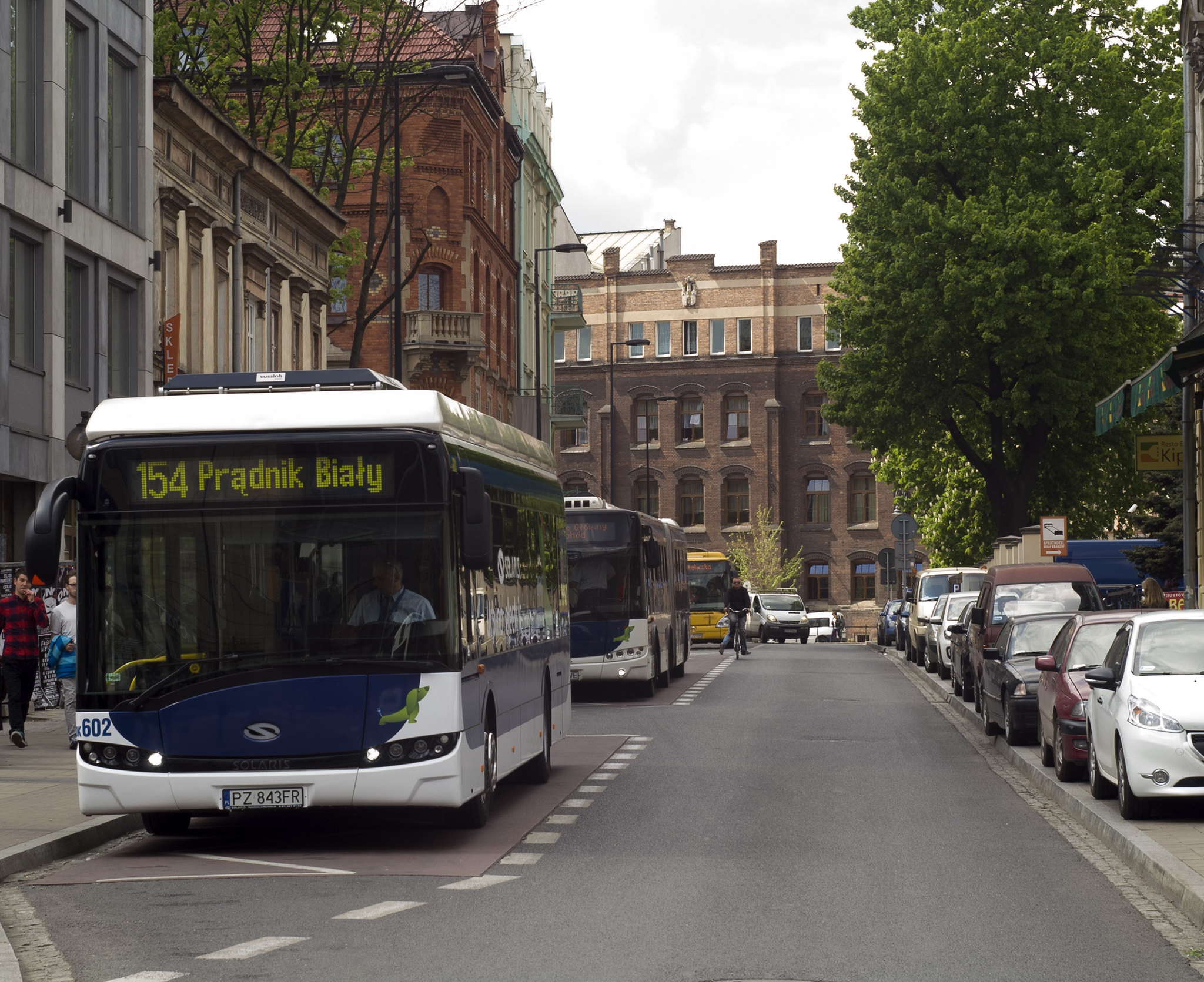
    Solaris Urbino 12 electric Krakow

    Read more about urban sprawl:

    Tuesday, September 3, 2019

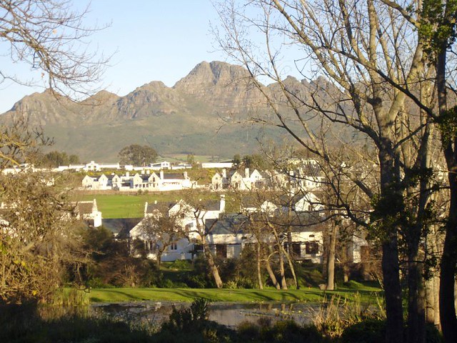
    Monitoring Urban Sprawl and Sustainable Urban Development Using the Moran Index: A Case Study of Stellenbosch, South Africa

    By Walter Musakwa and Adriaan van Niekerk

    The management of urban sprawl is fundamental to achieving sustainable urban development. Monitoring urban sprawl is, however, challenging. This study proposes the use of two spatial statistics, namely global Moran and local Moran to identify statistically significant urban sprawl hot and cold spots. The findings reveal that the Moran indexes are sensitive to the distance band spatial weight matrices employed and that multiple bands should be used when these indexes are used. The authors demonstrate how the indexes can be used in combination with various visualisation methods to support planning decisions.


    Wednesday, June 13, 2018

    Drivers of urban sprawl in two large Middle-eastern countries: literature on Iran and Egypt

    By Houshmand E. Masoumi, Maryamsadat Hosseini, and Amr Ah. Gouda

    This paper reviews the relevant literature of Iran and Egypt as two large countries of the region and concludes that four phenomena are common between the two countries and are accountable for sprawling, namely (1) wholesale land selling to the lower economic class, (2) defciencies of planning systems in controlling development plans, (3) fast and uncontrolled increase in urban population, and (4) rural-urban migration. These drivers are categorized in two classes of demographic and planning-related trends. Besides, there is a number of peculiar trends that have nationwide causes but are uncommon in Iran and Egypt. The authors of this paper consider that the demographic drivers or sprawl addressed by the Middle Eastern scholars are not actual causes but only consequences, or there is a correlation between the demographic factors and sprawl. More in-depth historical and socioeconomic studies are needed to fnd the associations between sprawl and unstudied phenomena like change in technologies, culture, and lifestyle.

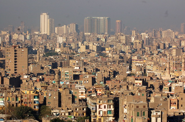
    View of Cairo (القاهرة) from the Saladin Citadel (قلعة صلاح الدين)

    More about urban sprawl in developing countries:

    URBANIZATION TRENDS AND URBAN PLANNING STRATEGIES IN THREE MAJOR MIDDLE EASTERN COUNTRIES: IRAN, EGYPT, AND TURKEY

    Urban Sprawl: A view from developing and developed Countries

    The Status of Urban and Suburban Sprawl in Egypt and Iran

    Evaluation of Urban Sprawl Speed and Intensity Based on International Urbanization. Example from a Mexican City

    URBAN SPRAWL AND CLIMATIC CHANGES IN TEHRAN

    Monitoring and modeling the urban growth of mid-size cities in Iran by Markov model: the case study of Zanjan City

    Friday, May 31, 2013

    Assessment of development and regeneration urban projects: cultural and operational implications in metropolization context

    by Roberto De Lotto

    It has been worldwide demonstrated that metropolization phenomenon is changing in an indelible way the structure, the shape, the livability and the environment of contemporary cities. This phenomenon can not be circumscribe d in a specific national context but it involves the urban sphere of the entire planet.
    Moreover, the suburban growth and the connected sprawl, have quite everywhere the same shape and present the same problems: the most critical concern the environmental issue, considered in an extensive meaning, that involves both na tural and anthropic elements.
    Considering the ecological approach the paper explores cultural and operational implications of assessm ent methodologies able to control and address new developments to sustainability.
    First the Metropolization phenomenon is analyzed throughout general data and specific thematic studies, considering the reasons of the birth and diffusion of the suburban model and the related critics; than the level of complexity that integrated assessment principles involve is connected to European Community proposals and to ethical concepts capable to guide aware plans.
    Finally a case study is presented with reference to the Italian context and in particular to the city of Pavia in which a research, developed by the author, about renewal plans of urban dismissed area, permitted to define a set of integrated criteria that can support planners and designers in finding sub-optimal revitalization solutions.


    more about Italy:

    Measuring Socially Sustainable Urban Regeneration in Europe 

    Correlating Densities of Centrality and Activities in Cities: the Cases of Bologna (IT) and Barcelona (ES)

    Street Centrality and Densities of Retails and Services in Bologna, Italy

    The cost of sprawl: an Italian case study Laura Fregolent, Stefania Tonin

    SIMULATING URBAN AND REGIONAL EVOLUTIONS: SCENARIOS OF DEVELOPMENT IN THREE STUDY CASES: ALGARVE PROVINCE (PORTUGAL), DRESDEN-PRAGUE TRANSPORT CORRIDOR (GERMANY-CZECH REPUBLIC) AND FRIULI-VENEZIA GIULIA REGION (ITALY)

    Skyline photos of Venice, Italy 1

    Public transportation in Venice, Italy

    Institutions in urban planning and urban transport; an Amsterdam /Naples case study

    Thursday, November 29, 2012

    Opportunities for transport mode change: an exploration of a disaggregated approach

    by Martin Dijst, Tom de Jong, and Jan Ritsema van Eck

    Research into the effects of spatial configuration on the use of transport modes has to date dominantly been based on analyses of actual travel behaviour or prediction of future transport mode choices. However, in this research it is not made clear what choice opportunities were available for travel behaviour of the various population categories, given their desired activities and time-space opportunities. The authors describe a time-space theoretical and methodological framework based on the concept of action spaces, within which the choice opportunities of different types of house- holds of various areas can be analysed. On the basis of a pilot study among the residents of a suburban neighbourhood in a Netherlands new town, the time space opportunities they have to use alternative transport modes other than the car are brought into the frame. It is shown that residents have more time-space opportunities to make use of existing environmentally friendly, transport modes than had been expected. The possibilities differ between types of action spaces and types of households. Some implications for policymaking are discussed. The authors state that policymakers should be more sensitive to interpersonal differences in accessibility.


    Similar posts:

    Correlating Densities of Centrality and Activities in Cities: the Cases of Bologna (IT) and Barcelona (ES)

    Geographically Weighted Regression: A Method for Exploring Spatial Nonstationarity

    Correlating street centrality with commerce and service location in cities

    Street Centrality and Densities of Retails and Services in Bologna, Italy

    Tuesday, October 9, 2012

    URBAN SPRAWL IN IRANIAN CITIES AND ITS DIFFERENCES WITH THE WESTERN SPRAWL

    by Houshmand E. Masoumi

    Recently a number of studies have focused on urban sprawl in the Iranian cities and the negative impacts of such development pattern. Although in a general view the phrase “urban sprawl” is used for fast and sometimes uncontrolled urbanizations, but there are dissimilarities between the urban sprawl in the western societies with the so-called Iranian urban sprawl. This paper discusses these differences as part of five main aspects that are mentioned in the internationally recognized urban sprawl definitions. Suburban sprawl, single-use developments/zoning, disconnected street network, low accessibility of the new developments, and commercial strip development are the aspects that are descriptively discussed as the main differences between the two types of sprawl. The main point of the discussion is that due to the wide range of similarities, which are briefly introduced, the type of the fast outward urban growth that is observed in the periphery of the Iranian cities can be defined as a part of the universal urban sprawl trend. Finally a definition is suggested for explaining urban sprawl in Iran.


    Tehran,Iran
    more about urban planning in Iran:

    Interconnections of Urban Green Spaces and Environmental Quality of Tehran

    Art in the Tehran Metro

    Tehran and the challenges of a metropolis in the millennium

    Urban Ecological landscape of Tehran

    Earthquake Management in Iran A compilation of literature on earthquake Management

    An Analysis to Challenges of Urban Management in Historic Center of Cities in Iran

    COMPARATIVE SUSTAINABILITY OF BAZAAR IN IRANIAN TRADITIONAL CITIES: CASE STUDIES IN ISFAHAN AND TABRIZ

    Saturday, April 28, 2012

    Documentary film: Sprawling from Grace: The Consequences of Suburbanization

    The following documentarey film shows concerns about the suburban sprawl trend in the United States. The basic element of the American dream, which is the basis of the nation's urban and suburban sprawl is automobile. The the same trend of motorization the we have today, the Vehicle Miles Traveled (VMT) in 2025 in the country will be 58% more than today. The money needed for building more transportion and residence infrastructure is becoming more and the transportation facilities are becoming older. Therefore the necessary investments for the future developments will be more. The films discusses similar debates about urban sprawl. It has mainly a look at the policy makers and decision takers. It takes 1 hour and 22 minutes to watch the film which is presented by Motion Pictures. The director is David M. Edward.

    more about urban sprawl:

    Strategy for Sustainable Urban Development: A Case Study of Urmia City, Iran

    MONITORING URBAN SPRAWL AROUND BARCELONA’S METROPOLITAN AREA WITH THE AID OF SATELLITE IMAGERY

    The impacts of major transportation infrastructure on the form and function of the urban space: the case of the "Athens urban freeway"

    High-tech HQ leaving suburbs for downtown

    SOME REALITIES ABOUT SPRAWL AND URBAN DECLINE

    Tuesday, April 3, 2012

    Five Myths About Sprawl: a review of "Sprawl: A Compact History"

    by Michael Lewyn

    Over the past several decades, metropolitan America has been transformed by “sprawl”: low-density, automobile-oriented, (usually) suburban development.1 Many central cities have lost population,2 while their suburbs have gained residents3 and jobs.4 Moreover, cities’ remaining residents are disproportionately poor: the average income of suburban households is nearly twice that of urban households,5 and the majority of America’s poor now live in central cities.6 Typically, new suburban devel-opment has been highly automobile dependent: the majority of suburban
    jobs are not accessible through public transit.7 A wide variety of commentators8 assert that sprawl has a number of social, political, and economic repercussions. In particular, critics of the status quo assert that sprawl immobilizes Americans too young, old, or poor to drive;9 increases trafªc congestion and pollution by increasing driving; 10 makes Americans less healthy by discouraging walking;11 reduces the supply of farmland and open space by consuming more land than more compact development;12 and increases overall government spending, as governments spend money on roads and utilities for new suburbs while urban infrastructure becomes underutilized.13 In Sprawl: A Compact History, Robert Bruegmann, an art historian, has painted a supercially convincing case for the status quo, asserting that sprawl is “a natural result of afºuence that occurs in all urbanized societies.” 14 Bruegmann’s book has generated glowing media publicity15 and some favorable scholarly attention.16 The purpose of this Review is to use Bruegmann’s defense of the status
    quo as a launching point for a broader discussion of the sprawl issue. In particular, this Review suggests that Bruegmann overestimates the universality of sprawl, by overlooking the differences between pedestrianfriendly cities with some sprawling development and cities in which automobile- dependent sprawl is the only choice available to most consumers. In addition, Bruegmann understates the harmful social effects of sprawl, especially the effect of automobile-dependent development upon nondrivers. Bruegmann also consistently underestimates the role of government spending and regulations in creating sprawl and, as a result, fails to adequately discuss the possibility that sprawl can be reduced by limiting, rather than increasing, the size and intrusiveness of government.


    more about urban sprawl:

    On defining "Sprawl"

    Cleanliness from a car

    New Urbanism: A Salve or Bane to Urban Wounds?

    Suburban Immigrants Feel Arizona Heat

    THE URBAN SPRAWL: A PLANETARY GROWTH PROCESS? AN OVERVIEW OF USA, MEXICO AND SPAIN

    Real Estate Brokerage to Unfettered Development: A History of Sprawl

    SOME REALITIES ABOUT SPRAWL AND URBAN DECLINE

    by Anthony Downs

    At the outset, suburban sprawl should be defined clearly. Sprawl is not any form of suburban growth, but a particular form. In our study The Costs of Sprawl – Revisited, we did not create the definition deductively from some internally coherent concept of “sprawlness.” Rather, we looked inductively at all the criticisms of sprawl in the literature, and derived traits that would cause them. The ten such traits are: (1) unlimited outward extension of develop ment, (2) low-density residential and commercial settlements, (3) leapfrog development, (4) fragmentation of powers over land use among many small localities, (5) dominance of transportation by private automotive vehicles, (6) no centralized planning or control of land- uses, (7) widespread strip commercial development, (8) great fiscal disparities among localities, (9) segregation of types of land uses in different zones, and (10) reliance mainly on the trickle- down or filtering process to provide housing to low-income households. These traits have dominated American metropolitan growth for 50 years. Most analyses of sprawl focus on only one or a few of these traits, thereby adopting an oversimplified approach.
    In theory, the American metropolitan growth and development process is not identical to sprawl, which is a particular form of that process. However, sprawl has been so dominant in United States metropolitan areas that most people think the growth process is the same as sprawl. I will try to distinguish between them in this analysis.

    Pheonix, Arizona, the downtown and the periphery of the city are seen, photo by TAYLOR149

    more about urban sprawl:

    LANDSCAPE EFFECTS OF URBAN SPRAWL: SPATIAL AND TEMPORAL ANALYSES USING REMOTE SENSING IMAGES AND LANDSCAPE METRICS

    Urban form and the ecological footprint of commuting. The case of Barcelona

    Compact Sprawl Experiments four strategic densification scenarios for two modernist suburbs in Stockholm

    Neighborhood Design and the Accessibility of the Elderly: An Empirical Analysis in Northern California

    Spatial Planning, Urban Form and Sustainable Transport: An Introduction

    Tuesday, March 6, 2012

    Urban shrinkage in Leipzig and Halle, the Leipzig-Halle urban region, Germany

    by Dieter Rink, Annegret Haase, Matthias Bernt, Thomas Arndt, and Johanna Ludwig 

    Leipzig looks back on a long-term period of shrinkage that lasted from the 1960s to the end of the 1990s. The political change after 1989 led to a rapid deindustrialization and breakdown in employment and, as a result, a mass out-migration towards western Germany bringing about a dramatic acceleration of population losses. From 1989-1998, Leipzig lost about 100,000 inhabitants, that is, 20 per cent of its total population. The main reasons for the recent population losses were the (job-related) out-migration to western Germany (starting right after 1990), a state-sponsored and thus artificially initiated suburbanization (that had its peak from the early mid-1990s until 1997), and demographic ageing (decrease in birth rates - a continuous process). The main reason for out-migration was the loss of jobs due to deindustrialization (loss of tens of thousands of jobs in the industrial sector in the early 1990s). In 1999, Leipzig enlarged its administrative territory. In this way the city ceased to lose inhabitants due to these reforms; the reform coincided with the stabilization of the city in terms of population size bringing with it positive migration balances and a vibrant in-migration. After 2000, Leipzig saw a turnaround, that is, a re-growth of the population after decades of shrinkage. Since 2000, Leipzig has had positive migration balances with the hinterland and in general. Research speaks about reurbanization tendencies that are prominent in Leipzig as one of only a few big cities in eastern Germany (see below).
    Although the population is no longer decreasing, Leipzig is still today faced with the consequences of urban shrinkage, and will also be faced with them in the future. The consequences are first and foremost housing and commercial vacancies, demolition, oversupply of infrastructure, brownfields and the perforation of the urban grid. Leipzig is characterized by the close neighbourhood of stabilizing and shrinking neighbourhoods in the city. Vacant and/or unused lots, wastelands and new forms of ‘urban wilderness’ exist in many places all over the city. In other words: urban shrinkage continues to play a role within the city, but not all neighbourhoods or districts are affected by it. Moreover, Leipzig will face a new wave of urban shrinkage within the near future: after 2015, household numbers will start to decrease; additionally, the reservoir of current in-migration (age groups 20-40) will decrease due to ageing. Today, Leipzig is not a shrinking city anymore when one only looks at the total population numbers; but urban shrinkage is an important topic for the city (coping with its consequences, dealing with shrinking neighbourhoods within the city) and this will also be true within the near future (new wave of shrinkage due to ageing and decrease in households).
    Paunsdorf, Leipzig, Germany, via Google
    Since 1990, socio-spatial separation and segregation in the city have advanced and the widespread socio-economic mix of many residential areas has decreased. Like in Halle, segregation has, however, not reached extreme values yet. It is most visible in its socio-economic dimension (income, share of unemployed). Socially weak households are concentrated in different parts of the city, mainly in some traditional old built-up workers’ areas as well as in parts of the prefab district Leipzig-Grünau. In the public debate, Leipzig is often mentioned as a ‘boom town’ or ‘lightening house’ within the eastern German ‘ocean of shrinkage’. The public perception is mainly of the story of stabilization and reurbanization of the city after the losses in the 1990s. Subsequently, it becomes more and more difficult to discuss urban shrinkage although urban planners already know about the processes that will lead to new population losses in a few years.


    more about Germany:

    Bridges to Utopia? A Sustainable Urban District in Freiburg, Germany

    The new district of Freiburg-Rieselfeld: a case study of successful, sustainable urban development

    A planned carfree neighborhood: Rieselfeld in Freiburg, Germany

    Friday, February 24, 2012

    Employment Decentralization as Urban Sprawl Character in 1950-80

    by Houshmand E. Masoumi

    Employment decentralization is one of the factors, which give a good estimation of the rate of urban and suburban sprawl.
    Suburban sprawl as an urban form has received attention more than any other form of development after the World War II. Urban sprawl and decentralization can be considered from several aspects such as housing, transportation, social issues, etc.
    A factor, which has always been a good indicator of sprawl, is employment decentralization. The location of jobs shows the attitude of people and industry about the circumstances of communing and living.


    Employment Decentralization in the 1950-1980 Period

    Since 1950s, along with the massive migration of the American affluent, middle-class, and working-class from inner-city to the periphery, the employment location experienced the same trend. The industrial centers and employers gradually transferred the jobs to the suburbs.
    As Logan and Golden report manufacturing jobs grew 16 percent in the suburbs from 1958 to 1963, while dropped 6 percent in central cities. Between 1963 and 1977, the manufacturing jobs of the central cities fell by 700000 in metropolitan areas, while the same figure in suburbs grew by 1.1 million.
    That is also the story for retail and wholesale employment which fell by 100000, during the aforementioned years. The related suburbs gained 1.8 million jobs.


    CBD versus Suburbia

    In a book written in 1, the authors note that between the years 1960 and 1980 the two third of the jobs created in American cities were in suburbs. Also 60 percent of the metropolitan jobs were located outside the CBD. This transfer of jobs to suburbs caused many empty lots in central cities and Central Business Districts.
    The U.S. national statistics of employment indicate that the employment location changes in 1950-1980 have been similar to the spatial development patterns. Of course the relationship between the outward migration of these years and location of jobs had a reciprocal relationship. The people’s migration aroused job decentralization and the suburban employment locations encouraged people to live in suburbs.
    However this trend slowed down after 1970s and 1980s and. AT the same time, a generation of urbanists tried to inform Americans about the deficiencies of suburban sprawl and also more sustainable urban forms such as different types of Neo-Traditional Development. This was while cities tried to change the shape of their downtowns with several revitalization and gentrification plans.


    References

    • Feagin, J. R. and Parker, R. (1989), “Building the American Cities: the Urban Real Estate Game”, Prentice-Hall.
    • Logan, J. R. and Golden, R. M. (1986), “Suburbs and Satellites: Two Decades of Change”, American Sociological Review 51:430-431.

    more about urban sprawl:

    Thursday, February 2, 2012

    The Role of Inner Ring Suburbs in Metropolitan Smart Growth Strategies

    by Sugie Lee and Nancey Green Leigh

    Strengthening the effectiveness of metropolitan smart growth policies requires an understanding of the role and conditions of inner ring suburbs. Nevertheless, the issue of the deterioration of the inner ring suburbs has only recently received significant consideration by urban scholars and policy makers. In this article, the authors review the literature on metropolitan formation and the smart growth movement to critically assess how well it characterizes and explains the evolution of inner ring suburbs, as well as to emphasize the role that inner ring suburbs can play in metropolitan smart growth strategies. They next characterize the literature specifically focused on inner ring suburbs in terms of what it has to offer on defining such areas. After identifying the gaps in the literature, the authors offer a methodology for accurately defining inner ring suburbs and conclude with a discussion of policy for effectively addressing the socioeconomic needs of the inner ring suburbs within the context of metropolitan smart growth.


    similar posts about suburbia:

    Changes in population settlement pattern in urban system of Tehran province (1966 to 2006)

    In Charleston, an Affordable, Effective Alternative to Highway Expansion

    Suburban Immigrants Feel Arizona Heat

    Chicago Takes a Census Shellacking

    THE SPACE SYNTAX AND CRIME: evidence from a suburban community

    Effects of Site Design on Pedestrian Travel in Mixed-Use, Medium-Density Environments

    10 enticing urban walkabouts help you explore Portland and its unique suburbs

    Thursday, January 26, 2012

    Changes in population settlement pattern in urban system of Tehran province (1966 to 2006)

    by Abolfazl Meshkini and Hojatollah Rahimi

    Rapid suburbanization in urban system of Tehran province has been driven by the government’s policies in past decades, transport system development and land price differences between metropolises and Periphery area. Cities in Periphery area grew rapidly during 1966 to 1986 as families moved there in anticipation of jobs. The non-appearance of jobs resulted in poor social services, gridlocked freeways and long travel distances to metropolises for job. The aim of this paper was to investigate how population settlement pattern in urban system of Tehran province USTP have been changed during 1966 to 2006. Methods adopted for this purpose were Mehta index, entropy coefficient and urban development model. Furthermore, for more analysis paper was supported by some theories such as system theory, primate city theory, basic economy theory, suburbanization theories, etc. Secondary data used in this paper were collected from governmental organizations (statistical data and map). Results show that growth of big cities in number and in population is the most considerable change which has been happened in urban system of Tehran province (USTP). What make it critical is their short distance from Tehran and Karaj. The paper argues that although distribution both in urban population and in urban points occurred during 1966 to 2006. But it is very important that where the destination of population flows. Because of their short distance, big cities exert double pressure on infrastructures of metropolises and agricultural lands in periphery area. The paper recommends seeking new structures for management in USTP because roots of change pressure extend beyond individual city.


    more about Tehran:

    IMPROVING THE SERVICE QUALITY, SUSTAINABILITY, AND EFFICIENCY OF MASS PUBLIC TRANSPORTATION SYSTEMS (WITH PARTICULAR REFERENCE TO TRANSIT ORIENTED DEVELOPMENT IN IRANIAN CITIES)

    Evaluating integration between public transportation and pedestrian-oriented urban spaces in two main metro stations of Tehran

    Tehran's "Bike House" Shines Green

    Urban Ecological landscape of Tehran

    Urban Planning for Tehran, By Using Environmental Modeling and GIS/RS

    A GIS-based Traffic Control Strategy Planning at Urban Intersections

    Sunday, January 1, 2012

    New Austin blueprint envisions new direction for growth


    After two years of debates and committee meetings, Austin officials have unveiled a broad vision for growth that condemns traditional suburban development and is garnering both praise and skepticism.
    The proposed, 197-page "comprehensive plan" would be the city's official philosophy for managing a booming population and the new housing, businesses, shops and restaurants that will come with it. The plan, dubbed Imagine Austin, envisions mixed-use development along corridors serviced by transit and new centers of housing and commerce miles north and south of downtown.
    The plan is intended to guide every city decision over the next three decades, from where to allow construction to how much to collect in taxes to managing the economy.
    It is unusually blunt for a municipal document. It talks of rectifying past mistakes. It plans around big-ticket initiatives such as urban rail or significantly expanded bus service.
    And it excoriates the city's rapid suburban growth, stating that the pattern of the past 60 years came "at a troubling price in terms of social segregation and isolation, (diminished) public health, air and water quality, loss of natural open space and agricultural lands, and climate change (while) driving up the public costs for roads, water lines and other infrastructure that must be continually extended to far-flung new development."
    The document assumes that 700,000 more people will move into the city over the next 30 years, creating civic pressures the city should address. The plan was compiled by the city planning staff, which distilled input from the general public and a sometimes quarrelsome, 31-member citizen committee appointed by the City Council.

    Facing West Lake Hills, As seen from the Spring condo, by rutlo


    more about Texas:

    Master of Landscape Architecture, University of Texas, Arlington

    Graffiti photos of Dallas, Texas

    PhD in Urban and Regional Sciences in Texas A&M University

    End of the Road for Eastside Urban Renewal?

    High speed rail in Texas: options

    Transportation: Austin - Rail studies costing city millions, before public vote

    Friday, November 18, 2011

    High-tech HQ leaving suburbs for downtown

    DSI bringing 150 high-salary jobs, says being in urban center will be just right for its recruiting efforts.

    By KEVIN COLLISON

    DSI, a global high-tech software company in Overland Park, is moving its headquarters and 150 employees to downtown Kansas City.

    It’s believed to be the first significant suburban company to make the switch downtown since a multi-billion-dollar revival began a decade ago. The firm said it thought a downtown location would boost the recruiting of younger and more tech-savvy employees.
    Reinforced by a $6.3 million incentive package from Missouri, DSI plans to occupy space in the 1201 Walnut office tower this March.
    It’s now in the College Boulevard office corridor at 7801 W. 110th St.
    “The space we’re in now doesn’t support the vision I have for the firm,” said Matt McGraw, president and CEO of DSI, which stands for Data Systems International. “When I started coming downtown I got the feel and vision for what it would be like being downtown.
    “We need younger and more progressive people and we believe it will be a huge recruiting tool for us.”
    DSI also will be bringing at least 125 high-paying jobs with a minimum salary of $100,000, according to documents filed with the Kansas City Council. The company is seeking property tax abatements from the city, and its request is on the agenda of today’s Council Planning and Zoning Committee.

    read more

    similar posts:

    Subsidies in the Suburbs

    Outside Cleveland, Snapshots of Poverty’s Surge in the Suburbs

    Shifting the Suburban Paradigm

    Post-Urban/Suburban Landscapes: Design and Planning the Centre, Edge and In-Between

    Tuesday, November 8, 2011

    Sydney is Planning to Spread Out … Is It Sustainable?

    by Paul Adkinson

    Australians have followed the American dream: A 3 bedroom house, an SUV, a big backyard and 10 paces from the house to any other property to keep neighbours at bay. Our overgrown houses are now the largest among the world’s detached dwellings – and we pay the price. All of Australia’s major cities are in the top listed expensive cities of the world to live in, with Sydney ranking 7th in the world.
    The cost of living in Sydney, however, is not limited to the price of a house. Sydney has the highest average commute time in Australia, at 4 hours and 48 minutes. But rather than encourage greater density around employment centres as the Metro Strategy suggests, local councils are fighting for what they believe their residents want and therefore should continue to have: wide, green streets with large front and back gardens and nothing above 2-3 storeys. Australians don’t have a front garden culture – we’re out the back with the kids or the barbecue, which means the remaining green space is purely for visual purposes. Those with children will be intimately aware of just how unsustainable this is, with many more now living with parents into their late 20s. But a willingness to change planning controls could deliver three times the housing we have in many of Sydney’s suburbs
    Sydney’s North Shore offers fine examples of spacious, wasteful planning controls. Frenches forest is a planned major centre in the Metro Strategy and 12 km from the CBD.

    read more

    Collaroy beach near Sydney. Downtown Sydney is seen in the picture, by sebr
    Sydney skyline, photo by Simon_sees

    more about Sydney, Australia:

    7 Ways to Improve Sydney’s E-Ticketing System

    QUANTIFYING THE QUALITATIVE: an evaluation of urban ambience

    Sydney Cycle Strategy: Building a Bicycle Friendly City

    Skyline photos of Sydney, Australia 1