Like Urban Research on Facebook

Showing posts with label Green Design. Show all posts

Saturday, July 25, 2026

How London’s Radical Green Plan Could Save Every Major City

How do you fit nine million people into one of the world’s most dynamic cities—without losing its trees, parks, and wild edges? That’s the central challenge London faces. This isn’t just about concrete and steel versus grass and gardens—it’s about how a global city evolves while keeping its soul rooted in green.


The Pressure of Growth

London is growing—fast. As of 2023, the city’s population surpassed 9 million, and projections suggest it could reach 10.5 million by 2050. With such rapid urban expansion, demand for housing, office space, and transport infrastructure has never been greater. At the same time, London is committed to being one of the greenest major cities in the world.

Balancing these priorities is at the heart of the London Plan—a strategic planning document guiding development in the city. First introduced in 2004, and most recently updated in 2021, the Plan emphasizes “Good Growth”, a principle that aims to integrate density, affordability, inclusivity, and environmental sustainability.

But how does this actually play out on the ground?

King’s Cross: Model for Urban Regeneration

One of the clearest examples is the King’s Cross redevelopment. Once an underused industrial zone, King’s Cross has undergone a transformation that embodies what the London Plan hopes to achieve. Over £3 billion has been invested into the area since the early 2000s.

This 67-acre site now includes over 2,000 new homes, 3.4 million square feet of office space—including the European headquarters of Google, and 26 acres of open space, including Granary Square and Gasholder Park.

King’s Cross demonstrates that high-density urban living and green public spaces can coexist—but not without careful design and planning. Developers here worked closely with Camden Council and community stakeholders to ensure that the area remained accessible, walkable, and inviting to the public, not just corporate tenants.

The Green Belt: London's Environmental Safety Net

Zooming out from the city center, we encounter one of the most hotly debated features of London’s planning ecosystem: the Green Belt.

Established in 1955, the Metropolitan Green Belt covers more than 5,000 square kilometers, or about 22% of all land in the Greater London area. The goal was simple: prevent urban sprawl and maintain a clear boundary between city and countryside.

It has largely succeeded—London is surrounded by protected woodland, farmland, and parkland, and unlike many global megacities, you can reach the countryside by train in under an hour.

But critics argue the Green Belt now acts as a constraint, artificially driving up housing prices by limiting available land. The average London home now costs £523,000, nearly 14 times the average salary.

Advocates of “Green Belt reform” suggest opening some parts for selective development, especially areas near existing transport infrastructure, while protecting ecologically valuable zones. But for many, the Green Belt remains sacred—a buffer against overdevelopment.

Inner-City Nature: The Role of Community Gardens

While policy debates rage at the macro level, a quiet revolution is happening at the local scale: community gardens and urban greening initiatives are reintroducing nature into London’s most densely built environments.

Across the capital, there are now over 2,500 registered community green spaces, including rooftop gardens, allotments, and micro-parks. In boroughs like Hackney and Southwark, local groups have reclaimed disused plots to create thriving green oases.

Take Dalston Eastern Curve Garden, built on an old railway line. It’s now a lively public space that hosts workshops, composting programs, and even movie nights—all while supporting biodiversity in one of London’s most urban neighborhoods.

These initiatives are more than just pretty—they help reduce urban heat, absorb rainwater runoff, and improve mental health. They represent how grassroots action can complement top-down policy.

Green Infrastructure and Climate Resilience

The role of green spaces has taken on new urgency as London grapples with climate change. The city experienced record-breaking heat in July 2022, with temperatures soaring past 40°C for the first time in recorded history.

To tackle this, the Greater London Authority is investing in green infrastructure, which includes not only parks and trees but also green roofs, walls, and rain gardens. These features reduce urban heat islands, lower energy use, and manage flooding—a growing concern due to heavier rainfall and aging drainage systems.

As of 2023, more than 700 green roofs had been installed in London, and the city’s Urban Greening Factor policy now requires developers to incorporate natural elements into new buildings.

The Importance of Access

Having green space is one thing—access is another. A key principle in London’s planning is that everyone should be within 400 meters (a 5-minute walk) of a green area.

But in reality, access is uneven. Neighborhoods like Tower Hamlets and Lambeth fall below this threshold, while wealthier boroughs like Richmond and Kensington & Chelsea exceed it. This inequality in green access mirrors broader socioeconomic divides.

To address this, local authorities are mapping “green poverty” zones and prioritizing investment in underserved areas. In Lewisham, for instance, the Greening Fund has supported 70+ projects aimed at increasing tree cover and revitalizing public parks in lower-income neighborhoods.

New Developments and Controversies

Not all land use stories in London end harmoniously. The Silvertown Tunnel project in East London, set to cost £2.2 billion, has sparked controversy. While supporters argue it will reduce congestion and support economic growth, critics say it will bring more cars into already polluted areas like Greenwich and Newham.

Similarly, plans for housing developments in Barnet and Hounslow have faced pushback due to fears of losing green space. These debates underscore the trade-offs involved in balancing housing, transport, and environmental goals.

Technology and Mapping the Future

Digital tools are now helping to map and manage London’s land use more effectively. The London DataStore, operated by the Greater London Authority, offers open access to detailed maps of land usage, green space distribution, and planning permissions.

Developers are also using GIS and machine learning to identify underused land, optimize green infrastructure layouts, and forecast future environmental impacts.

In a 2022 pilot, Lambeth Council used drone mapping to analyze tree canopy cover and identify where to plant new trees to cool down hotspots. This type of data-driven planning is reshaping how urban design happens in real time.

London’s Green Future

So, where is London heading?

The Mayor’s Environment Strategy lays out a bold vision: by 2050, London aims to become the world’s first National Park City, with more than 50% of its surface covered by green or blue infrastructure (including rivers, lakes, and ponds).

To get there, the city needs to deliver more homes—especially affordable ones—without sacrificing its green character. This means building up rather than out, promoting car-free developments, and using brownfield sites instead of greenfield ones.

Conclusion: The Living City

London’s story is not one of choosing between growth and green—it’s about finding new ways to do both. From Victorian parks to 21st-century eco-roofs, the city has always reinvented how space is used.

As new towers rise and neighborhoods evolve, the real challenge is ensuring that London remains a place where people can live, work, and breathe—together. Because in the end, a great city isn’t just made of buildings. It’s also made of gardens, trees, and the people who care for them.

More about London:

Why are some modern cities removing sidewalks? Are shared spaces good for mobility?


Thursday, May 8, 2025

The WORST urban planning catastrophes of Southeast Asia


Urban planning is the art and science of designing cities to be livable, efficient, and sustainable. It involves everything from transportation systems to zoning laws, green spaces, and housing developments. When done well, it creates harmony between people and their environment. But when it fails? It can plunge cities into chaos, creating problems that linger for decades.

Southeast Asia, home to some of the most vibrant and rapidly growing cities in the world, has seen its fair share of urban planning disasters. Today, we’re peeling back the layers on the most infamous examples: traffic-clogged streets, crumbling infrastructure, and policies that failed to keep pace with urban growth. Get ready for a jaw-dropping journey through the region’s urban planning nightmares.


Growing Cities, Growing Problems
Southeast Asia’s cities are booming, with urban populations growing by more than 70 million people over the last two decades. But rapid growth brings unique challenges. Many cities in this region face unplanned urban sprawl, fueled by high rural-to-urban migration and a lack of coherent planning strategies. This has led to haphazard infrastructure development, chaotic land use, and insufficient public services.

One of the biggest challenges is traffic congestion. Cities like Manila and Jakarta are infamous for their gridlock, where peak-hour traffic feels like a constant state of paralysis. Over-reliance on private vehicles and underinvestment in public transit are common culprits.

Another key issue is environmental vulnerability. Many of these cities are coastal and face rising sea levels, monsoonal floods, and poor waste management. Jakarta’s situation, for example, has become so dire that the government is relocating the capital.

Inequality is another challenge. Poorer neighborhoods often lack access to adequate transportation, clean water, and sanitation. This leaves millions trapped in poverty while wealthier areas thrive, creating stark contrasts within the same city.


Disaster Spotlights: Where It All Went Wrong

Let’s explore some of Southeast Asia’s worst urban planning disasters in detail:

Manila, Philippines
Manila’s traffic congestion is often ranked among the worst in the world. Commuters here lose an average of 257 hours a year stuck in traffic, according to the Asian Development Bank. The root cause lies in a history of car-centric urban planning, where investment in roads vastly outpaced investment in public transit.

The city’s public transportation system is also notoriously unreliable. The Metro Rail Transit (MRT), a key commuter rail line, is plagued by overcrowding, frequent breakdowns, and insufficient capacity. Meanwhile, the jeepneys—once a cultural symbol—are aging and inefficient. Manila’s failure to integrate these systems has only worsened the chaos.

Jakarta, Indonesia
Jakarta’s sinking streets are both a symptom and a symbol of poor urban planning. 40% of the city is below sea level, and it sinks by about 25 cm per year in some areas. The primary culprit? Excessive groundwater extraction, as much of the city lacks piped water infrastructure. This has left Jakarta vulnerable to floods that regularly displace thousands and damage infrastructure.

Despite the introduction of the TransJakarta bus rapid transit system, traffic remains a major issue. With 13 million people commuting daily, the lack of an integrated, multi-modal transport network leaves most residents relying on private vehicles.

Bangkok, Thailand
Bangkok presents a mixed bag of planning successes and failures. The BTS Skytrain and MRT subway are efficient, but they only serve certain parts of the sprawling city. Most Bangkokians still rely on cars, motorcycles, and informal transport modes like tuk-tuks, contributing to gridlock. Pedestrian infrastructure is equally problematic, with narrow sidewalks that are often blocked by vendors or parked motorcycles.

Ho Chi Minh City, Vietnam
Rapid urbanization has transformed Ho Chi Minh City, but poor zoning has resulted in chaotic development. Flooding is a constant issue due to poorly designed drainage systems and widespread paving of natural floodplains. Despite the city’s attempts to modernize, its nascent metro system has faced significant delays and cost overruns.

Kuala Lumpur, Malaysia
Kuala Lumpur’s urban sprawl has created vast, car-dependent suburbs, while the city center struggles with underused public spaces. The Mass Rapid Transit (MRT) system is a step forward, but first- and last-mile connectivity remains a challenge. Meanwhile, poorly maintained drainage systems contribute to frequent flash floods.

The Worst Case: Jakarta’s Sinking Crisis

If there’s one disaster that truly captures the consequences of poor urban planning, it’s Jakarta’s sinking neighborhoods. Imagine waking up to find your street submerged in knee-deep water—not once a year, but multiple times every rainy season. Residents of Pluit, one of Jakarta’s hardest-hit districts, have been forced to build makeshift walls around their homes to hold back floodwaters.

This disaster isn’t just a local issue—it’s a national crisis. The environmental toll includes the destruction of mangrove forests, which once protected Jakarta’s coastline. The economic cost is staggering, with annual flood damages running into billions of dollars. And the social cost? Entire communities are being uprooted, with no clear solution in sight.

Jakarta’s story serves as a cautionary tale for other cities in the region. Without sustainable urban planning, the combination of rapid growth, environmental challenges, and aging infrastructure can create disasters that are almost impossible to reverse.

Lessons from Failure
Urban planning disasters are more than just stories of failure—they’re lessons in what happens when we prioritize short-term gains over long-term sustainability. From Manila’s traffic nightmares to Jakarta’s sinking streets, Southeast Asia’s cities have shown us the cost of ignoring integrated, forward-thinking planning.

But all is not lost. Cities like Singapore and Hanoi are proving that with the right investments and policies, it’s possible to turn things around. Sustainable transport, better zoning laws, and climate-resilient infrastructure can help create urban spaces that work for everyone.


More about Southeast Asia:

The Production of Urban Space in Vietnam’s Metropolis in the course of Transition: Internationalization, Polarization and Newly Emerging Lifestyles in Vietnamese Society

Thursday, November 14, 2024

How Parks Saved Cities

 Have you ever wondered how cities would feel without parks? Just concrete, steel, and noise. Sounds like a dystopian movie, right? But there’s a reason why cities around the world have fought to preserve and create green spaces. Parks haven’t just made cities prettier—they’ve literally saved them! From boosting public health to giving us a much-needed breather from urban chaos, parks are some of the most vital lungs in any city.

Today, we’re diving into the fascinating story of how parks helped save cities, with two prime examples: Central Park in New York and Copenhagen’s green spaces. Get ready to find out how a few acres of green can transform an entire urban jungle!

Central Park, New York: The Green Lung of the City


Let’s start with one of the most famous parks in the world: Central Park in New York City. In the mid-19th century, New York was growing at an astonishing rate. As immigrants poured in and industry boomed, the city’s landscape became increasingly crowded, dirty, and chaotic.

In 1858, landscape architects Frederick Law Olmsted and Calvert Vaux won a competition to design Central Park, a vast green space right in the middle of the metropolis. But Central Park wasn’t just about aesthetics — it was a public health project!

Fun fact

Central Park spans 843 acres, which is larger than some countries! (Sorry, I mean Monaco.)

The park was designed to be the “lungs” of the city, offering fresh air and a place for New Yorkers to escape the suffocating urban environment. It provided a refuge where people could stroll, relax, and, most importantly, breathe. Remember, this was a time before air conditioning and modern public health standards.

Olmsted and Vaux believed that access to nature would improve the well-being of city dwellers, and they were right. Research today shows that green spaces like Central Park reduce stress, improve mental health, and even lower the risk of cardiovascular disease. It’s almost like a giant natural therapist in the middle of the city!


And let's be real—without Central Park, where else would you jog, do yoga, or awkwardly picnic while dodging frisbees in New York?

Data point

Over 42 million people visit Central Park each year, making it one of the most visited urban parks in the world. That’s roughly the population of Poland—visiting one park!


Copenhagen: A City That Prioritizes Green Spaces


Now, let’s head over to Copenhagen, Denmark—a city that’s taken urban green spaces to a whole new level. Unlike New York, where Central Park was built to offset the problems of rapid industrialization, Copenhagen’s parks were carefully woven into its urban planning from the beginning.

In recent decades, Copenhagen has gained a reputation as one of the most livable cities in the world, and a big reason for that is the way they integrate green spaces into the fabric of the city. The city’s planners weren’t just thinking about aesthetics—they were planning for public health, community interaction, and sustainability.

Fun fact

Over 60% of Copenhagen’s residents live within 300 meters of a green space. This isn’t just a coincidence—it’s deliberate!

One standout example is Superkilen Park, a park that’s also a global art project, showcasing design elements from 60 different countries to reflect the city’s diverse population. It’s more than just a place to relax; it’s a park that celebrates cultural diversity and fosters community bonding.


But Copenhagen didn’t stop at one park. The city has been systematically increasing its green spaces through initiatives like the Finger Plan, which ensures that urban development is always balanced with parks and green corridors. Copenhagen’s planners understood something crucial: green spaces aren’t just a luxury—they’re essential for a city’s health and sustainability.

Data point

Studies show that Copenhagen’s focus on green spaces has led to higher life satisfaction, and residents rank their quality of life 13% higher compared to other European cities. That’s the power of parks!

And Copenhagen isn’t just resting on its laurels. They’re aiming to be the world’s first carbon-neutral city by 2025, and green spaces are a big part of that goal. Parks help reduce the urban heat island effect, provide wildlife habitats, and even absorb carbon dioxide, making them crucial in the fight against climate change.


Parks and Walkability: A Win for Sustainable Transportation


Now, we can’t talk about parks without discussing walkability. Parks often serve as the hub for walking paths, biking trails, and sustainable transportation routes. They give people a reason to walk instead of drive, and that’s a big win for cities trying to reduce car dependency.

In cities like London, for instance, green spaces like Hyde Park and Regent’s Park serve as key components of the city’s walkability plan. They make it easier—and more enjoyable—for people to choose walking or biking over driving, contributing to a more sustainable urban future.

Fun fact: In cities with well-designed green spaces, residents are more likely to walk an extra 15 minutes a day, according to urban studies. Those extra steps might not seem like much, but over time, they contribute to lower obesity rates and improved cardiovascular health.


The Numbers Speak for Themselves


When you look at the numbers, it’s clear that parks aren’t just a “nice to have” — they’re a lifeline for cities:

  • In 2020, a study found that access to parks and green spaces in the U.S. increased life expectancy by an average of 2.5 years in urban areas.
  • Parks can increase nearby property values by 20-30%, which means they’re not only good for health but also for the economy.
  • During the COVID-19 pandemic, park usage in many cities increased by up to 60%, showing just how critical these spaces are in times of crisis.


Conclusion: How Parks Saved Cities

From the creation of Central Park in New York to the forward-thinking green spaces of Copenhagen, parks have saved cities in more ways than one. They’ve improved our physical and mental health, enhanced social interaction, boosted the local economy, and even helped tackle climate change.

The next time you take a stroll through a park, remember that you’re not just enjoying a bit of nature — you’re walking through one of the most important, life-saving features your city has to offer.

So, whether you’re in a bustling city like New York or a sustainable haven like Copenhagen, take a moment to appreciate the green spaces around you — because parks aren’t just nice—they’re essential.

Read more about green design:

The Skyscraper, Green Design, & the LEED Green Building Rating System: The Creation of Uniform Sustainable Standards for the 2 1 st Century or the Perpetuation of an Architectural Fiction?

Wednesday, June 27, 2012

The Skyscraper, Green Design, & the LEED Green Building Rating System: The Creation of Uniform Sustainable Standards for the 2 1 st Century or the Perpetuation of an Architectural Fiction?

by Stephen T. Del Percio

On March 28, 2000, one hundred commercial office buildings throughout the United States received an Energy Star Label, "the federal government's highest symbol of excellence for energy efficiency and environmental conservation.To qualify for Star status, which certifies buildings in the top quarter of comparable buildings in terms of energy efficiency, a building must meet certain energy performance criteria; it must also satisfy minimum standards for healthy indoor air quality. The Environmental Protection Agency (EPA) and the United States Department of Energy (USDOE) created the designation in 1998 "as an incentive for the [real estate] industry to reduce demand for electrical energy use and, thereby, help lower greenhouse gas emissions.
Four Times Square, a forty-eight story post modem office tower in the heart of Manhattan's Times Square, was one of the recipients of an Energy Star Label. The Durst Organization, its developer, chose a site that at the time seemed highly incongruous to the stringent, globally conscious, environmental construction standards it required of the entire project team. Completed in 1998, the building was America's first environment-friendly, large-scale green construction project, and it quickly became an important focal point of the ongoing controversy over the purported benefits of sustainable design. Notably, the tower's success as America's first green high-rise indirectly led to the creation of the United States Green Building Council's (USGBC) Leadership in Energy and Environmental Design (LEED) Green Building Rating System for high performance buildings.8 The critical acclaim that the building's innovative sustainable design concepts received, in both architectural and academic circles, encouraged developers across the street at Three Times Square to adopt similar green standards for their new high-rise office building. Boston Properties, the developer of the final two office towers in the Times Square redevelopment scheme, chose not to incorporate green elements into either of its structures despite the acclaim Four Times Square had received.
The overwhelming lack of uniform green design elements in America's most important modem high-rise buildings, in spite of substantial guidance for developers and contractors provided through programs like LEED," has led some to suggest that the purported economic and environmental benefits of such construction are illusory. This suggestion is erroneous. The necessity for green design in responsible twenty-first century architecture becomes frighteningly clear upon an examination of the impact high-rise construction has on the natural environment; the construction, maintenance, and operation of residential and commercial buildings in the United States produces numerous negative externalities which wreak havoc on the natural ecosystems in which those structures are erected. Moreover, many universally accepted global environmental problems have been directly or indirectly associated with the
built environment. Buildings occupy significant amounts of land, modify natural hydrologic cycles, contribute to global climate change, affect biodiversity, contribute to soil erosion, have major impacts on water and air quality, and are sources of major quantities of solid waste. It follows that promoting green buildings is essential to the ecological future of both our country and our planet.


Times Square

more about architecture:

River gyms and stackable cars: The future for sustainable design

Architecture: Domes Throughout History- Domes of the Past, Present and Future

Book review: Designing for Civil Defense in the Cold War

A New Architectural Standard for Sustainable-Minded Companies

The Subversive High Rise Designs of Rem Koolhaas and OMA

CN TOWER A Monument to Canadian Architecture

Will Chicago finally get a new supertall skyscraper?

Monday, April 16, 2012

Tackling eco-urbanity: Housing and placemaking at the urban edge

by A.Senem DEVİREN

With more than half of the world population is now living in urban settlements, urban growth is almost inevitable. But our cities are not growing in healthier and ecological ways, they are ‘sprawling’. Much of this sprawl is a result of new housing developments and constructions for their related services, occurring rapidly one after the other at urban peripheries. There are several principles and guidelines offered for ‘ecologic’ urban planning and ‘eco’ or ‘green’ building design. However, most of these guidelines are rigid, contemporary market-driven and global ‘checklists’ with no ability to inform local urban design and interdisciplinary practice and polarizing the differences in design disciplines with their incompetent content that is far from addressing the symbolically, ecologically and functionally powered interrelations between built environments and nature. This paper addresses ecological housing design and planning at urban edges by proposing an updated urban design strategy –the placemaking strategy- and testing its role in monitoring eco-urban development with actual case studies on two ecological settlements at the urban edge of Linz, Austria. The study investigates and highlights the importance of architecture and landscape combined comprehensive urban design strategy to preserve land, prevent consumption in all terms, to utilize the on-site resources, and use of renewable energy sources, to improve functional and social performance of urban contexts at urban edges and maintain healthy living conditions for the inhabitants for longer term goals of livability and sustainability.


more about sustainable city:

MESSAGE FROM TRADITIONAL SETTLEMENTS FOR FUTURE CITIES

Strategy for Sustainable Urban Development: A Case Study of Urmia City, Iran

German Village Becomes Model for Renewable Energy

SOM wins Beijing Bohai Innovation City Master Plan Competition

Lessons from Freiburg on Creating a Sustainable Urban Community

The Münster Application for the European Green Capital Award

Monday, March 26, 2012

Seven Rules for Sustainable Communities: Design Strategies for the Post-Carbon World


Patrick M. Condon, the James Taylor Chair in Landscape and Liveable Environments at the University of British Columbia, has just written a new book Seven Rules for Sustainable Communities: Design Strategies for the Post-Carbon World. The book aims to be an easy-to-use guide to basic urban design rules that, if followed, can help begin to halt the buildup of greenhouse gasses and create a more livable world for future generations.
It starts from a premise that Worldchanging covers regularly: the transformation of cities and metropolitan regions "into places that strike a balance between their human inhabitants and the planet's air and water systems" with compact, energy-efficient, and pedestrian- and transit-friendly design is the key to a bright green future. 


more book reviews:

Ecologist Stuart Cowan reviews The Nature of Order: Unfolding a Sustainable World.

Leon Krier's lesson in architecture

Urbanism in the Age of Climate Change

Book Review: Waiting on a Train

Book Review: Instant City

The City Beautiful Movement by William H. Wilson

Biophilic Cities: Integrating Nature into Urban Design and Planning

Tuesday, March 6, 2012

Bridges to Utopia? A Sustainable Urban District in Freiburg, Germany

by Jan Scheurer

...
Vauban's implementation can be divided into five stages: The first stage includes a student village and the alternative cohousing group SUSI, both largely in converted barracks buildings. The second stage, officially known as 'erster Vermarktungsabschnitt' consists of new buildings in the eastern half of the site, either side of the central avenue (Vaubanallee). This section is now about 90% inhabited and this is the part - or more precisely, about two thirds of it that are free of front-door parking, some 240 units at present - that the data presented here refers to. The second stage will be duplicated with similar urban typology in the western half of the site, where there will be a regional rail stop and tram terminus in a few years' time, as a third stage now under construction ('zweiter Vermarktungsabschnitt').
The remaining two stages are the solar district Schlierberg, east of the present sections - a neighbourhood of 210 plus-energyhouses, producing excess electricity from photovoltaic systems feeding into the grid - and a final stage at the north of the site designed to integrate residential and commercial/light industrial uses (Sperling 1999).
Most individual blocks within the surveyed section, which was largely completed during 1999, were sold to small cooperatives of owner-occupiers, each comprising between 3 and 21 households (Baugruppen). These cooperatives are responsible for the detailed building design of their shared property, accommodating their specific individual and collective needs and aspirations in a common plan, and frequently pursuing additional environmental and social objectives. This not only generates remarkable diversity of architectural and open space solutions in a fine-grained mix of lot sizes suitable for varying building types from singlefamily terrace houses to 20-unit apartment buildings. It furthermore fosters fruitful cooperation and common activites between future neighbours at an early stage, providing ample opportunity to build a robust and conflict-tested community along with the buildings (Forum Vauban 1999, Wirtschaftsministerium Baden-Württemberg 1999) .


pictures of residential units in Vauban, Freiburg:
 
photo by tom.brehm

photo by tom.brehm

photo by tom.brehm

photo by tom.brehm

more about Germany:

The Münster Application for the European Green Capital Award

Bicycle policies of the European principals: continuous and integral

Artbase Grabowsee – Urban Art Festival

The International Doctorate Programme European Urban Studies (IPP-EU), Bauhaus University, Weimar, Germany

The streets of central city of Aachen, Germany

The pedestrian streets of Bochum central city

BEYOND GROWTH – URBAN DEVELOPMENT IN SHRINKING CITIES AS A CHALLENGE FOR MODELING APPROACHES

The new district of Freiburg-Rieselfeld: a case study of successful, sustainable urban development

via Rieselfeld Projekt Group

Two new residential areas are currently under development in Freiburg: Rieselfeld and Quartier Vauban. They are a response to an enormous demand for housing in the late 1980s and early 1990s.
The new Rieselfeld district, situated in the western part of Freiburg and providing about 4200 residential units for approximately 10,000 to 11,000 inhabitants, is one of the largest new development projects in the state of Baden-Württemberg. The urban planning concept underlying it evolved on the basis of the first-prize winning contribution to an ideas competition in urban development and landscape planning. Its implementation was begun in 1994 and will be completed in a few years.
The development of the Rieselfeld district is taking place on an area of 70 hectares, situated in
 the eastern part of a former 320 hectare sewage farm which served the southwestern part of Freiburg for more than 100 years.* After extensive ground surveys were done and necessary steps such as soil removal were taken, the area fulfilled the conditions for residential construction.

Rieselfeld, Freiburg, Germany, by Payton Chung

Rieselfeld, Freiburg, Germany, by Payton Chung

Rieselfeld, Freiburg, Germany, by Payton Chung

more about urban planning in Germany:

A New Look at Germany's Postwar Reconstruction

The streets of central city of Aachen, Germany

A planned carfree neighborhood: Rieselfeld in Freiburg, Germany

New German community models car-free living

FIVE PLANNING PRINCIPLES FOR SUCCESSFUL URBAN DISTRICT DEVELOPMENT - RECENT EXAMPLES FROM GERMANY

A planned carfree neighborhood: Rieselfeld in Freiburg, Germany

by WMUD

...
The list of achievements at Rieselfeld is almost endless and mind-boggling from a UK perspective, it would be remarkable to achieve but a few of these. For example:
  • the city council controls the process from the outset rather than responding to private developers
  • the community is closely engaged in the development process at every level – there is a definite sense of pride and local distinctiveness
  • planners allow individual designs within an overall framework of design codes – generally the design of the buildings is simple, contemporary and refreshingly style-free in comparison to the UK preference for pastiche
  • there is a rich and diverse landscape with strong links to an adjacent country park – the overall feel of the development is green and open despite a grid layout and 3-5 storey buildings – and there is an integral SUDS which is an attractive central feature of the development (see top image)
  • cyclists and pedestrians have priority throughout and there is a direct 7 minute tram link service to the city centre – in addition to this the speed limit is 18 mph (30 km/h) within the development
  • there is a predominance of underground car parking throughout or carports with storage above – even housing blocks at the rural edge of the development have basement parking
  • there is a wide range of community facilities include kindergarten, children’s centre, sports area, churches, gymnasium, meeting centres, primary and secondary schools, sports clubs and day nursery – the schools are the hub of the community
  • there is a district centre with shops and a church shared by Protestants and Catholics
  • there is combined heat and power throughout with connection to a district heating system combined with low energy building and considerable use of solar power
Read more
Rieselfeld, Freiburg, via Google

more about Germany:

Berlin Wall street art (1)

Literature on Job Mobility in Germany State-of-the-Art of Mobility Research

FIVE PLANNING PRINCIPLES FOR SUCCESSFUL URBAN DISTRICT DEVELOPMENT - RECENT EXAMPLES FROM GERMANY

Dortmund Light Rail Developments, Germany

Lessons from Freiburg on Creating a Sustainable Urban Community

Brief History of Berlin

Monday, January 23, 2012

What is Green Urbanism? Holistic Principles to Transform Cities for Sustainability

by Steffen Lehmann

Over the last thirty-five years or so, an international debate on eco-city theory has emerged and has developed as a relevant research field concerning the future of urbanism and the city itself. During that time, a number of architectural schools of thought have been implemented worldwide. One such school is Technical Utopianism (a technological idealism that relied on the quick `techno-fix’, as expressed, for instance, in the work of Archigram).
Other early writing on green urbanism was available from Ebenezer Howard, whose 1902 book was entitled `Garden City of Tomorrow’, and whose political and social agenda has recently made a comeback. Much later, in 1969, Reyner Banham pioneered the idea that technology, human needs and environmental concerns should be considered an integral part of architecture. Probably no historian before him had so systematically explored the impact of environmental engineering and services on the design of buildings. (Howard, 1902; Banham, 1969) Some other early significant writing on green urbanism has come from Lewis Mumford and Jane Jacobs – although they didn’t call it green urbanism. From `Silent Spring’ (by Rachel Carson, 1962), to Victor Olgyay’s `Design with Climate’ (1963), to Reyner Banham’s `Architecture of the Well-tempered Environment’ (1969), to Ian McHarg’s `Design with Nature’ (1969), to the pivotal publications by authors re-connecting urbanism with the climatic condition (such as Koenigsberger, Drew and Fry, or Szokolay, in publications in the 1970s and 80s), to the remarkable `Brundtland Report’ (Brundtland, 1987); the important contributions from Robert and Brenda Vale (`Green Architecture: Design for an Energyconscious Future’, 1991), and the `Solar City Charter’ (Herzog et al, 1995/2007), the field of sustainable city theories and climate-responsive urbanism has constantly been expanded.
An important contribution came from Guenther Moewes with his book `Weder Huetten noch Palaeste’ (1995), which is a programmatic manifesto for designing and constructing longer-lasting buildings. More recent theories for `Compact Cities’ and `Solar Cities’ (Burton, 1997; Jenks and Burgess, 2000; Lehmann, 2005) encapsulate the visions based on the belief that urban revitalization and the future of the city can only be achieved through `recompacting’ and using clearly formulated sustainable urban design principles. These principles for achieving green urbanism have to be clearly defined and adjusted to an era of rapid urbanization, especially in the Asia-Pacific Region. In the 21st century we are working in an entirely new context, for which we need new types of cities. As noted by Ulrich Beck, we have arrived in `a new era of uncertainty’, where energy, water and food supply are critical. ‘We live in a world of increasingly non-calculable uncertainty that we create with the same speed of its technological developments.’ (Beck, 2000)

Sir Ebenezer Howard, by Mr Gue

more about urban sustainability:

Urban Sprawl and Atlanta’s Air Quality Problems

STRATEGY FOR SUSTAINABLE URBAN DEVELOPMENT GUIDELINES FOR TEHRAN

The Münster Application for the European Green Capital Award

Capturing Sao Paulo's Sidewalks

A Garden City Without A Garden!

Sustainable Urban Planning

Urban Planning and Real Estate Development

Saturday, January 21, 2012

The Münster Application for the European Green Capital Award

 European Green Capital

In Münster, bicycle transport is top priority. The entire municipal area is criss-crossed by a coherent network of safe bicycle trails, making the use of the bicycle as a means of travel so unique. In the German bicycle capital, there were designated bicycle lanes with an overall length of 304 kilometres in the year 2007. Three years before, this had been 270 kilometres, corresponding to an increment of 12.6%. Additionally, there are some 500 km of access routes including some 200 km of tracks through green spaces, serving the needs of pedestrians and bicyclists alike. The fact that the citizens of Münster make use of the area-wide bicycle lane network gladly and frequently is due to three factors:
• the manageability of the city, with its bicyclist-friendly topography
• the installation of 304 km of separate bicycle lanes along all main artery roads (resolution in principle),
• the car-free promenade of 4.5 km all around the old town which is reserved for cyclists and pedestrians and fulfils important functions as a link and distributor (up to 1,500 bicyclists per hour (at peak times) make use of this “bicycle highway”). The relation to the total number of inhabitants (280.000) to the designated cycle lanes is equivalent to 2,87 Meter per inhabitant. 
Further important factors for network coherence are:
•the interconnection of the main artery roads with dedicated bicycle tracks
•the junction point solutions taking into account bicycle track routeing and dedicated signalling for bicyclists,
•the integration with all residential areas (with area-wide speed limit of 30)
•the integration within the city centre - with partially limited clearance of the pedestrian precincts for bicyclists, and
• the implementation of bicycle parking offers for short-term and long-term parkers.


Cyclists from Münster, Germany:


more about Germany:

Bicycle policies of the European principals: continuous and integral

Lessons from Freiburg on Creating a Sustainable Urban Community

Brief History of Berlin

Artbase Grabowsee – Urban Art Festival

Skyline photos of Düsseldorf, Germany

The pedestrian streets of Bochum central city

Metroradruhr: Germany's Ruhr Valley Inter-City Bike Sharing

Innovative Urban Transport Concepts Moving from Theory to Practice

karlsruhe: a ride on the "tram-trains"

Friday, January 20, 2012

Lessons from Freiburg on Creating a Sustainable Urban Community

by Joseph Little

The development comprises 2,000 homes plus business units for 500 - 600 jobs. If all proceeded to programme it was completed in 2006. Excluding the remaining barracks buildings (shown in white to the right of the site) which were renovated and turned into student accommodation, an asylum seekers’ centre and the Forum-Vauban offices, the site was to be developed in three phases. From an early stage it was agreed that the primary goals for Vauban were:
1. To offer high quality building spaces for young families within the city's limits and to counteract urban sprawl.
2. A dense urban design concept comprising low energy standard for all buildings, green spaces, good public access (including a new tram) and further infrastructure (kindergartens and a primary school). Further objectives were developed during the participation process organized by Forum-Vauban. The most important were:
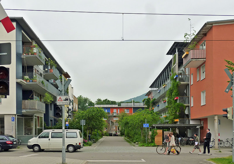
Vauban, Freiburg, Germany, photo by sararasmussen

3. The car-free project combined with the specific traffic concept and the special offer of alternative mobility,
4. Promotion and support of Baugruppen
5. A minimum of 100 buildings built to Passiv Haus Standard,
6. A central market place and a community center.
7. The Forum's priority was to develop a sustainable city district in aparticipatory way which could become a model for further initiatives.


Vauban, Freiburg, Germany, photo by Jute Marketing

Vauban, Freiburg, Germany, photo by Payton Chung

Vauban, Freiburg, Germany, photo by Jute Marketing
Vauban, Freiburg, Germany, photo by tom.brehm

Vauban, Freiburg, Germany, photo by bjoern.f | Björn Freiberg Fotografie

Vauban, Freiburg, Germany, photo by Payton Chung

Vauban, Freiburg, Germany, photo by tom.brehm

more about green design:

A Seattle development that is greener than green

A house with no furnace? You betcha

Sustainability on the Urban Scale: ‘Green Urbanism’

The Human Benefits of Green Building

The relationship of historic city form and contemporary greenway implementation: a comparison of Milwaukee, Wisconsin (USA) and Ottawa, Ontario (Canada)

New Heden: The City Made of Green Roofs

The Vauban district is a green, planned community in the city of Freiburg in southern Germany. Construction of this community began in the mid-1990s and opened in 2000. By 2001, it had 2,000 inhabitants living in a greener, more sustainable way. Now, the Vauban district is said to have 5,000 inhabitants and 600 jobs. A recently article I ran across highlights the green features of this community and I thought I’d share some of that here.