Like Urban Research on Facebook

Showing posts with label Tehran. Show all posts

Sunday, October 4, 2020

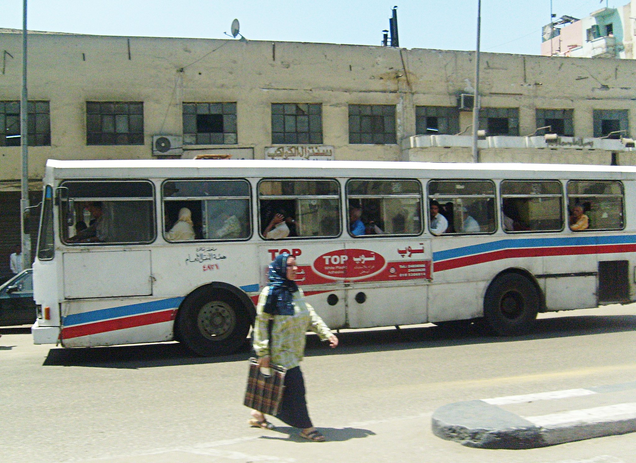
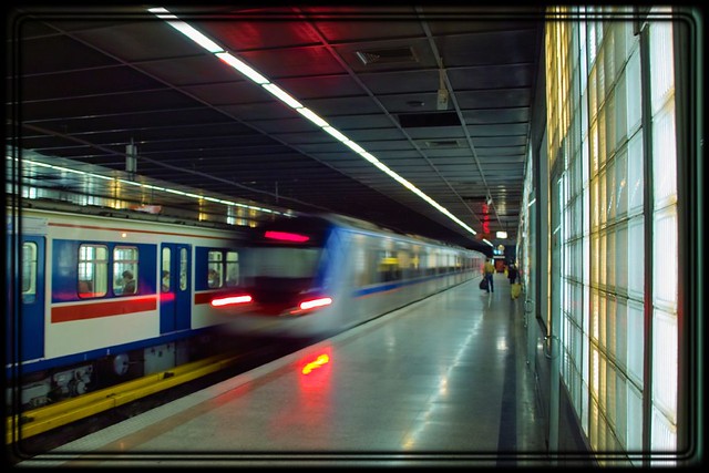
The Relationship between Regular Use of Ridesourcing and Frequency of Public Transport Use in the MENA Region (Tehran and Cairo)

By Hamid MostofiHoushmand MasoumiandHans-Liudger Dienel 

Despite the growing share of ridesourcing services in cities, there is limited research about their impacts on other transport mode choices in the large cities of the Middle East and North Africa (MENA). There is a debate about whether ridesourcing affects the frequent use of sustainable modes like public transport. This study uses the results of a large-scale series of face-to-face interviews in Tehran and Cairo to study the relationship between the regular use of ridesourcing and the frequency of public transport use. Descriptive statistics and logit regression are used to analyze this association. The findings indicate contradictory correlations between the regular use of ridesourcing and the frequent use of public transport in Tehran and Cairo. The regular use of ridesourcing has a positive correlation with the probability of frequent public transport use in Cairo. In contrast, this correlation is negative in Tehran, which means that the regular ridesourcing users are less likely than the non-regular users to use frequently public transport. The reasons for these different correlations are studied in terms of socioeconomic variables, accessibility, and the citizens’ perception of public transport in both cities.
Read More

Bus

More about urban transportation in the Middle East:

Thursday, March 30, 2017

A LONGITUDINAL ANALYSIS OF DENSITIES WITHIN THE PEDESTRIAN SHEDS AROUND METRO STATIONS: THE CASE OF TEHRAN

By HOUSHMAND E. MASOUMI and MARYAM SHAYGAN

Evaluation of spatial accessibility to public transportation has a weak background in many emerging countries, including Iran. Transit-Oriented Development is of great interest among Iranian planners and academics, but little is known about transit orientation provided by major public transport systems exemplified by the Tehran Metro. Statistical difference tests and polynomial regression done in this study show how residential densities within walking distances of metro stations established at different times after 1998 are significantly different. Both population and employment densities have decreased in more recent stations compared to those opened between 2005 and 2010. Moreover, one-way T-Tests comparing the population and densities of older lines with those of newer lines reveal that, in most cases, densities within walking distances of stations of older lines are higher. The paper concludes that lack of proper site selection and failing to locate new stations near job centers and highly populated areas threatens the transit-friendliness that emerged in the early years after establishing the first metro station in 1998.


Tehran Underground (2)

More about urban planning and mobility in the Middle East:

URBANIZATION TRENDS AND URBAN PLANNING STRATEGIES IN THREE MAJOR MIDDLE EASTERN COUNTRIES: IRAN, EGYPT, AND TURKEY

TENSIONS AND TRANSFORMATIONS IN THE MASTER PLANNING PROCESS OF ISTANBUL

Upgrading informal settlements in Egypt towards a sustainable urban development

Facilitating Urban Management Through Local SDI Case Study: The Municipality of Tehran 

THE IDENTITY OF OPEN SPACE: ADAPTING FROM THE MODEL OF TRADITIONAL NEIGHBORHOOD CENTER

Impact Assessment of Sustainable Public Transportation System on Quality of Life in Tehran

Changes in population settlement pattern in urban system of Tehran province (1966 to 2006)

Studying the effects of urban sprawl of metropolis on tourism - climate index oscillation: A case study of Tehran city

Friday, January 3, 2014

URBAN SPRAWL AND CLIMATIC CHANGES IN TEHRAN

by Gh. R. Roshan, S. Zanganeh Shahraki, D. Sauri, R. Borna

Urban sprawl beginning in the developed countries around 1950 is currently experienced in almost all countries. Many studies on the effects of urban sprawl indicate the emergence of harmful effects of this phenomenon. One of the most important environmental effects is the changes in climate. The purpose of this research was to identify the relation between urban sprawl components of Tehran with changes in climate variables. To this end, two data sets have been used to study the relation between these elements and components. The first data set included climatic elements such as rainfall, temperature, the percent of relative humidity and the percent of calm wind, as well as its mean speed for a period of 54 years (1953-2006). The second set of data was formed by components relevant to urban sprawl such as city area, private cars per capita, population density and number of urban population. Pearson correlation and multiple regression methods have been applied to compare and identify the relation between climatic components with urban sprawl indices. Results of correlation indicate that among the 5 aforementioned climatic components, annual rainfall and the mean of wind speed do not appear to have significant relation with sprawl, but the oscillations in percent of relative humidity and percent of calm wind seem to have a significant relation with Tehran sprawl. Consequently and using multivariate regression, it was concluded that the most important factor in the increasing temperature of Tehran, is the number of cars; the most important factor in increasing the percent of relative humidity is the area of Tehran, whereas the increase of the percent of calm wind may be attributed to the increase of population.


more about Tehran:

Residential Self-Selection and Its Effects on Urban Commute Travels in Iranian Cities Compared to US, UK, and Germany

A GEOGRAPHICAL STUDY OF KARAJ : A SATELLITE CITY IN THE URBAN REGION OF TEHRAN

The Study of Land Use Changes in the Tehran Metropolitan Area by Using MOLAND Model

Facilitating Urban Management Through Local SDI Case Study: The Municipality of Tehran 

Development Guidelines for Disaster Risk Management in Tehran 

THE IDENTITY OF OPEN SPACE: ADAPTING FROM THE MODEL OF TRADITIONAL NEIGHBORHOOD CENTER

MODELING THE TRAVEL BEHAVIOR IMPACTS OF MICRO-SCALE LAND USE AND SOCIO-ECONOMIC FACTORS

Saturday, October 26, 2013

Residential Self-Selection and Its Effects on Urban Commute Travels in Iranian Cities Compared to US, UK, and Germany

by Houshmand E. Masoumi

Residential self-selection has gained increasing attention in the Western travel behavior research during the past decade. Many studies in the US, UK, and Germany conclude that the role of individuals’ residential location choice on commute travel behavior is more important than that of the built environment or at least it has considerable effects. However the effectiveness of location choice in many countries and cultures like Iran is unclear. This study examines the self-selections in two neighborhoods in Tehran. As a part of a research about the influences of land use on travel behavior information about people’s location preferences was collected by direct questioning. The findings show that the main reasons for selecting the location of residential units are related to socio-economic factors such as rise of house price and affordability of house prices. Transportation has little impacts on location decisions. Moreover, residential self-selection accounts for only 3 to 7.5 percent of the pedestrian, PT, and car trips.


Hemmat Highway

more about  planning in Iran:

MODELING THE TRAVEL BEHAVIOR IMPACTS OF MICRO-SCALE LAND USE AND SOCIO-ECONOMIC FACTORS

The Study of Land Use Changes in the Tehran Metropolitan Area by Using MOLAND Model


Distribution and Determining of Urban Sprawl in Kerman with Emphasis on Kariz Water System


URBAN PATTERNS FOR A GREEN ECONOMY: LEVERAGING DENSITY


Facilitating Urban Management Through Local SDI Case Study: The Municipality of Tehran 

URBAN SPRAWL IN IRANIAN CITIES AND ITS DIFFERENCES WITH THE WESTERN SPRAWL


A new approach to the Iranian urban planning, using neo-traditional development

Wednesday, August 14, 2013

A GEOGRAPHICAL STUDY OF KARAJ : A SATELLITE CITY IN THE URBAN REGION OF TEHRAN

by H. BAHRAMBEYGUI,

A PhD dissertation from University of Durham, 1978. 

The main object of this study is to analyse the socio-economic situation of Karaj city -a medium-sized Iranian city which has grown rapidly as a result of being located in the neighbourhood of the Capital city of Tehran. Its particular geographical location has been mainly responsible for the city experiencing the most rapid rate of population growth of any Iranian city during the 1966-76 intercensal period. The population of Karaj, having increased annually 12.1% between 1966-76, has grown more than 3-fold over this period to a total of 138,774 persons. The acute housing shortages, difficulties with domestic water supply, and the congested traffic conditions, which are currently the main problems of the city, are mainly the result of this population explosion.
The proximity of Karaj to Tehran and the pressures this creates has recently caused the earlier functions of Karaj as an agricultural and tourist centre, to be gradually subordinated to those of a major step-migration city for many people migrating to Tehran. Lower prices of land and accommodation as compared with Tehran are becoming the important factors also in turning Karaj into a growing residential, satellite of the capital. The consequences of these two new functions are among the major issues to be pursued in this thesis.

read more 
 
2102. Karaj

more about Iran:

Studying the effect of neighborhood size in urban growth modeling using cellular automata

Strategy for Sustainable Urban Development: A Case Study of Urmia City, Iran

Studying the effects of urban sprawl of metropolis on tourism - climate index oscillation: A case study of Tehran city

An Analysis to Challenges of Urban Management in Historic Center of Cities in Iran

COMPARATIVE SUSTAINABILITY OF BAZAAR IN IRANIAN TRADITIONAL CITIES: CASE STUDIES IN ISFAHAN AND TABRIZ

The influence of urban physical form on trip generation, evidence from metropolitan Shiraz, Iran

Changes in population settlement pattern in urban system of Tehran province (1966 to 2006)

AIR QUALITY MANAGEMENT IN TEHRAN

Sunday, August 4, 2013

The Study of Land Use Changes in the Tehran Metropolitan Area by Using MOLAND Model

by Morteza Yaghoubkhani

Increasingly, in urban areas land is too scarce a commodity to allow it to be taken up in unplanned growth. However, any action – or lack of it – to influence land use has significant consequences both for people, businesses, and organizations in the area, and, more generally, for the urban morphology itself. According to the FAO’s definition of land use planning, estimating the socio-economic conditions of human society and the land potential for development, is necessary to select the best land-use options. So “Planning involves anticipation of the need for change as well as reactions to it” (FAO, 1993). Forecasting the effectiveness as well as the indirect consequences of policies are two main focal points of planning studies. Modeling urban land use changes is helpful to understanding urban dynamics and can be used as an important tool for planners, capable of producing insights about the possible consequences of decisions made by them. Land use modeling can provide a dynamic information base that can inform the policy process at the local, national, and transnational levels. Urban planning and urban models have to be discussed jointly. Couclelis has argued that connecting these two spheres could “amplify the positive synergies between the two domains and enhance the ability of spatial planning to prepare for the future” (Couclelis 2005: 1353).
Land use transformation models can therefore generate data of meaningful representations of the region’s characteristics and allow the processing of different data sets. The models contribute to understand the landscape changes and drivers of the dynamics in the development conditions of each study area. It is also helpful to answer where and at which intensity land-take for urbanization occurs and how spatial growth patterns alter over time; how urbanization (e.g. sprawl) affects large areas overruling local and regional decision.


more about urban planning of Iran:

Distribution and Determining of Urban Sprawl in Kerman with Emphasis on Kariz Water System

Facilitating Urban Management Through Local SDI Case Study: The Municipality of Tehran 

Development Guidelines for Disaster Risk Management in Tehran 

The impact of modernization on traditional Iranian cities the case of Kerman

THE IDENTITY OF OPEN SPACE: ADAPTING FROM THE MODEL OF TRADITIONAL NEIGHBORHOOD CENTER

TRADITIONAL SHOPPING: A Syntactic Comparison of Commercial Spaces in Iran and Turkey

A new approach to the Iranian urban planning, using neo-traditional development

URBAN SPRAWL IN IRANIAN CITIES AND ITS DIFFERENCES WITH THE WESTERN SPRAWL

Tuesday, April 23, 2013

Facilitating Urban Management Through Local SDI Case Study: The Municipality of Tehran

by Hamed Olfat, Abbas Rajabifard, Faisal Masood Qureshi, and Seyyed Abdolhadi Daneshpour

Integrated and sustainable management of cities is one of the most important challenges facing many countries. In this critical societal challenge context, spatial data is key for decision making, planning and management of cities. Thus, in order to have sustainable management and planning there is a need for managers and planners to have access to reliable, seamless and accurate spatial data. However, the current situation regarding availability, integration, sharing and its effective application by planners and decision makers is not very promising in many jurisdictions worldwide including Iran and Pakistan- the two countries under study by authors. Based on current situation, in urban management in Iran there is a need for anagreed platform that facilitates access to and sharing of spatially related data, services and other resources among different disciplines within any jurisdiction. This platform should also address characteristics such as standards and specifications for data collection, management, maintenance and distribution of spatial data. Having said that, in order to facilitate this situation and respond to the needs, many countries are developing Spatial Data Infrastructures (SDIs) which is a concept for facilitating and coordinating of sharing and integrating of data through different political and administrative levels. SDI can be developed at different levels ranging from local to state/provincial, national, regional and global. SDI as a platform can help to reduce the duplication and save resources in data collection which usually occur due to unknown information about availability of datasets among different urban organizations. In addition, organizations involve in urban planning can have access to a comprehensive dataset of the interested area like a city to achieve sustainable urban planning. This paper discusses the importance and benefits of developing SDI as an enabling platform for urban planning and management based on a case study, namely Tehran Municipality in Iran by exploring challenges and is sues in accessing and sharing spatial data in this jurisdiction. The paper then presents and discusses the process and experiences of developing an SDI Roadmap for this m unicipality. 

more about urban studies in Iran:

Development Guidelines for Disaster Risk Management in Tehran

by K. Amini Hosseini and M. K. Jafari

Tehran is located in a seismic prone zone, surrounded by some active faults and experienced several destructive earthquakes in its history. Seismologists, based on the probabilistic and deterministic evaluations, believe that a strong earthquake would occur in or around the city in foreseeable future. Furthermore, the vulnerability of the structures, in frastructures and old urban areas in Tehran is quite considerable. Weak buildings, old structures, vulnerable lifelines, insufficient emergency infrastructures and roads, lack of sufficient evacuation places at some districts, etc. are some of the key parameters of earthquake vulnerability of the city. In order to evaluate and improve the present condition, a multidisciplinary project has been carried out by the International Institute of Earthquake Engineering and Seismology (IIEES) for Tehran Municipality for considering earthquake risk in master plan of Tehran. In that project the seismic and geotechnical hazards in Tehran have been evaluated and then the vulnerability of buildings, lifelines and urban structures has been studied. In the third step the disaster management urban elements including rescue and relief stations, health and medical services, emergency roads and evacuation places have been evaluated and a preliminary guideline for development of the city of Tehran has been prepared based on the existing condition. In this paper a summery about the results of evaluation on existing condition for emergency response facilities would be presented and some of the guidelines developed in this field will be explained. 
More about Tehran:

THE IDENTITY OF OPEN SPACE: ADAPTING FROM THE MODEL OF TRADITIONAL NEIGHBORHOOD CENTER

Impact Assessment of Sustainable Public Transportation System on Quality of Life in Tehran

Changes in population settlement pattern in urban system of Tehran province (1966 to 2006)

Studying the effects of urban sprawl of metropolis on tourism - climate index oscillation: A case study of Tehran city

Evaluating integration between public transportation and pedestrian-oriented urban spaces in two main metro stations of Tehran

Urban Planning for Tehran, By Using Environmental Modeling and GIS/RS

A GIS-based Traffic Control Strategy Planning at Urban Intersections

Thursday, December 6, 2012

THE IDENTITY OF OPEN SPACE: ADAPTING FROM THE MODEL OF TRADITIONAL NEIGHBORHOOD CENTER

by V. Ahmadi, A.I. Che-Ani, H.Farkisch, and M.Surat

The City form consists of some different elements, which have been joined in the functional and spatial form. If these elements have an appropriate spatial organization the strong coherence is created among them. In the traditional urban spaces, most of the times, this spatial regularity among city elements is the result of thoughtful developed urban patterns. Many non-local agents influence on the form of new cities while the forming of traditional urban spaces depends on the morphology of the site, the historical background and the culture of local people. In this way, we were looking for some of the important researches by focus the open spaces and exactly neighborhood centers in Iran. We also choose the analysis literature review for our methodology. All our attention was on two case studies in Iran (Tehran and Shiraz). In this paper, we tried to find ways to evaluate the value of neighborhood centers in the traditional urban for fulfillment to sustainable development urbanism. Urban planners and designers should find out the secret of the traditional cities' sustainability and the factors which make the responsive environment, and think that what the reasons prevent using them in contemporary cities. And then they should find a way to update those factors based on today demands, and design new patterns according to old one.


North of Tehran

more about Iranian urbanism and urban planning:

TRADITIONAL SHOPPING: A Syntactic Comparison of Commercial Spaces in Iran and Turkey

A new approach to the Iranian urban planning, using neo-traditional development

URBAN SPRAWL IN IRANIAN CITIES AND ITS DIFFERENCES WITH THE WESTERN SPRAWL

Changes in population settlement pattern in urban system of Tehran province (1966 to 2006)

Evaluating integration between public transportation and pedestrian-oriented urban spaces in two main metro stations of Tehran

THE ROLE OF PHYSICAL IDENTITY OF CITY IN URBAN SUSTAINABILITY (THE CASE STUDY: YAZD,IRAN)

Good Governance, (as promoting in decision-making process) and its influence on urban strategic plans

Abadan: planning and architecture under the Anglo- Iranian Oil Company

Monday, August 13, 2012

Impact Assessment of Sustainable Public Transportation System on Quality of Life in Tehran

by Pooya Joodi, Mostafa Momeni, Hanieh Shams Kooshki, and Hamid Azizi

Quality of life Indicates the satisfaction of people about living conditions, and in sustainable urban development, continuity of citizen’s life with social welfare is considered. Quality of life in cities and approaches related to sustainable urban development are associated together. In recent years, increasing use of vehicles in major cities has had many effects on citizen’s quality of life. In this case, large cities in developing countries such as Tehran are faced with more problems than modern cities. One of the impressive aspects of urban sustainable development is using sustainable public transportation system. So, the development of public transportation as a sustainable approach not only encourages people to make use of it, but also it is on the agenda for policy makers and city managers to enhance and make it sufficient for the city’s demand. This paper will assess the impact of the use of sustainable public transportation systems on citizen’s quality of life in Tehran by using indicators such as security, health, citizen’s costs, and so on. Among the existing public transportation systems in Tehran, the subway and Bus Rapid Transit (BRT) systems are chosen to be assessed, because of their important function in this city. In the field, needed Information are obtained from two sources, first from available data in the relevant organizations and the second from people's opinions. The results of this assessment indicates the impact of these two public transportation systems on each of the indicators and the role they play to enhance citizen’s quality of life.


Teheran metro

more about Tehran:

Changes in population settlement pattern in urban system of Tehran province (1966 to 2006)

IMPROVING THE SERVICE QUALITY, SUSTAINABILITY, AND EFFICIENCY OF MASS PUBLIC TRANSPORTATION SYSTEMS (WITH PARTICULAR REFERENCE TO TRANSIT ORIENTED DEVELOPMENT IN IRANIAN CITIES)

Evaluating integration between public transportation and pedestrian-oriented urban spaces in two main metro stations of Tehran

Tehran's "Bike House" Shines Green

A GIS-based Traffic Control Strategy Planning at Urban Intersections

Governance of Tehran City - Region: Challenges and Trends

URBAN SPRAWL AND CLIMATIC CHANGES IN TEHRAN

Thursday, July 12, 2012

Changes in population settlement pattern in urban system of Tehran province (1966 to 2006)

by Abolfazl Meshkini and Hojatollah Rahimi

Rapid suburbanization in urban system of Tehran province has been driven by the government’s policies in past decades, transport system development and land price differences between metropolises and Periphery area. Cities in Periphery area grew rapidly during 1966 to 1986 as families moved there in anticipation of jobs. The non-appearance of jobs resulted in poor social services, gridlocked freeways and long travel distances to metropolises for job. The aim of this paper was to investigate how population settlement pattern in urban system of Tehran province USTP have been changed during 1966 to 2006. Methods adopted for this purpose were Mehta index, entropy coefficient and urban development model. Furthermore, for more analysis paper was supported by some theories such as system theory, primate city theory, basic economy theory, suburbanization theories, etc. Secondary data used in this paper were collected from governmental organizations (statistical data and map). Results show that growth of big cities in number and in population is the most considerable change which has been happened in urban system of Tehran province (USTP). What make it critical is their short distance from Tehran and Karaj. The paper argues that although distribution both in urban population and in urban points occurred during 1966 to 2006. But it is very important that where the destination of population flows. Because of their short distance, big cities exert double pressure on infrastructures of metropolises and agricultural lands in periphery area. The paper recommends seeking new structures for management in USTP because roots of change pressure extend beyond individual city.


Tehran and Milad Tower (HDR)
more about urban Iran:

Abadan: planning and architecture under the Anglo- Iranian Oil Company

Good Governance, (as promoting in decision-making process) and its influence on urban strategic plans

Strategy for Sustainable Urban Development: A Case Study of Urmia City, Iran

THE ROLE OF PHYSICAL IDENTITY OF CITY IN URBAN SUSTAINABILITY (THE CASE STUDY: YAZD,IRAN)

Interconnections of Urban Green Spaces and Environmental Quality of Tehran

A GIS-based Traffic Control Strategy Planning at Urban Intersections

AIR QUALITY MANAGEMENT IN TEHRAN

URBAN SPRAWL AND CLIMATIC CHANGES IN TEHRAN

Friday, March 16, 2012

Studying the effects of urban sprawl of metropolis on tourism - climate index oscillation: A case study of Tehran city

by Gholamreza Roshan, Iman Rousta and Mehdi Ramesh

The present research intends to identify the effects of urban sprawl of metropolis on tourism-climate index oscillation. To do this research, two types of data have been used. The first type includes climate data such as minimum monthly temperature average, monthly temperature average, minimum relative humidity rate and monthly relative humidity average, average of wind speed, duration of sunshine and monthly rainfall, and the second component includes parameters related to urban sprawl components of Tehran city such as number of population, density, expansion and number of automobiles per 100 persons. In this research in order to identify climate-tourism range for different months TCI coefficient has been used. Based on the results taken from the average of three 18-year periods using TCI index, it has been concluded that time oscillation is seen for the majority of months in qualitative and quantitative range of climate-tourism coefficient. In a way that these time oscillations of TCI has positive trend for some months and negative for others. In the next step after making correlation between the components of urban sprawl of Tehran city with TCI index, it has been concluded that in April, May, September and November, the results show that the components of urban sprawl of the city has direct effect on providing more suitable climate-tourism conditions, however in June, July, August and September, the components of urban sprawl of the city has had a negative effect on TCI index. But in general, considering the outcome results for annual statistics, we can conclude that urban sprawl of metropolis of Tehran has had a negative effect on TCI index and this factor can be followed by undesirable conditions for Tehran in view of climate comfort in future and it will be considered as a difficulty in view of biologic conditions for tourists.

The chronological development of Tehran between 1952 and 2006, source: Zanganeh SS (2006). The analysis of Tehran urban sprawl and its effect on agricultural lands, M A Thesis in Geography and Urban Planning, University of Tehran (In Persian)

more about the urbanism of Iran:

TRANSPORT MANAGEMENT IN IRAN: TRAFFIC SAFETY AND CLEANER CARS

An Analysis to Challenges of Urban Management in Historic Center of Cities in Iran

COMPARATIVE SUSTAINABILITY OF BAZAAR IN IRANIAN TRADITIONAL CITIES: CASE STUDIES IN ISFAHAN AND TABRIZ

AIR QUALITY MANAGEMENT IN TEHRAN

STRATEGY FOR SUSTAINABLE URBAN DEVELOPMENT GUIDELINES FOR TEHRAN

IRAN’S MASHHAD LRT OPEN

URBAN SPRAWL AND CLIMATIC CHANGES IN TEHRAN

Thursday, January 26, 2012

Changes in population settlement pattern in urban system of Tehran province (1966 to 2006)

by Abolfazl Meshkini and Hojatollah Rahimi

Rapid suburbanization in urban system of Tehran province has been driven by the government’s policies in past decades, transport system development and land price differences between metropolises and Periphery area. Cities in Periphery area grew rapidly during 1966 to 1986 as families moved there in anticipation of jobs. The non-appearance of jobs resulted in poor social services, gridlocked freeways and long travel distances to metropolises for job. The aim of this paper was to investigate how population settlement pattern in urban system of Tehran province USTP have been changed during 1966 to 2006. Methods adopted for this purpose were Mehta index, entropy coefficient and urban development model. Furthermore, for more analysis paper was supported by some theories such as system theory, primate city theory, basic economy theory, suburbanization theories, etc. Secondary data used in this paper were collected from governmental organizations (statistical data and map). Results show that growth of big cities in number and in population is the most considerable change which has been happened in urban system of Tehran province (USTP). What make it critical is their short distance from Tehran and Karaj. The paper argues that although distribution both in urban population and in urban points occurred during 1966 to 2006. But it is very important that where the destination of population flows. Because of their short distance, big cities exert double pressure on infrastructures of metropolises and agricultural lands in periphery area. The paper recommends seeking new structures for management in USTP because roots of change pressure extend beyond individual city.


more about Tehran:

IMPROVING THE SERVICE QUALITY, SUSTAINABILITY, AND EFFICIENCY OF MASS PUBLIC TRANSPORTATION SYSTEMS (WITH PARTICULAR REFERENCE TO TRANSIT ORIENTED DEVELOPMENT IN IRANIAN CITIES)

Evaluating integration between public transportation and pedestrian-oriented urban spaces in two main metro stations of Tehran

Tehran's "Bike House" Shines Green

Urban Ecological landscape of Tehran

Urban Planning for Tehran, By Using Environmental Modeling and GIS/RS

A GIS-based Traffic Control Strategy Planning at Urban Intersections

Friday, December 9, 2011

IMPROVING THE SERVICE QUALITY, SUSTAINABILITY, AND EFFICIENCY OF MASS PUBLIC TRANSPORTATION SYSTEMS (WITH PARTICULAR REFERENCE TO TRANSIT ORIENTED DEVELOPMENT IN IRANIAN CITIES)

by S. Majid Mofidi and Khashayar Kashani Jou

This manuscript outlines a summary of the analyses and set of recommendations given by a group of transit experts aiming at improving the novel transit systems recently inaugurated for some Iranian cities. This summary emphasizes on those recommendations directed towards improving the service quality, efficiency and sustainability of mass public transportation systems in large cities in the developing world and that can be implemented in a short term (within two or three years). Some major dimensions of public transit are considered as follow: regulation and competition; investment, financing, design, etc. Although the investigation grew out of the characteristics and needs of a city such as Tehran (Iran), much of the recommendations and analyses can be implemented and adopted in the major cities of developed countries in Asia, North America and Europe.


more about Iranian urban planning:

THE ROLE OF PHYSICAL IDENTITY OF CITY IN URBAN SUSTAINABILITY (THE CASE STUDY: YAZD,IRAN)

The Mechanism of Transformation of Shiraz City from Past to Present

Earthquake Management in Iran A compilation of literature on earthquake Management

A GIS-based Traffic Control Strategy Planning at Urban Intersections

Evaluating integration between public transportation and pedestrian-oriented urban spaces in two main metro stations of Tehran

by Khashayar Kashani Jou

Goods and people movement is one of the most fundamental challenges of urban development in the contemporary world. Public transportation, among different modes of inner city transportation, has gained special attention. In addition, quality and magnetism of urban public spaces that are related to the broadening of pedestrian-orientation have been introduced as the main indicators of the development of cities. Each of the above subjects will be studied in developed countries. The necessity of doing researches for the purpose of evaluating the relationship between these notions, especially regarding urban design approach, has become more obvious. However, developing countries, including Iran, have not paid attention until recently to both public transportation and pedestrian areas within a more comprehensive urban development approach. The purpose of this paper is to study and evaluate integration between public transportation and pedestrian-oriented urban spaces in the Tehran metropolitan area focusing on two main metro stations of the city. A documentary research through valid sources (articles, researches and studies of transportation master plans), along with on-site investigations by participant observation methods, has been utilized to substantiate this study. After introducing the theoretical framework of the subject, the evaluating criteria of the subject have been proposed and then two case studies have been compared and analyzed based on them. The findings demonstrate that concentrated development on the public transit nodes integrated to pedestrian-oriented urban spaces would have many positive effects on the whole urban structure. Qualitative aspects of urban spaces are more important than quantitative ones in attraction of pedestrians and efficiency of transit stations.


A view of a Tehran Metro station, photo by martisak

more about planning for Tehran:

Tehran's "Bike House" Shines Green

Urban Ecological landscape of Tehran

Tehran and the challenges of a metropolis in the millennium

Urban Planning for Tehran, By Using Environmental Modeling and GIS/RS


Tuesday, November 22, 2011

Tehran's "Bike House" Shines Green


Reducing traffic on congested streets, clearing pollution from smog-laden overcast skies, and completing that last kilometer to your destination from transit points are the accepted benefits of bike-sharing no matter the political situation or location in the world. Bike-sharing has become an integral part of many cities' green economy. It comes as no surprise that even in the Islamic Republic of Iran, bike-sharing is thriving.
Tehran’s “Bike House” bikes are rolling across the city. The system, less than a year old, is funded by Tehran’s municipal government. It is currently only in one of Tehran’s 22 administrative districts.


more about bike sharing:

sustainable transport

World’s largest bike-share system in China dwarfs popular U.S. program


City of Boston Announces Its BIXI Bike Share Program Is a Go


Urban Bike Sharing System Coming to London!

Tuesday, November 15, 2011

Urban Ecological landscape of Tehran

by Behrang Bahrami, and K.V. Aiyanna

Urban ecological systems can link terrestrial ecological, physical, and socioeconomic components of metropolitan areas in an ecological approach to landscape planning in urban environment. The experiences and theories demonstrate that ecological patches and corridors play a crucial role in the sustainability of urban environments and their transformations directly influence the ecological functions of the city. Basic Landscape Elements in Tehran concluded natural topographical features or landforms like the mountains, valleys, hills or ridgelines or other features forming distinctive landscape elements which give a sense of place. For ecological network designing in Tehran, applying landscape ecology approach as could be interpreted in urban ecological planning, determining the current situation and analyzing the natural and built elements of the ecological systems of Tehran, applying strategies for structural and functional improvement of natural and built urban ecological systems and finally proposing a ecological model for the application of ecology in landscape scale.


Kuhsar urban park in Kan, west of Tehran, photo by PhoTongueless


Kuhsar urban park in Kan, west of Tehran, photo by PhoTongueless

Kuhsar urban park in Kan, west of Tehran, photo by PhoTongueless


more about urban and transportation planning in Iran:

Tehran and the challenges of a metropolis in the millennium

Art in the Tehran Metro

Interconnections of Urban Green Spaces and Environmental Quality of Tehran

IRAN’S MASHHAD LRT OPEN

AIR QUALITY MANAGEMENT IN TEHRAN

Urban Planning for Tehran, By Using Environmental Modeling and GIS/RS

Tuesday, November 8, 2011

Tehran and the challenges of a metropolis in the millennium

 by Maryam Ala Amjadi
When it comes to convenient public transportation in Tehran, one always thinks of the bus and the subway. But when it comes to the question of the most convenient bus, the recently established BRT is an all-time favorite among the commuters of the city.
Officially inaugurated in 2008, the BRT like any of its brother and sister buses across the world aims at a system in which it could provide the near service quality of rail transit plus the affordability and flexibility of the bus transit. A special bus lane that allows the bus to operate separately and majorly skip the traffic without an interruption, makes the red colored BRT a popular choice among the citizens, particularly in the high traffic hours (7AM to 9AM & 4PM to 8PM).
Passengers can travel for 200 Tomans (roughly about 0.23 dollars) via the BRT special lines which travels very quickly from Azadi square (west of Tehran) directly to the East (Terminal-e-Shargh) and Imam Khomeini square (South of Tehran) directly to the North (Tajrish square) .
As of 2011, there is a network line of 100 kilometers dedicated to the BRT but the government plans to extend it to 300 Kilometers. It is also estimated about 1.8 million passengers travel on the BRT daily. As with the subway and normal buses, the men and women’s seat and queues are segregated. The contactless ticket validator, special air conditioning and convenient seats have made the BRT the top favorite of all public transportation systems. 

Tehran Metro, the city’s underground heart

If you want to travel across Tehran and save on two inevitably crucial factors of a modern life, that being time and money in a cosmopolitan city, then it is suggested that you take the subway and experience the necessity of the underground scene of transportation. 
Compared with industrial cities of the world, Tehran’s Metro is indeed a new metropolitan phenomenon; nevertheless one could say that it has been beautifully integrated into the city’s everyday life of transportation. Although construction of a metro system began a while before the Islamic revolution in 1979, due to the financial issues and the years of the imposed Iran-Iraq war, the first mass transit did not open until March 1999.

read more

A winter day in the streets of Tehran, photo by HAMED MASOUMI

Parkway highway and bridge in the north of Tehran, photo by wvs

more about urban problems of Tehran:

Interconnections of Urban Green Spaces and Environmental Quality of Tehran

Low Carbon Housing for `Young Cities`: Experiences from Hashtgerd New Town, Iran

A GIS-based Traffic Control Strategy Planning at Urban Intersections

Urban Planning for Tehran, By Using Environmental Modeling and GIS/RS

Art in the Tehran Metro

via Jadidonline

Tehran’s Metro offers a possibly unexpected store of modern artwork for the visitor to see as they go on their way in the city.
London is said to be the site of the first metropolitan underground railway, operational from 1863, and Moscow’s subway system is considered to be practically a museum of socialist realist art of the 20th Century, whilst Tehran’s Metro which became operational in 1999 showcases a mix of modern art styles.

read more 

artwork in Tehran Metro, photo by Mamooli

artwork in Tehran Metro, photo by Mamooli

artwork in Tehran Metro, photo by Mamooli


more about Tehran:

Interconnections of Urban Green Spaces and Environmental Quality of Tehran

STRATEGY FOR SUSTAINABLE URBAN DEVELOPMENT GUIDELINES FOR TEHRAN

URBAN SPRAWL AND CLIMATIC CHANGES IN TEHRAN

Urban Planning for Tehran, By Using Environmental Modeling and GIS/RS

Interconnections of Urban Green Spaces and Environmental Quality of Tehran

by Faryadi, Sh. and Taheri, Sh.

In this study the direct effects of urban green space dispersal and density on quality of the environment of the regions of Tehran have been investigated and evaluated. In order to do so, the area and green space per capita and vegetation cover density of the regions of Tehran have been measured as ecological indices for evaluating their environmental quality. The measurements have been done by means of land use layers in GIS, satellite images of vegetation cover dispersal and density and calculating the normalized difference vegetation index (NDVI). High levels of population density and carbon monoxide concentration in each city region have been considered as human indices for low quality of urban environments. Comparison of these indices, and analysis of the correlation level between them, indicates that the regions which have the least green space area per capita and vegetation cover density are also the most polluted and populated areas. The results of this study would introduce planning priorities for urban green space development in Tehran.


A view of Tehran from Jamshidieh urban park in the north or the city, photo by Hapal


more about urban planning in Iran:

STRATEGY FOR SUSTAINABLE URBAN DEVELOPMENT GUIDELINES FOR TEHRAN

AIR QUALITY MANAGEMENT IN TEHRAN

IRAN’S MASHHAD LRT OPEN

Urban Planning for Tehran, By Using Environmental Modeling and GIS/RS