Like Urban Research on Facebook

Showing posts with label Urban Sociology. Show all posts

Sunday, January 26, 2025

Spanning History: How Bridges Transformed Cities


Bridges are more than feats of engineering; they’re symbols of connection and progress that have fundamentally shaped the urban world. They link people, fuel economies, and transform landscapes. Two iconic examples, the Brooklyn Bridge in New York City and the Golden Gate Bridge in San Francisco, illustrate how these structures redefine cities and their futures.


The Brooklyn Bridge: A Gateway to New York’s Future

Completed in 1883, the Brooklyn Bridge was an unprecedented achievement in engineering. It was the first steel-wire suspension bridge and, at the time of its opening, the longest suspension bridge in the world, stretching 1,595 feet across the East River. Before the bridge, Brooklyn and Manhattan relied on ferries to connect their residents, a method that was often unreliable and slow. The bridge revolutionized this connection, paving the way for Brooklyn to become part of New York City in 1898.

The construction of the bridge wasn’t without challenges. It took 14 years to complete, costing $15 million—equivalent to nearly $400 million today—and the lives of at least 27 workers, including its original designer, John A. Roebling. However, the payoff was immense. By the early 20th century, Brooklyn emerged as a major industrial hub, and the bridge facilitated the daily commute of thousands. Today, the bridge carries approximately 120,000 vehicles, cyclists, and pedestrians daily, serving as both a vital transport link and a global icon.

The Golden Gate Bridge: Opening the Bay Area

The Golden Gate Bridge, completed in 1937, had a similarly transformative effect on San Francisco and its surrounding areas. Spanning 4,200 feet, it was the longest suspension bridge in the world at the time and remains an engineering marvel. Its construction cost $35 million (around $700 million in today’s dollars), and its vibrant International Orange color was chosen to enhance visibility in the Bay Area’s infamous fog.

Before the bridge, the only way to travel between San Francisco and Marin County was via ferry—a time-consuming and limited option. The bridge slashed travel times, opening up Marin County and the northern Bay Area for development. Suburban areas flourished, and economic activity surged as businesses and residents gained easier access to the city. Today, the bridge carries over 100,000 vehicles daily, making it a lifeline for the region.

Beyond the Icons: The Broader Impact of Bridges

Bridges have left a mark on cities around the world. The Tower Bridge in London, completed in 1894, not only became an iconic landmark but also addressed the challenges of increasing traffic during the Industrial Revolution by allowing both vehicles and ships to pass. In modern times, the Danyang-Kunshan Grand Bridge in China, which stretches an astonishing 102 miles, connects key cities along the Beijing-Shanghai High-Speed Railway, promoting regional development.

However, bridges come with challenges. The environmental impact during construction, such as habitat disruption, and long-term maintenance costs pose ongoing issues. For example, the Brooklyn Bridge has undergone several renovations over the years, with recent projects costing upwards of $800 million. Similarly, the Golden Gate Bridge requires constant upkeep to combat the corrosive effects of saltwater and fog, costing millions annually.

Bridges as Cultural Icons

In addition to their functional roles, bridges often become cultural symbols. The Brooklyn Bridge has been featured in countless films, books, and artworks, symbolizing innovation and resilience. The Golden Gate Bridge, with its unique color and sweeping vistas, is one of the most photographed structures in the world.

Conclusion: Building Futures

From uniting boroughs in New York to connecting regions in San Francisco, bridges are not just structures; they’re agents of transformation. They link people, spur economic growth, and redefine landscapes. As cities continue to grow, bridges will remain vital in shaping urban futures, proving that the path to progress is often a bridge away.

More about San Francisco:
How Public Markets Shaped Cities

Wednesday, September 4, 2019

Cyclability in Lahore, Pakistan: Looking into Potential for Greener Urban Traveling


  • By 
  • Sheikh Atif Bilal Aslam, 
  • Houshmand E. Masoumi, 
  • Muhammad Asim, 
  • Izza Anwer


  • Measuring perceived or objective cyclability or bikeability has drawn less attention compared to walkability, particularly in developing countries like those in South Asia and the Middle East. This paper presents the results of a survey about cyclability in Lahore, Pakistan, focusing on human perceptions rather than the built environment. The overall sample included a total of 379 respondents from three socio-economic classes: those from lower socio-economic backgrounds accessing traditional/older bazaars, respondents from the middle socio-economic class accessing uptown bazaars, and respondents of higher socio-economic status accessing pedestrian shopping malls. The exploratory data collection was conducted in spring 2018 in Lahore by means of a short standard questionnaire with 19 questions, resulting in 17 categorical/dummy variables, two open-ended variables, and two continuous variables targeting socio-economics, bike trip characteristics, biking barriers, and preferred travel specifications. The results showed that the middle socio-economic group was more inclined, flexible, and willing to bike compared to the lower and higher socio-economic-groups. The lower socio-economic group used the bicycle more frequently than the middle socio-economic group. Around half of the middle socio-economic group commutes via bike compared to the lower socio-economic group. There was little to no representation of 55-64 and 65+ age groups in the data. The descriptive findings of this survey indicate some preliminary signs of differences of decisions and perceptions about biking compared to high-income and European countries. These differences need to be tested in future statistical analyses.


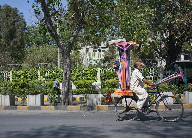
  • Squeegies for sale

    More about Asian cities:

    Facilitating Urban Management Through Local SDI Case Study: The Municipality of Tehran

    Wednesday, August 28, 2019

    DESIGNING THE HEALTHY NEIGHBORHOOD: DERIVING PRINCIPLES FROM THE EVIDENCE BASE

    By Ellen M. Bassett, Timothy Beatley, Reuben M. Rainey, Robert Lamb Hart, David P. Howerton, J. Timothy McCarthy II, Paul Milana, and Stuart Siegel

    The built environment is a critical factor in human health outcomes. In the late 19th and early 20th centuries, for instance, poor urban environments were a great threat to city residents from all walks of life. Rapidly growing cities experienced severe epidemics of infectious diseases, including tuberculosis, cholera, typhoid, and yellow fever. These epidemics were effectively mitigated through investment in public infrastructure and better urban planning. Sewers were built to manage human waste, public parks were created give access to fresh air, building standards were changed to ensure safe shelter, and development regulations served to reduce traffic congestion and relieve urban overcrowding. Importantly, visionary architects and planners of the time recognized the role of urban design as a tool for improving health. Some of the earliest American suburbs—like Riverside, Illinois, planned by Vaux and Olmstead—were created as havens from the industrial city and designed in a way that incorporated nature and health-giving open space throughout the model community. In reaction to heavily polluted London, Ebenezer Howard envisioned the “garden-city” which strove to integrate the best of the city with the benefits of rural life. His iconic vision informed the thinking of other leading 20th century designers and urbanists who created places like the New Deal-era Greenbelt towns—practical but utopian communities designed to provide decent housing, strong community life, and nearby employment and amenities to its residents. Our triumph over the acute diseases of the city provides important lessons for today since communities across the United States now face a different type of health threat—namely the spread of chronic diseases, such as asthma, Type-2 diabetes, cancer, and heart disease.1 Of particular concern relative to the rise of chronic diseases is the global rise in levels of obesity. The prevalence of obesity or extreme obesity for adults aged 20 to 74—conventionally measured as a Body Mass Index exceeding 30 for obesity and 40 for extreme obesity—has risen from 14.3% in 1960-62 to 41.9% in 2010-2011 (Fryar, et al.(a), 2014). Child and adolescent (aged 2 to 19) obesity now measures at 16.9%, up from 5.2% in 1971-1974 (Fryar, et al.,(b), 2014). At the same time that obesity has risen, average rates of physical activity have fallen for both adults and children. In the US, only 48% of adults meet the Surgeon General’s Guidelines for physical activity, namely 150 minutes of moderate intensity aerobic activity like brisk walking every week (http://www.cdc.gov/physicalactivity/data/ facts.html). Physical inactivity amongst children is also a concern. For instance, in 2009, 13 percent of children five to 14 years old usually walked or biked to school compared with 48 percent of students in 1969. The concern with obesity and physical inactivity is so pronounced in our public health conversations because of the known link between these factors and chronic diseases such as diabetes, heart disease and various forms of cancer.


    Friday, April 7, 2017

    REDUCING CRIME BY SHAPING THE BUILT ENVIRONMENT WITH ZONING: AN EMPIRICAL STUDY OF LOS ANGELES

    By JAMES M. ANDERSON, JOHN M. MACDONALD, RICKY BLUTHENTHAL & J. SCOTT ASHWOOD

    The idea of using law to change the built environment in ways that reduce opportunities to commit crimes has a long history. Unfortunately, this idea has received relatively little attention in the legal academy and only limited rigorous empirical scrutiny. In this Article, we review the considerable literature on the relationship between zoning, the built environment, and crime. We then report the results of two empirical studies on these relationships. First, we conducted a study of the effect of zoning on crime using 205 blocks selected in eight different relatively high crime neighborhoods in Los Angeles that have similar demographic characteristics but different forms of zoned land use. We find that mixed commercial- and residential-zoned areas are associated with lower crime than are commercial-only  zoned areas. Second, we matched neighborhoods undergoing zoning changes between 2006 and 2010 with neighborhoods that underwent no zoning changes during this period but had similar preexisting crime trajectories between 1994 and 2005. The primary zoning change in these neighborhoods was to convert parcels to residential uses. We find that neighborhoods in which there was a zoning change experienced a significant decline in crime. Our results suggest that mixing residential-only zoning into commercial blocks may be a promising means of reducing crime.


    Crime

     more about built environment:

    Urban Transformations of the Mediterranean Cities in Light of Developments in the Modern Era

    Urban Sprawl: A view from developing and developed Countries

    A THEORETICAL APPROACH TO CAPABILITIES OF THE TRADITIONAL URBAN FORM IN PROMOTING SUSTAINABLE TRANSPORTATION

    Liveable Neighbourhoods: Street Layout, Design and Traffic Management Guidelines

    Applying a CA-based model to explore land-use policy scenarios to contain sprawl in Thessaloniki, Greece

    Thursday, January 29, 2015

    Addressing Urban Transportation Equity in the United States

    By Robert D. Bullard

    Transportation touches almost every aspect of our lives and plays a pivotal role in shaping human interactions, economic mobility, and sustainability. Transportation provides access to opportunity and serves as a key component in addressing poverty, unemployment, and equal opportunity goals. This article examines the inequity that exists in the United States when it comes to transit, as the benefits from transportation advancements and investments are not distributed equally among communities, making transportation equity an issue of civil rights and social justice. This article frames transportation issues as a continuation of the civil rights movement and the wrestling with differential treatment that goes back to Plessy v. Ferguson and later Brown v. Board of Education and Rosa Parks. Communities today are disadvantaged when it comes to investments, enhancements and access to transportation resources, detailed in the article in various examples of disparate transportation spending. Measures taken to erase transportation inequities, including government response and fallout from the environmental justice movement attempt to eliminate unequal enforcement of the nation’s transportation systems and policies and combat burgeoning issues such as suburban sprawl and the shift of many jobs to the suburbs where public transportation is inadequate. Transportation continues to be divided along racial lines, but it is a key ingredient in building economically viable and sustainable communities and with the policy recommendations detailed in the article’s conclusion, these inequities can be addressed.


    more about public transportation:

    Transportation Policy for Poverty Reduction and Social Equity

    Examining the Impacts of Residential Self-Selection on Travel Behaviour: A Focus on Empirical Findings

    TOWARDS A SUSTAINABLE URBAN TRANSPORT SYSTEM: PLANNING FOR NON-MOTORIZED VEHICLES IN CITIES

    Challenges of urban transport in developing countries- a summary

    A Review and Critique of NJ TRANSIT, Bicycle Access Policies

    A Methodology for Incorporating Fuel Price Impacts into Short-term Transit Ridership Forecasts

    Los Angeles Streetcars: A Push To Bring Back The Rich History Of Streetcars Begins In Downtown LA

    Monday, January 26, 2015

    Transportation Policy for Poverty Reduction and Social Equity

    By Debra Efroymson and Maruf Rahman

    Most people would agree that reducing poverty is an important goal, as is reducing the gap between the rich and poor. However, exactly how to achieve these goals is a matter of much debate. One often-neglected aspect is transport.
    Transport is a key aspect of life, affecting us not only when we travel, but throughout our days. Our peace and quiet are disturbed by car horns. Our air is polluted from vehicular emissions. Our neighborhoods are given over to moving and parked cars, leaving less room for ourselves and our children to walk, bicycle, and play.
    In addition to these quality of life and environment issues is that of economics. Investments made in roads take away from investments in public transport and facilities for non-motorized travel, such as by foot or bicycle. For those who can’t afford travel expenses, education and jobs may become inaccessible. For others, travel to and from work represents a heavy expense that contributes to keeping them in poverty. Reducing the travel expenses of the poor could thus help them to improve their standard of living.
    This paper discusses various transport options and their advantages and disadvantages, and makes suggestions for improving mobility of the majority while simultaneously decreasing poverty and increasing social equity.


    more about public urban transportation:

    A REGIONAL ANALYSIS OF URBAN POPULATION AND TRANSPORT ENERGY CONSUMPTION

    Climate change and urban transportation systems

    A THEORETICAL APPROACH TO CAPABILITIES OF THE TRADITIONAL URBAN FORM IN PROMOTING SUSTAINABLE TRANSPORTATION

    How the Built Environment Influences Non-Work Travel: Theoretical and Empirical Essays 

    MODELING THE CHOICE CONTINUUM: AN INTEGRATED MODEL OF RESIDENTIAL LOCATION, AUTO OWNERSHIP, BICYCLE OWNERSHIP, AND COMMUTE TOUR MODE CHOICE DECISIONS

    Examining the Impacts of Residential Self-Selection on Travel Behaviour: A Focus on Empirical Findings

    TOWARDS A SUSTAINABLE URBAN TRANSPORT SYSTEM: PLANNING FOR NON-MOTORIZED VEHICLES IN CITIES

    Challenges of urban transport in developing countries- a summary

    Tuesday, April 17, 2012

    GATED COMMUNITIES: PHYSICAL CONSTRUCTION OR SOCIAL DESTRUCTION TOOL?

    by ABDELHAMID Hatem Touman

    The Congress theme: “The Dream of a Greater Europe” combined with themes of some tracks such as: “Housing and community development”, have both encouraged us to present this paper. The social blend which we are gaining by the birth of The Greater Europe ; the big variety of social classes living together on the new European community ; and the mobility freedom all over the Continent, may launch again the desire to be enclosed in settlements with homogeneous social fabric, with people of the same nationality, culture and standard of living. This may re-launch the movement of gated communities in Europe. This is why we are trying here to explore possible forms and effects of gated communities on the societies. In order to avoid its bad effects on our growing European Community.
    The main task of this paper is to explore the effects of gated communities as an urban paradigm on the:
    - social life. Its danger on the social fabric.
    - national planning : infrastructure ; transport network ; etc.
    - National economy and the econo-spatial distribution. (We mean the distribution of the national budget and the capitals of the private investment on the territory).
    We are interested, as well, in Gated Communities through our research about the new urban forms, in order to construct an ideal model of new urban settlements. We started discussing that during my paper’s presentation of AESOP2004, concerning New Towns as a European ideology affecting the urban policy on foreign territories. Our case study was Egypt. So this year we’ll continue the second part of the research on the same case study. Our paper of AESOP2004 and this paper were the topic of our research for the Master degree and which we are developing now as a part of our PhD research.


    more about the urbanism in Middle East:

    MESSAGE FROM TRADITIONAL SETTLEMENTS FOR FUTURE CITIES

    Strategy for Sustainable Urban Development: A Case Study of Urmia City, Iran

    TRANSPORT MANAGEMENT IN IRAN: TRAFFIC SAFETY AND CLEANER CARS

    Art in the Tehran Metro

    Earthquake Management in Iran A compilation of literature on earthquake Management

    Tehran's "Bike House" Shines Green

    Friday, April 13, 2012

    Modelling Perceived Accessibility to Urban Amenities Using Fuzzy Logic, Transportation GIS and Origin-Destination Surveys

    by Marius Thériault & François Des Rosiers

    Accessibility to goods and services is a complex notion which completely pervades territorial issues (Hansen, 1959). It relates to the ability of individuals to travel and to participate in activities at different locations in an environment. Accessibility can be considered as one of the main determinants of property values, although its influence will differ depending on the type of trip as well as on the configuration of the urban fabric. Previous research show that Euclidean distances to the CBD and various urban amenities, as well as travel times to schools and shopping centres, are appropriate measures of the phenomenon. Such indicators are proxies for accessibility focusing on distances from specific physical features which could be easily assessed using physical network measurements. However, other perceptual dimensions are at stake, which are driven by preferences and actual behaviour of people; these, in turn, depend on self valuation of their time and easy access to various types of services. They define specific utility functions which are somewhat different for each household, but could be differentiated among social groups. These values and willingness are related to specific constraints of individuals and households, including economic status (employment and income), motorization, family structure and life cycle. For instance, a lone person has more freedom for choosing his home than a dual-earner couple with children since the latter must consider the overall needs of all family members while trying to minimise housing and travel costs simultaneously.
    Due to the complexity of the urban fabric though, and considering the polycentric pattern of most modern cities, using mere Euclidean distances to the CBD falls short of integrating all relevant aspects of accessibility (Jackson 1979, Dubin and Sung 1987, Niedercorn and Ammari 1987, Hoch and Waddell 1993). Although it could be argued that in modern cities, social gradients are progressively prevailing over access factors as major house price determinants, the faulty specification of accessibility descriptors may well explain their poor performances. Indeed, most of these studies actually resort to Euclidean distances (or their numerical transforms) to measure accessibility-related externalities although minimum travel time and minimum walking distance are also used (Bateman et al. 2001).
    Some authors resort to O-D surveys to look at accessibility to jobs and houses. In his study on metropolitan Washington, DC., Levinson (1996) analyzes commuter trips patterns and finds that, by balancing accessibility, the suburbanization of jobs maintains stability in commuting durations despite ising congestion, increasing trip lengths, and increased work and non-work trip making. Helling (1996) explores the effect of residential gravity accessibility by automobile to all employment in the Atlanta metropolitan region on the quantity and nature of travel by men and women, using the Atlanta Regional Commission’s 1990 Household Travel Survey. The author finds that while individuals and households who live in more accessible portions of the metropolitan area spend significantly fewer minutes in travel, this effect is seen primarily for employed men. The research also demonstrates that residential accessibility’s effects on travel, though significant, do not affect everyone and that, while gravity measures of accessibility may help transportation planners predict the results of planned and unplanned changes when used with other information, they do not predict travel behaviour well when used alone.


    more papers about perceptions:

    Journey-to-Work Patterns in the Age of Sprawl: Evidence from Two Midsize Southern Metropolitan Areas

    Beautiful Places: The Role of Perceived Aesthetic Beauty in Community Satisfaction

    Reliability of Self-Reported Neighborhood Characteristics

    Perceptions of Accessibility to Neighborhood Retail and Other Public Services

    Tuesday, April 3, 2012

    SOME REALITIES ABOUT SPRAWL AND URBAN DECLINE

    by Anthony Downs

    At the outset, suburban sprawl should be defined clearly. Sprawl is not any form of suburban growth, but a particular form. In our study The Costs of Sprawl – Revisited, we did not create the definition deductively from some internally coherent concept of “sprawlness.” Rather, we looked inductively at all the criticisms of sprawl in the literature, and derived traits that would cause them. The ten such traits are: (1) unlimited outward extension of develop ment, (2) low-density residential and commercial settlements, (3) leapfrog development, (4) fragmentation of powers over land use among many small localities, (5) dominance of transportation by private automotive vehicles, (6) no centralized planning or control of land- uses, (7) widespread strip commercial development, (8) great fiscal disparities among localities, (9) segregation of types of land uses in different zones, and (10) reliance mainly on the trickle- down or filtering process to provide housing to low-income households. These traits have dominated American metropolitan growth for 50 years. Most analyses of sprawl focus on only one or a few of these traits, thereby adopting an oversimplified approach.
    In theory, the American metropolitan growth and development process is not identical to sprawl, which is a particular form of that process. However, sprawl has been so dominant in United States metropolitan areas that most people think the growth process is the same as sprawl. I will try to distinguish between them in this analysis.

    Pheonix, Arizona, the downtown and the periphery of the city are seen, photo by TAYLOR149

    more about urban sprawl:

    LANDSCAPE EFFECTS OF URBAN SPRAWL: SPATIAL AND TEMPORAL ANALYSES USING REMOTE SENSING IMAGES AND LANDSCAPE METRICS

    Urban form and the ecological footprint of commuting. The case of Barcelona

    Compact Sprawl Experiments four strategic densification scenarios for two modernist suburbs in Stockholm

    Neighborhood Design and the Accessibility of the Elderly: An Empirical Analysis in Northern California

    Spatial Planning, Urban Form and Sustainable Transport: An Introduction

    Monday, March 12, 2012

    Beautiful Places: The Role of Perceived Aesthetic Beauty in Community Satisfaction

    by Richard Florida, Charlotta Mellander, and Kevin Stolarick

    Economists have argued that individuals choose locations that maximize their economic position and broad utility. Sociologists have found that social networks and social interactions shape our satisfaction with our communities. Research, across various social science fields, finds that beauty has a significant effect on various economic and social outcomes. Our research uses a large survey sample of individuals across US locations to examine the effects of beauty and aesthetics on community satisfaction. We test for these effects in light of other community-level factors such as economic security and employment opportunities; the supply of public goods; the ability for social exchange, that is to meet people and make friends; artistic and cultural opportunities, and outdoor recreation; as well as individual demographic characteristics such as gender, age, presence of children, length of residence, income and education levels, and housing values. The findings confirm that perceived beauty or aesthetic character of a location has a positive and significant effect on perceived community satisfaction. It is one of the most significant factors alongside economic security, good schools, and the perceived capacity for social interaction. We also find community-level factors to be significantly more important than individual demographic characteristics in explaining community satisfaction.


    similar articles about perception of neighborhood and urban form:

    Reliability of Self-Reported Neighborhood Characteristics

    Perceptions of Accessibility to Neighborhood Retail and Other Public Services

    Residents’ perceptions of walkability attributes in objectively different neighbourhoods: a pilot study

    Reliable and valid NEWS for Chinese seniors: measuring perceived neighborhood attributes related to walking

    Measuring neighborhood distress: a tool for place-based urban revitalization strategies

    Measuring neighborhood distress: a tool for place-based urban revitalization strategies

    by James Jennings

    The United States federal administration’s recent Promise Neighborhood and Choice Neighborhood initiatives are part of increasing calls for place-based strategies in the delivery of education and human services in inner cities. Within this new policy context, measures of community-level inequality emerge as a key tool for identifying places which manifest relatively high levels of social and economic distress and where this condition places acute pressures on local servicedelivery nonprofits. Measuring and spatially showing levels of neighborhood social and economic distress can enhance our understandings of the needs associated with low-income communities and facilitate civic engagement in the development of neighborhood-based responses. A ‘‘neighborhood distress score’’ can be generated and used to target services into urban areas but can also encourage greater resident civic participation. This score is based on the variables identified in the literature and input from community and civic leaders in Boston, MA.


    more about urban revitalization:

    The Tragedy of Urban Renewal – The Destruction and Survival of a New York City neighborhood

    How Brownfield Redevelopment Reduces Pollution

    Gentrification before Gentrification? The Plight of Pilsen in Chicago

    It's a Big Week for the Ft. McPherson Redevelopment Project

    Shrinking Cities: The Forgetting Machine

    Culture and Urban Revitalization: A Harvest Document

    Friday, February 24, 2012

    Call for papers: Journal of Cultural Heritage Management and Sustainable Development, Special issue on Planning and heritage

    Special issue call for papers from Journal of Cultural Heritage Management and Sustainable Development


    Understanding how plans are developed and implemented in specific important cases would help to develop further consensus on the whole topic. The special issue of the JCHMSD wishes to put together experts and experiences from a variety of contexts: (a) a variety of disciplinary viewpoints: management scholars, archaeologists, city planners, policy makers, geographers, etc.; (b) a variety of experiences and objects of plans: heritage sites, museums, historical cities, cultural projects; and (c) a variety of countries, to avoid ethnocentrism.
    A threefold question is addressed for potential submissions:
    1 To reconstruct a short but incisive literature review of the planning approach in their specific discipline, aiming to reconstruct commonalities, the genealogy of knowledge, and similar issues.
    2 To focus on a specific case study, highlighting issues and results (not necessarily focusing only on ``best'' practices).
    3 To bridge to other disciplines involved in the field/case study.
    Submission requirements and related information
    The closing date for submission is 20 October 2012
    Expected date of publication: 2013, second semester

    read more


    more about social issues:

    Systematic Social Observation of Public Spaces: A New Look at Disorder in Urban Neighborhoods

    Sense of Community: A Definition and Theory 

    Working-Class Respectability in Leicester c.1845-1880

    Book Review: Cities for People

    Outside Cleveland, Snapshots of Poverty’s Surge in the Suburbs

    Thursday, February 23, 2012

    Systematic Social Observation of Public Spaces: A New Look at Disorder in Urban Neighborhoods

    by Robert J. Sampson and Stephen W. Raudenbush

    This article assesses the sources and consequences of public disorder. Based on the videotaping and systematic rating of more than 23,000 street segments in Chicago, highly reliable scales of social and physical disorder for 196 neighborhoods are constructed. Census data, police records, and an independent survey of more than 3,500 residents are then integrated to test a theory of collective efficacy and structural constraints. Defined as cohesion among residents combined with shared expectations for the social control of public space, collective efficacy explains lower rates of crime and observed disorder after controlling neighborhood structural characteristics. Collective efficacy is also linked to lower rates of violent crime after accounting for disorder and the reciprocal effects of violence. Contrary to the “broken windows” theory, however, the relationship between public disorder and crime is spurious except perhaps for robbery.


    more about urban sociology:

    The sociology of urban public spaces

    Urban Planning and Cultural Inclusion

    Creative Copenhagen: Globalization, Urban Governance and Social Change

    URBAN SOCIOLOGY IN THE 21ST CENTURY

    The Missing Organizational Dimension in Urban Sociology

    Sense of Community: A Definition and Theory

    Working-Class Respectability in Leicester c.1845-1880

    Environmental Justice and the Sustainable City

    Sense of Community: A Definition and Theory

    by David W. McMillan and David M. Chavis

    For several years many of us at Peabody College have participated in the evolution of a theory of community, the first conceptualization of which was presented in a working paper (McMillan, 1976) of the Center for Community Studies. To support the proposed definition, McMillan focused on the literature on group cohesiveness, and we build here on that original definition. This article attempts to describe the dynamics of the sense-ofcommunity force-to identify the various elements in the force and to describe the process by which these elements work together to produce the experience of sense of community.


    similar posts:

    Outside Cleveland, Snapshots of Poverty’s Surge in the Suburbs

    Residential Location Decisions: Heterogeneity and the Trade-off between Location and Housing Quality

    Healthy Urban Planning The Concept, Tools, and Application

    Working-Class Respectability in Leicester c.1845-1880

    by Barri Haynes

    This paper examines a range of local working-class perceptions and attitudes in order to determine the extent to which an ethic of respectability was a formative influence on the development of workin-class conciousness and ideology in Leicester in the period c. 1845 to 1880. The conclusion is reached that respectability was an increasingly important element in working-class thought in Leicester in the period. At the same time it was an ethic with a distinctively working-class formulation, essentially collectivistic in orientation and committed to working-class independence and defering to no one. The paper also raises important questions for future investigations.


    more about urban sociology:

    Retail Trade as a Route to Neighborhood Revitalization

    Healthy Urban Planning The Concept, Tools, and Application

    Is Detroit the new Brooklyn?

    Grafitti photos, Los Angeles 1

    Book Review: Cities for People

    Subsidies in the Suburbs

    Tuesday, February 7, 2012

    Research on Internal Migration in Thailand: The State of Knowledge

    by Aphichat Chamratrithirong

    An interest in, and a concern about, internal migration was first evident in the academic community and among policy makers over thirty years ago. This concern was shown in several in-depth studies on “internal migration” dating back to at least early 1970s. It is important to note that initial attention of both national and international demographers and social scientists centered on the “negative” impact of migration. Attention to shifts in population distribution began in the 1960s when worldwide alarms about the population explosion that had begun in the 1950s were spread among the national and the international agencies. The rapid growth of population especially in the rural areas was seen as a factor in the fast changing population distribution that resulted in a large movement of people from rural places to urban areas that place over a short period of time. Although this was not confined to Thailand, it did spark a body of research on internal migration in Thailand by national and international scholars that is perhaps unparalleled in the developing world.
    Seeing the threat of massive movement of people from the over-populated and poor rural areas to the better-off urban areas, researchers responded with a series of studies that focused on understanding population movements. Level, trends and demographic and socioeconomic patterns of demographic movement were described and analyzed. Comprehensive analysis of the censuses of 1947, 1960 and 1970 were first carried out and led by the National Statistical Office, East-West Center and Sidney Goldstein1. They were compared to increasing evidence of poor migrants especially from the Northeast of Thailand, in the city that came from small focused studies2. Although earlier studies of migration included both rural and urban places as both origin and destination of moves, the migration stream that received the most attention, and became of greatest interest, was movement to the primate city of Bangkok. Determinants and consequences of migration, especially to major urban areas and to Greater Bangkok become the focus of inquiry in the 1970s.


    Highway to Bangkok, photo by Storm Crypt
    Sathorn Road, Bangkok, Thailand, photo by Timo Kozlowski


    more aout Thailand:

    Urbanization and Urbanism in Thailand

    Urban Ecology in Bangkok, Thailand: Community Participation, Urban Agriculture and Forestry

    A DATA MINING APPROACH TO THAILAND URBANIZATION INDEX DEVELOPMENT

    Friday, January 13, 2012

    Retail Trade as a Route to Neighborhood Revitalization

    by karen chapple and rick jacobus

    At the end of World War II, most American neighborhoods were serviced by neighborhood commercial districts populated with stores selling food, clothing, household goods, jewelry, and other items. The strongest of these districts successfully competed with downtowns as locations for major department stores. But rapid suburbanization and the development of automobile-oriented shopping centers led to the decline of most of these historic commercial districts. In low-income and minority neighborhoods, the decline of neighborhood retail coincided with dramatic shifts in residential housing patterns as middle-income minorities and white families of all income levels moved out of urban neighborhoods, leaving behind increasingly concentrated poverty and racially segregated neighborhoods. By the 1980s, growing income inequality was contributing to a “spiral of decay” in which declining incomes and population losses led to declining retail and other neighborhood conditions, which, in turn, caused further outmigration. This was especially true in communities of color. While the 1990s saw the return of some more affluent and white residents to the inner city, neighborhood commercial strips have been slower to revitalize. By 2000, half as many central city neighborhoods had a middleincome profile as in 1970, suggesting that these areas epitomize national patterns of growing income inequality. Disinvestment has remained so pervasive that policymakers (urged on by Michael Porter) paradoxically consider these older neighborhoods to be “new” or “emerging” markets.
    Neighborhood commercial disinvestment stems not only from population shifts but also from shifting consumption patterns. Most obvious, the rise of big box retail, now commonly called the Wal-Martization of retail, has vastly increased the type and quantity of goods available to consumers, for the most part at lower prices. “Big box” means larger market areas and stores, but rarely in the traditional commercial corridor locations. The need for larger sites and freeway access means that this type of retail generally must locate in industrial or commercial areas distant from residential neighborhoods, most often requiring the use of an automobile. Moreover, as consumers increasingly purchase goods in bulk from discounters, the car has become essential to the shopping trip. Though the debate is ongoing about whether big box outlets cannibalize or complement small local stores, this overall shift in retailing has undoubtedly discouraged retailers from locating in neighborhood retail strips.

    Neighborhood shops and retail, Berlin, photo by La Citta Vita

    Neighborhood shops and retail, Berlin, photo by La Citta Vita

    Neighborhood shops and retail, Berlin, photo by La Citta Vita

    more about revitalization:

    Detroit’s Renewal from a Funder’s Perspective

    Manhattan’s Master Plan: Why NYC Looks the Way it Does

    Hopeful Footsteps in Mexico City’s Centro Histórico

    Waterwalk Sustainable Urban Regeneration Project for Green Brussels Capital

    Developing sustain ability: sustainability policy and gentrification on Toronto's waterfront

    Implications of an Urban Renewal Based State-Led Gentrification Process in a Roma Neighborhood in Istanbul


    Monday, January 2, 2012

    Healthy Urban Planning The Concept, Tools, and Application

    by Lauri Andress

    This paper examines the connections between population health and urban planning to develop a healthy urban planning framework that rests upon five concepts. 1 The report captures the critical thinking, significant theories, and key ideas on each of these concepts.

    Social determinants of health
    Equity
    Sustainable development
    Civic deliberation
    Health in all policies

    What follows next is a description of three assessment tools aimed at highlighting the connections between health, community, and socioeconomic conditions. These tools were developed in an effort to demonstrate the linkages between health and society as expressed in a social determinants of health framework. In this case, each assessment, to varying degrees, explicates the associations between a geographic locale, the population’s health status, and the socioeconomic and planning and design characteristics of that locale.
    Eleven key factors based on the interests of the University of Texas Medical Branch (UTMB), Center to Eliminate Health Disparities are used to analyze the three tools. The essential elements of each assessment tool are captured in Table 1, which demonstrates the utility of the tools.
    Finally, a set of recommendations on how to apply a healthy urban development model to a local, post disaster site in the United States is presented. The report recommends that any plan of action must first originate from an understanding of the locale’s sociopolitical landscape.
    In this case, because of a heightened interest, activity, and conflict around post disaster redevelopment (housing and economic development), the primary recommendations are the following:
    1. The effort should not select specific development projects to assess at this time.
    2. The primary framing of the effort should be centred on enhanced urban design, planning, and development standards to support economic development and tourism, walkability, physical activity of all kinds, and better streetscapes.
    3. Goals of improved neighborhoods endowed with affordable, mixed-income housing, enhanced green space, parks, and access to goods and services should be incorporated but remain secondary.
    4. The effort should proceed through and in cooperation with the City government.
    5. Representatives from the City government and other stakeholders and key decision makers (as recommended by the City government) should be informed about the effort using a one-to-one meeting process. When completed, individuals/organizations from the one-to-one meetings should be merged into a larger group.
    6. The primary method to steer the effort should be the assessment tools and subsequent reports. Components taken from all of the tools should be used based on agreement by the larger group.
    7. Later reports from the assessments should be accompanied by proposed city resolutions expressing support for healthy urban development principles.
    8. Consequent ordinances should be introduced under the advisement of the City and with the support of the larger group.


    more about sustainable urban planning:

    European urban development: Sustainability and the role of housing

    A house with no furnace? You betcha

    Sustainability on the Urban Scale: ‘Green Urbanism’

    Living Cities: Collaboration is Key

    How the Imagery of "Urbanized" Motivates Better Places

    Sunday, January 1, 2012

    Is Detroit the new Brooklyn?


    Last weekend, the New York Times featured a story in its Style section about the onslaught of hip, young urban pioneers streaming into downtown Detroit. These “creatives,” as they are being called, are taking advantage of low rents and the opportunity to recycle this abandoned, blank slate of an urban landscape into something new and exciting. There are restaurateurs and entrepreneurs of all stripes living alongside environmentalists and urban farmers.  The city, according to the Times, seems like “a giant candy store for young college graduates wanting to be their own bosses.” One woman said that there’s a cool party just about every evening.  The article pointed out that even though recent census figures show that Detroit’s overall population shrank by 25 percent in the last 10 years, downtown Detroit experienced a 59 percent increase in the number of college-educated residents under the age of 35.
    No doubt this is partly a word-of-mouth, grass-roots “movement.”  But behind the scene, millions of public, private and foundation dollars are greasing the wheels. Last April, Blueprint America profiled an effort called Live Midtown, an incentive program created to lure some of the 30,000 employees of midtown’s major anchor institutions (Wayne State University, Detroit Medical Center and Henry Ford Health System) to move from the suburbs back into the city. By the end of June, 178 people were reported to have taken advantage of deep discounts on rent ($2,500 the first year and $1,000 the second) or purchases ($20,000 toward the purchase of their primary residence). We also looked at an effort by the mayor’s office to use federal stimulus money to lure members of Detroit’s police force out of the ’burbs and back into town.

    Night life in Detroit, by Thomas Hawk

    more about Detroit:

    Detroit’s Renewal from a Funder’s Perspective

    Detroit: The Death of Manhattanism

    Wednesday, December 28, 2011

    Pop-up placemaking and next gen urban neighborhoods

    by Neil Takemoto

    Trendwatching.com reports that with 180,000 people moving into cities daily, a rising creative urban population they refer to as Citysumers are defining a new generation that’s more demanding, open-minded, connected, spontaneous and more try-out-prone than ever. What that means is if there ever was a time to experiment with forward-thinking placemaking, the time is now.
    The current manifestation of that mentality is with ‘pop-up’ placemaking. It allow cities to try out innovative placemaking without much if any taxpayer commitment. What happens more often than not, however, is that the aforementioned citysumers see it as an opportunity to make it permanent. From Cities rethink urban spaces with ‘pop-up’ projects:
    - Pop-up placemaking took off in Copenhagen in the 1950s when the City’s closing of its main downtown Strøget Street to car traffic turned public opposition into such a well-received experience, what was supposed to be temporary over the Christmas holiday has been permanent ever since.
    - In 2009 New York City closed Times Square to cars temporarily and found that business revenue increased 71%, injuries to motorists and passengers dropped 63% and northbound west midtown trips were actually 17% faster. It’s been closed permanently ever since.
    - Vancouver’s VIVA program began a roving street closing program in 2009 to test pedestrian-only places in neighborhoods throughout the city (see photo above).
    - Bristol, Connecticut hosted a pop-up piazza festival in August, 2011 to test out its upcoming piazza on its future site, presently within a giant parking lot. Expecting 1500 people, it attracted upwards of ten times that many.


    Restuarants in Queen West, Toronto, by LexnGer

    Queen West, Toronto, by Danielle Scott
    more about urban landscape:

    The Heights: The Anatomy of a Skyscraper

    Urban Ecological landscape of Tehran

    The streets of central city of Aachen, Germany

    Trees In Transit

    New City Landscape - Seoul