Like Urban Research on Facebook

Showing posts with label Turkey. Show all posts

Monday, May 23, 2022

The Land Use and Individual Correlates of Pedestrian Commuting: Who Walks to Their Work or Place of Study in the Large Cities of the MENA Region?

 By Houshmand Masoumi and Grzegorz Sierpiński

 The body of research on the determinants of pedestrian commuting and the characteristics of on-foot commuters at the international level and especially in the Global South is inconsistent; hence, this study focuses on this topic with the case of megacities in the Middle East and North Africa. The study is based on 8284 face-to-face interviews with respondents in the three cities, 4543 of whom worked, and of those 4543, 658 individuals walked to their work or place of study. By using binary logistic regression, the determinants of walking to work were identified. Age, household car ownership, last relocation time, intersection density, number of accessed facilities from home, average walking accessibility to neighborhood amenities, and commuting distance are the significant determinants of on-foot commuting. The study identifies younger commuters with fewer cars or no driving license living in neighborhoods with connected street networks as the walkers. The results of the Mann–Whitney U Test show that there is a significant difference between the values of these determinants for walking commuters and those who commute by other modes. Based on these findings, this paper encourages urban planners and decision-makers of the MENA region to use urban land use, including street networks and access to local facilities, to motivate commuters to commute on foot, especially those who work within a walkable distance to their work or place of study.


Read more

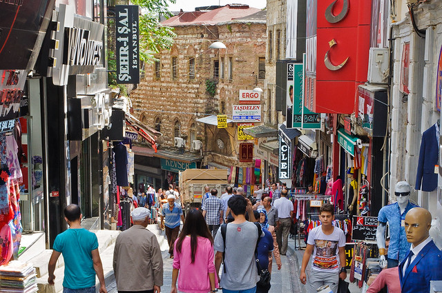
Istanbul ~ Istiklal Caddesi

Urban Sprawl, Socioeconomic Features, and Travel Patterns in Middle East Countries: A Case Study in Iran

The Relationship between Regular Use of Ridesourcing and Frequency of Public Transport Use in the MENA Region (Tehran and Cairo)

Thursday, December 3, 2020

Polycentricity in a developing world: A micro-regional analysis for morphological polycentricity in Turkey

By N. Aydan Sat

Following the publication of ‘European Spatial Development Perspective’ in 1999, a large number of theoretical and empirical studies have been carried out on polycentric spatial development especially in European settlements. The relationship between polycentricity and economic competitiveness, environmental sustainability and social cohesion are some of the main concerns of these studies. This study aims to clarify ‘the meaning of polycentricity’ in the case of Turkey, as a developing country and analyse the relationship between polycentric spatial development and economic competitiveness, environmental sustainability and social cohesion. After calculation of morphological polycentricity of the regions at NUTS-5 level, the propositions on the positive effects of polycentric spatial development on economic competitiveness, environmental sustainability and social cohesion is tested by using Pearson correlation and OLS regression models. The results of the empirical study are mixed for these three subjects. Polycentric spatial development has not positive effects on economic competitiveness and social cohesion in Turkey case. Conversely, a positive effect exists in terms of environmental sustainability. 


istanbul

Read more about urban planning in Turkey:

Friday, July 6, 2018

Urban Travel Behavior in Large Cities of MENA Region: Survey Results of Cairo, Istanbul, and Tehran

By Houshmand E. Masoumi, Amr Ah. Gouda, Lucia Layritz, Pia Stendera, Cynthia Matta, Haya Tabbakh, Sima Razavi, Houshiar Masoumi, Betül Mannasoğlu, Özlem Kılınç, Ashraf M. Sharara, Mahmoud Elnably, Ahmad Alhakeem, Sherzad Ismail, Erik Fruth

The present discussion paper summarizes an urban mobility survey as a part of the project “Urban Travel Behavior in Large Cities of MENA Region” (UTB-MENA) funded by the German Research Foundation (DFG) undertaken in summer and autumn 2017 in Tehran, Istanbul, and Cairo. This data collection was conducted in 18 neighborhoods located in different urban forms related to three different eras: traditional urban form, in-between (transitional) urban form, and new developments. The survey instrument included 31 questions organized in six different sections. As a result of face-to-face interviews with residents as well as quantification of several land use indicators, a database of 8284 validated subjects (Cairo: 2786 , Istanbul: 2781 , Tehran: 2717) was created by the research team based in Berlin, Tehran, Istanbul, and Cairo. The results of 46 variables (24 continuous and 22 categorical) are presented in this paper. The neighborhood-level precision of the findings is 4.5% to 4.7% for individual variables and 1.8% to 2.4% for household variables. These findings make the data representative for the case-study neighborhoods. These data are expected to provide a reliable sample for researchers of the region for the purpose of strengthening human-oriented urban transportation planning and research against the mainstream of transportation engineering by bringing in disaggregate individual urban mobility data into urban transport research of the Middle East and North Africa (MENA) region.
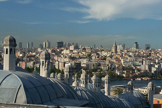
Istanbul rooftops

More about urban transport and urban planning in the Middle East:

Drivers of urban sprawl in two large Middle-eastern countries: literature on Iran and Egypt

A LONGITUDINAL ANALYSIS OF DENSITIES WITHIN THE PEDESTRIAN SHEDS AROUND METRO STATIONS: THE CASE OF TEHRAN

URBANIZATION TRENDS AND URBAN PLANNING STRATEGIES IN THREE MAJOR MIDDLE EASTERN COUNTRIES: IRAN, EGYPT, AND TURKEY

Tuesday, February 13, 2018

Promoting Schoolchildren's Physical Activity by Change in Transport to School Behavior: Statistical Analysis

By Houshmand E. Masoumi

During the past decade, a number or researchers have focused on the interdisciplinary topic of active transport to school (ATS) and children’s health and wellbeing including their body weight and Body Mass Index (BMI). Most of the recent studies are focused on a handful of high-income societies, leaving other countries less researched. Thus, this study targeted both high-income and less-studied contexts within the European context. The aim was to provide reliable inter-contextual data for facilitating comparative studies as well as undertaking preliminary analyses on the contextual differences in children’s walking to school, relationships between parent’s commuting mode choice and that of their children, the associations of built environment with ATS and BMI, and finally noteworthy points for interventions for promoting children’s school-based physical activity. Using the results of surveys undertaken in nine European cities in 2016, statistical analyses were conducted, which led to preliminary results confirming strong significant associations of the built environment with children’s ATS as well as strong and significant associations of parents’ commute mode choice with that of their children. These preliminary results do not confirm significant differences between walking to school in different European contexts. It is probable that these differences exist regarding biking to school, but this may be tested in future research. This study underlines the circumstances of planning a more active school commuting behavior in the future of European societies: activation of 9-12-year-old European children’s school commuting is recommended to be done by changing the parent’s commute mode choices as well as integrating urban planning, transportation planning, and school site selection in future urban plans. Awareness of policy makers, families, and also children may be essential in planning more active school commuting. Applying the results of the surveys done during this project, future research will target inter-contextual differences between factors such as physical activity, ATS, and BMI, correlations between the perceptions of children and parents regarding school commuting and neighborhood and the associations with physical activity and BMI, the possible importance of city size in determining all the above factors regardless of the national context, and the differences between the tendencies and phenomena influencing school commuting-related physical activity and BMI in emerging European countries compared to high-income countries.

Read more  

 
Schools Out Girls

More about children's active commuting to school:

Thursday, August 3, 2017

Children’s Travel to School and their Body Weight; Results of a Survey in Seven European Countries: Technical Report

By Masoumi, Houshmand, E.; Zanoli, Gabriele; Papageorgiou, Athanasios; Smaga, Soultana; Miloš, Ana; Van Rooijen, Martin; Łuczak, Monika; Komorek, Joanna; Çağan, Birol; Calabrese, Carla; E. Jamerson, Gordon; Patsakas, Georgios; Parisopoulos, Georgios; Meimaridis, Ioannis; Anagnostaras, Konstantinos; Perrostis, Andreas; Dessi, Eleni; Družeta, Toni; Udović, Tatjana; Daams, Ingmar; Drużek, Paweł, and Dalcı, Ahmet 


Problem: A number or researchers have recently focused on the interdisciplinary topic of active transportation of children and adolescents, their physical activity, and their body weight as an important aspect of their health. Such studies have been dominantly undertaken in a specific geographical context. Lack of contextual studies necessitates data collection with samples covering different countries and/or regions applying a uniform methodology. Such a lack of data is observed in both Europe and overseas.
Objective: This survey attempts to collect dissaggregate data about the travel behaveior of children of 9-12 years of age and their parents, children’s body specifications, and their households characteristics as well as aggregate data about the built environment of their school.
Method: direct questioning based on a standard questionnaire consisted of 26 questions was conducted in spring and summer of 2016 in nine cities in seven European countries (Foggia, Italy; Berlin, Germany; Thessaloniki, Greece; Rijeka, Croatia; Utrecht, The Netherlands; Łódź, Poland, Konstantynow, Poland; Malatya, Turkey, and Doğanşehir, Turkey).
Results: Out of 2735 children handed out the questionnaires, the parents of 1424 schoolchildren filled out the questionnaires, 1304 of which were validated and kept for analysis. This makes an overall response rate of 52.07 percent. In this report, the researchers of M.A.P.S. project have provided detailed descriptive findings separately for each case-study citiy as well as for the whole cities together as one sample.

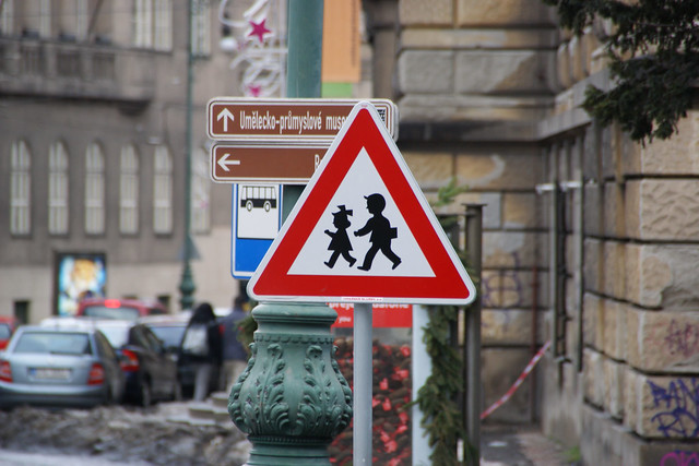
Warning Sign "Children" in Prague, Czech Republic

More about urban planning and children's health:

Active Transport to School and Children's Body Weight: A Systematic Reivew

Active transport to school and the risk of obesity


Systematic Review of Active Commuting to School and Children’s Physical Activity and Weight

Walking, Cycling, and Obesity Rates in Europe, North America, and Australia

Societal trends, mobility behaviour and sustainable transport in Europe and North America

Friday, December 23, 2016

URBANIZATION TRENDS AND URBAN PLANNING STRATEGIES IN THREE MAJOR MIDDLE EASTERN COUNTRIES: IRAN, EGYPT, AND TURKEY

By MARYAMSADAT HOSSEINI, AMR AH. GOUDA, HOUSHMAND E. MASOUMI


Rapid urbanization has turned into a problematic phenomenon laying negative effects on the Middle Eastern cities and their peripheries. Although fast increase in urban population of the countries of the region has been well-researched, the connections to urban development strategies and patterns are being neglected. This paper examines the time coincidence of some of the dominant planning trends of the past decades that are considered to be associated with the intensive urban population changes. The paper attempts to discuss over the points in which the three countries witnessed significant increase and decrease in fertility rates. For that, the data of the World Bank have been applied. The graphs seen in this paper have been produced by the Google public data from the World Bank website, which provides the possibility of separating urban and rural populations. The descriptive analysis of this study shows that these vigorous changes of population growth rates have been more powerful in Iran and Turkey and steadier in Egypt. Examples of weak planning in the three target countries of this study, Iran, Egypt, and Turkey, such as failure in new city planning in Egypt, extensive sprawl in Turkish cities, rural-urban migration in Iran and Turkey, and the policy of wholesale land selling in Iran depict uncontrolled and vis-à-vis urban planning taking the wrong route. It is concluded that controlling urbanization trends in emerging countries, like the Middle Eastern states, requires a strong and strict urban planning system that avoids trial and error.


Peripheral Shoppers  

More about cities and urban planning in the Middle East:

Urban Transformations of the Mediterranean Cities in Light of Developments in the Modern Era

TENSIONS AND TRANSFORMATIONS IN THE MASTER PLANNING PROCESS OF ISTANBUL

Upgrading informal settlements in Egypt towards a sustainable urban development

The Status of Urban and Suburban Sprawl in Egypt and Iran

A REGIONAL ANALYSIS OF URBAN POPULATION AND TRANSPORT ENERGY CONSUMPTION

Urban Sprawl Pattern Recognition Using Remote Sensing and GIS – Case Study Shiraz City, Iran

A THEORETICAL APPROACH TO CAPABILITIES OF THE TRADITIONAL URBAN FORM IN PROMOTING SUSTAINABLE TRANSPORTATION

The Study of Land Use Changes in the Tehran Metropolitan Area by Using MOLAND Model

Tuesday, December 18, 2012

Modeling street connectivity, pedestrian movement and land-use according to standard GIS street network representations: A Comparative Study

by Ayse Ozbil, John Peponis, and Brian Stone

Two 1 mile x 1 mile areas in Atlanta and two 1 mile x 1 mile areas in Istanbul are compared to establish correlations between the distribution of pedestrian movement and street configuration. In each city, one area is chosen in the urban center and the other in one of the residential neighborhoods. The aim is to identify both underlying regularities that link street connectivity to pedestrian flows and differences regarding the volumes of pedestrian presence that can be traced to the influence of different modes of space appropriation. Based on pilot studies we expect to show that the volumes of pedestrian traffic per road segment can be post-dicted based on an analysis of standard GIS-based representations of street networks to implement two new measures of connectivity: reach, which measures the length of street network accessible within a given walking radius, and directional distance, which measures the number of direction turns needed to get to all accessible parts of the network. The work has several consequences. First, it complements existing work on the influence of density and design upon pedestrian movement by bringing into sharper focus a variable that clearly partakes of both design and density, namely the connectivity of the street network and its configuration. Second, it helps clarify that while land-use may play an important role in determining the average volume of movement in a given area, spatial layout plays a more important role in determining the distribution of movement within an area. This has consequences for at least some kinds of local urban economy as the comparative analysis will show: in Istanbul retail still relies on the “passing trade” more than it does in Atlanta because of the finer grain not only of the street network but also the size of businesses.


more about Space Syntax:

TRADITIONAL SHOPPING: A Syntactic Comparison of Commercial Spaces in Iran and Turkey

Can Betweenness Centrality Explain Traffic Flow?

Correlating Densities of Centrality and Activities in Cities: the Cases of Bologna (IT) and Barcelona (ES)

Correlating street centrality with commerce and service location in cities

Street Centrality and Densities of Retails and Services in Bologna, Italy

Evaluated Model of Pedestrian Movement Based on Space Syntax, Performance Measures and Artificial Neural Nets

THE STREETS OF INNOVATION: an exploratory analysis of knowledge transfer in the public realm

An integration of space syntax into GIS for modelling urban spaces

Thursday, November 29, 2012

TRADITIONAL SHOPPING: A Syntactic Comparison of Commercial Spaces in Iran and Turkey

by Erincik EDGÜ, Alper ÜNLÜ, Mehmet Emin ŞALGAMCIOĞLU, and Ashkan MANSOURI

Commerce is an ancient economical system that enables establishment of legal and ethical foundations, strengthening of social ties, improving cultural relationships, trading values and technology as well as goods. Trading routes necessitates places for accommodation and rest both for traders and pack animals, horses, camels, oxen and such. For many centuries, caravanserais helped as design solutions for this purpose. However as the stopping places on routes began to act as small trading towns, sarās or hans took over the accommodation service for traders. Although administrative, social, cultural, religious and linguistic distinctions present many functional and semantic variations, having situated on the ancient routes and ports of the Silk Road, cities and states of the west Asia have developed a traditional insight to shopping activity and design that are being preserved in the hearts of these ancient cities.
Although there may be predesigned grid or crisscross exceptions, in most cases, traditional Islamic commercial i.e. shopping spaces are built in time, with expansions in relation to the organic pattern of the city and street layouts. In Turkish social system, covered bazaars are usually built as a part of a larger complex including, hamams, soup kitchens, and such as a source of revenue for mosques, religious or charitable trusts known as vakıfs, where the donated assets cannot be turned over to individuals or institutions. In Iranian system however, covered bazaars are built by state authorities or wealthy individuals solely for the purpose of commerce, although the latter may also include mentioned public amenities. On the other hand, unlike Turkish organisations, having a strong political and/or religious demonstration tradition, Iranian covered bazaars act as a reflection of social indicator. This distinction presents formal variations in layout and attributes semantic uses to spaces as well.
Although sarās or hans were initially used for accommodation purposes in both cultures, they also act a guild for specific branch of trade or manufacturing with their enclosed square/rectangular forms having courtyards or eyvans. However, Iranian bazaar structure relies on linear shopping strips rāstās or arastas combined to compose chārsugs or çarşıs at intersections and meydans serving as the hubs of the network. In Turkish system on the other hand, bedesten, the covered and enclosed core building, where the most expensive and valuable goods are exchanged, determines the formation of the whole bazaar. This building and arastas of the Turkish bazaars are predesigned and built in single sessions without any expansion. Thus, although in both cultures, both organic and pre planned bazaar systems, developed from linear strips are seen, contrary to the articulated and clustered Iranian bazaars, Turkish bazaars formed through connection of arastas acting as gridiron building blocks. 
This research focuses on the comparison of the physical layout of Iranian and Turkish traditional covered bazaars in the context of Tabriz and Istanbul respectively. The usage of gathering spaces, articulation of nodes, connection of main or secondary axes in forms of hans, bedestens, eyvans, courtyards, meydans with streets or arastas and such, are the syntactic experiment areas of the research. The research hypothesis assumes that guild formation affects the articulation and spatial configuration of the spaces that in return changes the usage in terms of social gatherings versus pedestrian flow in the traditional covered bazaars.


Busy Morning @ Historic Grand Bazaar, Istanbul
more about Space Syntax:

Can Betweenness Centrality Explain Traffic Flow?

Correlating Densities of Centrality and Activities in Cities: the Cases of Bologna (IT) and Barcelona (ES)

An integration of space syntax into GIS for modelling urban spaces

An integration of space syntax into GIS for modelling urban spaces

SPATIAL GROWTH AND FUNCTION IN A JAVANESE COASTAL CITY

Agent-based Simulation of Human Movement Shaped by the Underlying Street Structure

Space Syntax and Transit Networks

Wednesday, October 31, 2012

Paratransit for mobility impaired persons in developing regions: Starting up and scaling up

by Access Exchange International

It is about addressing the need of persons with disabilities and others for paratransit service when accessible “fixed-route” bus or rail service is not available or, if available, cannot be used by persons who need more specialized transportation.
This guide is written for city officials, transit operators, entrepreneurs, non-governmental organizations (NGOs), social service agencies, and others who may wish to start up or expand door-to-door paratransit services to help mobility-impaired persons to get to where they need to go. It is not aimed at countries which already have such services and have the resources and money to support and pay for them, although many of our findings will be relevant to them. Rather, this guide provides information and guidance for cities and towns and villages in less-wealthy regions faced with many barriers to such transportation. These barriers are so great that many cities, to say nothing of the countryside beyond these cities, have not begun to address the task of providing paratransit for those who most need it.
The financial, infrastructure, and operational issues are daunting. In many rural areas, nearly everyone is mobility-impaired because there is very little public transportation. The situation can be equally bad in cities for persons with disabilities who are unable to use bus and rail lines. They remain trapped where they live, unable to get to work, to school, or to medical help and other activities due to the prohibitive cost of hiring a taxi or finding an accessible vehicle.
To provide guidance in these situations, we will be helped by the example of practitioners in cities which have begun to address some of the needs of mobility-impaired citizens. We will look at case studies of paratransit systems in São Paulo, Cape Town, Moscow, New Delhi, Istanbul, and Kuala Lumpur. We will also bring in the hard-won knowledge of paratransit systems in countries with longer histories of paratransit provision, such as the USA and France, or wealthier cities such as Hong Kong or San Francisco.
If the problems are large, so are the opportunities! This guide is about leveraging opportu- nities to overcome problems.


Pierce Transit Vans
more about sustainable transportation:

A “STEP” TOWARDS SUSTAINABLE TRANSPORT: A CASE STUDY OF PENANG, MALAYSIA

Impact Assessment of Sustainable Public Transportation System on Quality of Life in Tehran

China’s Hangzhou Public Bicycle: Understanding Early Adoption and Behavioral Response to Bikesharing

Chinese bike-sharing dwarfs US and European programs

Measuring Perceived Accessibility to Urban Green Space: An Integration of GIS and Participatory Map

The eco-city: ten key transport and planning dimensions for sustainable city development

Wednesday, April 18, 2012

Urbanization and Natural Disasters in the Mediterranean Population Growth and Climate Change in the 21st Century Case Studies on Izmit, Algiers and Alexandria

by Hans Günter Brauch

This paper analyzes the relationship between urbanization – in relation with population growth and climate change – (as causes) and natural disasters as outcomes of environmental stress for the Mediterranean region from 1900 to 2001 – with a specific focus at three case studies in Turkey, Algeria and Egypt. It includes trends of urbanization up to 2015/2030, for population growth up to 2050, and projections of climate change impact models until 2100 that will increase both the vulnerability to and impact of natural disasters. Based on a medium definition of the Mediterranean space (figure 1) that includes all Mediterranean riparian countries plus Portugal, Jordan and the former Yugoslav Republic of Macedonia (Brauch 2001, 2001a, 2003) this paper addresses both the increasing vulnerability of major cities to geophysical and hydro-meteorological disasters due to rapid urbanization combined with extreme poverty in most countries of the Middle East and North Africa (MENA).


more about urbanization:

Strategy for Sustainable Urban Development: A Case Study of Urmia City, Iran

Can Chongqing's Urbanization Survive China's Shrinking Workforce?

Analyzing Land Use Change In Urban Environments

Modeling the environmental impacts of urban land use and land cover change—a study in Merseyside, UK

Remote Sensing and Urban Growth Models – Demands and Perspectives

Urban Transport Trends and Policies in China and India: Impacts of Rapid Economic Growth

Sunday, April 15, 2012

MESSAGE FROM TRADITIONAL SETTLEMENTS FOR FUTURE CITIES

by S. Ecemis Kilic

The concepts of “liveable city” or “sustainable city” are used widely for describing what the expectation of the future cities is. The concepts have some common objectives and refer to human oriented, environmentally friendly, economically efficient and socially sound, urban areas. When different traditional urban fabrics in Turkey have analyzed, it is seen that they  are  successful with  respect  to  sustainable  /liveable  urban  design  parameters  although they were not designed by a designer or planner.  The paper aimed to attain some principles for the more liveable future cities from the traditional urban forms and to find instruments for  transferring them in today’s planning and design theories and practices.


more about urban Turkey:

Urban Reforms of Tanzimat: Early Urbanization and Transportation Practices in The Formation Process of Turkish Reconstruction System (1839-1908) in Bursa The First Capital City of Ottoman Empire

UNDERSTANDING URBAN GROWTH PATTERNS: A LANDSCAPE ECOLOGY POINT OF VIEW

De-spatialized Space as Neoliberal Utopia: Gentrified İstiklal Street and Commercialized Urban Spaces

Accessibility effect on urban land values

APPLICATION OF THE URBAN REALMS MODEL TO ISTANBUL

Friday, February 10, 2012

Urban Reforms of Tanzimat: Early Urbanization and Transportation Practices in The Formation Process of Turkish Reconstruction System (1839-1908) in Bursa The First Capital City of Ottoman Empire

by M.Bilal Bagbanci and Ozlem Koprulu Bagbanci

Bursa, since the establishment of the Ottoman Empire, being on the important trade roads and having a capital accumulation as a result of silk production, was one of the first cities of modernization activities applied. Bursa maintained its importance even during the Republican Period and became one of the most important cities of the country and today is the fourth biggest and the industrialized city in Turkey. Social, political, economical and cultural changes occured with the reforms starting with the 1839 Edict of Tanzimat that aimed at modernizing the society and the government and centralizing the political power began in the Ottoman Empire. After the Tanzimat Reforms transformation of the city changed and planning processes began in Bursa according to the vision of Governors. The theresholds of the city are very important data for a sustainable planning for the city planners. Main aim of this study is to investigate the changes and transformations of the city according to the changes in the socio-economical and cultural properties for the city planners.


Bursa, Turkey, by iriskh

Bursa, Turkey, photo by cocoate.com

more about urban planning in Turkey:

UNDERSTANDING URBAN GROWTH PATTERNS: A LANDSCAPE ECOLOGY POINT OF VIEW

De-spatialized Space as Neoliberal Utopia: Gentrified İstiklal Street and Commercialized Urban Spaces

Globalisation, Cleaner Energy and Mega-Cities: Options and Messages for Turkey/Istanbul

THE PLANNING HISTORY OF TURKEY: POLICIES, PRACTICES, BREAKDOWNS

Polycentric Urban Development and Istanbul

Wednesday, February 1, 2012

UNDERSTANDING URBAN GROWTH PATTERNS: A LANDSCAPE ECOLOGY POINT OF VIEW

by H. Esbah, D. Maktav, L. Atatanir , and F. Sunar Erbek

Landscapes always change, as they are the expression of the constant interaction between natural and cultural forces in the environment. Applied to an urban/peri-urban case, changes are seen as a menace. By identifying the past urbanization patterns, policy makers and planners can gain better insight into the contributing factors that have resulted in the most problematic development patterns now and into the future. Remote sensing and GIS technology seem to be a proper and effective tool to understand and present the phenomenon. Thus, this study aims to identify and compare the development pattern in the town of Aydin, Turkey to highlight the underlying process by utilizing satellite images between 1986 and 2002. Population information obtained from the State Statistics Institute is used along with satellite images for the land use/land cover change analyses. Existing ancillary data and aerial photographs are also utilized. Several critical land resource impact indicators associated to urbanization are being elaborated: density of new urbanization, loss of agricultural areas, and loss of core habitat areas. The results indicate that urbanization pattern of the town of Aydin is not so impacting natural core habitats so far. However, the investigations yielded some warning signs with regards to the density of population and the agricultural land loss. The distribution of population is favoring the rural areas. This is causing lower rates of urbanization compared to other cities in Turkey. But the establishment of industrial areas would attract more people in the future. Therefore, the shift has to be occurred in the traditional land use management, which is only concerning those areas within the municipality boundary, to include the peripheral settlements and the landscape context.

Aydin, Turkey, by Kemal Y.

more about urbanization and urban planning in Turkey:

De-spatialized Space as Neoliberal Utopia: Gentrified İstiklal Street and Commercialized Urban Spaces

THE PLANNING HISTORY OF TURKEY: POLICIES, PRACTICES, BREAKDOWNS

Polycentric Urban Development and Istanbul

APPLICATION OF THE URBAN REALMS MODEL TO ISTANBUL

Implications of an Urban Renewal Based State-Led Gentrification Process in a Roma Neighborhood in Istanbul

Accessibility effect on urban land values

Thursday, January 19, 2012

De-spatialized Space as Neoliberal Utopia: Gentrified İstiklal Street and Commercialized Urban Spaces

by Yaşar Adnan Adanalı

Today İstanbul ranks seventh among world cities in the number of foreign visitors and international meetings it hosts and fifth in the number of dollar millionaires living within its premises.[2] It is possible to list many other striking statistics about İstanbul. What these numbers indicate is that İstanbul is moving at a fast pace towards becoming a global city and it finds its place in the world city map as a global magnet of capital and people. “Global city” is a project made possible via the reproduction of the city in the framework of processes of capitalist accumulation and mechanisms of neoliberal production and consumption. This project consists of spatial, economic and social processes as well as those that are by content and application political.
Istiklal Street, Istanbul, Turkey, photo by Augapfel
Although İstanbul’s current transformation has been presented as a non-Western miracle of development in the face of the destructive effects of economic crises, it is actually possible to think of this transformation as a “skillful” application of well-known global(urban)ization strategies by an alliance formed between the state, the capital and local governments: (a) The segmentation of the city into detached islands through the construction of profitmaking fragments of the global urbanization catalogue, such as shopping malls, gated communities, mass housing settlements (TOKİ: Republic of Turkey Prime Ministry Housing Development Administration of Turkey), residences, plazas, airports, techno parks, golf courts, cruise harbors; (b) rendering lower and middle classes “powerless” in the face of this transformation by means of forced evictions and legal pressure in order to secure the land necessary for the construction of these urban fragments; such that social and class-based segregation is conducted alongside spatial segregation; (c) the production of urban corridors and transportation infrastructures that will facilitate the flow of capital, goods and humans between these fragments of the urban catalogue. Consequently, while prioritizing the city of fluxes composed of corridors to the city of integrated urban spaces, İstanbul’s global(urban)ization project constructs wealthy spaces  on the sites of poor spaces. Lower class neighborhoods inhabited by the city’s poorest, which at time same time carry the highest potential in terms of the rising value of urban land, are refashioned by local municipality-private sector partnerships and allotted to new İstanbulites with highest cultural and economic capital (such as local and foreign executives working in sectors that are in great demand in the post-industrialist era like finance, design and informatics, as well as professionals of the institutionalized field of arts and culture).
The aforementioned strategies can be explained with reference to gentrification processes inherent to neoliberal urban transformation. While these processes construct new wealthy spaces and forge new socio-spatial relationships, they are abstracted from the concrete space where the transformation is taking place; they are (de-spatialised).

Istiklal Street, Istanbul, Turkey, photo by Mrmya

Istiklal Street, Istanbul, Turkey, photo by Mrmya

Istiklal Street, Istanbul, Turkey, photo by Vince Millett

Istiklal Street, Istanbul, Turkey, photo by bluedvls11

Istiklal Street, Istanbul, Turkey, photo by emredjan

more about Istanbul:

Globalisation, Cleaner Energy and Mega-Cities: Options and Messages for Turkey/Istanbul

Modeling street connectivity, pedestrian movement and land-use according to standard GIS street network representations: A Comparative Study

THE PLANNING HISTORY OF TURKEY: POLICIES, PRACTICES, BREAKDOWNS

Polycentric Urban Development and Istanbul

Thursday, March 10, 2011

Globalisation, Cleaner Energy and Mega-Cities: Options and Messages for Turkey/Istanbul

by Mehmet Öğütçü

Tectonic changes are occurring not only in the world financial system, trading and investment, energy, geopolitics, and technology; a fundamental transformation is also underway in the way the cities have been managed and regenerated, creating profound implications for mega-cities such as Istanbul. The global population is congregating in our cities. Eighty per cent of the world’s estimated nine billion people in 2050 are expected to live in urban areas. Our cities and urban areas face many challenges from social to health to environmental. The impacts of cities and urban areas are felt in other regions which supply cities with food, water and energy and absorb pollution and waste. However, the proximity of people, businesses and services associated with the very word ‘city’ means that there are also huge opportunities. Indeed, well designed, well managed urban settings offer a key opportunity for sustainable living.


Istanbul, Turkey, by obinho27
more articles about Istanbul:

Modeling street connectivity, pedestrian movement and land-use according to standard GIS street network representations: A Comparative Study

THE EFFECTS OF PROPOSED BRIDGES ON URBAN MACROFORM OF ISTANBUL: a syntactic evaluation

APPLICATION OF THE URBAN REALMS MODEL TO ISTANBUL

Sunday, February 6, 2011

THE EFFECTS OF PROPOSED BRIDGES ON URBAN MACROFORM OF ISTANBUL: a syntactic evaluation

by Ayşe Sema Kubat, H. Serdar Kaya, Fırat Sarı, Gülşen Güler, and Özlem Özer

In recent years, the third bridge on Istanbul Bosporus has become a topic of lively debate but the probable results of introducing this new connection for the two sides of Istanbul are yet to be examined and evaluated. This paper investigates impacts of the existing and proposed bridges on the spatial development of the metropolitan area of Istanbul and explains the interaction between land use on urban macro form and transportation network via simulating the probable effects of the third bridge on the urban structure. The study has prepared and examined two syntactic maps that refer to two different time periods; the current situation and the future city network according to the proposed alternatives. The land use and urban growth data have also been collected for the two time periods available; before the two bridges were built and the current situation.
The study aims to estimate the possible effects of the new alternatives on land use, urban spread and location of Central Business District (CBD), by comparing the data of the earlier, current and future situations. According to syntactic analyses, it is clearly seen that the activities of CBD have expanded from the historical Eminönü district to the new CBD of 1980’s through Mecidiyeköy and Maslak axis, which also reflects the existing situation of CBD of Istanbul (Figure 5) (Kubat, 2001). The syntactic maps further show a shift of the central cores of Istanbul and a strong interaction between urban macro form and the existing and proposed bridges. This shift has been a potential threat for the northern sides of the metropolitan city, a vital region for the city as it has river basins and forest areas.
Space syntax have been built on the concept of pedestrian movement. This research, however, also investigates transportation system and traffic flow, which differs from pedestrian movement. The traditional ways to represent the urban network have some inefficiencies in making depictions about vehicular movement. Therefore, in order to represent the urban grid with priority given to the vehicular movement, a new deformed map of Istanbul has been prepared. Both the syntactic analyses and the analyses of deformed transportation network show the dominant character of highways and their effects on land use, and thus the possible direction of urban sprawl in Istanbul. 
In light of the two bridge experiences, and comparative analysis of urban macro form in various years from 1925 to 2005 using space syntax, this study will help to evaluate the likely effects of the proposed bridge alternatives on the urban development for sustainable future of Istanbul Metropolitan area. The study aims to be a source forurban planning in greater Istanbul and offer recommedations for today and future. The results of this study can also benefit other cities that deal with similiar problem of connecting two urban regions.


Mecidiyeköy , by portukcan
more about urban planning in Turkey:

Accessibility effect on urban land values

THE PLANNING HISTORY OF TURKEY: POLICIES, PRACTICES, BREAKDOWNS

Polycentric Urban Development and Istanbul

Friday, February 4, 2011

Accessibility effect on urban land values

Mehmet Topçu

There has always been a demand for real estate with the aim of accommodation and/or making investments. The real estate is also vital for a country’s economy as urban land value is determinative in both urban planning and real estate activities in economies of today’s world. Knowing the factors affecting the land values is an important advantage in identifying the future of urban development and anticipating probable changes. This study aims to discuss these values from housing perspective. There are many factors affecting housing land values. Among all, this study examined the accessibility factor related to housing land values. The study aims to discuss which accessibility factor affects mostly and to propose an original methodology with reference to Istanbul, a world metropolis. This study has been conducted using GIS database, statistical methods as well as space syntax method. The spatial configuration is examined based on two different integration parameters; local and global, used in space syntax approach. In the scope of this study, there are 18 different variables that are analyzed in 403 streets in Istanbul. The data collected is entered in GIS and statistical analyses have been conducted. Based on the analysis, the distances from the sea are the most related parameter affecting housing land values. The others are the distance from the central business district, spatial integration values, universities and sanitary facilities are effective factors in determining housing land values respectively. The other 13 parameters affect the results with low level. This study is important as it offers a possibility of integrating different approaches including space syntax, which examines factors affecting the housing land values. This study with its original methodology proposed is expected to contribute the further studies in city planning, urban design and real estate.


Middle class houses in Istanbul, Turkey, photo by dlisbona
Istanbul houses, by CyberMacs

read more about Space Syntax:

THE ROLE OF SPACE SYNTAX IN SPATIAL COGNITION: evidence from urban China

Solutions for Visibility Accessibility and Signage Problems via Layered Graphs

New Developments in Space Syntax Software