Like Urban Research on Facebook

Thursday, August 29, 2019

Accessibility in Cities: Transport and Urban Form

By Philipp Rode, Graham Floater, Nikolas Thomopoulos, James Docherty, Peter Schwinger, Anjali Mahendra, Wanli Fang, Bruno Friedel, Alexandra Gomes, Catarina Heeckt, and Roxana Slavcheva

This paper focusses on one central aspect of urban development: transport and urban form and how the two shape the provision of access to people, goods and services, and information in cities. The more efficient this access, the greater the economic benefits through economies of scale, agglomeration effects and networking advantages. This paper discusses how different urban accessibility pathways impact directly on other measures of human development and environmental sustainability. It also presents the enabling conditions for increasing accessibility and low-carbon mobility in cities. This paper is one of three papers by LSE Cities that form part of the cities research programme of the New Climate Economy (NCE) project for the Global Commission on the Economy and Climate. The two other contributing papers cover ‘Cities and the New Climate Economy: the Transformative Role of Global Urban Growth’ (NCE Paper 01) and ‘Steering Urban Growth: Governance, Policy and Finance’ (NCE Paper 02).


Finally 

More articles about accessibility and urban form:

A comparative study of the morphological characteristics of residential areas in San Francisco

Policies for Sustainable Accessibility and Mobility in Urban Areas of Africa

UNDERSTANDING PERCEPTIONS OF ACCESSIBILITY AND MOBILITY THROUGH STRUCTURATION THEORY

Modelling Perceived Accessibility to Urban Amenities Using Fuzzy Logic, Transportation GIS and Origin-Destination Surveys

The Effects of Teleshopping on Travel Behavior and Urban Form

Accessibility Measures: Overview and Practical Applications

MEASURING ACCESSIBILITY AND PROVIDING TRANSPORT CHOICE

Wednesday, August 28, 2019

DESIGNING THE HEALTHY NEIGHBORHOOD: DERIVING PRINCIPLES FROM THE EVIDENCE BASE

By Ellen M. Bassett, Timothy Beatley, Reuben M. Rainey, Robert Lamb Hart, David P. Howerton, J. Timothy McCarthy II, Paul Milana, and Stuart Siegel

The built environment is a critical factor in human health outcomes. In the late 19th and early 20th centuries, for instance, poor urban environments were a great threat to city residents from all walks of life. Rapidly growing cities experienced severe epidemics of infectious diseases, including tuberculosis, cholera, typhoid, and yellow fever. These epidemics were effectively mitigated through investment in public infrastructure and better urban planning. Sewers were built to manage human waste, public parks were created give access to fresh air, building standards were changed to ensure safe shelter, and development regulations served to reduce traffic congestion and relieve urban overcrowding. Importantly, visionary architects and planners of the time recognized the role of urban design as a tool for improving health. Some of the earliest American suburbs—like Riverside, Illinois, planned by Vaux and Olmstead—were created as havens from the industrial city and designed in a way that incorporated nature and health-giving open space throughout the model community. In reaction to heavily polluted London, Ebenezer Howard envisioned the “garden-city” which strove to integrate the best of the city with the benefits of rural life. His iconic vision informed the thinking of other leading 20th century designers and urbanists who created places like the New Deal-era Greenbelt towns—practical but utopian communities designed to provide decent housing, strong community life, and nearby employment and amenities to its residents. Our triumph over the acute diseases of the city provides important lessons for today since communities across the United States now face a different type of health threat—namely the spread of chronic diseases, such as asthma, Type-2 diabetes, cancer, and heart disease.1 Of particular concern relative to the rise of chronic diseases is the global rise in levels of obesity. The prevalence of obesity or extreme obesity for adults aged 20 to 74—conventionally measured as a Body Mass Index exceeding 30 for obesity and 40 for extreme obesity—has risen from 14.3% in 1960-62 to 41.9% in 2010-2011 (Fryar, et al.(a), 2014). Child and adolescent (aged 2 to 19) obesity now measures at 16.9%, up from 5.2% in 1971-1974 (Fryar, et al.,(b), 2014). At the same time that obesity has risen, average rates of physical activity have fallen for both adults and children. In the US, only 48% of adults meet the Surgeon General’s Guidelines for physical activity, namely 150 minutes of moderate intensity aerobic activity like brisk walking every week (http://www.cdc.gov/physicalactivity/data/ facts.html). Physical inactivity amongst children is also a concern. For instance, in 2009, 13 percent of children five to 14 years old usually walked or biked to school compared with 48 percent of students in 1969. The concern with obesity and physical inactivity is so pronounced in our public health conversations because of the known link between these factors and chronic diseases such as diabetes, heart disease and various forms of cancer.


Measuring Neighborhood Quality of Life: Placed-Based Sustainability Indicators in Freiburg, Germany

By Craig A. Talmage, Bjoern Hagen, David Pijawka, and Cara Nassar

There has been a recent upswing of academic interest in the social dimensions of sustainable cities, especially the dynamics of Quality of Life (QoL), Environmental Equity, Ecosystem Services, Eco-Friendliness, Public Engagement, and Well-Being and Happiness Indicators. These factors are only now being evaluated as critical aspects of sustainable place-making and community development. This paper explores the social dimensions of neighborhood development in what some believe to be one of the most sustainable cities—Freiberg, Germany. We look at two neighborhoods that were specifically designed and built with sustainability principles and practices at their core. The authors surveyed residents of these neighborhoods to measure their levels of well-being, satisfaction with place, and other important QoL factors. Quantitative data was ascertained from residents using a survey questionnaire. The results show a high correlation between QoL factors as a function of place-making and sustainability practice. 


More papers about quality of life:

Impact Assessment of Sustainable Public Transportation System on Quality of Life in Tehran

Tuesday, August 27, 2019

Walking and Transit Use Behavior in Walkable Urban Neighborhoods

By Devon McAslan,

Urban transportation is one of the most important target sectors for creating more sustainable and livable cities. Many US cities are making huge investments in public transit infrastructure in efforts to lower automobile use, encourage compact development, and curb greenhouse gas emissions. This paper explores how differences in the urban environment impact walking and transit use and how urban residents utilize walking and transit as modes of transportation. I use data from neighborhood mapping, observations, surveys, and interviews to explore these two questions. I find that walking is indeed the main mode of transportation within the urban core of Seattle. In contrast to what mainstream urban planning literature would suggest, residents living in the dense urban core of Seattle do not appear to be transit dependent and continue to drive at higher than expected rates. To help explain this, I explore how the ‘theory of urban fabrics’ applies to walkability and transit planning. This new emerging theory encourages planners to rediscover how to prioritize different modes of transportation within different parts of the city instead of current trends, which advocate for multimodal and shared streets throughout the city. Evidence indicates that the most walkable neighborhoods are those that have the least number of conflicts between pedestrians, transit, and automobiles, and that the transit system in Seattle suffers because it is not prioritized over cars in any significant way. This reduces the likelihood that individuals will make the switch to transit over driving, which has important implications for transportation planning policies.


Kalamazoo is a Walkable Community Photo by Michigan Municipal League

More articles about walkability:

Urban Travel Behavior in Large Cities of MENA Region: Survey Results of Cairo, Istanbul, and Tehran


Thursday, June 27, 2019

Understanding Urban Travel Behaviour by Gender for Efficient and Equitable Transport Policies

By Wei-Shiuen Ng and Ashley Acker

Gender is one of the key socio-demographic variables that can influence travel behaviour, but it is often the least understood. Understanding travel behaviour by gender will help better design transport policies that are efficient and equitable. Due to the gendered division of work in households, women often have multiple tasks and activities. As a result, women are more likely to have shorter commute distances, to chain trips, to have more non-work related trips, to travel at off-peak hours, and to choose more flexible modes. This study examines travel behaviour by gender in eight different cities, across three different continents, focusing on transport mode, trip purpose, travel distance and departure time for Auckland, Dublin, Hanoi, Helsinki, Jakarta, Kuala Lumpur, Lisbon and Manila. The most common trends found in the cities are that women tend to travel shorter distances and prefer public transport and taxi services to cars more than men.


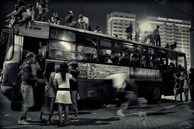
Di atas bus

Read more about urban travel transportation planning:

Economic Impacts of Adopting a Sustainable Transport System in Beirut

A critical review of new mobility services for urban transport

Urban Travel Behavior in Large Cities of MENA Region: Survey Results of Cairo, Istanbul, and Tehran

Longitudinal correlations of car ownership with socio-economics, urban form, and transport infrastructure in Latin America: Example from Ensenada, Mexico

Active Transport to School and Children's Body Weight: A Systematic Reivew

An Analysis of Car Ownership in Latin American Cities: a Perspective for Future Research

A dynamic formulation for car ownership modeling

Potential Impacts of Climate Change on U.S. Transportation

Monday, November 19, 2018

Economic Impacts of Adopting a Sustainable Transport System in Beirut

By Mazen Omran, Johnny Ojeil, and Youssef Fawaz

The proposed Beirut Master Plan aims to put the city back on the international map as a hub for trade and investment, a place to work, and a destination for leisure. The execution of this plan has started with major construction works taking place in the Beirut Central District (BCD) and its planned natural extension on reclaimed land known as the New Waterfront District (NWD).
However, this proposed Master Plan may not achieve its main economic objectives due to the lack of transport infrastructure and multi-modal systems, i.e. transport is lagging behind. Congestion levels are currently unacceptable and will get worse in the future as a result of these development proposals. The key missing link is that Beirut is lagging on the sustainable public transport front and therefore it will not be able to economically compete in a strong manner with other cities in the region. 
The work carried out in this paper demonstrates the economic benefit of a sustainable transport system. It compared a scenario with and without such system, and calculated loss time as a result of being held up in congestion during key peak hours mainly due to relying entirely on the private car. The work demonstrates that in addition to reducing congestion levels a sustainable transport system will generate benefits related to travel time, accident costs, vehicle operating costs, carbon emissions, environmental impacts, wellbeing of individuals, attraction of international companies to locate in Beirut with reduced congestions levels prevailing, positive effect on business efficiency, and wider labor catchment in terms of penetration of non-car owning communities thus improving labor mobility and accessibility.
Qualitative and quantitative analyses were carried out to determine the impacts of adopting a sustainable transport system on the economy. The results were alarming for the ‘Do Nothing Scenario’, i.e. remaining reliant on the private car as a sole means of transport. The analyses showed that without a road map adopting a sustainable transport system, Beirut will reach an economic standstill. Therefore, Beirut will have to develop a multi-modal transport system to become resilient and to be able to meet the economic growth that is being pursued by stakeholders and interested parties alike.
A broad but critical Action Plan was produced as part of the work that set the key functions required to move transport into a full multi-modal system that will give people a real choice to choose based on policy changes and traffic management initiatives including parking control.


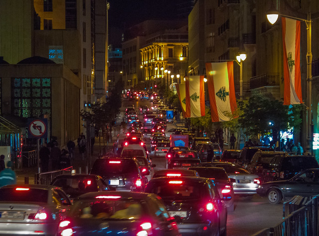
Rue Weygand, Beirut Central District, Lebanon. 20111126

Tuesday, October 30, 2018

A critical review of new mobility services for urban transport

By Maria Kamargianni, Weibo Li, Melinda Matyas, and Andreas Schäfer

The growing pressure on urban passenger transport systems has increased the demand for new and innovative solutions to increase its efficiency. One approach to tackle this challenge has been the slow but steady shift towards shared mobility services (car-, bike-sharing etc.). Building on these new modes and the developments in information and communication technologies, the concept of “Mobility as a Service” (MaaS) has recently come to light and offers convenient door-to-door transport without the need to own a private vehicle. The term Mobility as a Service (MaaS) stands for buying mobility services based on consumer needs instead of buying the means of mobility. In recent years, various MaaS schemes have been arisen around the world. The objective of this paper is to review these newly existing mobility services and develop an index to evaluate the level of mobility integration for each based on the assumption that higher level of integration is more appealing to travellers. The review presented in this paper allows a comparison among the schemes and provides the background and the key points of MaaS systems that the research community could use for designing surveys. It also provides significant insights to transport operators and authorities on the elements they should take into account to apply an attractive MaaS scheme that could effectively shift demand away from private vehicles.

In the Days Before Uber
More studies on public trasnportation:

Urban Travel Behavior in Large Cities of MENA Region: Survey Results of Cairo, Istanbul, and Tehran

Promoting Schoolchildren's Physical Activity by Change in Transport to School Behavior: Statistical Analysis

Longitudinal correlations of car ownership with socio-economics, urban form, and transport infrastructure in Latin America: Example from Ensenada, Mexico 

A LONGITUDINAL ANALYSIS OF DENSITIES WITHIN THE PEDESTRIAN SHEDS AROUND METRO STATIONS: THE CASE OF TEHRAN

What shapes local public transportation in Europe? Economics, mobility, institutions, and geography

Transforming the Land Public Transport System in Malaysia

Ten Principles for Successful Development Around Trans

Friday, July 6, 2018

Urban Travel Behavior in Large Cities of MENA Region: Survey Results of Cairo, Istanbul, and Tehran

By Houshmand E. Masoumi, Amr Ah. Gouda, Lucia Layritz, Pia Stendera, Cynthia Matta, Haya Tabbakh, Sima Razavi, Houshiar Masoumi, Betül Mannasoğlu, Özlem Kılınç, Ashraf M. Sharara, Mahmoud Elnably, Ahmad Alhakeem, Sherzad Ismail, Erik Fruth

The present discussion paper summarizes an urban mobility survey as a part of the project “Urban Travel Behavior in Large Cities of MENA Region” (UTB-MENA) funded by the German Research Foundation (DFG) undertaken in summer and autumn 2017 in Tehran, Istanbul, and Cairo. This data collection was conducted in 18 neighborhoods located in different urban forms related to three different eras: traditional urban form, in-between (transitional) urban form, and new developments. The survey instrument included 31 questions organized in six different sections. As a result of face-to-face interviews with residents as well as quantification of several land use indicators, a database of 8284 validated subjects (Cairo: 2786 , Istanbul: 2781 , Tehran: 2717) was created by the research team based in Berlin, Tehran, Istanbul, and Cairo. The results of 46 variables (24 continuous and 22 categorical) are presented in this paper. The neighborhood-level precision of the findings is 4.5% to 4.7% for individual variables and 1.8% to 2.4% for household variables. These findings make the data representative for the case-study neighborhoods. These data are expected to provide a reliable sample for researchers of the region for the purpose of strengthening human-oriented urban transportation planning and research against the mainstream of transportation engineering by bringing in disaggregate individual urban mobility data into urban transport research of the Middle East and North Africa (MENA) region.
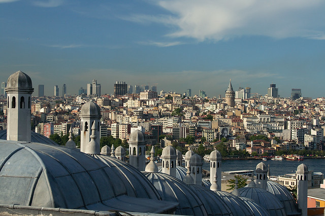
Istanbul rooftops

More about urban transport and urban planning in the Middle East:

Drivers of urban sprawl in two large Middle-eastern countries: literature on Iran and Egypt

A LONGITUDINAL ANALYSIS OF DENSITIES WITHIN THE PEDESTRIAN SHEDS AROUND METRO STATIONS: THE CASE OF TEHRAN

URBANIZATION TRENDS AND URBAN PLANNING STRATEGIES IN THREE MAJOR MIDDLE EASTERN COUNTRIES: IRAN, EGYPT, AND TURKEY

Wednesday, June 13, 2018

Drivers of urban sprawl in two large Middle-eastern countries: literature on Iran and Egypt

By Houshmand E. Masoumi, Maryamsadat Hosseini, and Amr Ah. Gouda

This paper reviews the relevant literature of Iran and Egypt as two large countries of the region and concludes that four phenomena are common between the two countries and are accountable for sprawling, namely (1) wholesale land selling to the lower economic class, (2) defciencies of planning systems in controlling development plans, (3) fast and uncontrolled increase in urban population, and (4) rural-urban migration. These drivers are categorized in two classes of demographic and planning-related trends. Besides, there is a number of peculiar trends that have nationwide causes but are uncommon in Iran and Egypt. The authors of this paper consider that the demographic drivers or sprawl addressed by the Middle Eastern scholars are not actual causes but only consequences, or there is a correlation between the demographic factors and sprawl. More in-depth historical and socioeconomic studies are needed to fnd the associations between sprawl and unstudied phenomena like change in technologies, culture, and lifestyle.

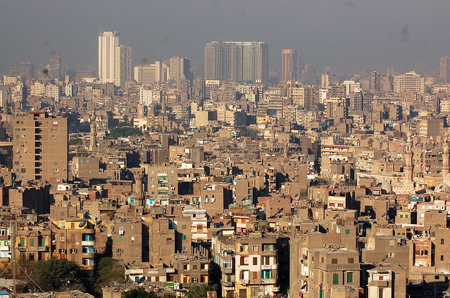
View of Cairo (القاهرة) from the Saladin Citadel (قلعة صلاح الدين)

More about urban sprawl in developing countries:

URBANIZATION TRENDS AND URBAN PLANNING STRATEGIES IN THREE MAJOR MIDDLE EASTERN COUNTRIES: IRAN, EGYPT, AND TURKEY

Urban Sprawl: A view from developing and developed Countries

The Status of Urban and Suburban Sprawl in Egypt and Iran

Evaluation of Urban Sprawl Speed and Intensity Based on International Urbanization. Example from a Mexican City

URBAN SPRAWL AND CLIMATIC CHANGES IN TEHRAN

Monitoring and modeling the urban growth of mid-size cities in Iran by Markov model: the case study of Zanjan City

Tuesday, February 13, 2018

Promoting Schoolchildren's Physical Activity by Change in Transport to School Behavior: Statistical Analysis

By Houshmand E. Masoumi

During the past decade, a number or researchers have focused on the interdisciplinary topic of active transport to school (ATS) and children’s health and wellbeing including their body weight and Body Mass Index (BMI). Most of the recent studies are focused on a handful of high-income societies, leaving other countries less researched. Thus, this study targeted both high-income and less-studied contexts within the European context. The aim was to provide reliable inter-contextual data for facilitating comparative studies as well as undertaking preliminary analyses on the contextual differences in children’s walking to school, relationships between parent’s commuting mode choice and that of their children, the associations of built environment with ATS and BMI, and finally noteworthy points for interventions for promoting children’s school-based physical activity. Using the results of surveys undertaken in nine European cities in 2016, statistical analyses were conducted, which led to preliminary results confirming strong significant associations of the built environment with children’s ATS as well as strong and significant associations of parents’ commute mode choice with that of their children. These preliminary results do not confirm significant differences between walking to school in different European contexts. It is probable that these differences exist regarding biking to school, but this may be tested in future research. This study underlines the circumstances of planning a more active school commuting behavior in the future of European societies: activation of 9-12-year-old European children’s school commuting is recommended to be done by changing the parent’s commute mode choices as well as integrating urban planning, transportation planning, and school site selection in future urban plans. Awareness of policy makers, families, and also children may be essential in planning more active school commuting. Applying the results of the surveys done during this project, future research will target inter-contextual differences between factors such as physical activity, ATS, and BMI, correlations between the perceptions of children and parents regarding school commuting and neighborhood and the associations with physical activity and BMI, the possible importance of city size in determining all the above factors regardless of the national context, and the differences between the tendencies and phenomena influencing school commuting-related physical activity and BMI in emerging European countries compared to high-income countries.

Read more  

 
Schools Out Girls

More about children's active commuting to school:

Monday, August 14, 2017

A comparative study of the morphological characteristics of residential areas in San Francisco

By Mehmet TOPCU and Michael SOUTHWORTH

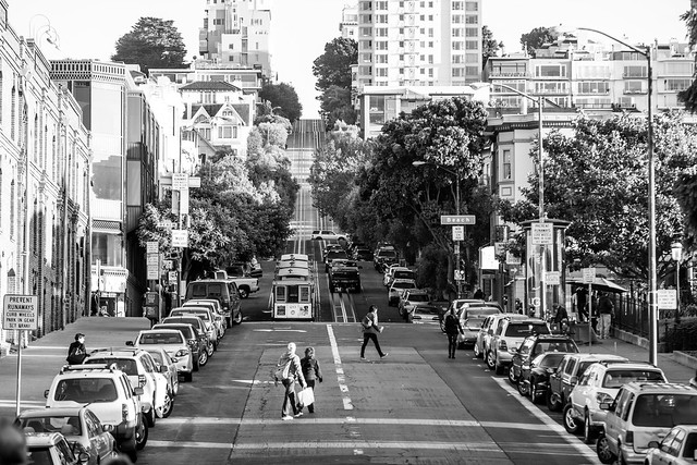
This study compares residential neighborhoods with different gridiron patterns in terms of some morphological properties. Nine different gridiron street patterns of San Francisco neighborhoods were chosen to assess the livability of residential areas in terms of several morphological evaluation criteria including accessibility (local and global spatial integration), intelligibility, density, livability index and time period. When measuring these criteria, the focus was on the street-block and building-lot relationships using several different methods. Accessibility and intelligibility values were measured by the ‘space syntax’ method which evaluates the street system of urban form. Density measures were calculated by the ratio of total built area within sample areas to the total sample area and by the ratio of private open spaces of sample areas to the total built area. In addition, a livability index was calculated by the ratio of pedestrian area to total built area. The contribution of time in the process of city building is also an important part of the morphology of cities. Therefore, in this study time period was used to analyze the historical background of the city. All the findings were evaluated according to these criteria by using GIS. In conclusion, based on the findings, this study stresses that the criteria of accessibility, intelligibility levels and density are inversely proportional with the degree of livability in the study areas. Therefore, we hypothesize that accessibility, density and livability index are the important inputs for making better designs for urban residential space and city design as a whole.


Russian Hill

More about urban form:

Longitudinal correlations of car ownership with socio-economics, urban form, and transport infrastructure in Latin America: Example from Ensenada, Mexico

Children’s Travel to School and their Body Weight; Results of a Survey in Seven European Countries: Technical Report

The Role of the Built Environment in Human Life. Selected Issues

REDUCING CRIME BY SHAPING THE BUILT ENVIRONMENT WITH ZONING: AN EMPIRICAL STUDY OF LOS ANGELES

Evaluation of Urban Sprawl Speed and Intensity Based on International Urbanization. Example from a Mexican City

A THEORETICAL APPROACH TO CAPABILITIES OF THE TRADITIONAL URBAN FORM IN PROMOTING SUSTAINABLE TRANSPORTATION

Sustainable Urban Growth Management Using What-If?

Tuesday, August 8, 2017

Urban Design and the Changing Context of Urban Regeneration in the Netherlands

By Paul STOUTEN,

Urban design schemes accompanied by avant-garde design of space have been an outcome of economic growth of cities and countries in many periods of time. At the beginning of the 21st century, Nieuw Crooswijk in Rotterdam was the largest area involved in nationally launched policies. Many times the conflicts surrounding the plan were in the news, particularly concerning the aim to attract higher incomes. Gentrification, with displacement of present and original residents forms a central issue and the discussions in Nieuw Crooswijk fit within the more general urban landscape and language of urban regeneration in Europe.


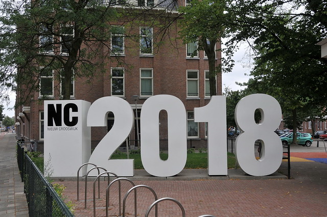
'Nieuw Crooswijk 2018' Rotterdam

More about the Netherlands:

Photos of bike lanes in Amsterdam, Netherlands (1)

Residential self-selection and travel: The relationship between travel-related attitudes, built environment characteristics and travel behaviour

The World's 7 Most Bike-friendly Cities

Graffiti photos of Rotterdam, Netherlands

BEST PRACTICE IN FACILITATING AND PROMOTING ACTIVE TRAVEL

Sunday, August 6, 2017

Longitudinal correlations of car ownership with socio-economics, urban form, and transport infrastructure in Latin America: Example from Ensenada, Mexico

By Daniela Roque & Houshmand E. Masoumi

Car-orientated modal splits represent problems for the city in economic, environmental and social terms. The implementation of policies and other measures can fail if the causes are not well recognized. Mid-sized cities in Mexico are not well-represented in studies where only the capital and other bigger cities are studied. This research aims to recognize those causes focusing on northern mid-sized cities in Mexico. The approach involves numerical work (linear regression) complemented with a descriptive analysis of the city. The analysis takes on such areas of consideration as socio-economic factors, land-use variables and the street network of the city. Of the 16 variables, almost all presented a relationship with car ownership levels, but not all behaved as expected. The final part of the research is a reaction to the previous studies and recommendations to change the city from car-orientated to one with a sustainable modal split.

Read more

Ensenada, Mexico

More about urban planning in Mexico:

An Analysis of Car Ownership in Latin American Cities: a Perspective for Future Research

Thursday, August 3, 2017

Children’s Travel to School and their Body Weight; Results of a Survey in Seven European Countries: Technical Report

By Masoumi, Houshmand, E.; Zanoli, Gabriele; Papageorgiou, Athanasios; Smaga, Soultana; Miloš, Ana; Van Rooijen, Martin; Łuczak, Monika; Komorek, Joanna; Çağan, Birol; Calabrese, Carla; E. Jamerson, Gordon; Patsakas, Georgios; Parisopoulos, Georgios; Meimaridis, Ioannis; Anagnostaras, Konstantinos; Perrostis, Andreas; Dessi, Eleni; Družeta, Toni; Udović, Tatjana; Daams, Ingmar; Drużek, Paweł, and Dalcı, Ahmet 


Problem: A number or researchers have recently focused on the interdisciplinary topic of active transportation of children and adolescents, their physical activity, and their body weight as an important aspect of their health. Such studies have been dominantly undertaken in a specific geographical context. Lack of contextual studies necessitates data collection with samples covering different countries and/or regions applying a uniform methodology. Such a lack of data is observed in both Europe and overseas.
Objective: This survey attempts to collect dissaggregate data about the travel behaveior of children of 9-12 years of age and their parents, children’s body specifications, and their households characteristics as well as aggregate data about the built environment of their school.
Method: direct questioning based on a standard questionnaire consisted of 26 questions was conducted in spring and summer of 2016 in nine cities in seven European countries (Foggia, Italy; Berlin, Germany; Thessaloniki, Greece; Rijeka, Croatia; Utrecht, The Netherlands; Łódź, Poland, Konstantynow, Poland; Malatya, Turkey, and Doğanşehir, Turkey).
Results: Out of 2735 children handed out the questionnaires, the parents of 1424 schoolchildren filled out the questionnaires, 1304 of which were validated and kept for analysis. This makes an overall response rate of 52.07 percent. In this report, the researchers of M.A.P.S. project have provided detailed descriptive findings separately for each case-study citiy as well as for the whole cities together as one sample.

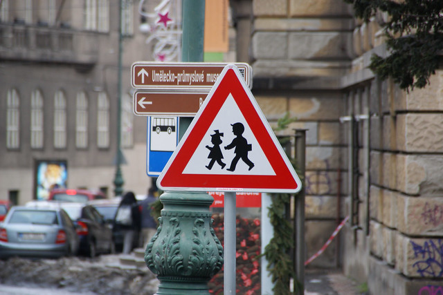
Warning Sign "Children" in Prague, Czech Republic

More about urban planning and children's health:

Active Transport to School and Children's Body Weight: A Systematic Reivew

Active transport to school and the risk of obesity


Systematic Review of Active Commuting to School and Children’s Physical Activity and Weight

Walking, Cycling, and Obesity Rates in Europe, North America, and Australia

Societal trends, mobility behaviour and sustainable transport in Europe and North America

Wednesday, August 2, 2017

The Role of the Built Environment in Human Life. Selected Issues

By Mariusz Lamprecht,

Creation of the built environment and research in this field pose a particularly difficult challenge nowadays. The pace of social and technological change does not allow for evolutionary development of cities and the formation of their land use according to current conditions. Creating spatial solutions that are unmatched in their contexts is becoming not only possible, but very probable (see Alexander, 1964). The development of the built environment involves not only art, technology, history, economics and law, but also philosophy, culture, medicine, psychology, sociology and many other spheres in which human life is manifested. However, only a relatively small number of disciplines such as spatial planning, urban design, urban planning, etc. (ignoring at this point the differences in the meaning of the concepts) in their application layer are meant to create space and bear responsibility for it. Also society has certain requirements of practical nature towards them.
This article attempts to outline the nature of research on space urbanised by people and to determine the four main fields of research aimed at the problems of man and the built environment. In the next part, particular attention is paid to issues related to the impact of the built environment on the life of its residents in order to highlight the particular role and complexity of this area of research. This study, acting as a kind of test of the research, cannot be considered representative. Nevertheless, the analysis prompts several reflections on the current and future role of the built environment in the development of our civilisation, as well as further challenges related to it.

Baroque Porto Portugal

more about urban sustainability:

Indicators of Sustainable Development: Guidelines and Methodologies

A Review of Urban Sustainability Assessment Methodologies

Sustainable Urban Development and the Chinese Eco-City: Concepts, Strategies, Policies and Assessments

Transportation and Sustainability Best Practices Background

TOWARDS A SUSTAINABLE URBAN TRANSPORT SYSTEM: PLANNING FOR NON-MOTORIZED VEHICLES IN CITIES

Tuesday, May 2, 2017

Active Transport to School and Children's Body Weight: A Systematic Review

By ,

Because of decreasing physical activity of children, they are becoming more obese. Moreover, commuting to school has become more passive during the past decades. The objective was to update the previous systematic reviews by narrowing down the topic to body mass index of children (3-12 years) as a representative of body composition. Applying search terms such as active transport to school, body mass index, childhood obesity, and so on in four online databases: PubMed, ScienceDirect, WorldCat, and Google Scholar. Peer reviewed English journal papers published between 2005 and 2015 presenting empirical quantitative studies were eligible studies to be reviewed. 310 journal papers were screened, 27 of which were reviewed by studying the full text. The final 13 papers were limited to those that focused only on active commuting to school and body mass index of children and adolescents. Out of 13 final studies, 3 found conclusive associations, three indicate partial associations in subgroups or societal or geographical limitations, and seven show no correlations. The existing literature are still inconsistent, so this study suggests conducting surveys with larger samples on less-studied contexts and applying more complex statistical methods for adjusting some of the variables. It is also argued that this topic can be culturally and contextually specific.


177/365. School Chale Hum - We Go Towards The School

more about children's mobility and active transportation:

Active transport to school and the risk of obesity


Systematic Review of Active Commuting to School and Children’s Physical Activity and Weight

Walking, Cycling, and Obesity Rates in Europe, North America, and Australia

Societal trends, mobility behaviour and sustainable transport in Europe and North America

Friday, April 7, 2017

REDUCING CRIME BY SHAPING THE BUILT ENVIRONMENT WITH ZONING: AN EMPIRICAL STUDY OF LOS ANGELES

By JAMES M. ANDERSON, JOHN M. MACDONALD, RICKY BLUTHENTHAL & J. SCOTT ASHWOOD

The idea of using law to change the built environment in ways that reduce opportunities to commit crimes has a long history. Unfortunately, this idea has received relatively little attention in the legal academy and only limited rigorous empirical scrutiny. In this Article, we review the considerable literature on the relationship between zoning, the built environment, and crime. We then report the results of two empirical studies on these relationships. First, we conducted a study of the effect of zoning on crime using 205 blocks selected in eight different relatively high crime neighborhoods in Los Angeles that have similar demographic characteristics but different forms of zoned land use. We find that mixed commercial- and residential-zoned areas are associated with lower crime than are commercial-only  zoned areas. Second, we matched neighborhoods undergoing zoning changes between 2006 and 2010 with neighborhoods that underwent no zoning changes during this period but had similar preexisting crime trajectories between 1994 and 2005. The primary zoning change in these neighborhoods was to convert parcels to residential uses. We find that neighborhoods in which there was a zoning change experienced a significant decline in crime. Our results suggest that mixing residential-only zoning into commercial blocks may be a promising means of reducing crime.


Crime

 more about built environment:

Urban Transformations of the Mediterranean Cities in Light of Developments in the Modern Era

Urban Sprawl: A view from developing and developed Countries

A THEORETICAL APPROACH TO CAPABILITIES OF THE TRADITIONAL URBAN FORM IN PROMOTING SUSTAINABLE TRANSPORTATION

Liveable Neighbourhoods: Street Layout, Design and Traffic Management Guidelines

Applying a CA-based model to explore land-use policy scenarios to contain sprawl in Thessaloniki, Greece

Thursday, March 30, 2017

A LONGITUDINAL ANALYSIS OF DENSITIES WITHIN THE PEDESTRIAN SHEDS AROUND METRO STATIONS: THE CASE OF TEHRAN

By HOUSHMAND E. MASOUMI and MARYAM SHAYGAN

Evaluation of spatial accessibility to public transportation has a weak background in many emerging countries, including Iran. Transit-Oriented Development is of great interest among Iranian planners and academics, but little is known about transit orientation provided by major public transport systems exemplified by the Tehran Metro. Statistical difference tests and polynomial regression done in this study show how residential densities within walking distances of metro stations established at different times after 1998 are significantly different. Both population and employment densities have decreased in more recent stations compared to those opened between 2005 and 2010. Moreover, one-way T-Tests comparing the population and densities of older lines with those of newer lines reveal that, in most cases, densities within walking distances of stations of older lines are higher. The paper concludes that lack of proper site selection and failing to locate new stations near job centers and highly populated areas threatens the transit-friendliness that emerged in the early years after establishing the first metro station in 1998.


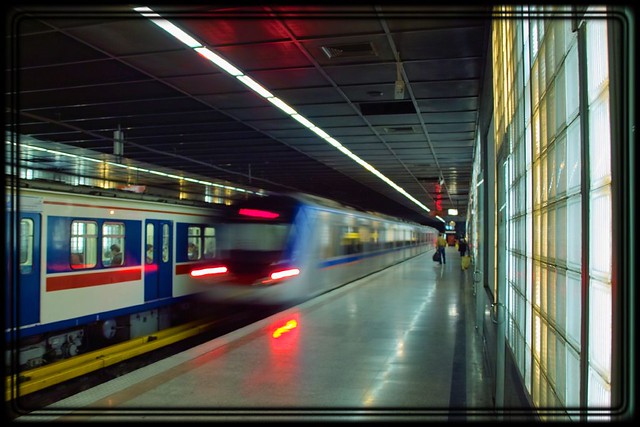
Tehran Underground (2)

More about urban planning and mobility in the Middle East:

URBANIZATION TRENDS AND URBAN PLANNING STRATEGIES IN THREE MAJOR MIDDLE EASTERN COUNTRIES: IRAN, EGYPT, AND TURKEY

TENSIONS AND TRANSFORMATIONS IN THE MASTER PLANNING PROCESS OF ISTANBUL

Upgrading informal settlements in Egypt towards a sustainable urban development

Facilitating Urban Management Through Local SDI Case Study: The Municipality of Tehran 

THE IDENTITY OF OPEN SPACE: ADAPTING FROM THE MODEL OF TRADITIONAL NEIGHBORHOOD CENTER

Impact Assessment of Sustainable Public Transportation System on Quality of Life in Tehran

Changes in population settlement pattern in urban system of Tehran province (1966 to 2006)

Studying the effects of urban sprawl of metropolis on tourism - climate index oscillation: A case study of Tehran city